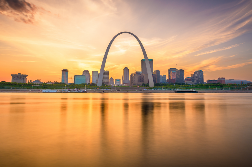
Mississippi River
A Cultural Treasure
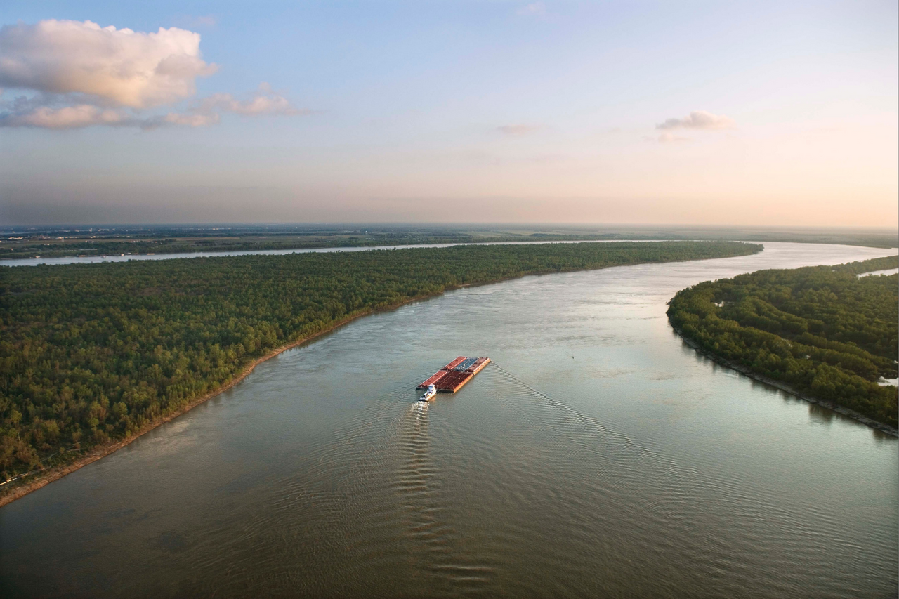
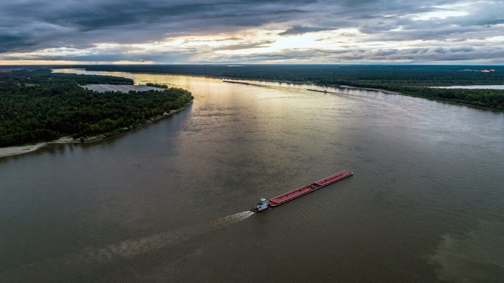
Known as “America’s River,” the Mississippi River flows through the nation’s heartland, supporting vital agriculture, industry, and recreation, and also provides drinking water to tens of millions of people. As the nation’s second-longest river, behind only the conjoining Missouri, the Mississippi supports a $400 billion dollar shipping industry, as one of the greatest water highways on earth, carrying commerce and food for the world. The river is also important habitat for fish and wildlife, with over half of all North American birds migrating along the river annually. It’s the backdrop for countless American stories and serves as a constant muse for artists and musicians from Minneapolis down through St. Louis to the Louisiana Delta. The river is a cultural treasure and inspiration for the nation, from the works of known authors, such as Mark Twain, to the music of blues legends, like Muddy Waters. From its humble beginning at Lake Itasca in Minnesota to its eventual end in the sprawling Louisiana Delta, the fabric of America truly is woven from the common thread of the Mississippi River.
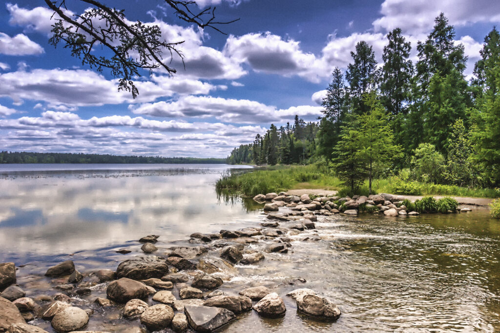
There is so much to consider along this great American waterway as it courses through 10 states, though the beginning of the river might make it easy to initially overlook. The Mississippi River begins as a small outlet for Lake Itasca in Minnesota as no more than a 20-foot stream from bank to bank but as the river runs south, it eventually turns into a half-mile-wide body of water that is large enough to support commercial shipping. From Wabasha, Minnestoa to Rock Island, Illinois, the Upper Mississippi River National Wildlife and Fish Refuge stretches for over 260 miles and provides public recreation opportunities, ranging from paddling, fishing, hunting, hiking and birdwatching. From Rock Island, Illinois south to St. Louis, Missouri, numerous federal and state-managed lands provide additional public recreation opportunities and important floodplain habitat.
Did You know?
The Mississippi River Basin captures the water from all or parts of 31 U.S. states and 2 Canadian provinces, between the Rocky Mountains and Appalachian Mountains.
The Mississippi ranks as the fourth-longest and ninth-largest river in the world by discharge.
The Upper Mississippi River is not the main stem of the Mississippi River. The Missouri River is roughly 100 miles longer than the Upper Mississippi. That was noted by explorers, but the Upper Mississippi River made a convenient boundary between the United States and the French Louisiana Territory.
The sport of water skiing was invented in 1922 by Ralph Samuelson of Lake City, MN, on the river in a wide region between Minnesota and Wisconsin known as Lake Pepin.
Slovenian long-distance swimmer Martin Strel swam the length of the river, from Minnesota to Louisiana, over the course of 68 days in 2002.
At the center of the Mississippian culture which stretched from the Midwest to the Southeast, Cahokia Mounds World Heritage Site near Collinsville, IL is the site of the largest pre-Columbian civilization north of Mexico.
The Mississippi River Basin produces approximately 95% of U.S. agricultural products, and employs over 400,000 people in the recreation economy.
What states does the river cross?
Minnesota, Wisconsin, Iowa, Illinois, Missouri, Kentucky Arkansas, Tennessee, Louisiana, and Mississippi.

The Middle Mississippi River National Wildlife Refuge intermingles with the Shawnee National Forest and rich farmland as the river heads south to its confluence with the Ohio River. From the Ohio River to the Louisiana Delta, the river is a varied mosaic of agricultural lands, bottomland forests, diverse wetlands, and, ultimately, estuarine marshes. The river and its floodplain support more than 400 different species of wildlife, and nearly half of North America’s waterfowl migrate along the Mississippi Flyway.
America’s Most Endangered Rivers®
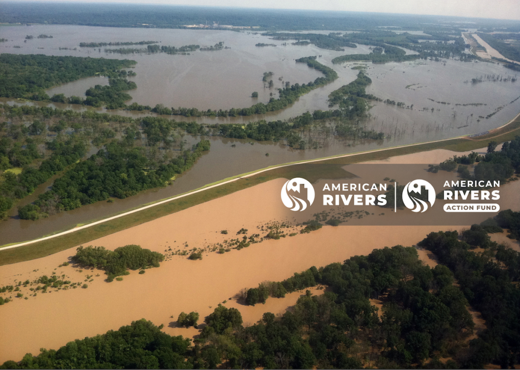
The Mississippi River was named the #1 most endangered river of 2025. Frequent and severe floods are threatening lives and businesses, while the river’s health declines. Communities along the river need significant support for disaster prevention and response, as well as river restoration, but the fate of the lead federal agency, FEMA, hangs in the balance. The Trump administration should modernize FEMA to improve river health and maximize the safety, security, and prosperity of Mississippi River communities.
Speak up for the Mississippi River
Join American Rivers and the American Rivers Action Fund in urging the Trump administration to prioritize flood and disaster relief on the Mississippi River.
The Backstory
Native Americans have lived along the Mississippi River since at least the 4th millennium BCE, including the Choctaw, Chickasaw, Quapaw, Osage, Caddo, Natchez, and Tunica in the Lower Mississippi, and the Sioux, Sac and Fox, Ojibwe, Pottawatomie, Illini, Menominee, and Winnebago in the Upper Mississippi. The river provided transportation, clean water, and abundant food, including freshwater mussels and fish.
The richness of resources proved equally tempting to European settlers who first learned of the Mississippi from Spanish explorer Hernando de Soto in 1541, followed by French explorers Louis Jolliet and Jacques Marquette who traveled south down the river in the 17th century. Soon after, the race between countries to settle the river’s shores led to conflict and eventual development. Britain, Spain, and France all laid claim to land bordering the Mississippi River until the Louisiana Purchase in 1803. Following the United States’ victory over Britain in the War of 1812, the highly coveted Mississippi River officially and permanently belonged to the Americans.
The river was essential to the nation’s growth throughout the Industrial Revolution and beyond, altered and harnessed over time to advance navigation and reduce flood damage. Following the monumental flood of 1927, an era of federally funded levees, dredging, and diking ensued. Following approval from Congress, between the 1930s – 1940 the “Nine Foot Channel” was established on the Upper Mississippi between the Twin Cities and St. Louis. And, to be administered by the U.S. Army Corps of Engineers to manage both navigation and the river system as a whole. During this same period, the Lower Mississippi from south of St. Louis to New Orleans was straightened, leveed, and dredged to help facilitate American commerce. This system of infrastructure stretches over 2,000 miles, and includes the Arkansas, Red, and Atchafalaya, isolating it from its historic floodplain.
As result of this development, the dynamic mosaic of side channels, backwaters, and forests that once spread out across the Mississippi River floodplain was drained and cut off from the river, leading to a loss of habitat, decrease in biodiversity, and significant reduction in floodplain function. Nearly a century after the “Nine Foot Channel” and other navigation projects were first completed, the river has changed. Communities can no longer plan for a “Spring Flood”, as the timing, intensity, and duration of flood events has grown more erratic. Farmers can no longer be certain about either the abundance or lack of precipitation. And, the traditional river infrastructure and floodplain management can no longer meet the needs of a growing America and a changing Mississippi River.
Let's stay in touch!
We’re hard at work in the Central Region for rivers and clean water. Sign up to get the most important news affecting your water and rivers delivered right to your inbox.
The Future
As “America’s River,” we at American Rivers are dedicated to the long-term health and functionality of the Mississippi River. Through a belief that both forward-looking flood management and a prioritization for public safety are paramount to the long-term sustainability of the Mississippi River, we strive to work with an array of river conservation partners and like interests to ensure that sustainability is achieved.
Flooding is the most costly and common natural disaster across the United States and certainly within the Mississippi River Basin. The magnitude of major floods in the Basin has increased in frequency and intensity at a greater rate within the last 100 years than during the prior four centuries. And, recent floods have broken records for both size and duration, with the 2019 flood along the Mississippi River inundating communities for over 100 days. The combined cost of flooding to the U.S. on the Mississippi, and its Arkansas and Missouri River tributaries, alone in 2019 was an estimated $20 billion, and a dozen lives were lost. In addition to the loss of life and financial impacts of loss of property, there are often unseen damages to drinking water supplies, native plants and animals, and overall river health.
Changes to federal agencies put the health of the Mississippi River at risk and jeopardizes the clean water, livelihoods, and safety of those who live along and depend on it. To prepare for, respond to, and recover from floods, Mississippi River communities require local, state, and federal agencies to work together. Without these vital services, communities along the Mississippi River will be less prepared for the next flood and potentially face greater risk and loss and important natural areas that preserve a small portion of the historic Mississippi River floodplain may not be available for us to enjoy.
The Federal Emergency Management Agency produces flood risk maps, provides minimum standards to ensure development is safe from floods, and helps homeowners rebuild on higher ground so they are safer during the next flood. The National Oceanic and Atmospheric Administration’s National Weather Service provides publicly available data on precipitation that helps communities prepare for a coming flood. The Department of Housing and Urban Development provides grants that help communities rebuild flood-damaged homes and businesses on higher ground, invest in public facilities like parks, prevent potential clean water impairments, and avoid loss of life. The Army Corps of Engineers not only maintains commercial navigation on the river, but is also responsible for the management of river levels, maintenance of water infrastructure, such as levees, and construction of multi-million-dollar ecosystem projects, like building new islands, recreating side channels, and replanting floodplain forests. The Natural Resources Conservation Service assists flood-prone farmers and landowners through the Emergency Watershed Protection and Wetland Reserve Enhancement Programs. The numerous National Wildlife Refuges, National Parks, and National Forests, coupled with a variety of state- and county-managed lands, provide millions of acres along the river and across its floodplain of expansive public recreation and local tourism opportunities.
As extreme weather brings more flooding to river communities, American Rivers believes it is essential that the federal government maintain a pivotal role in both directly managing Mississippi River floods, and expanding opportunities to reconnect and restore its floodplain to provide flood relief, improve water quality, restore wildlife habitat, and increase public recreation. We are committed to:
- Working with federal legislators to advance bipartisan policies that positively address river health and functionality
- Coordinating with state and local authorities to identify their flooding and clean water risks, needs, and options
- Building coalitions of communities, landowners, government agencies, and non-profit organizations to enact positive change
- Increasing the public awareness of how important the Mississippi River has been and will continue to be to America
As we look toward the future of the Mississippi River and its ever-changing dynamic, it is important to remember that we will all need to work with the river and not against it. As Mark Twain once said, and as still rings true today:
“The Mississippi River will always have its own way; no engineering skill can persuade it to do otherwise; it has always torn down the petty basketwork of the engineers and poured its giant floods withersoever it chose, and it will continue to do this.”