On January 15, 2015 the Environmental Protection Agency released a scientific report demonstrating the importance of small streams and wetlands to downstream water quality. The report, Connectivity of Streams and Wetlands to Downstream Waters, is based on current scientific research, specifically 1,200 publications from peer-reviewed scientific literature. The EPA’s report concludes that there is an undeniable chemical, physical, and biological connection between small streams, wetlands and floodplains to downstream waterbodies such as lakes, estuaries, oceans, and larger river systems.
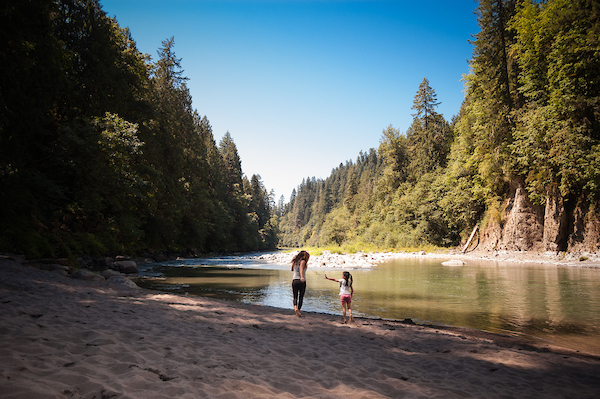
Small unknown stream
The report will be used to help finalize the proposed Clean Water Protection rule, which was first proposed in the spring of 2014. The final rule will restore protections to over half of America’s streams and millions of acres of wetlands. Although these important waters contribute to the drinking water supplies of one in three Americans they are currently vulnerable to degradation.
This report demonstrates that the Clean Water Protection rule is grounded in science. The report makes the sound, scientific case for what we have long known- what happens upstream will affect downstream. We have to protect the smaller streams and wetlands in order to comprehensively protect larger bodies of water. Anyone who has an interest in healthy rivers – for drinking or recreation – can appreciate this report and should support the proposed Clean Water Protection rule.
Update: Feb 6, 2015
Three weeks after the Poplar Pipeline spewed 40,000 gallons of oil into the Yellowstone River in eastern Montana, cleanup efforts have been called off due to dangerous ice conditions. The spill, which occurred on January 17, contaminated the city of Glendive’s drinking water supply and sickened local residents. It was the second major oil pipeline spill in the Yellowstone River in four years. In July 2011, Exxon’s Silvertip Pipeline dumped 63,000 gallons of oil into the river near Laurel, Montana.
During the abbreviated cleanup, a total of 1,200 gallons of oil was allegedly recovered from the river. At the peak of the cleanup effort, a spokesman for the company that operates the Poplar Pipeline said that oil was being recovered at the rate of one teaspoon every ten minutes. At that pace, it would have taken 1,753 years to remove all the oil from the river.
The Poplar Pipeline, like hundreds of pipelines that cross underneath the nation’s rivers, was constructed in the 1950s and buried just eight feet under the bed of the Yellowstone River when it was last inspected in 2012. Federal regulations require that pipelines be buried only four feet underneath rivers despite evidence that large rivers like the Yellowstone can scour 40 feet deep during floods and ice jams.
January 24, 2015
Nearly a week has passed since an oil pipeline ruptured underneath the bed of the Yellowstone River in eastern Montana, contaminating drinking water supplies for the 6,000 residents of Glendive, sickening several people, and taking an unknown toll on fish and wildlife.
Here’s what we know about the spill so far:
According to the pipeline owner, Bridger Pipeline LLC, 40,000 gallons of light crude oil gushed from a 12-inch pipeline that ruptured underneath the bed of the Yellowstone River. Of that amount, 10,080 gallons were recovered from inside the pipeline and 630 gallons of an “oily, watery mix” have been recovered from the river.
Oil recovery efforts have been hampered due to the fact that the Yellowstone River in the vicinity of the spill is locked under two feet of ice. Meanwhile, an oily sheen has been spotted as far down river as Williston, North Dakota.
Testing earlier this week found that Glendive’s drinking water supply had three times the amount of benzene, a known carcinogen, than the Environmental Protection Agency (EPA) deems safe for human consumption. Following the installation of a new filter at the city’s water treatment plant, benzene levels have dropped to acceptable levels. The city is expected to lift its bottled water order this weekend.
Bridger Pipeline LLC has a long history of pipeline safety violations. According to the Pipeline Safety Trust, the company has double the average number of pipeline safety incidents per mile of pipeline over the past six years.
Of Bridger Pipeline LLC’s 384 miles of pipelines, 186 miles of pipeline, or 35%, were constructed with 1950s-era pipe using faulty welds. It is unknown at this point whether the section of pipeline that ruptured under the Yellowstone River was of this variety.
The last time this pipeline was inspected was in 2012. At the time, the pipeline was buried as shallow as eight feet under the bed of the Yellowstone River, which is well within the river’s scour depth.
Meanwhile, as this oil spill tragedy continues to unfold, the U.S. Senate is debating a bill to approve the controversial Keystone XL pipeline, which would cross the Yellowstone River approximately 20 miles upstream of the spill site. On the other side of the capitol, the U.S. House passed legislation on Wednesday that would expedite the approval of new natural gas pipelines, giving government regulators less time to evaluate their potential environmental impacts.
Take Action to Stop Future Oil Spills into Our Rivers
Since 1986, pipeline oil spills have caused more than 55 deaths, 2,500 injuries, and more than $7.7 billion in damages. Tell the Obama Administration to protect our rivers by strengthening the environmental standards for these pipelines.
As much of the US is in the grip of a frigid arctic air mass, California is in the grip of a ridge of high pressure that has blocked the procession of drenching storms we had in December.
A similar pattern, dubbed the Ridiculously Resilient Ridge, set up at this time last winter and pushed the normal storm track to the Pacific Northwest and Canada, resulting in one of the driest years on record in California. This winter, the December storms got us off to an above average start and raised hopes that the drought was coming to an end. But with the three weeks of dry weather and a forecast for at least one more dry week, we will likely fall below average by January 15th. If the Ridiculously Resilient Ridge returns and blocks precipitation for the rest of the winter, we will be in trouble.
It seems unlikely, at least statistically, that a drought as bad as last year will recur, but after three dry years for our rivers and fish, we have little resiliency and water storage is far behind needs. This is especially true for the San Joaquin River. The December storms helped, but California reservoirs remain about half of average for this time of year.
Our wet season is far from over, and the seasonal forecast from the National Weather Service shows a probability of above average precipitation this winter, so there is some basis for hope. However, as each day dawns warm and dry, we drift closer to another year of drought. Already, the state and federal agencies responsible for managing California’s water system and protecting imperiled fish and wildlife have developed an Interagency 2015 Drought Strategy that lays out a plan to adapt to what could be year 4 of a ridiculously resilient drought. This is one strategy everyone would be glad to have gather dust on a shelf.
It’s been said that good things come to those who wait.
After four decades, the wait is finally over for all the citizens and conservation groups who have patiently and persistently fought to maintain the integrity of the North Fork of the Flathead River watershed along the western boundary of Glacier National Park.
Last month, President Obama signed legislation to formally withdraw 430,000 acres of public land in the North Fork watershed from all new mineral entry. The legislation fulfills a 2010 deal negotiated between the state of Montana and the Canadian province of British Columbia.
The North Fork is born in the mountains of British Columbia and flows south for 153 miles before emptying into Flathead Lake, the largest natural freshwater lake in the western United States. Over the years, it has faced multiple threats from proposed open-pit coal mines, gold mines and oil and gas drilling, prompting American Rivers to name it one of the nation’s Most Endangered Rivers in 2009.
As a follow-up to the 2010 North Fork deal, mining and energy companies with valid existing claims on the Canadian side of the watershed were paid $10 million to forfeit the right to mine and drill in the future. While mining and energy companies on the U.S. side of the border voluntarily surrendered more than 200,000 acres of claims, roughly 50,000 acres of existing claims remain. Extinguishing those claims will be the next chapter in the North Fork saga.
If you’ve never been to the North Fork, it is difficult to describe its beauty in words. For while the river itself is crystal clear and the views of the Livingston Range are truly spectacular, the North Fork’s real beauty lies in its abundance of wildlife. As one of the last intact low-elevation river corridors in the western U.S., it is home to every wildlife species that was present when Lewis and Clark passed through Montana more than two centuries ago, including the highest concentration of grizzly bears in Interior North America.
I was fortunate to spend a winter doing wildlife research in the North Fork when I was a graduate student at the University of Montana in 1991. While I was there, I kept a daily journal. As I started writing this blog, I re-read that journal for the first time in a long while. One thing I wrote really stuck with me:
“In the future, my concept of beauty will be measured against this place.”
There are many places I’ve been to that are more beautiful to the eye than the North Fork, but there are few whose wild soul remains so intact.
Thanks to you and everyone else who rallied to her defense for so many years, the North Fork’s wild soul will continue to inspire people for generations to come.
Today’s blog is a guest post by Howard Bridgman.
The sun had fallen behind the trees and the nip of winter to come was in the air as the paddlers were greeted at the Dorchester Boat Club with hot coffee, snacks, and local craft beer from Freehouse Brewery. Freehouse, a supporter of American Rivers and the Ashley River Blue Trail, is located just downstream on the banks of the Ashley in North Charleston. People were alive with the joys of our scenic paddle and the prospects of hot, steamed oysters soon to come.
The event was American Rivers’ inaugural paddle trip and oyster roast for the Ashley River Blue Trail, which flows from Summerville to Charleston, South Carolina. We invited members of municipal governments, local businesses, and paddlesport enthusiasts to explore the river with us and better understand the importance of its recreation benefits and in making sure it is accessible and remains healthy for the future. A turn out of approximately 70 local leaders for the event on a cool autumn day fulfilled that goal.
For many the trip was their first exposure to the upper Ashley River, and the purpose of our day was to let people see firsthand what a gem the Ashley is while also understanding that actions need to be taken to ensure it remains that way. The trip was followed with a warm-up around the fire and words from Gerrit Jöbsis, Southeast Regional Director of American Rivers, about how community-led Blue Trail initiatives can and have improved recreational access while putting in place safeguards to ensure it will remain a valuable community asset for future generations. A video of the Hitchcock Creek Blue Trail was shown, a community success story where citizens around Rockingham, NC created a paddle trail that improved access, created greenways, protected critical riverside lands, and now serves as a driver for the local economy. Robust discussion followed about how the Blue Trail can be an engine for improved recreation and conservation on the Ashley River. The evening drew to a close with roasted oysters and good conversation around the fire. New friends were made and many left inspired about the potential of the Blue Trail and the actions they and their community can take to keep the Ashley River the gem that it is.
Howard Bridgman, former Summerville Town Council member and founding member of the Ashley Scenic River Advisory Council, serves as the Ashley River Blue Trail Coordinator and works to connect local communities to the river through recreation and finding ways to ensure its long-term health.
Last weekend brought the first snows to the Sierra. Julie and I were lucky to be out in it– at 8000 feet with the Sierra Native Alliance’s Native Youth Conservation Corps. We were at the very headwaters of the Mokelumne River, planting hundreds of willows in the restored portion of Indian Valley. The goals were to stabilize recovering portions of stream bank and to share restoration skills with Native American youth. I tried to postpone the trip on Thursday, when I saw the weather forecast, but the young workers were excited and all-in for a restoration adventure.
The trip by the numbers: We planted more than 500 willows along 1.5 miles of stream– 11 people, 2 nights camping and more than 3 inches of snow fell. Daily high temperatures dropped 30 degrees over the weekend. We were fueled by 5 dozen eggs, 10 pounds of hamburger, 40 cups of hot cocoa, dozens of peanut butter sandwiches and countless smiles.
This multi-benefit restoration project is the kind of investment the people of California would make by supporting Proposition 1 in November. Proposition 1 would provide funding for river restoration, water conservation, as well as groundwater and water supply projects.
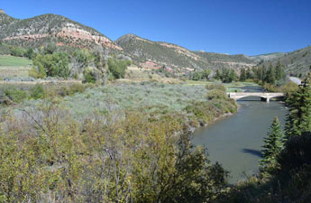
The Eagle River | Photo by Jamie Mierau
Last week I had the opportunity to spend two glorious days in Eagle County, Colorado exploring the Upper Colorado and one of its tributaries in Central Colorado, the Eagle River. Joined by a few of my colleagues, we partook in one of my favorite summer activities: floating a river. These two rivers are a destination for families and adventurers wanting to fish, float and enjoy the beautiful river and canyon.
The Upper Colorado and Eagle are surrounded by ranches and natural canyons with tall cliffs and steep slopes. Formations of sandstone, shale and volcanic intrusions gaze down at the river as you float pass. Spruce trees, cottonwoods and a variety of other riverside shrubs border the river. In the distance, forests can be seen climbing the mountains, with various shrubs and grasses in the lower foothills.
Smooth and playful rapids are dispersed throughout the two rivers. Family friendly rafting, tubing and wading are common occurrences during the hot summer months. From small children to dogs, teens and families, seeing people enjoying and connecting with their river, their special place is a delight.
Fly-fishing fanatics have found a home on these rivers in Central Colorado. Many public access points are dispersed along the river where fisherman wading or boating with a fly rod in hand are the norm. Cool, shaded ponds line the river where Brown and Rainbow trout can be caught with ease. If you are lucky, you might catch a Cutthroat or Brook trout as well, but these are much less common.
If fishing isn’t your thing but birding and wildlife viewing catches your fancy, these rivers are for you. Last week I saw my first wild bald eagle soaring high above us as we floated down the Eagle. Seeing this magnificent bird flying high instilled a feeling of pride, reminding myself how great it is we live in a country where we can protect such beautiful and important rivers. Additionally, blue herons, ducks, geese and other raptors are commonly seen. If furry animals are more your speed, fox, sheep, beaver, and an occasional deer or elk roam the riverside as well.
Spending time on your local river, your favorite treasured place, is something we can all do more of in the summer. The Eagle and Upper Colorado are two very special places in Colorado. Not only do these two rivers offer a place for the local community and tourists to get out on the river and have fun, but they also provide the community with a strong economy and sense of place.
Where are your special places?
“This all has far exceeded our expectations” Rockingham, NC mayor Steve Morris told American Rivers’ President Bob Irvin and me as he drove us on an early May day to the Roberdel Access. We were going to kayak down the Hitchcock Creek Blue Trail to celebrate its official opening.
The Mayor proudly admitted to taking us the long way to show off some of his community’s highlights. To our right we passed a pick-up truck, its bed stuffed with four kayaks. “See, they’re not even part of our group” the mayor exclaimed.
In 2009, American Rivers helped the City and other partners remove the Steeles Mill Dam which for more than 100 years had clogged Hitchcock Creek, blocked access for families wanting to boat or fish, and caused stagnant conditions which lowered oxygen levels and choked aquatic life. We then collaborated with the City to develop the Blue Trail to connect the community to the creek, improve recreational access and protect its natural setting. Once a forgotten stream, thousands now use Hitchcock Creek even before the Blue Trail officially opened.
Blue Trails help people discover rivers, provide connections to communities and the outdoors, and are economic drivers that benefit local economies and quality of life. The City of Rockingham understands this. Once the economic hub of the area, all of the textile and paper mills in Rockingham many of them on Hitchcock Creek closed during the final decades of the past century. The city had a new vision for its community and turned to Hitchcock Creek as a focal point of its economic future. Following the removal of Steeles Mill Dam, American Rivers and the City developed the Blue Trail which runs 14 miles starting in Rockingham, courses through floodplain forests, passes remnants of old mills and is home to many rare plants and animals. The Blue Trail offers not only an intimate recreational setting, but also an opportunity to learn about the area’s history and natural places.
River recreation is not only good fun; it’s good business, too. Three out of every four Americans participate in active outdoor recreation each year and paddle sports are among the fastest growing segments of the industry. All of this outdoor activity generates 1.6 million jobs in industries including manufacturing, leisure and hospitality, transportation, and wholesale and retail trade. That’s why the increasing popularity of Blue Trails in our region is a good thing for our economy.
After our two-hour paddle along river banks bounded by massive trees and blooming rhododendron, we arrived at the Steele Street Access. The solitude of Hitchcock Creek was broken by the throng of people there to participate in the official opening ceremony of the Blue Trail. Camera crews filmed, elected official shook hands and a red ribbon was strung before one of the footbridges that crisscross the creek as part of a greenway. Excitement filled the air as the ribbon was cut. The city’s vision for Hitchcock Creek had become a reality. A once forgotten creek had been transformed into a community treasure. The community abuzz with the Blue Trail, and knowing that American Rivers helped fulfill the city’s vision through funding, technical support and a lot of hard work was a reward that far exceeded my expectations.
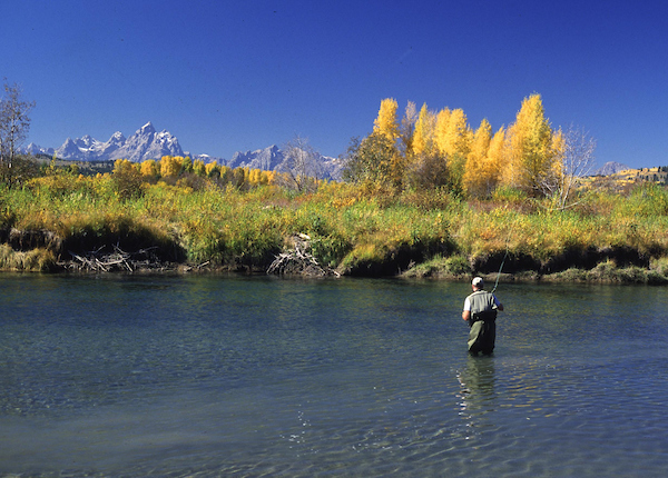
Editor’s note: The author wrote this column on behalf of Eagle River Watershed Council.
The Eagle River | Photo by Ken Neubecker
Colorado is blessed with many rivers that flow from melting winter snows to the sea crossing nearly a third of the country. These rivers support the significant recreation economy of Colorado’s mountain communities. Fishing, rafting, kayaking, skiing and the many golf courses all depend on sustainable water flowing in these rivers systems. These same rivers also support many thriving ranches and farms along their journey.
The rivers themselves are the living heart of the most important wildlife habitat in the West, where water is often the single most precious resource. These vibrant ribbons of life are also at the heart of why so many of us love and live in the West.
Eagle County hosts two of these great rivers, the Eagle and Colorado, as they flow west toward Utah and the great canyons of the Colorado Plateau. The watershed of the Eagle lies almost entirely within the county’s borders, something unique in Colorado. The Eagle River Watershed Council advocates for the health and conservation of the Upper Colorado and Eagle River basins in the county through research, education and projects.
American Rivers, a national river conservation organization, has developed a program of Blue Trails to help people connect with special rivers. The Blue Trail program works with local partners, like the Watershed Council, to link communities and their rivers through access, recreation and informed stewardship. It also helps foster a sense of “ownership” for the rivers and the lands through which they flow and support. Local citizens are now working to develop Blue Trails on the Eagle and Upper Colorado from State Bridge to Dotsero.
People in Eagle County have long cared for these rivers. The efforts to clean up the Eagle Mine Superfund site, the fight for the river and wilderness in the Homestake II case and the earlier efforts to keep Denver Water’s Eagle-Piney project at bay and I-70 from destroying the Gore Creek Valley above East Vail are examples of the Eagle Valley’s determination to protect its rivers.
Today the Eagle Valley is home to a new generation who are the heirs of these past efforts on behalf of the Eagle and Colorado rivers. The Eagle River Blue Trail project is working with groups like the Eagle River Watershed Council, Eagle County, municipalities, outfitters and recreation organizations to strengthen the community ties to the rivers.
At the heart of the Eagle River Blue Trail will be a tremendous source of information about the rivers, access and recreation opportunities. Eagle County, the Eagle Valley Land Trust and others have acquired new land parcels along both rivers, opening up greater opportunities to enjoy the Eagle and Colorado.
These parcels join many other access points and lands. The Eagle River Blue Trail project will provide a single source for all of these places, from Tennessee Pass and Rancho Del Rio down to Dotsero where the two rivers join.
American Rivers will continue to partner with the community and local organizations to promote, preserve and protect Eagle County rivers. Join the Eagle River Watershed Council and American Rivers on Wednesday, March 19, at 6 p.m. in the Eagle Library for a Watershed Wednesday program on the Eagle River Blue Trail project. We want to hear from you: your thoughts, ideas and concerns. The Eagle and Colorado Rivers face new challenges, and a new generation of residents and visitors alike who care for them. Get to know these rivers better and help make a Blue Trail that can serve the Eagle and Colorado into the future.
Ken Neubecker is the Eagle River Blue Trails coordinator for American Rivers. Ken served as the president of the board of directors for the Eagle River Watershed Council and remains closely tied with the organization. Contact Ken at ken.neubecker@americanrivers.org. The Eagle River Watershed Council has a mission to advocate for the health and conservation of the Upper Colorado and Eagle River basins through research, education, and projects. Learn more at erwc.org.
It’s a really exciting time for our work along the Waccamaw! In recent months we’ve partnered with a local chamber of commerce to promote ecotourism and build support for conservation along the Waccamaw River Blue Trail, South Carolina’s only National Water Trail. One of the projects we’re working on with the Georgetown County Chamber of Commerce is through an advertisement in Guest Quest that showcases the Blue Trail as one of the area’s premier tourist attractions.
Another way in which we are working to enhance recreation is through a unique partnership with a corporate sponsor that provided funding to install directional signage along the trail as well as interpretive information, picnic tables, and Carolina Fence gardens at three key landings. In addition, we were able to make improvements to canoe and kayak launches within the City of Conway and at the Waccamaw National Wildlife Refuge’s Cox Ferry Recreation Area.
All of these efforts are aimed at building support for increased river recreation in the region and promoting enhanced conservation along the Waccamaw. Our goal is to help build a larger and more diverse constituency that recognizes the economic, recreation, and conservation values a healthy Waccamaw River provides the community.
Eagle County in Colorado has moved one step closer to adding well over a mile on the Eagle River to open space and public access. Last week the County signed a contract for purchase with the owners of the old Horn Ranch in the heart of Red Canyon. The Horn Ranch, one of the most scenic reaches along the Eagle River and I-70, lies in the middle of the Eagle Valley, between Vail and the towns of Eagle and Gypsum.
The County’s purchase will acquire lands south of I-70 along the river and southerly uplands in Red Canyon along with a conservation easement on the remaining ranch lands north of the interstate highway. It will also link BLM public lands along the river from Wolcott upstream through the rest of Red Canyon downstream.
This is a huge boon for those who love to fish and float on the Eagle River! The ranch owners and Eagle County Open Space have been working on this deal for a long time, and it should close later this year. Eagle County plans to build a single access point and parking area on the western end of the property with a recreation trail along the north side of the river.
American Rivers was proud to support this great project by giving testimony at the county commissioner’s meeting in last week. We applaud Eagle County in this successful and significant addition to its open space system!
With parts of the country and the West slowly, tenuously re-opening, we know people are loading up trailers and trucks, putting air in tires and crafts, dusting off sun hats and heading out the door to visit places they miss, and do the things that make them feel whole.
South Fork Buffalo Fork, WY | Photo by Scott Bosse
But the world has changed, is indeed still changing underfoot, and in our desire to get back out there, the checklist of what to bring might be better served as a checklist of how we recreate in ways that are thoughtful and considerate not just toward the places we go, but the people we encounter there.
With that in mind, and in celebration of June as National Rivers Month, we compiled tips for recreating thoughtfully during a time when COVID-19 is causing stress for, well everyone, but especially front-line workers and small, rural communities at the gateway to popular recreation hotspots.
1) Consider Your Impact
This isn’t a new concept; for those of us who rely on wild lands and rivers for our well-being, we know how critical it is that we care for them—that we move consciously through them and measure our gains with the long-term impacts our presence may pose. That same ethos can serve us well in the time of COVID if we expand our lens to the gateway communities that often rely on places we love for revenue from tourism, and are also often rural, with limited health and emergency resources. It’s the job of every recreationist now (and perhaps always) to consider how their added presence in a place contributes or detracts from the community (or communities) that call that place their permanent home by knowing and respecting all local guidelines and restrictions for going out and recreating. And, of course, by following #6.
2) Forget the Parks
In a recent article for High Country News, Craig Childs wrote: “Forget the parks; seek out the spaces in between, the backyards and alleys. It’s a great time to explore an irrigation ditch or the woods at the edge of town — to see what’s around you…”. Let Craig’s charge serve as a challenge: what nearby plot of public land or stretch of river, back alley or small park, might not be “the best”, but that you could come to know without putting others, or yourself, at risk?
Sandy River, OR | Photo by Bradley Hebdon
3) Stay Close (to home)
In many states, recreationists are restricted in terms of how far they can travel to ride a bike or get on the water. In Colorado, for example, residents were encouraged to travel no more than 10 miles from home to recreate. Even as those restrictions change, and they will, we know that people visiting hotspots and then travelling home, or coming from a hotspot to a rural mountain town, is part of how the virus spread in the first place. Those places will remain (if we fight for them – see #7), and now is the time for patience.
Klamath River | Photo by Josh Miller
4) Take Some Distance (from others)
You can honor social distancing recommendations and still be out. Get creative. Consider small crafts, like packrafts or kayaks, rather than cramming big crews into one raft. Enjoy smaller groups of friends. Maybe take some alone time. Consider non-peak hours – set the alarm earlier, or take an off-hour lunch break. Maybe your new at-home schedule means you can recreate during the week days, and log Zoom calls on the weekends. Whatever the trick, keep away from the crowds, and when you can’t – wear a mask. Masks are more about keeping others safe around you than protecting yourself (think #1 here).
5) Look close, hold still
Writer Krista Langlois recently penned a piece called “The Beauty of Staying Still” for the Adventure Journal. In it, she argues for the intimacy that comes with slow, unstructured time spent in a place, and offers up an alternate way for understanding our current reality: “staying still doesn’t have to be a sentence. It can be a gift.”
Bog Turtle, Kishwaukee River, IL | Photo by USFWS
6) If You’re Sick, Please
We probably don’t have to say it, but we will, because even if you think you’re being cautious, this wildly contagious virus is outmaneuvering our understanding of it. Even if you think “aha”, I’ll go solo, any encounter with people or the places they visit can put them at risk. Stay home and off the trail for at least two weeks. Rest. Get well. And, while you’re staying the course and making sure you don’t expose others, become a couch warrior for the places you can’t wait to visit once you’re able and allowed.
7) The Fight Goes On
Take some of the time at home to get educated, up-to-speed, and to advocate for the rivers and places you miss. They aren’t going anywhere, unless we let them. If we stay vigilant, those sanctuaries will still be there when we can visit again without putting communities and fellow humans at risk. When it comes to rivers, there are some things you can do at home, starting today. First, thank Senators Udall and Heinrich for introducing a bill to designate the Gila River in New Mexico as Wild & Scenic. Next, let’s protect our vital headwaters streams by opposing the rollback of the Clean Water Rule. Finally, discover how rivers act as an economic engine, for nearly every small town and city across the country.
Photo Credit: Skip Armstrong
Finally, don’t forget what rivers mean—all the ways they matter. Sure, they’re important for bringing you together with people care about. But they’re also timeliness in a way this pandemic isn’t. That gentle rocking of the boat, the technicolor reflection at last light, the soothing (or unnerving) churn of water in motion—those are things that have been and will be well beyond this pandemic. Lean into the memory and solace of them. Lean into each other. We’re all on this wild ride, this river, together—even if we’re in different boats.
Lake Mead National Recreation Area, AZ | Photo by Colleen Miniuk-Sperry
