They’re at it again. An opinion piece in The New York Times co-authored by Senator Lisa Murkowski tries to put a positive spin on harmful hydropower legislation.
But behind all of the talking points about clean and green energy, the truth is that the hydropower industry’s so-called “Unlock Hydro” bill is an attack on healthy rivers and your right to have a say in how your rivers are managed.
Here is why President Obama vowed to veto the legislation:
- The hydro legislation is an extreme power grab: The legislation represents a major power grab by already powerful energy companies including Pacific Gas & Electric, Duke Energy, Exelon and Southern Company. The bill would gut environmental protections and curtail the ability of states, tribes, local communities and recreation and conservation interests to have a say in how dams are operated. By trying to “streamline” the dam relicensing process, energy companies are steamrolling your values.
- Giant loopholes for energy companies: This legislation creates major loopholes for dam owners so they can avoid requirements to protect fish, wildlife or clean water. It also undermines the rights of states and Native American tribes to protect these values on their lands.
- Rivers pay the price: Poorly operated hydropower dams can dry up rivers, kill fish and wildlife, and cause major damage to communities and businesses that rely on healthy rivers. There’s nothing “clean” or “green” about that. If hydropower is so clean, why are hydro companies lobbying Congress to get them out of complying with the Clean Water Act?
It’s time to stop this legislation in its tracks. Learn more about H.R. 8 and take action for rivers today.
This fall American Rivers led the first phase of efforts to restore iconic Hope Valley Meadow. This 1600-acre meadow complex is one of the largest and most beloved in the Sierra. Hope Valley is located just south of Lake Tahoe and is a popular recreation destination, as well as an integral ecological component of the West Fork Carson River, home to an important recreational fishery and the drinking water supply for many communities in Western Nevada.
Although strikingly beautiful, historic grazing and other human impacts have created a deeply eroded stream channel throughout much of the meadow. Wet meadow plants that rely on shallow groundwater can no longer thrive at the water’s edge, creating high, bare banks that do not provide cover for fish or birds. Without this anchoring vegetation, these banks erode easily, continuing the cycle of erosion and soil loss, negatively affecting water quality.
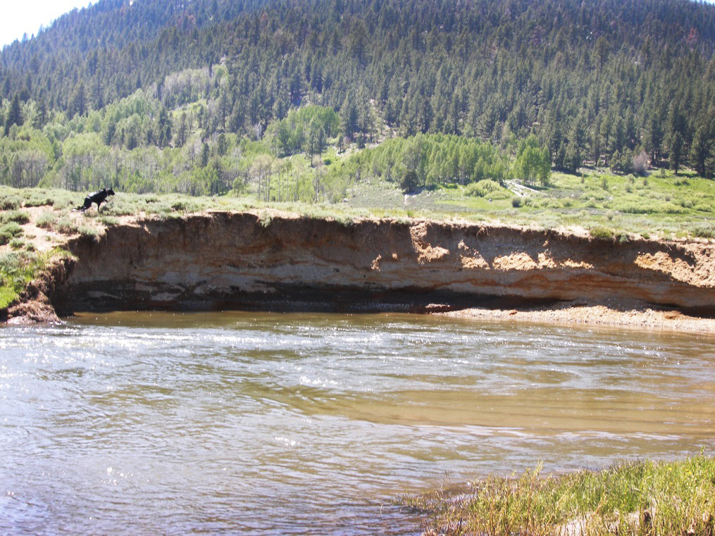
Project site before stabilization.
To address this problem, American Rivers led an effort to repair these streambanks and help the meadow recover. In October, we completed the first phase of this effort, in which we stabilized 130 feet of especially high, eroding streambank using a structure made of large logs. The structure will limit future erosion and provide habitat complexity for fish.
Repair also included planting willows to help to re-establish vegetative cover that will provide shade and habitat for birds and further stabilize the bank. The remainder of the project, which will stabilize an additional 7000 feet of stream channel primarily using native vegetation, will be completed next summer.
The project is an important milestone for the local community that has been pushing for restoration for over 20 years. It has also been a highly collaborative effort which has surely contributed to its success, with partners including the Humboldt-Toiyabe National Forest, California Department of Fish and Wildlife, Alpine Watershed Group, Friends of Hope Valley, Institute for Bird Populations and Trout Unlimited, and funding from the National Fish and Wildlife Foundation, Sierra Nevada Conservancy, California Wildlife Conservation Board, Wildlife Conservation Society, and Bella Vista Foundation.
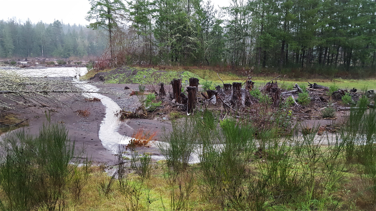
Standing on a brushy bank in soggy raincoats, we watched as the Puyallup River carried whole trees past us on swift silty-brown waters. Beside us a trickle of water began to meander through a breach in the riverbank and across a bed of dark glacial sediment. Days of rain across western Washington had engorged the region’s creeks and rivers, bringing many of them to flood stage. This is exactly what members of American Rivers’ River Restoration team and staff from Pierce County had come to see; a river using its floodplains.
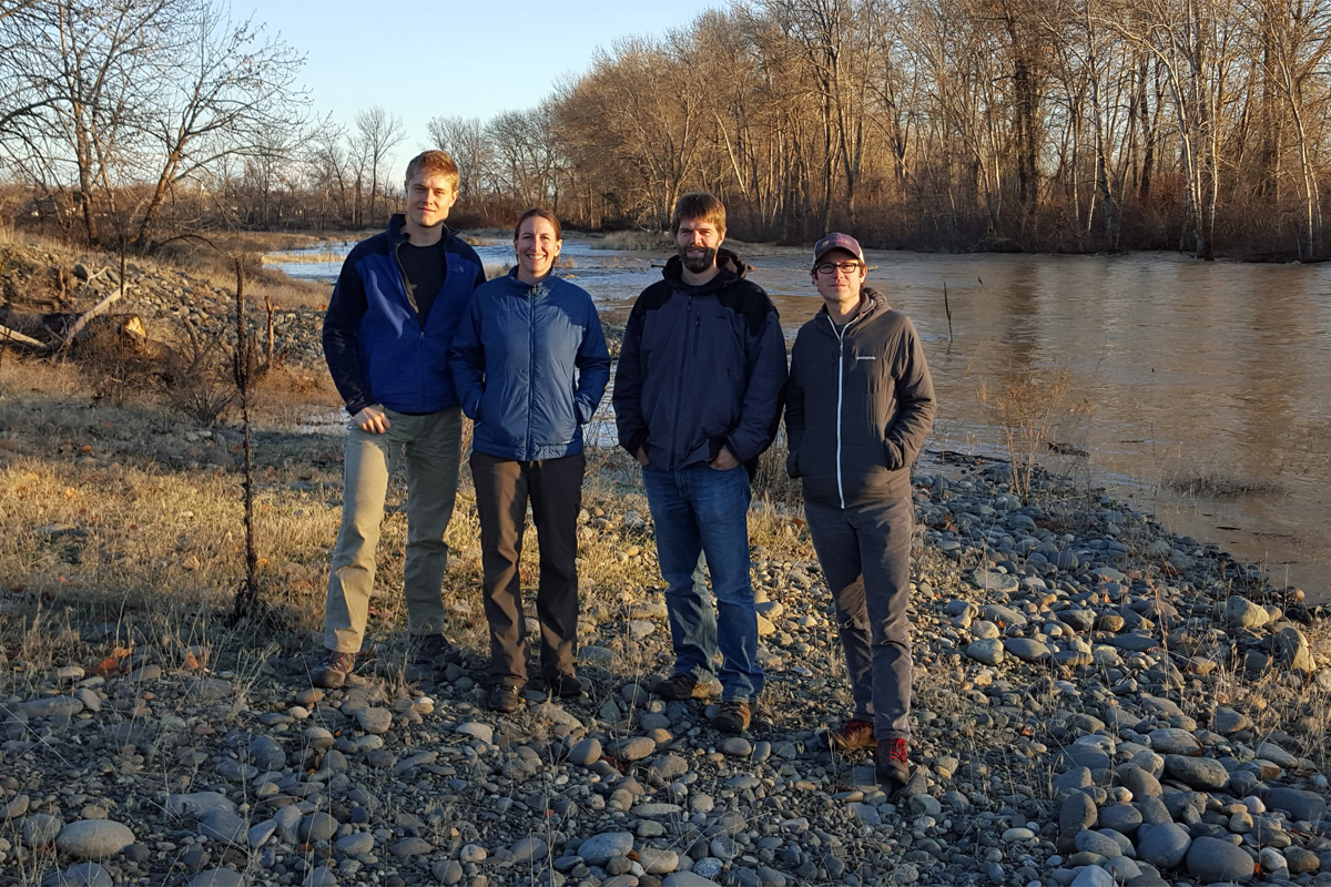
Michael Garrity, Brian Graber, Eileen Shader, and Jonathon Loos visit restored floodplains on the Yakima River in eastern Washington
This breach was not a natural feature of the riverbank, in fact, the riverbank we were walking on was not a ‘riverbank’ at all. It was a manmade levee historically built to protect adjacent lands from flood.
This particular reach of the Puyallup River is the site of a recently completed floodplain reconnection project by the Flood Control District of Pierce County, Washington. The levee breach we stood beside was the result of that project; a restored connection between the main channel of the Puyallup and the braided floodplain we had just walked across. We cheered on the trickle of water as it steadily crept onto the floodplain, charting a patient but clear course towards the historic side-channels of the Puyallup River.
A half-century ago the Puyallup was the focus of significant straightening and levee building, efforts intended to corral the river into a single channel and more quickly move flood waters and sediment downstream. Levees provided communities with an artificial sense of control over where the river could move and how often it could overtop its banks. Being perceived as reasonably safe from flood, the levees opened the river’s floodplains for people to cultivate and build on.
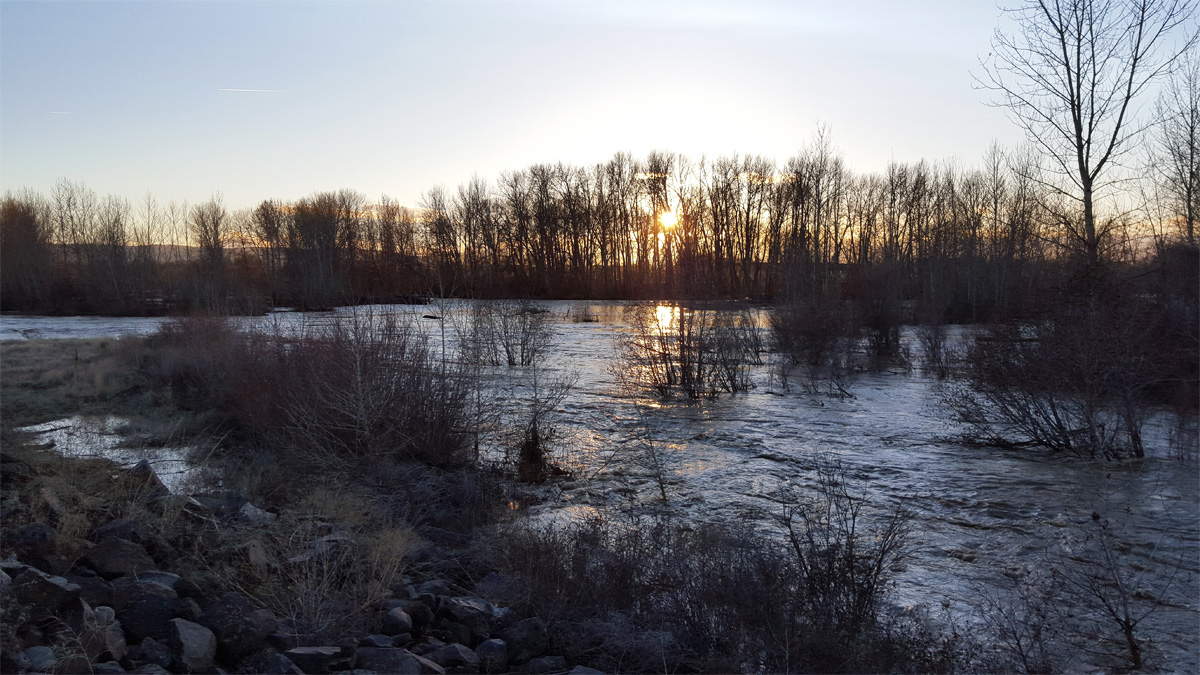
High waters can access historic side-channels of the Puyallup River as a result of levee setback projects by Pierce County in western Washington
Fast-forward to 2015 on the Puyallup River, where levees are being intentionally breached or setback to reconnect the river with its floodplains. Across the nation, people are beginning to recognize that floodplains benefit people, fish and wildlife, and the economy.
Communities of the Pacific Northwest are leading the way in acting on this through floodplain reconnection and restoration. Regional efforts resulted in the Floodplains by Design program, a partnership with Washington State’s Department of Ecology, the Puget Sound Partnership, and The Nature Conservancy. Floodplains by Design uses a competitive process to fund multi-benefit floodplain restoration projects that “improve flood protection for towns and farms, restore salmon habitats, improve water quality, and enhance outdoor recreation”.
It might seem counterintuitive to remove a levee to improve flood safety. After all, a levee is constructed to provide flood protection in the first place. The consequences of engineered flood control protection, such as levees and dams, are multifaceted, and not always obvious. A leveed river doesn’t stop flooding, it simply moves flood waters downstream more quickly. Oftentimes this results in more damaging floods downriver. Where a river isn’t constrained by levees, floodwaters can overtop riverbanks and spread across floodplain lands. In doing so, floodplains provide storage volume for floodwaters. Floodplain habitats slow moving water and allow debris and sediment to settle. By just allowing a river to access its floodplains flood levels can be lower, slower to occur, and overall less damaging in downstream reaches.
Most people likely think of floodplains as risk zones that require hazard mapping, extra building requirements or flood insurance. It turns out that a floodplain is more than just a land development term.
Floodplains support some of the most productive and diverse ecosystems on the planet, and support rivers and the surrounding environment. A river’s floodplains provide habitat for fish and wildlife, supply nutrients and shelter that enhance fish reproductive success and growth rates and help regulate in-stream temperature conditions and water quality.
Floodplain restoration efforts by Yakima County on the Yakima River reconnect salmon with vital spawning habitat in the floodplain
When a river is leveed it becomes disconnected from its floodplain. Floodplain lands are often developed in response, eliminating the natural and beneficial functions they provide to ecosystems and people.
The impacts of floodplain loss are many, but one of the most apparent is the decline of floodplain dependent fish species.
This is the case in the Puget Sound watershed, where a combination of riverbank armoring and levees, alongside residential, commercial, industrial and agricultural development has resulted in a large scale loss of functioning floodplains. Endangered Chinook salmon, Steelhead and Bull trout depend on access to floodplain habitat features like log jams to spawn and grow. Puget Sound Chinook salmon populations are at 10% of their historic numbers today as reported by The Puget Sound Partnership, and are heavily supplemented by hatchery released fish.
As the current Lapham Fellow for American Rivers I’m working with our River Restoration Team to enhance our floodplain restoration program. American Rivers is a national leader at restoring rivers from headwaters to the sea through dam removal; we want to spur similar success in restoring connection between rivers and their floodplains. By learning from the successes of Washington’s Floodplains by Design program, and engaging with local leaders that have enabled those successes, we can position ourselves to enable floodplain restoration in river basins across the country.
As we stood in the rain along the Puyallup River in December, big grins on our faces, we were watching a river retake its floodplain for the first time in decades. The next day we had the opportunity to visit other successful floodplain reconnection projects on the Yakima River in eastern Washington. Excitement about these projects and the benefits they’re bringing to communities and rivers is palpable among local, county and state professionals. Witnessing these projects in action (especially during a week of downpours and flooding) helps us define what successful floodplain restoration looks like, and reaffirms the serious need for such work to continue. We’re eager to get started.
Fire and water: two elements necessary for life, remedies for one another, contradictory, and in this case, important factors for overall watershed health.
American Rivers staff recently helped organize and oversee a controlled burn at Murphy Meadow. After a few years of hard work to align schedules and obtain burn permits, “Burn Day” was upon us and, cameras in hand, we chattered excited as we drove to meet the folks from Terra Fuego who would conduct the burn.
[su_youtube url=”https://www.youtube.com/embed/FwjMptB5GvA” width=”1020″ height=”580″]
Murphy Meadow, high above the South Yuba River Canyon, is located in the Sierra Nevada foothills and hosts a variety of interesting creatures. I spotted a Sierra Alligator Lizard and a bobcat in the half-day I was there watching the burn.
In addition to providing invaluable wildlife habitat, meadows sequester carbon, act as natural reservoirs for water storage, and improve the water quality of rivers. However, increased wildland fire suppression has led to meadows slowly being overtaken by conifers, gradually converting them to forested landscapes, rather than open spaces that offer unique habitat and hydrologic benefits. Performing prescribed burns is one way to reduce conifer encroachment and preserve the ecological function of the meadow.
Performing prescribed burns of these areas can be traced back to the Native Americans of the region, who would systematically burn swaths of land in order to clear brush and understory growth. Ron Goode of the North Fork Mono tribe describes how clearing growth from areas that were once meadows improves their ability to absorb snowmelt, allowing the water to enter aquifers and decrease fuel loads for large wildfires. For the Murphy Meadow burn, we worked with members of the local Sierra Native Alliance.
In addition, burning can be an effective way to remove invasive plant species because they are often not adapted to fire like California native species. But with development of rural areas and changes in fire management policies, setting fire to any area has become more and more challenging.
Once burned, we reseeded the meadow with native species including wildflowers. Clear of invasive species, newly sprouting conifers, and ladder fuels, the meadow is now a canvas of potential for new growth. Almost immediately, the meadow is showing signs of new life: the beginning shoots of the many native grasses and wildflower seeds that we planted will add greenery and color to the charred mounds of deergrass. The newly cleared area will also reduce fire danger for uphill homes by providing an important fire break in the event of a wildfire.
Controlled burning is just one way American Rivers is working to restore meadows, which are important hydrologic features of river headwaters. Better management of river headwaters sites can mean improved response to climate change and increased water supply reliability—both major benefits for drought-ridden California. Fire will bring life to this landscape again. And I can’t wait to see what it looks like.
In December, we were disappointed to read some ugly comments from Illinois Senator Mark Kirk about his “evil plan” (his words) to turn the Mississippi River into “one huge ag drag strip” (again, his words) by allowing the private sector to “widen and lengthen all the locks and dams.”
Come again?
Senator Kirk’s appears to be talking about an effort to use a new infrastructure financing plan called the Public Private Partnership Pilot Program to implement the lock expansion components of the Navigation and Ecosystem Sustainability Program (NESP). The Pilot Program is the brain child of the Illinois Congressional delegation, namely Congresswoman Cheri Bustos and Senators Mark Kirk and Dick Durbin. It is intended to diminish federal subsidies for navigation infrastructure. Since navigation is the most heavily subsidized mode of transportation (about 90 percent of barge infrastructure spending is paid for out of the General Treasury), we hoped an increase of private investment would be a good thing.
Unfortunately, when it’s used to pay for programs like NESP, the privatization of America’s rivers starts to look a bit scary.

Lock and Dam 24 on Mississippi River
See, NESP isn’t supposed to “widen and lengthen all the locks and dams on the Mississippi River.” The program is a dual-purpose authorization to invest in ecosystem restoration and navigation efficiency.
The ecosystem restoration component invests in aquatic habitat rehabilitation like restoring floodplain access and rebuilding islands. The navigation efficiency component invests in small-scale and non-structural alternatives that will reduce congestions at some locks and dams on the Mississippi and Illinois Rivers. If those measures aren’t successful, then the Corps will construct new, bigger locks at specific dams on the Upper Mississippi River System.
While my description sounds like a reasonable enough program, many proponents of the program want to jump right to building new locks, while ignoring the cheaper nonstructural navigation improvements and the environmental restoration. While NESP has been authorized by Congress, it has not been funded because it continually fails to pass a benefit-cost analysis smell test. The Nicollet Island Coalition detailed the problems with NESP here.
Unfortunately, the draft NESP Public-Private Partnership Pilot looks more like a mash up of NESP’s ugliest features. The proposal completely ignores the “Ecosystem” part of the Navigation and Ecosystem Sustainability Program, despite the fact that Congress requires the ecosystem and navigation projects to be funded, planned and constructed comparably and at the same time. Funding over the past year to develop NESP into a Pilot Project has focused exclusively on the navigation part of the program. Not a dime has gone to ecosystem restoration – it’s not even mentioned in the draft.
The draft NESP Pilot Program also ignores the program’s Congressionally approved implementation timeline that requires the Army Corps of Engineers to implement small-scale and non-structural navigation improvements first. These measures are cheaper and have a smaller environmental footprint. Following the completion of these projects, the Corps must then do an economic evaluation and reconsider the plan to build new locks.
Regardless of these requirements, the draft NESP Pilot Program says that if the private sponsor wants new locks right now, they will get new locks right now through the Public-Private Partnership.
Who is the private sponsor for NESP? The Illinois Soybean Association.
While the Illinois Soybean Association is willing to put up some of the money to build new locks on the Illinois and Mississippi Rivers, they still expect to make their money back, and then some. At the November 2015 Upper Mississippi River Basin Association Meeting, they outlined several options to recoup their investment, including:
- Subsidies from the Illinois general treasury,
- A lockage fee for barges,
- Tariffs on goods being transported, and/or
- A tax on all recreational boaters – including paddlers.
That’s right. Paddlers. Such a proposal adds insult to injury. Not only is the ability of generations of river recreationists to enjoy a free-flowing river impeded by the lock and dam system, now they may be asked to pay for that privilege.
Politicians usually try to sugar coat their evil plans, but the Public Private Partnership Pilot Program for NESP is being pretty open about advancing environmentally detrimental projects that aren’t in the public’s best interest – and make those of us who would prefer a free-flowing river pay for it.
Congress has launched at least fourteen legislative attacks on the Environmental Protection Agency and Army Corps’ Clean Water Rule since it was proposed in April of 2014 – this week marks one more.
The Clean Water Rule restores important safeguards to small streams and wetlands that are needed in order to protect our drinking water supplies, economy and environment. It also provides clarity for all stakeholders as to which waters are and which waters are not protected by the Clean Water Act. Unfortunately, polluters and their allies in Congress have become desperate to avoid the possibility of having to get a permit before filling in or polluting our nation’s waters and are now trying to use the Congressional Review Act to block the Clean Water Rule and any iteration of it in the future.
The U.S. House of Representatives is voting on a resolution under the Congressional Review Act to block the Clean Water Rule [S.J. Res 22]. The resolution does far more than just reject the Clean Water Rule; it prevents the EPA and Army Corps from ever developing a new rule that is “substantially similar.” Therefore if S.J. Res. 22 is enacted, EPA and the Army Corps will be prohibited from taking the necessary steps to protect our drinking water from polluters.
The scientific foundation of the The Clean Water Rule is the accompanying scientific report Connectivity of Streams and Wetlands to Downstream Waters: A Review and Synthesis of the Scientific Evidence, a compilation of more than 1,200 individually peer reviewed scientific studies. The Connectivity Report itself was formally peer reviewed by a Science Advisory Board. The science is conclusive: small streams and wetlands exert a strong influence on the physical, chemical, and biological integrity of downstream waters and are interconnected with navigable waters hydrologically and ecologically. Due to this scientifically proven connection to larger bodies of water, small streams and wetlands are protected under the Clean Water Rule.
The comment period for the Clean Water Rule lasted almost seven months. During that time more than 1 million comments were submitted to the EPA, and of those comments more than 800,000 were in favor of the Clean Water Rule. The EPA and Army Corps reviewed those comments very carefully and incorporated them into the final Clean Water Rule which was published in June of 2015.
The final Clean Water Rule is based on sound science and had ample public input and support. Congress should be protecting our clean water rather than trying to protect polluters.
Winter rain is starting to bring welcome relief to dehydrated California, but with an epic El Niño sending storm after storm our way, how do we prepare for too little water and too much all at once? Despite the historic and continuing drought, emergency response officials are already busy planning for floods and mudslides in the months to come.
How do we capture more water from this wet winter while diminishing floods? Slow that water down, and sink as much of it into the ground as we can.

Storm drains often pour straight into creeks and streams increasing flood risk downstream
In cities and towns, that means relying on green infrastructure like rain gardens to capture stormwater from our rooftops and streets.
For instance, the roof on a 30 by 30 foot building catches more than 500 gallons of water from just a single inch of rain. Those 500 gallons can go straight into the storm drain and contribute to flooding, or they can go into a rain garden to soak into the ground.
Much of the water will still make its way to nearby streams and rivers, but more slowly. Even better, if you have a rain barrel installed, that water can help meet your landscape water needs on the way.
That may not sound like a huge difference, but when you consider an entire neighborhood it adds up quickly.

This rain garden catches stormwater from a large parky lot and in Nevade City, CA and sinks it into the ground
Watch where water goes in your own neighborhood the next time it rains—are green spaces soaking up the water, or does it pour into storm drains? Working together with neighbors and encouraging your town to adopt green infrastructure practices wherever possible can make a big difference.
Where we point our stormwater can mean helping reduce the drought or dealing with a harsher winter floods.
Find out more about polluted runoff from storms and green infrastructure practices.
When considering the challenges faced in the upper Flint River, water use and land use change tend to dominate the conversation. However, there’s another big ‘change’ out there that deserves serious consideration—the ‘change’ of the climate. Considering that some of the worst impacts of climate are expected to be felt through the changing hydrologic cycle, this is an issue that cannot be ignored.
Many of the policy discussions surrounding climate change focus on mitigation—how to slow or reverse the trend of a warming planet in the medium- to long-term. On the ground, we talk about climate change adaptation—how to prepare for an increasingly erratic climate today. Climate scientists’ latest predictions for Georgia envisage a similar amount of rain (compared to current conditions) on average, but it will probably come from storms that are more intense and less frequent, resulting in an overall decrease in water availability along with an increase in adverse environmental impacts from stormwater flooding. Additionally, we can expect a lot more days above 95oF, more large hurricanes, and a more frequent occurrence of flood and drought over the next century. Nothing we do in the short term will change these outcomes, but we can adapt.
American Rivers and The Conservation Fund recently attended a workshop by the Wildlife Conservation Society on how to integrate climate predictions into conservation planning. For the upper Flint River, the shoals became a primary focus. The shoals are shallow sections of river with fast currents and small rapids, which are home to the shoal bass (a prized endemic sport fish), the recently discovered Halloween Darter, and several species of threatened and endangered mussels. In previous droughts, the Flint River dropped enough to dry out the major shoals. Based on the climate predictions for the region, there is a high risk that these shoals will spend even more time without water running through them during future droughts, resulting in further loss of habitat and recreational opportunities like fishing or paddling. S.O.S.—Save Our Shoals!!!
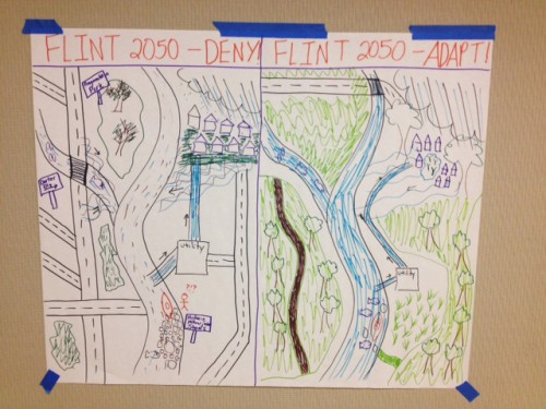
After two days of considering the predictions, challenges, opportunities, and the potential actions that could be taken from a ‘climate informed’ perspective, we left confident that our plan for the upper Flint River is a solid first step to address the anticipated impacts of climate change. However, maintaining flexibility in our plan will be vital as better science becomes available. We also learned that adaptation can be fun!
The Hydrologic Regimes They Are A-Changin’
Adapted from The Times They Are A-Changin’ by Bob Dylan
Come gather ’round people
Wherever you roam
And admit that the waters
Around you have an altered hydrologic regime
And accept it that soon
You’ll be drenched to the bone, or bone dry
If your river to you
Is worth savin’
Then you better start adaptin’
Or you’ll sink like a stone
For the hydrologic regimes they are a-changin’
As of November 19, 2015, Colorado has its first ever Water Plan. The Plan, ordered by Governor Hickenlooper in 2013, is intended to guide how the State of Colorado will manage water, protect rivers, and sustain agriculture through 2050 while facing climate change and a growing population. The Plan represents thousands of hours of work on behalf of the Colorado Water Conservation Board, river basin roundtables, and conservation organizations like American Rivers and many others.
So what’s in the Plan? Groundbreaking stuff- a conservation goal of 400,000 acre/feet or a little over 130 billion gallons of water in cities and towns, recognition that streams and rivers are important to Colorado’s economy and quality of life, committed funding for Stream Management Plans, a commitment to more flexible and dynamic water management, and an assurance that future water development will not come at the expense of farms and ranches.
The revolution of the Colorado Water Plan cannot be overstated. For over a hundred years, water has been managed at the expense of rivers. It has been litigated and literally fought over. In Colorado, it has been the east side of the state vs. the west side, farmers vs. cities, and environmentalists vs. all of the above. On November 19th, the needle moved. Conservationists, ranchers, and city water providers representing every corner of the state stood behind the governor in support of the final Plan.
Equally as revolutionary is that following the release of the Plan, one representative from each of the 9 basin roundtables (the structure from which the Water Plan was developed) was selected to comment before the Governor, CWCB, and the media. There are 25-30 representatives on each roundtable, of which one or two represent conservation interests. Ken Neubecker, Associate Director of the Colorado Basin Program for American Rivers, was chosen by his roundtable colleagues to speak for the Colorado River basin. This represents a colossal shift in the paradigm and recognition that if the State of Colorado is going to have healthy rivers, thriving cities, and vibrant agriculture, we have to work together and embrace our shared values. Seven years ago, it was unthinkable that an established conservationist like Ken would be asked by his roundtable peers (mostly ranchers) to speak for their river.
It is important to understand that the final Water Plan is merely a document. Real success will be determined by how it is implemented, which will take a lot of work, dedication and money. Successful implementation depends on growing the goodwill and trust that has been built between conservation, agriculture, and municipal water providers during the Plan’s development. But for, now we should celebrate how far we have come and all those who made it happen.
Big congratulations to American Rivers, Western Resource Advocates, Trout Unlimited, Conservation Colorado, Environmental Defense Fund, Audubon, all the basin roundtables, the Colorado Water Conservation Board, Governor Hickenlooper, and many many others.
When I was in high school and my sister was away at college, we would ask for large desk calendars for Christmas (now that I see this fact in writing, I notice how sad it sounds. We did receive other, less boring gifts, I promise). We would then spend the following year using them to keep track of homework assignments, test dates, and more importantly, our vacations from school. We’d also keep track of fun activities we did, any trips we took, or notable things from our days on our calendars. After each month, instead of ripping the page off and throwing it in the recycling, we’d simply turn it over and tuck it behind the rest of the calendar.
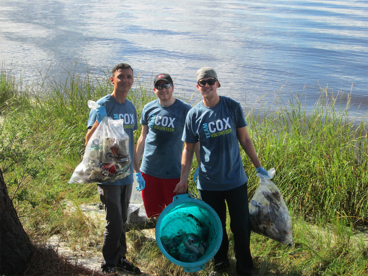
In November 2015, volunteers removed trash from the banks of the St. Johns River in Jacksonville, FL
By the end of the year, our calendars would be a little bulky but we managed to keep them in one piece most of the time.
After Christmas, when my sister was home from college on her long winter vacation, we would each pull out our calendar, flip to the beginning and each take turns going through our year, month by month. Even though we kept in touch while she was away at school, it was a great way to catch up with each other, share our accomplishments, and remember some of the smaller details that might have been forgotten.
To honor that tradition, I’m going to share the highlights, accomplishments, and memories from the 2015 cleanup season! In the past 12 months of cleanups, organizers across the country have accomplished great things, including:
- Registering 1,320 cleanup sites
- Mobilizing 45,399 volunteers
- Removing 1,971,442 pounds of trash
I was lucky enough to take over the National River Cleanup® program in August of this year and was out at my first American Rivers cleanup on the Merrimack River in Massachusetts within the month. I learned a lot about organizing a cleanup and was energized by the enthusiasm and passion of the volunteers. The excitement stuck with me as we hosted cleanups in some of our priority river basins.
We cleaned up the Ashley River in South Carolina, the Yampa River in Colorado, and Marsh Creek in California. The first half of the year brought volunteers together with American Rivers in Knoxville, Tennessee; Windsor, Virginia; Sumner, Washington; Castroville, California; and Waterbury, Vermont.
I saw volunteers stick out the rain and extreme heat to clean up their waterways and pull tremendous amount of trash out of rivers.
We unearthed countless tires, bottles, and even an ATM and enjoyed getting a closer look at our local rivers. With 2015 coming to a close, I’ve already started filling in my calendar for 2016: The 25th Anniversary of National River Cleanup!
With this milestone, American Rivers plans to expand our reach and hold more cleanup events in our priority river basins! Make sure to mark your calendars with these events and come out to clean up:
- the Anacostia River in Washington, DC in April
- the Yampa River in Steamboat Springs, CO in July
- the Nooksack River in Bellingham, WA in September
- the Ashley River in Charleston, SC in September
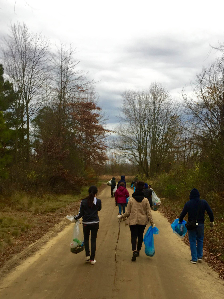
Volunteers at a local cleanup in November 2015 remove trash from Assunpink Creek in Trenton, NJ
I have had a blast being a part of the National River Cleanup program for the past few months. It has definitely added some bright spots to my planner and I look forward to filling in more in 2016!
Because of the hard work of all the cleanup coordinators and volunteers, communities have cleaner rivers, safer drinking water, and more scenic waterways for all to enjoy. Thank you for all your hard work in 2015!
Leave a comment below telling me about your favorite river cleanup memory from 2015, or what you’re most looking forward to in 2016!
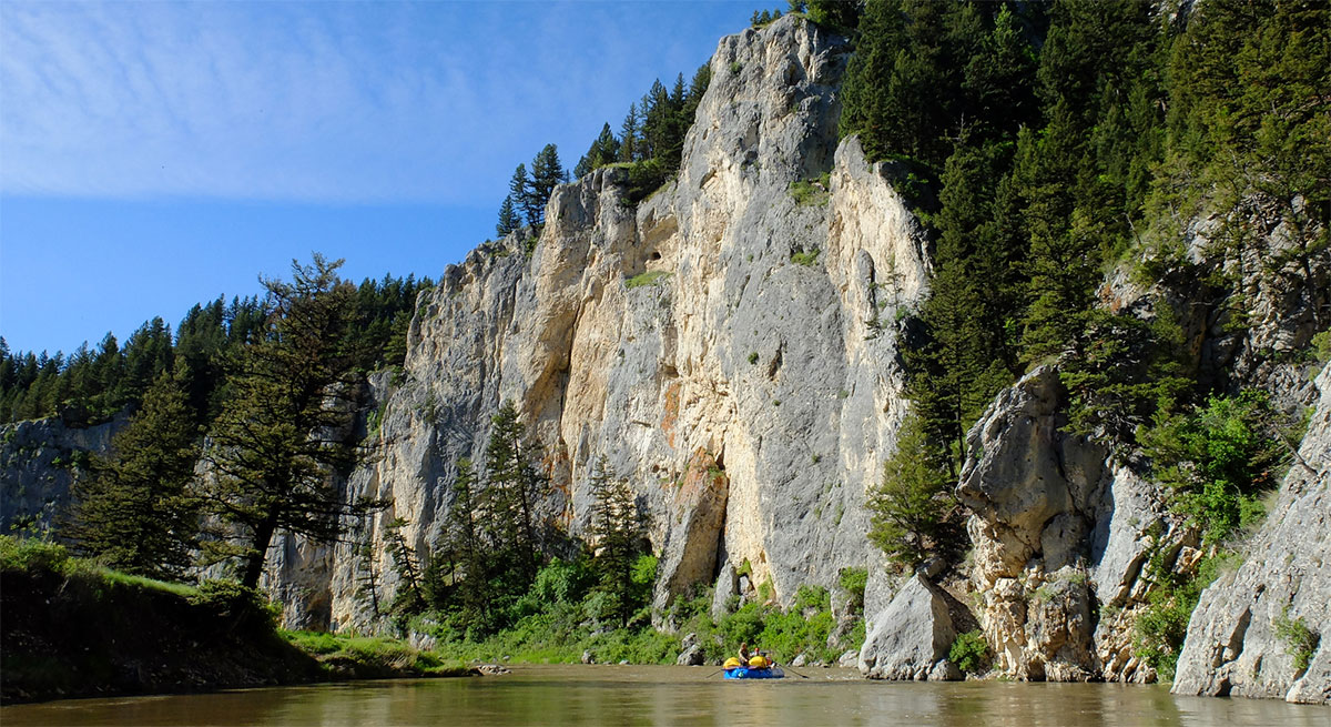
Last June, while on a Smith River float trip hosted by American Rivers, our group was on the Smith River in Montana and got caught in one of the most violent rainstorms I’ve ever witnessed.
Thunder shook the canyon walls, lightning flashed all around us, and it dumped two inches of rain in a matter of minutes. As the storm passed, the once-clear river quickly turned to mocha and its volume more than doubled.
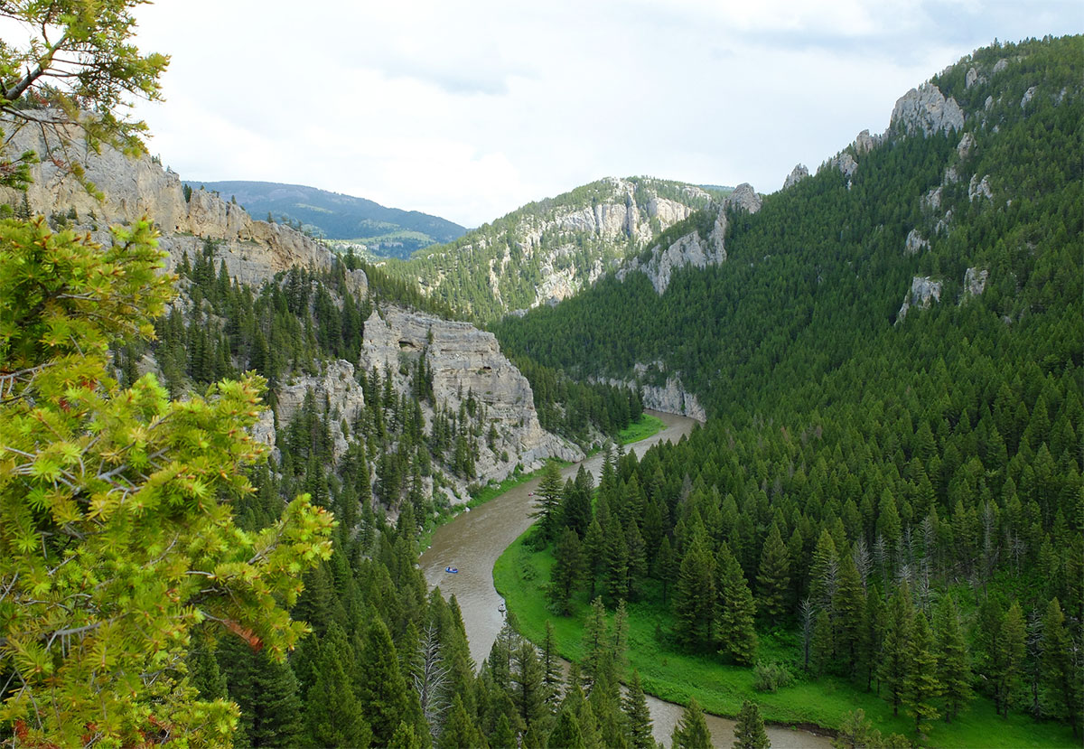
Smith River
Why am I sharing this story?
Because the mining company that just submitted a permit application to the Montana Department of Environmental Quality (DEQ) to build an underground copper mine in the headwaters of the Smith River, listed as one of America’s Most Endangered Rivers in 2015, says not to worry. They tell us that the mine would be located along upper Sheep Creek, some 19 miles upstream from its confluence with the Smith River.
But as that thunderstorm so vividly demonstrated, what happens in the headwaters affects everything downstream. Pollution from mining flows downstream, too.
To be fair, the Vancouver, B.C. based company that wants to build the so-called Black Butte copper mine, Tintina Resources, has been very transparent about their plans and they promise to build a modern mine with environmental protections the likes of which Montana has never seen.
And having met with Tintina’s front people in White Sulphur Springs, they are genuinely nice and I believe they care about what happens to their community and the surrounding landscape.
The problem is, these lifelong Montanans don’t control Tintina Resources. As of last month, Tintina fell under the control of an Australian mining company, Sandfire Resources. That means every major decision about the Black Butte copper mine will be made in a boardroom ten thousand miles away.
It’s not far-fetched to say that sometime in the future after the mine is opened – if it is permitted—it could be sold to another company. At that point, the new owner could seek to change the mine from a relatively benign underground operation to a much riskier open-pit mine. Tintina says that would never happen because its contracts with surface landowners prohibit it, but contracts can be renegotiated if the financial incentives are sweet enough.
Rafting on Montana’s Smith River
Even if Tintina retains ownership of the Black Butte copper mine for the duration, the anticipated lifespan of the mine is only 11 years. After the mine closes, or perhaps even before then, Tintina almost surely will seek to expand its mining operations onto adjacent lands. While the footprint of the Black Butte copper mine is a mere 250 acres, Tintina controls mineral rights on 12,000 acres of surrounding lands.
For all intents and purposes, what is being proposed here is not simply a modest-sized copper mine that will be around for only a decade: It’s a gambit to establish an industrial-scale mining district that could be around for several decades.
Finally, there’s no getting around the fact that mining companies are notorious for making, and then breaking, lofty promises about how their operations will be environmentally benign. Far too often they metastasize into unmitigated environmental disasters. A recent case in point is the “state-of-the-art” Mt. Polley open-pit copper and gold mine in British Columbia, which suffered a catastrophic breach of its tailings impoundment last year, wreaking havoc on downstream salmon runs.
There are plenty of examples of modern mining operations gone bad right here in Montana. Among them are the Zortman-Landusky mine near Malta, Beal Mountain mine near Anaconda, Kendall mine near Lewistown, and Basin Creek mine south of Helena. In most of these cases, taxpayers will end up paying millions of dollars in cleanup costs. Meanwhile, the rivers and streams that are polluted rarely are returned to their former health.
In reviewing the permit for the proposed Black Butte copper mine, the Montana DEQ would be wise to heed the words of advice that casinos commonly post for all gamblers to see: “Don’t bet more than you can afford to lose.” For what’s at stake here is much more valuable than a stack of poker chips: It’s the Smith River. Once it is lost, it can never be won back.
Earlier this week, the US House of Representatives voted to advance an industry wish list bill for hydropower dam owners.
H.R. 8, the hydropower industry’s so-called “Unlock Hydro” bill creates a giant loophole that allows hydropower dam operators to avoid requirements to protect fish, wildlife and water quality. My colleagues and I are springing into action to fight this bill as it moves to the Senate.
The industry and their allies in Congress claim that hydropower is “clean” energy. But if their idea for power rejects the Clean Water Act and Endangered Species Act, then I don’t think you can call it clean, or responsible.
It shouldn’t come as a surprise that massive coal-fired utilities like Duke Energy and Southern Company are pushing this anti-environment bill. After all, hydropower companies own four of the top ten dirtiest power plants.
The good news is that H.R. 8 passed the House on a narrow vote. And President Obama threatened to veto the bill [pdf] if it gets to his desk because the bill “would undercut bedrock environmental statutes, including the Clean Water Act, the National Environmental Policy Act, and the Endangered Species Act.” However, we can’t afford to let it get that far. My colleagues and I will not sit by while this happens. But to take on critical fights like this, we need you!
The “Unlock Hydro” bill is outrageous. We need your help to stand up to the industry and to promote real clean energy – not a 19th century vision for the future of U.S. energy policy. If you agree, help us fight back.
Thanks for standing with us to ensure our rivers, fish and wildlife are protected.