Removing dams has tremendous benefits for river health, public safety and climate resilience, according to “Free Rivers: The State of Dam Removal in the U.S.,” a report released today by American Rivers. Fifty-seven dams were removed in 2021, reconnecting more than 2,131 miles of rivers. In addition, American Rivers is highlighting 25 dam removals to watch for 2022 and beyond.
Resources to bookmark
Report: Free Rivers: The State of Dam Removal in the U.S.
Full Database of Dam Removals 1912-2021: www.americanrivers.org/DamRemovalDatabase
Map of U.S. Dams Removed Since 1912: www.americanrivers.org/DamRemovalMap
As part of its leadership in river restoration, American Rivers tracks dam removal trends and maintains a national dam removal database. A recorded 1,957 dams have been removed in the U.S. since 1912. In 2021, the states leading in dam removal were:
- Vermont, Pennsylvania and Oregon (7 removals each)
- New Jersey (6 removals)
- Wisconsin (4 removals)
Twenty-two states removed dams in 2021: California, Connecticut, Idaho, Illinois, Indiana, Kentucky, Maine, Massachusetts, Michigan, Minnesota, Montana, New Hampshire, New Jersey, New York, North Carolina, Ohio, Oregon, Pennsylvania, Texas, Vermont, Washington and Wisconsin.
Successes from 2021 include:
- Public safety (Hammel Woods Dam on DuPage River, Illinois)— This low-head dam was removed by the Will County Forest Preserve District because three people had drowned at the dam in recent years. This project is complemented in the broader watershed by the neighboring Forest Preserves of Cook County who have been working to remove unsafe and ecologically harmful dams on the Des Plaines and North Branch Chicago River (see our “projects to watch” list for more information).
- Access and recreation (Hyde Dam on White River, Vermont)— This project involved the removal of a former mill dam from a site that had a dam as early as the 1700s. Upon completion of the dam removal project, partners will develop the historic site as a public access area for angling, swimming and boating. This project builds upon the momentum of the Vermont Dams Task Force as one of seven dam removals for Vermont in 2021.
- Fish and wildlife habitat (Ward Mill Dam on Watauga River, North Carolina)— Built in 1890, this hydropower dam ranked first in the North Carolina barrier assessment tool to increase aquatic connectivity. American Rivers led this project that improved habitat for resident fish and wildlife like the Eastern hellbender (the largest salamander in the U.S.) in partnership with MountainTrue, Blue Ridge Resource Conservation and Development and U.S. Fish and Wildlife Service.
While we busted some key dams in 2021, we all need to work together to significantly accelerate dam removal efforts nationwide if we are to prevent further declines in river health, prevent extinction of fish and wildlife, enhance our diverse communities and safeguard the public from failing dams. The Infrastructure Investment and Jobs Act, signed into law late last year is an important step, committing $2.4 billion for the removal, retrofit and rehabilitation of dams. Now we are urging Congress to include the 21st Century Dams Act, a bill introduced in 2021, in the upcoming Water Resources Development Act. This will provide programmatic authority and funding authorization for the removal of dams with willing owners, funding to increase capacity of state dam safety programs and resources to support dam retrofits to improve hydropower productivity.
American Rivers also released a list of 25 dam removal “projects to watch” for 2022 and future years. This list is not exhaustive. It is meant to illustrate examples and highlight opportunities. The projects range from small dams with willing owners where river restoration will deliver important local benefits, to bigger dam removal efforts that are vital to saving species from extinction and addressing longstanding injustices across entire regions.
Today, dam safety offices, fisheries managers, dam owners and communities are taking a second look at the benefits and impacts of dams. Many are deciding that removal is the best option— one that can bring significant benefits to the environment, community and economy. Every $1 million invested in restoring watersheds generates 16 jobs and up to $2.5 million for the economy. Dam removal is a proven tool to restore river health, improve public safety, revitalize fish and wildlife populations, safeguard cultural values and reconnect communities to their rivers.
American Rivers imagines a country where everyone has access to clean, safe, healthy rivers; where people don’t have to fear being evacuated from their home in the middle of the night because a dilapidated dam is about to fail and where municipal governments can invest tax dollars in community programs rather than patching up outdated infrastructure. We imagine a world where Tribal Nations’ spiritual and cultural connection to rivers, water and salmon are honored by bringing Indigenous voices to the forefront and through actions that heal our collective relationship with rivers; where the entire web of life can thrive.
We congratulate our partners across the country on their 2021 dam removal projects and look forward to busting more dams in 2022!
As part of “Free Rivers: the state of dam removal in the U.S.”, American Rivers is spotlighting 25 projects to watch for 2022 and beyond.
Thousands of dams need to come down in the U.S., and there are opportunities for river restoration at every size and scale. American Rivers curated the following list of 25 dam removal projects to illustrate examples and highlight opportunities of the types of dam removal projects that exist across the country.
“The related crises of climate change, racial injustice, and biodiversity loss are further degrading our rivers and require us to accelerate river restoration through dam removals nationwide,” said Tom Kiernan, President of American Rivers.
“Congress, the administration, and the river restoration community need to significantly accelerate dam removal efforts nationwide if we are to prevent further declines in river health, prevent extinction of fish and wildlife, enhance communities, and safeguard the public from failing dams,” Kiernan said.
This “projects to watch” list is not exhaustive. The projects range from small dams with willing owners where river restoration will deliver important local benefits, to bigger dam removal efforts that are vital to saving species from extinction and addressing longstanding injustices across entire regions.
River: Little Sugar Creek
Dam: Lake Bella Vista Dam
State: Arkansas
Notes: Lake Bella Vista Dam is a dilapidated structure originally built in 1915 on Little Sugar Creek in Bentonville, AR as part of a vision to establish a recreational lake for a new resort. However, a 1921 flood nearly destroyed the dam and caused severe damage to several resort facilities. Further flooding in April 2021 breached the dam and washed out more of the structure. The City of Bentonville voted to remove the remains of the dam in September 2021.
Removal of the Lake Bella Vista Dam will remove any remaining hazards from the river and allow Little Sugar Creek to be restored.
Contact:
Greg Van Horn
Friends of Little Sugar Creek
gregmvanhorn@gmail.com
River: Matilija Creek
Dam: Matilija Dam
State: California
Notes: Built in 1947, the 168-foot tall Matilija Dam blocks a tributary of the Ventura River about 16 miles from the Pacific Ocean, completely blocking federally endangered Southern steelhead migration on the Ventura River and preventing passage to over 50 percent of the primary spawning.
Its removal will reconnect access to critical steelhead habitat and help with the recovery of steelhead in Southern California.
Contact:
Russell Marlow
California Trout
rmarlow@caltrout.org
River: Malibu Creek
Dam: Rindge Dam
State: California
Notes: A 100-ft high concrete dam and spillway structure built in Malibu Creek on the Rindge family property in 1926, Rindge Dam was constructed as a water supply for local ranching, agriculture, and landscape irrigation. Removal is a high priority for Southern California steelhead trout recovery because it will allow access to 18 miles of high-quality spawning and rearing habitat in the Malibu Creek watershed.
The U.S. Army Corps of Engineers and the California Department of Parks and Recreation completed a feasibility study in 2020 and will move forward with dam removal design (the preferred alternative) in 2022.
Contact:
Lisa Schiavinato
California Trout
lschiavinator@caltrout.org
River: Eel River
Dam: Scott Dam
State: California
Notes: One of two dams that make up the Potter Valley Project. The Eel River is the third-largest watershed in California, traversing Trinity, Lake, Mendocino and Humboldt Counties. It was once home to some of the West Coast’s most productive salmon and steelhead fisheries. The Potter Valley Project, a hydroelectric facility that transfers water from the Eel River into the Russian River was built in the early 20th Century. The project now produces very little power and completely blocks fish passage to the Eel River’s headwaters.
There is clear scientific proof that the best path forward for the health of the Eel River and for water assurance to the Russian River is to remove Scott Dam.
Contact:
Tracey Diaz
California Trout
tdiaz@caltrout.org
River: San Francisquito Creek
Dam: Searsville Dam
State: California
Notes: For over a century, the dam has impacted San Francisquito Creek watershed and the greater San Francisco Bay estuary. Built in 1892, Searsville Dam has lost over 90% of its original water storage capacity as roughly 1.5 million cubic yards of sediment has filled in the reservoir. Searsville Dam does not provide potable water, flood control, or hydropower – its primary use is providing irrigation water to Stanford campus.
Current plans to address fish passage at the dam are unsatisfactory and may still create risk for downstream property owners. A draft Environmental Impact Report is expected later this year as project partners await more detail about the path Stanford is pursuing.
Contact:
Patrick Samuel
California Trout
psamuel@caltrout.org
River: Klamath River
Dam: 4 dams — J.C. Boyle, Copco No. 1, Copco No. 2, and Iron Gate dams
State: California and Oregon
Notes: For nearly 100 years, dams on the Klamath have blocked salmon and steelhead from reaching hundreds of miles of habitat, and have harmed water quality for people and wildlife. Four dams – J.C. Boyle, Copco No. 1, Copco No. 2 and Iron Gate – built between 1908 and 1962, are slated to be removed in 2023. This river restoration project will have lasting benefits for the river, salmon and communities throughout the Klamath Basin.
Dam removal will restore access to more than 300 miles of habitat for salmon. A free-flowing Klamath River will better support the river’s Tribal Nations and local communities, as rising temperatures threaten resources they depend on. The four Klamath dams produce a nominal amount of power, which will be replaced using renewables such as new wind energy and efficiency measures.
This dam removal and river restoration effort will be one of the most significant the world has ever seen.
Contact:
Brian Graber
American Rivers
bgraber@americanrivers.org
River: Brandywine River
Dam: Bancroft Mills Dam No. 4
State: Delaware
Notes: Currently, there are 10 low-head dams littering 7.2 miles of the Brandywine River in Delaware. Many of these small dams are safety hazards and block access to spawning habitat for migratory fish.
Brandywine Shad 2020 is now working with the Delaware DNREC Division of Parks & Recreation and DuPont Co./City of Wilmington to obtain final permits, prepare final engineering plans/specifications, and retain contractors to remove three dams — including Bancroft Mills Dam — in 2022.
Contact:
Dr. Jerry Kauffman
University of Delaware Water Resources Center
jerryk@udel.edu
River: Ocklawaha River
Dam: Rodman Dam
State: Florida
Notes: In 1968, the natural connection of the Ocklawaha River to the St. Johns River was severed by the Rodman Dam, part of the Cross Florida Barge Canal that was never built. The dam flooded over 7,500 acres of forested wetlands, 20 springs and 16 miles of the Ocklawaha River. It also caused significant harm to threatened and endangered species, adjacent wetlands and forests, 12 miles of downstream river and wetlands and the St. Johns River. While the reservoir behind the dam, Rodman Pool, became a popular bass fishing destination, the pool has never functioned as a natural lake and must be artificially maintained and drained every three to four years to kill nuisance aquatic vegetation with herbicides.
Decades of federal and state agency science and recommendations, two environmental impact statements and more than 30 conservation organizations across the state support improving river health by breaching the earthen dam at the historic Ocklawaha River channel. This plan would restore river and spring flows and improve water quality and floodplain function
Contact:
Lisa Rinaman
St Johns Riverkeeper
lisa@stjohnsriverkeeper.org
River: Des Plaines River
Dam: Multiple dams
State: Illinois
Notes: Forest Preserves of Cook County are working to restore river habitat and remove outdated infrastructure in the Des Plaines River and North Branch of the Chicago River by removing a series of low-head dams. At one time, the Forest Preserves of Cook County owned seven low-head dams on the Des Plaines River and two low-head dams on the North Branch of the Chicago River. These dams were built between 1918 and 1968 for recreation, transportation and sanitary waste purposes. Today, with regional waste water treatment plants and roadway/highway bridges, these dams no longer serve their original purposes. In fact, these dams prevent the passage of riverine fishes, trap bedload material of sand and gravel and are hazardous to canoeing and paddlers.
Removing the dams on the Des Plaines River will complete the defragmentation of the upper Des Plaines River mainstem, allowing it to flow freely from its headwaters in Racine County, WI to the Brandon Road Lock & Dam in Joliet, IL. To date, more than nine dams have been removed from the Des Plaines River with more planned.
Contact:
Adnan Nammari
Forest Preserves of Cook County
adnan.nammari@cookcountyil.gov
River: Henderson Creek
Dam: Hickey-Martin Dam
State: Indiana
Notes: The 8-foot tall Hickey-Martin Dam was built in the 1930s by the Civilian Conservation Corps to create a swimming area as part of a larger, planned recreation area. The reservoir began filling with sediment by the 1950s, and the project was officially abandoned in the 1960s. The dam is now in disrepair and blocks all upstream passage of native fish.
The U.S. Forest Service is leading removal of this dam and considers it an essential project in a priority watershed on the Hoosier National Forest. This phased dam removal is set to begin in 2022.
Contact:
Len Kring
US Forest Service
len.m.kring@usda.gov
River: Ipswich River
Dam: South Middleton Dam
State: Massachusetts
Notes: The removal of the South Middleton Dam has been many years in the making, but 2022 promises to be a big year for the project. This project will be the first major dam removal project to take place on the Ipswich River (declared one of American Rivers’ Most Endangered Rivers of 2021). The dam removal will restore connectivity to over 57 miles of valuable mainstem and tributary habitat, as well as 119 acres of coastal headwater ponds. The project will also serve as an example of the multi-benefit nature of dam removal projects within the dam-dense North Shore of Massachusetts.
The majority of necessary permits have been recently secured, but one final push is needed to finish the permitting and secure the funding required to move to project implementation.
Contact:
Neil Shea
Ipswich River Watershed Association
nshea@ipswichriver.org
River: Ipswich River
Dam: Ipswich Mills Dam
State: Massachusetts
Notes: This dam has interrupted the ecology of the river for almost 400 years. The granite block dam was originally constructed to power adjacent mills yet currently has no functional use. A fishway was installed in 1995, but it is not effective for some migratory species such as rainbow smelt and American shad. The Division of Ecological Restoration ranks this dam in the top 5% of all dams in Massachusetts for the restoration potential removal would provide, opening 49.19 miles of habitat and restoring freshwater tidal habitat.
The completion of this project would be a triumph and testament to the hard work and dedication of the community, local and state government, and multitude of organizations who have contributed to advancing this project over the years.
Contact:
Neil Shea
Ipswich River Watershed Association
nshea@ipswichriver.org
River: Cypress Branch
Dam: Cypress Branch Dam
State: Maryland
Notes: Cypress Branch Dam is an earthen and rock-rubble dam structure owned by the Maryland Department of Natural Resources (DNR), that currently serves no functional purpose and is in an advanced state of disrepair.
American Rivers, working in partnership with the Maryland Department of Natural Resources and the U.S. Fish and Wildlife Service, aims to restore anadromous species habitat through the removal of the dam. This project will restore Cypress Branch to a free-flowing, un-impounded stream, and will restore 18 mainstem and tributary miles of spawning habitat for blueback herring and alewife in an effort to ensure sustainable populations of these native species.
Contact:
Serena McClain
American Rivers
smcclain@americanrivers.org
River: Temple Stream
Dam: Walton’s Mill Dam
State: Maine
Notes: The decision to remove Walton’s Mill Dam was developed with local citizens, and the work will include rebuilding the adjacent community park and replacing several upstream undersized road stream crossings. The watershed-wide effort will restore over 52 miles of productive cold-water habitat for wild Atlantic salmon and other native fish.
The project is part of a broader effort over the past several decades to restore endangered Atlantic salmon and other sea-run fish to the Kennebec River, an effort ignited by the successful removal of Edwards Dam in 1999.
Contact:
Maranda Nemeth
Atlantic Salmon Federation
mnemeth@asfmaine.org
River: Mississippi River
Dam: 2 Dams — Lower St. Anthony Falls Dam and Lock and Dam 1
State: Minnesota
Notes: Starting in the early 1900s, locks and dams were built on the Mississippi River below the Falls of St. Anthony in the heart of the Twin Cities to provide hydropower and navigation. When the rapids drowned, dozens of species of mussel, fish, birds, reptiles and other wildlife suffered.
The dams no longer serve their navigation purpose and hydropower production is significantly below capacity. Yet their ecosystem impacts are far less benign. Habitat in the upper half of the Mississippi River is degrading at a rate of up to 4 percent annually – primarily due to the locks and dams. Restoring the Mississippi River Gorge would create habitat for over 50 rare, threatened and endangered species. Of those, over a dozen species recovery outlooks would significantly improve if the Mississippi River Gorge Rapids were restored.
Contact:
Olivia Dorothy
American Rivers
odorothy@americanrivers.org
River: Furnace Brook
Dam: Maiden Lane Dam
State: New York
Notes: This 25-foot tall concrete gravity structure is located in the Town of Cortlandt on Furnace Brook, a tributary of the Hudson River. Built sometime around 1900 by one of the former owners of McAndrews Estate for aesthetic purposes, the estate was abandoned in the 1960’s and became a Westchester County Park shortly after the County condemned the property. It is the first dam fish encounter traveling up from the Hudson and provides habitat for approximately 85% of New York State’s fish and wildlife species, 200 of which rely on the Hudson River for spawning, nursery and forage habitat.
The first barrier on Furnace Brook, Furnace Brook Barrier #1, was removed in 2020. The removal of Maiden Lane Dam will reconnect approximately 1.5 miles of habitat for fish and other aquatic species.
Contact:
Suzette Lopane
County of Westchester
sbl1@westchestergov.com
River: Mahoning River
Dam: Multiple dams
State: Ohio
Notes: The Lowellville Dam was the first dam removal and river restoration project to take place in the Mahoning River. It was the catalyst for subsequent projects that will follow, which includes a commitment to removing the nine remaining low head dams in the Mahoning River. The lower Mahoning Restoration Project is a priority of Eastgate due to the level of water quality impairments caused by the low head dams and the contaminated sediments that have accumulated behind them.
Contact:
Eastgate Regional Council of Governments
https://www.eastgatecog.org/environmental-planning/mahoningriver
River: Kellogg Creek
Dam: Kellogg Dam
State: Oregon
Notes: Constructed in 1858 for a flour mill that closed in the 1890s, the dam has been obsolete for over a century, having served no purpose since the mill closed. It is a barrier to threatened and endangered salmon as well as other native species. The dam also impounds water increasing floodway elevation, restricts sediment transport, and increases water temperatures. The Hwy 99E bridge was constructed on top of the dam in 1934 complicating its easy removal.
The project would replace the Highway 99E Bridge, restore the existing impoundment to a functioning creek and floodplain, and create a pedestrian nature trail. Removal would restore access to the entire Kellogg-Mt. Scott Watershed and 16 miles of important spawning habitat and thermal refugia for listed species.
Contact:
April McEwen
American Rivers
amcewen@americanrivers.org
River: Susquehanna River
Dam: Oakland Dam
State: Pennsylvania
Notes: A former hydropower dam abandoned more than 20 years ago, the dam spans the river at more 755 feet wide and 16 feet tall. A 100-ft wide breach in the center is a severe hazard for paddlers and anglers on the North Branch Susquehanna River Water Trail and a velocity barrier for fish.
Removal will reconnect 250 miles of aquatic habitat for sport fish, ESA and common mussels and mussel fish host species. It will also eliminate a known hazard from a water trail that is gaining popularity with paddlers.
Contact:
Lisa Hollingsworth-Segedy
American Rivers
lhollingsworth-segedy@americanrivers.org
River: Chiques Creek
Dam: Chiques Roller Mill Dam
State: Pennsylvania
Notes: American Rivers is working on the removal of this dam (an approximately 10-foot high by 130-foot long stone masonry structure), which is experiencing significant erosion of its structural integrity, and consequently, the owners have been ordered to repair or remove it. Given the dam’s location in a populated area, its condition makes it a public safety hazard. Originally, it operated as a mill dam, but it no longer serves any purpose. The owners have decided that they no longer want to maintain the dam and be liable for the safety of the community around it.
Removal of Chiques Roller Mill Dam will open more than 13 river miles, reconnect a portion of the floodplain, and restore natural form and function to a stream that supports American eel, a critical host for Elliptio mussels (a PA Species of Greatest Conservation Need) living in Chiques Creek, which provide natural filtration for water quality improvement.
Contact:
Jessie Thomas-Blate
American Rivers
jthomas@americanrivers.org
River: Pig Pen Creek
Dam: Chattooga River Brook Trout Tributary Dam
State: South Carolina
Notes: Pig Pen Creek, a tributary of the Chattooga River, is one of South Carolina’s few brook trout streams and contains a brook trout population that is native to the stream. Removal of the Chattooga River Brook Trout Tributary Dam will restore 4 miles of critical brook trout habitat.
Work to remove old houses and other structures on the property has been completed, and the impoundment has been drained. Partners have also rescued plants from the old dam and moved many into the lake bed to accelerate reforestation and revegetation of the lake bed. Once the dam structure is removed, SC DNR will manage the restoration of the trout population
Contact:
Frank Holleman
Naturaland Trust
FrankHolleman@naturalandtrust.org
River: South Anna River
Dam: Ashland Mill Dam
State: Virginia
Notes: This project is crucial for efforts to support and encourage growth of American shad populations.
Removal of Ashland Mill Dam will open 38 miles of upstream spawning habitat for this species, and will restore the South Anna River and open up 440 miles of upstream river network for American eel and more than 108 miles for alewife, blueback herring and hickory shad.
Contact:
Wes Newell
Restoration Systems, LLC
wnewell@restorationsystems.com
River: Snake River
Dam: Multiple dams
State: Washington and Idaho
Notes: Once the largest salmon producer in the Columbia River Basin, today Snake River salmon runs are at the brink of extinction. The loss of salmon is a crisis for the entire web of life, from black bears to Southern Resident killer whales. It is also an existential threat to Northwest tribes who depend on the fish for their cultures and identities.
Scientists say that removing four dams on the lower Snake River in eastern Washington must be part of a Snake basin salmon recovery plan. It is estimated that by 2080 the Snake River Basin will provide two-thirds of the coldest, most climate-resilient stream habitats for salmon and steelhead on the West Coast.
Contact:
Amy Kober
American Rivers
akober@americanrivers.org
River: Kinnikinnic River
Dam: Powell Dam and Upper Junction Falls Dam
State: Wisconsin
Notes: The Kinnickinnic River in River Falls, Wisconsin, is the last major tributary to the Wild and Scenic St. Croix River and is one of the best trout streams in the Midwest. But these two dams have caused the river’s health to decline. The two dams on the Kinni have supported an outdated hydroelectric facility that collectively cause fluctuations in flow, increases in water temperature, and directly impact trout, macroinvertebrates, mussels and other wildlife.
The River Falls City Council passed a resolution calling for eventual removal of both dams from the Kinni. They decided to end power generation in 2023 and remove the Powell Dam by 2026. The structure sustained significant damage during 2020 storms and has been drawn down since.
Unfortunately, the City has indicated the Upper Junction Dam is currently expected to remain in place through at least the mid-2030s. Friends of the Kinni and partners have called on the City to accelerate their timeline for removal, indicating the current timeline is completely unacceptable for the health of the river and for the economic vitality of the adjacent Main Street Community.
Contact:
Michael Page
Friends of the Kinni
friendsofthekinni@gmail.com
River: Cheat River
Dam: Albright Power Station Dam
State: West Virginia
Notes: This dam was part of a First Energy coal-fired power plant, providing water that once fed the plant’s cooling towers. Though the power plant was decommissioned in September 2012, the dam remains in place, degrading water quality by allowing water to slow and stagnate and creating a dangerous hazard to boaters and anglers.
Other than the dam at Cheat Lake, this obsolete dam is the only barrier to aquatic passage for migrating species of fish, such as walleye, throughout the entire 78.3 mile-long Cheat River main stem. Its removal will support ongoing water quality improvements to the Cheat River and provide an ever-increasing walleye population in Cheat Lake the opportunity to expand upstream. It will also eliminate the burdens of maintenance and repair along with any safety concerns.
Contact:
Madison Ball
Friends of the Cheat
madison@cheat.org
The first step in developing a comprehensive water management system in the upper Neuse River watershed has been taken with the initiation of a new regulatory program by the NC Department of Environmental Quality with the support of the local governments of the watershed. The new program started in July 2021 will drive investment in projects that will improve watershed health and restore ecological function in the watershed.
The upper Neuse River watershed spans 770 square miles through North Carolina and serves as a vital environmental, economic, and social resource for the Raleigh-Durham region. Notably, the river basin provides water to over 600,000 residents, with supplies that are largely supported by Falls Lake, a man-made reservoir constructed by the Army Corps of Engineers in 1981. Formed at the confluence of the Flat and the Eno rivers, Falls Lake Reservoir’s primary purpose is to manage flooding in the Neuse River which begins at the base of the dam.
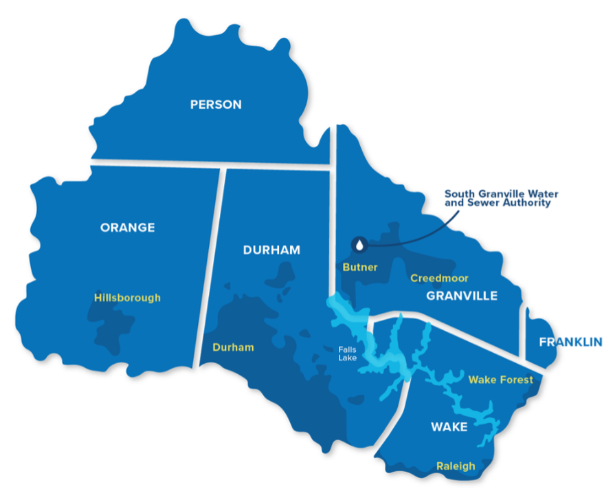
Water quality in the tributaries flowing into Falls Lake and the reservoir itself degraded over the past several decades due to the impacts of stormwater run-off and increased effluent from wastewater systems associated with population growth and land-use changes. Pollution reduction approaches for the Upper Neuse have existed in the form of the Falls Lake Nutrient Management Strategy (also commonly referred to as the Falls Lake “Rules”). Since approval in 2011, the Rules have addressed certain sources of pollution, such as wastewater treatment plant effluents, but have they have struggled to address the more complicated parts of watershed management, especially around pollution from existing development. This created the opportunity for a new alternative approach to restoring the health of the watershed.
In 2016, American Rivers- looking towards a new approach– partnered with the Upper Neuse River Basin Association (UNRBA), a coalition of the watershed’s local government officials, as well as NC Department of Environmental Quality and other non-government stakeholders to develop a management framework based on the principles of Integrated Water Management (IWM) to address the watershed’s pollution and sustainability challenges.
Early investments by the City of Durham, Town of Hillsborough, and Granville County Sewer and Water District to upgrade their water reclamation facilities (e.g. wastewater treatment plants) reduced pollution enough now to allow regulatory compliance flexibility within other areas of the law without concern about water quality impacts. The IWM system developed over five years of intensive discussions and negotiations, a pilot program known as the Interim Alternative Implementation Approach (IAIA), represents a mechanism for basin stakeholders to make cooperative, adaptive decisions around water resources management that can improve the water quality and long-term sustainability of a watershed.
In January 2021, the NC Environmental Management Commission (the state’s regulatory body) adopted updated rules for the clean-up of the upper Neuse River watershed implementing the new IWM program. This is the first time the state of North Carolina has approved a regulatory structure based in IWM.
This initial version of the program secured an investment of at least $1.5 million annually from local governments for projects that protect and restore the watershed- primarily stormwater management projects. The program includes the expansion of accepted practices for local governments to implement, such as water quality and quantity improvements projects focused on green infrastructure, protection of critical lands from development in the watershed, and floodplain, stream, and riparian buffer restoration. UNRBA members have stated that their investments will make pollution reduction progress more measurable, trackable, and transparent.
This IWM program represents the first of its kind in watershed management for North Carolina and can serve as a blueprint for other basins to utilize more holistic and cooperative approaches to tackle water quantity and quality challenges. By continuing to collaboratively utilize smarter policies, scientific data, and the region’s financial resources, American Rivers is working with the UNRBA members and other community partners to clean up the upper Neuse River watershed.
Sami & Jon Soffer
Sami Soffer is an Oncology Registered Nurse and Jon Soffer is a Nurse Practitioner. They live with their daughter in Hood River, Oregon.
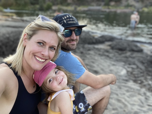
We are water people. Every trip we take centers around some body of water — and spending as much time as possible in or around it. So it’s no surprise that we’ve chosen to anchor our family right alongside the Great Columbia River.
This source of water is as much a part of our home as our very own backyard. It’s where we go to play with our daughter — to watch her squeal as she runs into the water and back out again on a hot summer’s day. It’s where we go to experience moving meditation atop a paddleboard — or to honor our traditions through the ritual of Tashlich on the first day of the Jewish New Year. And as healthcare workers struggling through two years of a global pandemic, the Columbia River has remained steadfast in its offering as a wild and free space for us to go to for respite, movement, and joy.”
Luke Parr
Luke is a Critical Care Physician in Oregon

Over the last few years, we have all learned that in addition to keeping our bodies safe from the spread of COVID, we also need to put more effort into our mental health. While physically staying away from others has been important to reducing COVID outbreaks, I have found that time outdoors has done wonders for my mental state when not in the hospital. I believe in helping to protect Oregon’s rivers and natural spaces so that we all have places to get outside, breathe deep, and relax.
Jenn Kamrar
Jenn is a College Professor located in the Columbia River Gorge in Oregon.
I grew up on the Puget Sound as part of a fly-fishing family; water was everywhere and everything. Rivers and flows and trout dictated my family’s seasons and patterns. When I decided to move to Oregon after grad school, I ultimately chose the Columbia River Gorge as my home — for the rivers and the land. As an educator, I believe that we must make what we care about central to our personal and professional lives. And so I do this within — and outside — of the classroom. I take my students down the Deschutes in the warmth of late spring, my friends out to cast on the Hood in the cooling fall, and my dog out for runs on the sandy stretches of the Columbia all year long.
Jude Gerace
Jude is a Board Member of the Oregon Timber Trail Alliance
We build communities wherever we go, be it on our block, throughout our cities or town, or on our adventures! Communities may seem like they are just the people around us, but I think we all know that a place can also hold so much power to bring us together. Portland just wouldn’t be Portland without the Willamette running down the middle, allowing us beautiful bridges to cross, bike and walking paths to commute on, and glimpses at sunsets from vistas above the water. Place has just as big a part in communities as people do.
John Vuylsteke
John is a Lifelong Oregonian
As a lifelong Oregonian and outdoorsman, I have seen many changes to this state, but one of the constant joys of my life has been the rivers. Growing up and spending my life in Washington County I have felt lucky to be able to fish the streams and rivers near my house. The landscape of our watershed was the backdrop to my childhood, and as an adult, it has been great to share the love of our rivers and wild areas with my children.
Dave Gee
Dave is an avid recreationist + Small Business Owner
I spend as much time as I can outdoors, be it skiing Mt Hood, biking in the Gorge, or sunset sails on the Columbia; this area of Oregon is my home. As the owner of Oregon Growers, a specialty foods company in Hood River, it’s important to me to share the amazing agricultural products that we have here in the Gorge with the rest of the US. Like all farming regions, healthy rivers and streams are a critical component to this agricultural community. Both my recreation and my business thrive when we protect the land and waters we rely on to live.
Meg Devo
Meg is a Physician in Oregon
As a doctor, I see everyday the need for people to take care of themselves for the long term. While for most people that means paying attention to their diet, getting some exercise and enough sleep, we also need to take our mental health into account. For me and my family, including my little one, getting outdoors can make such a difference to our attitudes and mental state. The joy of a sunny day on a river is tough to beat!
Carla Lerum
Carla is a Veterinarian
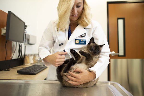
With everyone adopting pets during COVID, the veterinary industry has done nothing but grow in the last few years. Not only did we all need someone to snuggle up on the couch with, we needed someone to remind us to get outdoors. While work has been super busy, my family does our best to get out and adventure as much as we can, from winter snow cabin hikes to summertime canoe trips, or the never-to-be-missed weekend mornings at 1000 Acres, we are always on or near the water… though Miso the Cat is less inclined for boat trips.
Christopher Vuylsteke
Christopher is a Lifelong Oregonian

Growing up in Oregon, most of my experiences have been intertwined with the outdoors. From camping, boating and fishing with my family, to adventures to the coast with friends, the landscape of Oregon has always been a big part of my life. The rivers of Oregon have always been there as the backdrop to all my adventures, and I want them to stay that way for generations to come.
Austin Sanchez
Austin is a Craft Beer Brewer
Throughout my years photographing and tasting unique craft beers, I’ve had the privilege of experiencing some of the most beautiful rivers and lakes in Oregon. The absolute power and purity flowing in these bodies of water are a huge inspiration behind my photographs, motivation for me as a blogger, a beer enthusiast and as an Oregonian. Thank you for protecting these irreplaceable rivers, streams, lakes and waterfalls!
Micah Chase
Micah is a Farm Manager
I am a life-long Oregonian, farmer, and outdoorsman living in the Willamette Valley. I am writing this letter because I care about wild and scenic rivers in Oregon. Among several special rivers in Oregon, the Willamette River is what I’d like to focus on. My wife and I live in a beautiful farmhouse that’s 250 feet from the river, on the hop farm that I help manage. We raise a thousand acres of hops for the craft brewing industry, and I attribute our success to the abundance of water and fertile soil we were lucky to have. The farm is named after the phenomenon of soil being deposited to land from the river flooding. The Alluvial Farm. As a farmer though, a certain outdoor lifestyle comes along with working with our soil and plants. A specific memory comes to mind where I was able to help a friend catch a fish for the first time. It is amazing to see someone’s face light up with excitement when that feeling hits them for the first time, a fish on the other end of their line
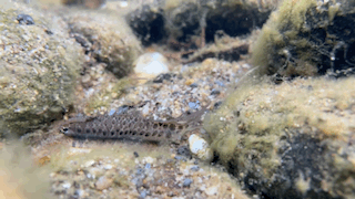
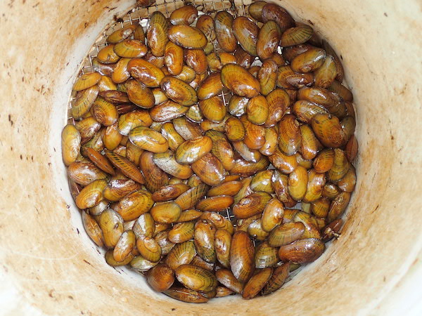
Today is the kind of workday I live for — a day not just on the river, but in the river. I slip on my snorkel and mask and lay prone in the stream, relaxing, breathing and watching. I see small fish — called darters because they dart around the bottom of the stream — looking for food. There’s another, then another. That’s when I realize, I’ve been tricked!
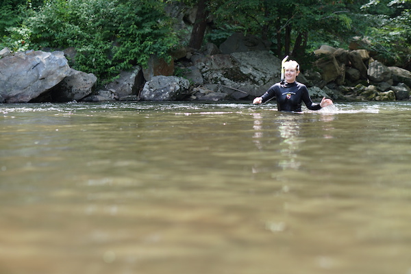
What I thought was a fish is actually a freshwater mussel with its fishing lure out. It looks exactly like the darter I just saw. I stop and watch. The mussel beats the lure rhythmically for a few seconds, then it stops. Then again for a few seconds, then stops. Not too different from how I learned to jig a worm on a fishing line as a kid. This freshwater mussel so perfectly mimicked a fish that it tricked a freshwater mussel biologist. A playful reminder to stay humble.
Female mussels are master anglers, crafting their young into packages that look exactly like a favorite snack of larger local fish species — in this case, a darter. When predatory fish take a nibble, the baby mussels are elegantly transferred to the gills of the host fish, a necessary step in the progression of baby mussel to adult mussel. After a few weeks, the now-mature baby mussel floats off the fish gill, maybe near mom, maybe a ways away, and gets down to the business of breathing the river.
Breathing is what freshwater mussels do best: They inhale water full of algae, bacteria, and sediments, and exhale clean water. They literally breathe our streams clean.
Freshwater mussels once paved most streams, especially in the South, breathing and filtering the water. Now, these incredible, indispensable creatures are in trouble. Eight were recently officially deemed extinct from Southeastern rivers alone. Why? Mussels took a big hit when big-river dam-building boomed in the early 1900s. Thousands of miles of river were flooded behind dams, the flow of water slowed, and river bottoms were buried in layers of muck. Mussels, which need to siphon moving water to breathe, couldn’t tolerate the entombment and died.
That’s partly why we work hard at American Rivers to remove dams — so that rivers, their mussels, and all the life that depends on clean, free-flowing water can thrive again.
But an alarming new phenomenon is taking hold. In places untouched by dams, we have started seeing mussel populations blip out for no apparent reason. In the Little Tennessee River, the federally endangered Appalachian elktoe mussel could be found by the thousands before 2004, but now biologists are lucky to find four individuals after hours of searching — and those they find are small, and pale, and sickly looking. Some mussels can live to be a century old, but mussels like the Appalachian elktoe live less than two decades. This means that we don’t have a century to figure out what’s going on and make changes — we have a fraction of that time. This urgency has motivated mussel biologists, like me, to find out why the die-offs are occurring — so that we can figure out how to stop them.
Thanks to investment by the BAND Foundation and Merck Family Fund and expertise of the US Forest Service’s Southern Research Station, American Rivers is bringing together the best minds working on freshwater mussels in a three-year investigation into why we’re losing our stream filterers. With partners across 13 states, this unprecedented study assesses the enigmatic decline of freshwater mussels to inform a science-backed solution to protect mussels — the lungs of the river. Our initial learning shows that freshwater mussels might be facing their own pandemic of sorts. If we don’t act quickly, we could lose more species within a generation.
Several species already live in captive “ark” populations — the last known living of their species. Such populations are waiting for critical habitat to be restored, waiting to breed new baby mussels for reintroduction, or waiting to die off. I recently visited an ark population of Tar spiny mussels hosted by the North Carolina Wildlife Resources Commission. These very old mussels with eroded shells unceremoniously languished in a retrofitted shed, recirculating water bubbling in and out of their black-plastic basin home. I was struck with grief to see these individuals — the last known of their kind — because we don’t yet know how to bring their kind back to health. Nor do we have suitable habitat where they can thrive.
The loss of nature and the accelerating decline of species are emergencies — and none are as severe or as unseen as the loss of freshwater mussels. But action is a good antidote to grief. The science our study uncovers could change how we manage and regulate rivers — and that could change the course for freshwater mussels.
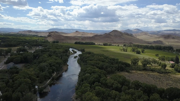
Across the southwest, water is an essential, often scarce resource that communities rely on for their ways of life. In south-central Colorado, the Rio Grande, its tributaries and the water flowing underground supports communities across the San Luis Valley, an 8,000 square-mile high elevation desert that sees less than seven inches of precipitation per year. Water ties generations of people and communities together across the Valley. Married by shared ethics of caring for land and water, everyone across the San Luis Valley depends deeply on the Rio Grande – for their livelihoods, the rich diversity of wildlife and outdoor activities, and a deep connection to the rich history of people who have come before them.
To help tell the story of the San Luis Valley, the interdependent nature of the people, the river and water flowing below their feet and the threats facing the Valley’s way of life, American Rivers developed Groundswell on the Rio Grande, an interactive ESRI Story Map that illustrates the connection between people, communities and water.
Learn more about the San Luis Valley, visit Groundswell on the Rio Grande
In developing the Story Map, we had the pleasure of engaging with a wide cross-section of people that rely on and appreciate the Valley’s waters for different reasons. Whether we talked to a rancher, small business owner, recreation advocate, retired bus driver, brewer or water manager, it was clear how important the Valley, and the Valley’s water is to them. Water undeniably touches everyone in the Valley, but it is the threats to the rivers and aquifers that bring communities together to fight for their water.
The San Luis Valley is facing a real threat from Renewable Water Resources (RWR), a proposal to export groundwater out of the San Luis Valley to Colorado’s southern Front Range. In late 2021, RWR approached the Douglas County Commission, asking for $20 million of federal rescue plan funds to pipe water out of the San Luis Valley to the Denver suburbs.
As the Story Map describes, water flowing through and beneath the Valley is essential for communities, agriculture, recreation and the environment. The inextricable link between groundwater and surface water in the Valley means that the RWR proposal would have direct, negative impacts for everything from agricultural communities and culture to fish, wildlife, and a growing recreation economy, specifically at Great Sand Dunes National Park. Douglas County Commissioners are currently considering the proposal from RWR as they grapple with a growing population within their communities. However, there are other options – such as water conservation, efficiency and reuse – that are lower in cost and create local jobs that the County should consider instead. Join us in urging the Douglas County Commissioners to reject RWR’s proposal to pipe water from the San Luis Valley to the Front Range. Click here for petition
As you view the Story Map we hope you gain a better understanding of why protecting and preserving the health of the Rio Grande, the viability of aquifers, and the deep history of the San Luis Valley is as critical for communities that rely directly on the river as it is for the state of Colorado and the Southwest. Make your voice heard and speak up for the San Luis Valley, and the rivers and waters that flow through and underneath such an incredible part of Colorado.
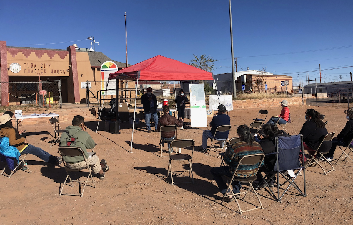
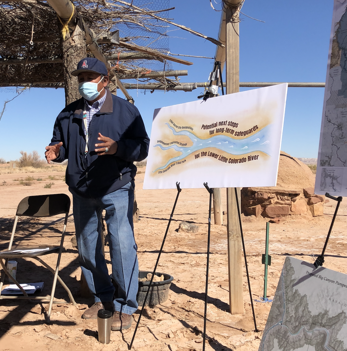
It’s late fall 2021 and I’m at the Tuba City Chapter House on the Navajo Nation for one of several community meetings that American Rivers, the Grand Canyon Trust, and local communities are hosting to explore ways to safeguard and sustain the Little Colorado River. The air is crisp and the sun peeks above the eastern horizon as we set up an outdoor meeting space designed to respect necessary Covid-19 precautions. Because this type of grassroots organizing has been nearly impossible for over a year, there is a tangible feeling of excitement as people gather to engage in conversations about this lifegiving watershed that supports much of present-day northern Arizona.
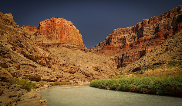
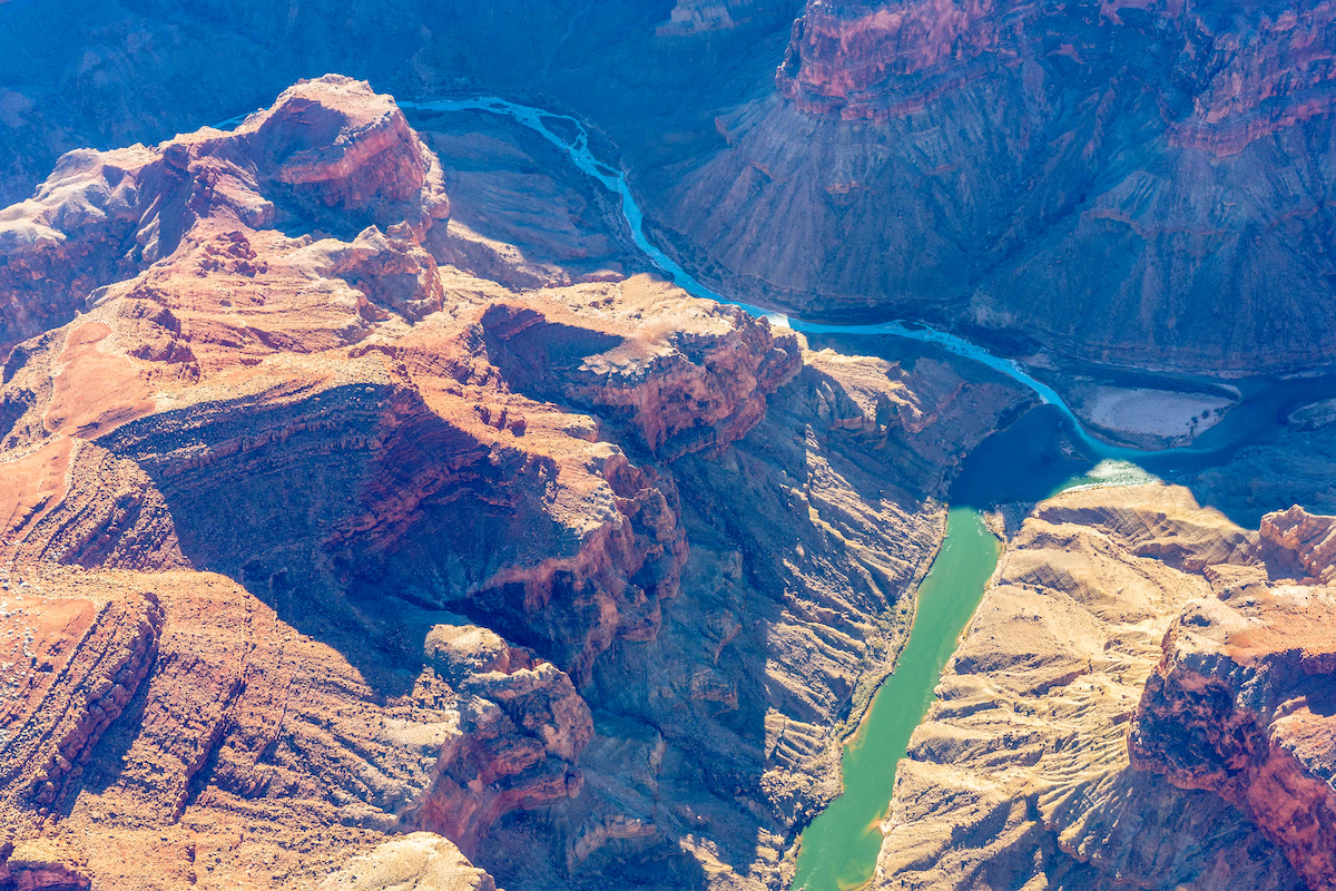
The Little Colorado River (LCR) is essentially a misnomer—“little” only in title and by comparison to the Colorado River. The LCR basin is 27,000 square miles of high deserts, mesas, and mountains near the center of the Colorado Plateau. Its grandeur can be understood from various angles. As part of the larger Colorado Plateau, the LCR basin has the highest agricultural and ethnolinguistic diversity north of the Tropic of Cancer. The river itself originates in the White Mountains where its headwater springs have been designated as a sacred site by the White Mountain Apache Tribe. From there, the river drops over 5,000 feet as it flows northwest to its Confluence with the Colorado River deep within Grand Canyon. As it nears the mainstem Colorado, the LCR cuts steeply into limestone and sandstone, creating the spectacular lower LCR gorge. Springs in the lower gorge provide the cerulean baseflow of the LCR, which at the Confluence with the Colorado is approximately 158,000 acre feet annually—equivalent to over half of Nevada’s allocation of Colorado River water.
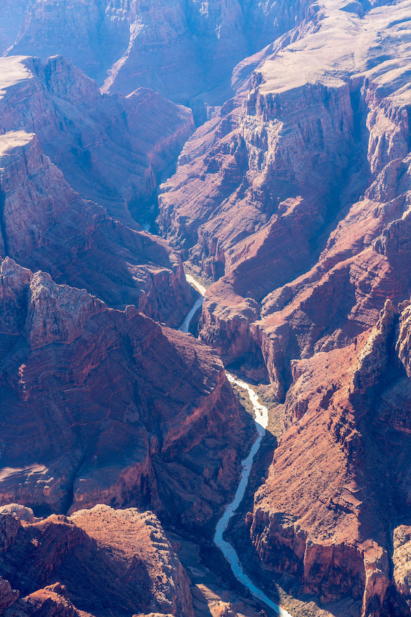
With monsoon and spring runoff events, the LCR can swell to over 400 times its baseflow. The river is a primary contributor of sediment to the Grand Canyon and critical habitat for the threatened humpback chub. In truth, the cultural and ecological significance of the LCR and its watershed is difficult to overstate. It is the ancestral or present-day homelands of at least eight tribes, including Hopi, Zuni, Diné, Southern Paiute, Cibecue and White Mountain Apache, Havasupai, and Hualapai, each of whom have maintained relationships with the LCR since time immemorial.
The uniqueness of this high desert river and watershed is also demonstrated by its resilience. Until the early 20th century, the LCR flowed year-round for its entire 340-mile course. It is now intermittent except for three short stretches. Sixty years of industrial groundwater withdrawal has impacted aquifers critical to springs, tributaries, and drinking water in an increasingly arid region. The Grand Canyon Escalade project proposed a massive tourist attraction at the remote and sacred Confluence of the LCR and Colorado River, which led American Rivers to list the Colorado River in the Grand Canyon as America’s Most Endangered River in 2015. Coal-fired generating stations polluted the air and drove strip mining in the basin. Uranium mining and milling contaminated water sources and continues to impact human, animal, and plant health.
Now, hydroelectric dam proposals threaten the lower LCR. With total disregard for tribal sovereignty, Pumped Hydro Storage LLC applied for three preliminary permits in 2019 and 2020 from the Federal Energy Regulatory Commission (FERC) to dam the LCR and its tributaries. While two of the permits have been surrendered, the company is awaiting a preliminary permit for the Big Canyon project. Despite objection from the Navajo Nation and Hopi Tribe, the Big Canyon project proposes four dams and four reservoirs that would be filled with groundwater from the same aquifer that sustains the sacred springs and iconic milky-blue waters of the lower LCR.
The concentrated harm to the LCR caused by colonization, coupled with the ongoing uncertainty of what threat will have to be fought off next, makes the LCR a poster child for environmental injustice. But the river and LCR communities persist. Save the Confluence stopped the Grand Canyon Escalade and continues to advocate for the Confluence as a sacred area. Black Mesa Trust advocates for the ancient aquifers in the LCR basin and their related springs that are central to Hopi religion. Tó Nizhóní Ání protects the sacred lands and waters of Black Mesa, a central recharge area for the LCR. And Tolani Lake Enterprises rebuilds the Indigenous food sovereignty movement on the banks of the LCR.
Such grassroots efforts hold the barrage of threats to the LCR at bay while also highlighting the need for durable and permanent protections for this remarkable river and the life it supports. Building on our previous work in the basin, in the Spring of 2020 American Rivers joined LCR communities and allies, like the Grand Canyon Trust, to explore ways to safeguard the river’s cultural and natural resources—with particular focus on the lower LCR—in ways that align with the needs and wants of local communities. For a year and a half, we’ve been working collaboratively to identify pathways to protect the LCR while upholding local autonomy and traditional land uses. This includes preventing commercial and industrial developments in the area, such as the Big Canyon proposal, that are unwanted by local communities. Our guiding belief is that thoughtful community engagement and collective management approaches can help protect the lower LCR, surrounding sacred sites, and all living beings for years to come. By engaging individual community members through in-depth conversations, hosting in-person and virtual community meetings, and providing information on possible protective pathways, we are collaborators in a growing movement to protect the LCR. Looking ahead, we are committed to supporting this movement through expanded community engagement and leadership until permanently protecting the LCR simply becomes inevitable.
As I drive away from the meeting in Tuba City, I am reminded that despite overuse, unregulated groundwater withdrawal, impacts from industrial energy production, and the increasing effects of climate change, the LCR is alive. It is sustained as much by monsoons, ancient groundwater, and high elevation snow as it is by the collective stories, ceremonies, and traditions of its Indigenous communities. Often described as an umbilical cord, the LCR is a literal lifeway in the region and, as such, it deserves more than simply being resilient. It deserves to thrive.
I heard a quote once that has stuck with me over the years, “A river cuts through rock not because of its power, but because of its persistence.”
As I reflect on the past year of challenge, loss and victory, that quote takes on new meaning. Not just because American Rivers and our partners removed dams and advanced critical new protections for rivers — despite the trials COVID-19 and political divisions, but because the power of our relationships and the resolve of our community is stronger than ever.
Alongside advocates, supporters, tribes, conservation organizations, government agencies, municipalities and local groups, this community has proven that we will protect wild rivers, restore damaged rivers, and conserve clean water for people and nature — no matter what. We will travel onward, together.
It is my pleasure to share with you American Rivers’ 2021 Impact Report. From essential fish and wildlife habitats restored, to pristine rivers that will never be dammed, to people who have cleaner drinking water — the stories you’ll read in this report are proof of the difference this river-loving community is making for rivers.
I invite you to read about some key victories American Rivers achieved in 2021. The 2021 Impact Report features:
- Statistics on the number of river miles protected, restored and cleaned up.
- A state-by-state map of river wins.
- Key progress made to free rivers and defend clean water.
From rivers freed from harmful dams, to ground gained in the quest for clean water for all, to enormous leaps toward permanently protecting more river miles than at any other time in history, we couldn’t have achieved any of this without your support, time and expertise.
As we look ahead to 2022, I feel more driven than I have at any other moment in my 30-year career in conservation. Because right now is a make-or-break moment for rivers, clean water, our communities and our planet. Climate change is an emergency. Preserving our freshwater heritage is imperative. Joining together toward a common goal is non-negotiable.
And you have a vital role as we create the best way forward. Because withstanding the major challenges of our time will take all of us paddling in rhythm in the same direction. Healthy rivers give us the opportunity to address each of these threats and ensure that our ecosystems, communities and nation are resilient. This is our moment to reach even higher as we drive forward the movement for healthy rivers and clean water. Please enjoy American Rivers’ 2021 Impact Report. We are so grateful for your support.
Rivers that are unimpeded by dams or diversions are the basis of life in our country. They allow water levels to fluctuate, naturally sustaining healthy habitats and reducing the likelihood that floods will inundate homes and property. Free-flowing rivers also nourish soil, filter out pollutants and support indigenous cultures that rely on fish and wildlife, like salmon, that can thrive only in intact river systems.
As our country urgently searches for tactics to avoid the worst of climate change, tackle the accelerating loss of nature, and address prolonged racial injustice, free rivers will be critical. And 2022 could be a pivotal year. Here are some of our key priorities for free-flowing rivers this year.
Protect 6,700 miles of healthy streams
It costs millions of dollars, takes decades of work and requires complicated technical know-how to transform a polluted or dammed river into a clean, free-flowing one. Meanwhile, protecting a river and its beauty, water quality and cultural values before it is damaged is far easier — and a lot less costly. If successfully defended, the benefits last forever: Undisturbed streams and wetlands require little to no human management or interference to provide clean sources of freshwater and habitat.
Winning a Wild and Scenic designation is one of our best tools for defending a river that still flows freely. Like the National Park System, the Wild and Scenic Rivers System makes our healthiest, most astonishingly beautiful, most ecologically significant rivers — and the land alongside them — permanently off-limits to dams or activities that would negatively affect the river.
If Congress passes and President Biden signs every piece of current introduced Wild and Scenic legislation to protect rivers, approximately 6,700 new miles of rivers would be permanently off limits to future mining, development and dams.
- 4,700 miles in Oregon: The River Democracy Act would expand recreation access and boost local economies, protect drinking water, reduce wildfire threats, and sustain endangered fish and wildlife.
- 450 miles in New Mexico: The M.H. Dutch Salmon Greater Gila Wild and Scenic River Act would protect nearly 450 miles of the Gila and San Francisco rivers and their tributaries.
- Doubling protection in Montana: The Montana Headwaters Legacy Act would protect nearly 387 miles of rivers, including sections of the Madison, Gallatin, Yellowstone and Smith.
- 26,500 pristine acres in Washington: The Wild Olympics Wilderness and Wild and Scenic Rivers Act would protect 464 river miles flowing out of Olympic National Park, such as the cerulean-blue Elwha and Hoh.
American Rivers has played a role in nearly every U.S. river mile protected as Wild and Scenic since 1973. Together with grassroots partners, individuals and businesses, we will work to ensure key Wild and Scenic bills get across the finish line.
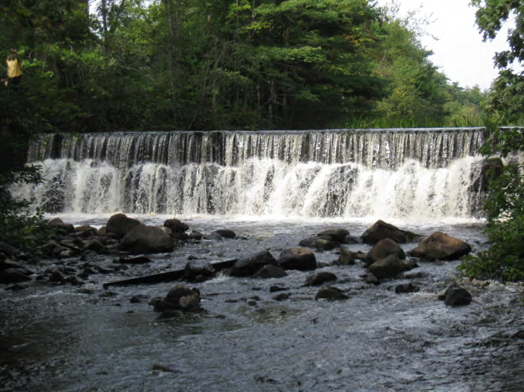
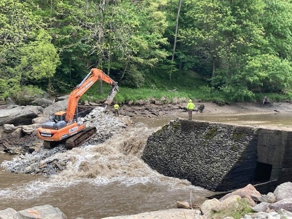
Remove old, unsafe dams
While we can’t create new rivers, we can improve the health of rivers that have been damaged. Taking down a dam is the fastest way to revive a river. In fact, a river starts coming back to life almost immediately after a dam is breached. Migratory fish return within just a couple of years, and the entire water system benefits: Allowing water to flow restores clean water for wildlife and communities, creates opportunities for recreation, and saves taxpayer money on expensive structural repairs.
For more than 20 years, American Rivers has restored rivers by removing outdated and unsafe dams. We have also spearheaded the removal of 200 dams and restored more than 1,040 miles of free-flowing river — equal to the distance between New York and St. Louis.
But making a dent in the 90,000 dams that still block our rivers is more than any single organization can do on its own. That is why we need a national river restoration movement to pick up the pace on a much larger scale. Here are two priorities that American Rivers will continue to advance throughout 2022:
- Pass the 21st Century Dams Act: Congress needs to take additional urgent steps to protect clean water and rivers nationwide. It must pass the bipartisan 21st Century Dams Act, which dedicates $25.8 billion to the removal, rehabilitation and retrofit of dams, including $7.5 billion to support removal of 1,000 dams to restore 10,000 miles of rivers.
- Snake River Vision: Millions of wild salmon and steelhead ran the Snake — the largest tributary of the Columbia River — prior to the construction of four federal dams on the lower Snake in Washington. Today, salmon populations have crashed, threatening 130 other wildlife species and imperiling traditional livelihoods and cultures across the Pacific Northwest. American Rivers is supporting efforts led by the Nimiipuu (Nez Perce) and other Native American tribes to remove the four lower Snake dams and restore the healthy salmon runs.
MOVING FORWARD —TOGETHER
The river movement can take pride in the rivers we’ve saved. But our work is just beginning. Less than 1 percent of our 3 million river miles are safe from dams and development, and 90,000 dams still choke our nation’s rivers. Meanwhile, freshwater habitats that are still healthy will be critically important as climate change stresses our rivers with higher temperatures, drought and flooding. We know what needs to happen: We need to remove unnecessary dams and protect our remaining pristine rivers. We need to work alongside frontline groups and partners and in coalitions that drive policy change. And we need to inspire people to imagine a better future for their communities and the rivers they love. We can save our free-flowing rivers if we act now — and do it together.
Dealing with excessive stormwater is top of mind if your neighborhood floods regularly. But even if you’re not used to trudging through water-logged streets, there are plenty of reasons to care about what happens when too much rain falls in your city. American Rivers’ Economics and Policy Research Associate, Shanyn Viars, talks about why.
Why should people who care about rivers and clean water care about stormwater?
Just in the last couple of years, we’ve seen that the impacts of climate events are particularly hard on our water systems, right? Too little — as in the Colorado River — too much as in catastrophic flooding in the Midwest and South. And even the wildfires in the West, the water crisis is becoming more urgent. And it’s definitely becoming more urgent in cities and in urban areas that are trying to safeguard their communities against the effects of climate change.
We also know that much of the existing infrastructure that manages water to flow out of our cities is vulnerable and outdated. We’re talking about infrastructure that’s over 100 years old. It can’t keep up with growing cities and growing demands that we put on the environment. Local economies can’t keep up with the cost to maintain the systems either. Because of the funding gap, it’s going to take all of us, holistically as a community, to address urban water challenges and improve our water systems.
Let’s get more specific. How do cities contribute to problems in rivers?
A large portion of land area in cities is made up of private properties, which are covered in impervious areas — rooftops, driveways, parking lots and sidewalks. Rain flows off of those surfaces, collecting trash and pollutants along the way, and carries it directly to our rivers.
The large shopping plazas, retail stores and big malls have acres of impervious area that send large volumes of polluted stormwater directly to rivers and streams when it rains. On top of that, in the wake of climate change, without any green space in those environments, the urban heat canopy effect makes those areas much hotter, which could make even conditions for employees or guests more hazardous.
What is a feasible solution to stormwater problems in cities?
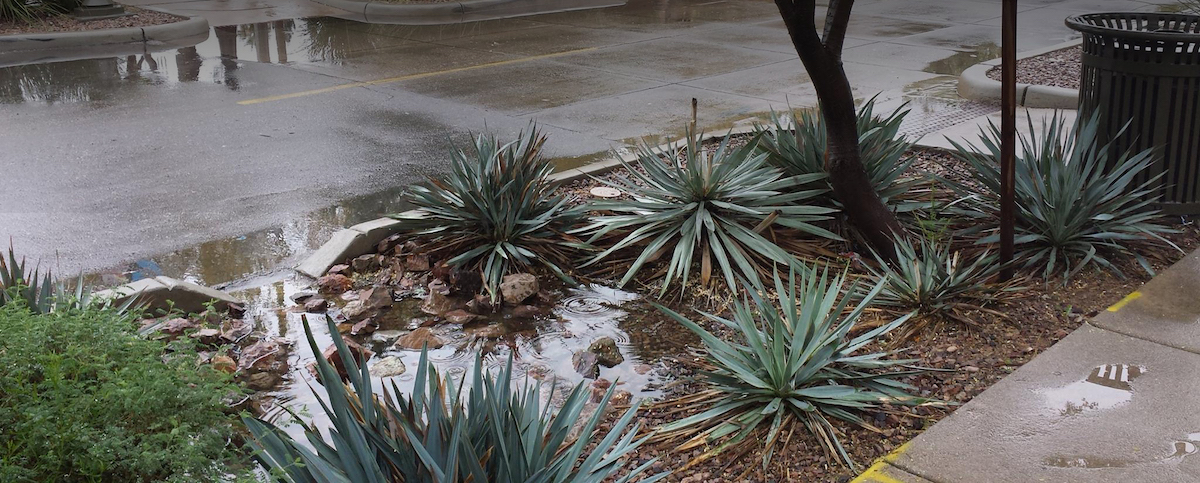
Green stormwater infrastructure, which incorporates natural elements into the landscape to mimic the natural water cycle. This includes rain gardens — which you sometimes see lining the curbs of your streets or walkways — green roofs, rain barrels, bioswales and infiltration ditches. Basically, flowers and plants are planted into areas to absorb water. So as rain falls, it absorbs into the ground where it lands instead of running over those hard services and collecting trash on its way to the river. Capturing that water reduces the amount of pollution that flows into our waterways and also reduces localized flooding in neighborhoods, streets and basements. Financing green infrastructure projects is a challenge, because the majority of funding usually comes from tax dollars. So, there’s a gap between what private property owners — and the cities themselves — want to do and what they can afford.
So how do you convince more property owners to use green infrastructure if they can’t afford it?
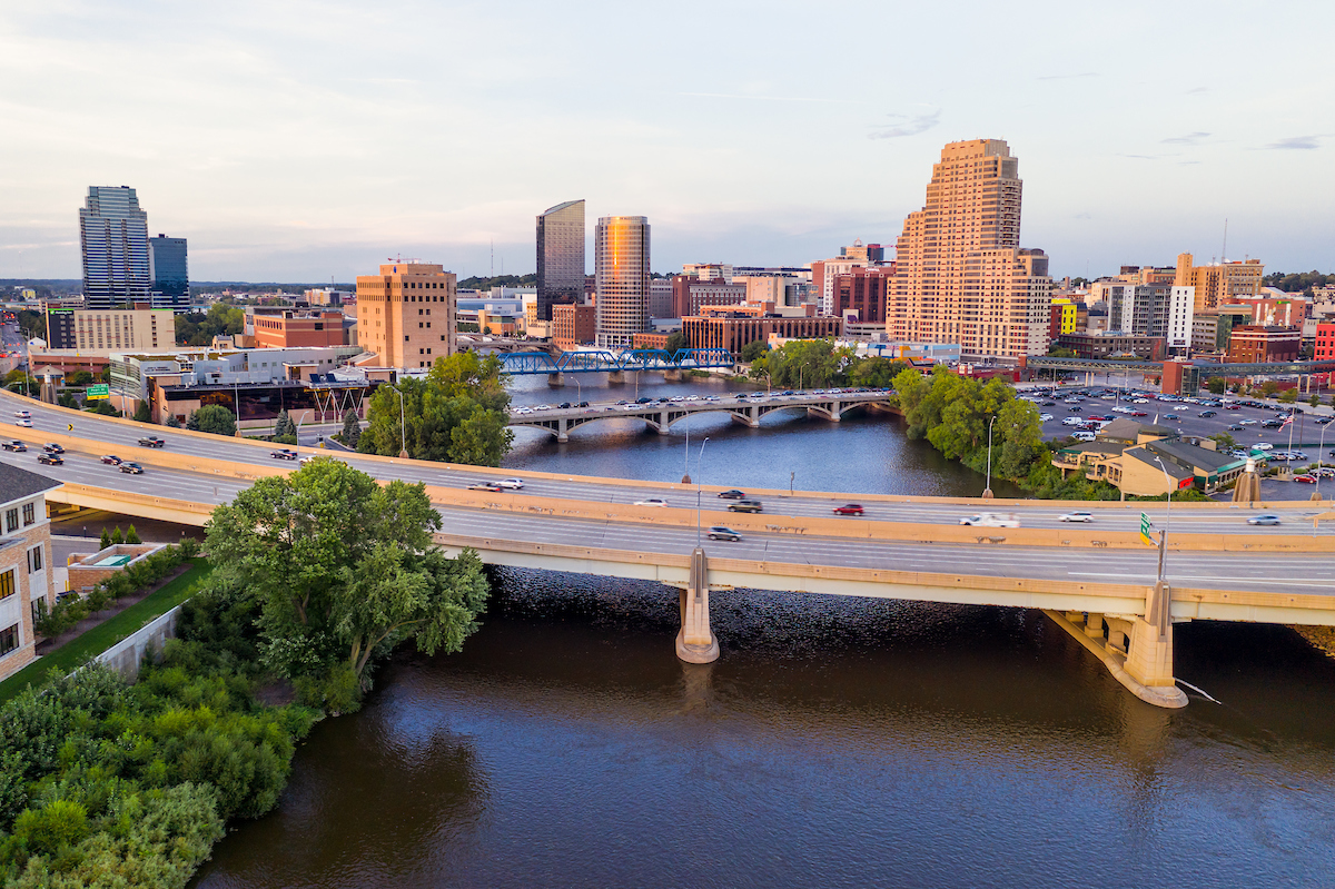
We can use the market to actually fund and advance sustainable approaches. For the last couple years we’ve been working to develop and implement a stormwater credit trading program in the city of Grand Rapids, Michigan, where I live. This would provide private property owners, specifically developers, flexibility when they go to meet their stormwater requirements in their project planning phase. But it also allows community members, like nonprofits and local neighborhood organizations, to “sell” their stormwater captured into the market for developers that need it to meet their stormwater requirements. In September 2021, the state of Michigan finally approved new stormwater requirements that provide the flexibility to allow stormwater credit trading in Grand Rapids. American Rivers worked with the city for five years to get this permit approved. The Stormwater Credit Trading program will launch in July 2022.
Where else are you working beyond Grand Rapids?
Through our Stormwater Currency program, American Rivers is working one-on-one with communities across the country to explore appropriate funding mechanisms to deliver these approaches. We like to look at holistic water approaches not just in the city or municipal boundaries that we’re working in but in the whole watershed. In addition to Grand Rapids, we’ve worked with San Mateo County, California; Eugene, Oregon; Green Bay, Wisconsin; Sheboygan, Wisconsin; Cook County, Illinois — which includes Chicago — Greensboro, North Carolina; and about 10 other cities.
Tell me about one project you are especially proud of.
My project with La Casa de la Cobija in Grand Rapids is probably the most inspiring. A small business owner that I met one day at a community event spoke to me with concern about gentrification occurring in the neighborhood as the community is starting to revitalize. The owner wanted green space and improvements to improve visibility and safe walking in the neighborhood, but she didn’t know how to go about it without large investments or attracting development that could create gentrification.
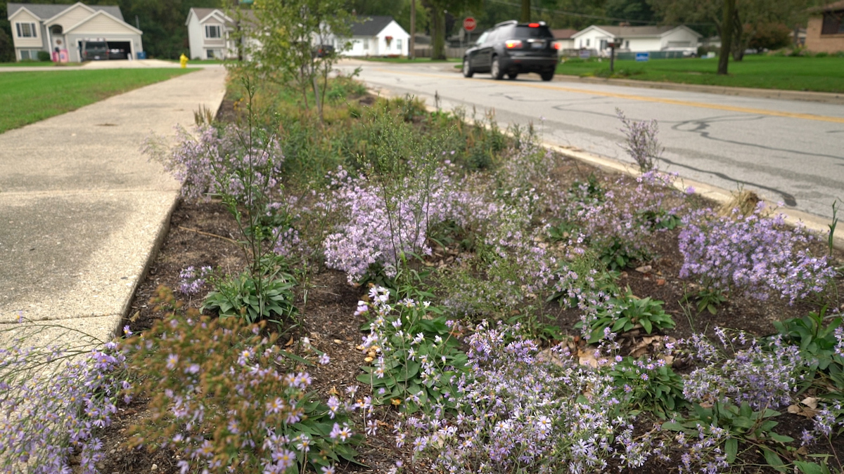
We connected the business owner with local partners to implement small curb-cut rain gardens along the sidewalks and parking lot. The native plants with bright flowers actually increase visibility on the corner of a very busy traffic corridor. The rain gardens also keep stormwater from flowing into the most polluted stream in the city. The owner was so proud as customers and neighbors noticed the improvements. During COVID, La Casa de la Cobija’s parking lot turned into a community space for distributing food donations and registering voters. The space drove broader community conversations and fueled advocacy that led the owner and other seniors to supply garden kits to neighborhood families during COVID to plant food in pots and backyards to address food insecurity. Neighbors, including businesses were seeing her garden now grow and are interested in planting rain gardens and more trees in their community. The advocacy and support from the business owner and community led to a partnership with Friends of Grand Rapids Park, which planted 300 trees in the Baxter Heights neighborhood. The owner now leads her neighborhood business association and participates on city-planning committees. You can read more from the owner at RAINscaping for Small Businesses. The community engagement has been amazing! And with the launch of a stormwater-credit trading program, more small businesses like La Casa de la Cobija will be able to implement green stormwater infrastructure on their properties. It’s a win-win for the community and for our rivers.
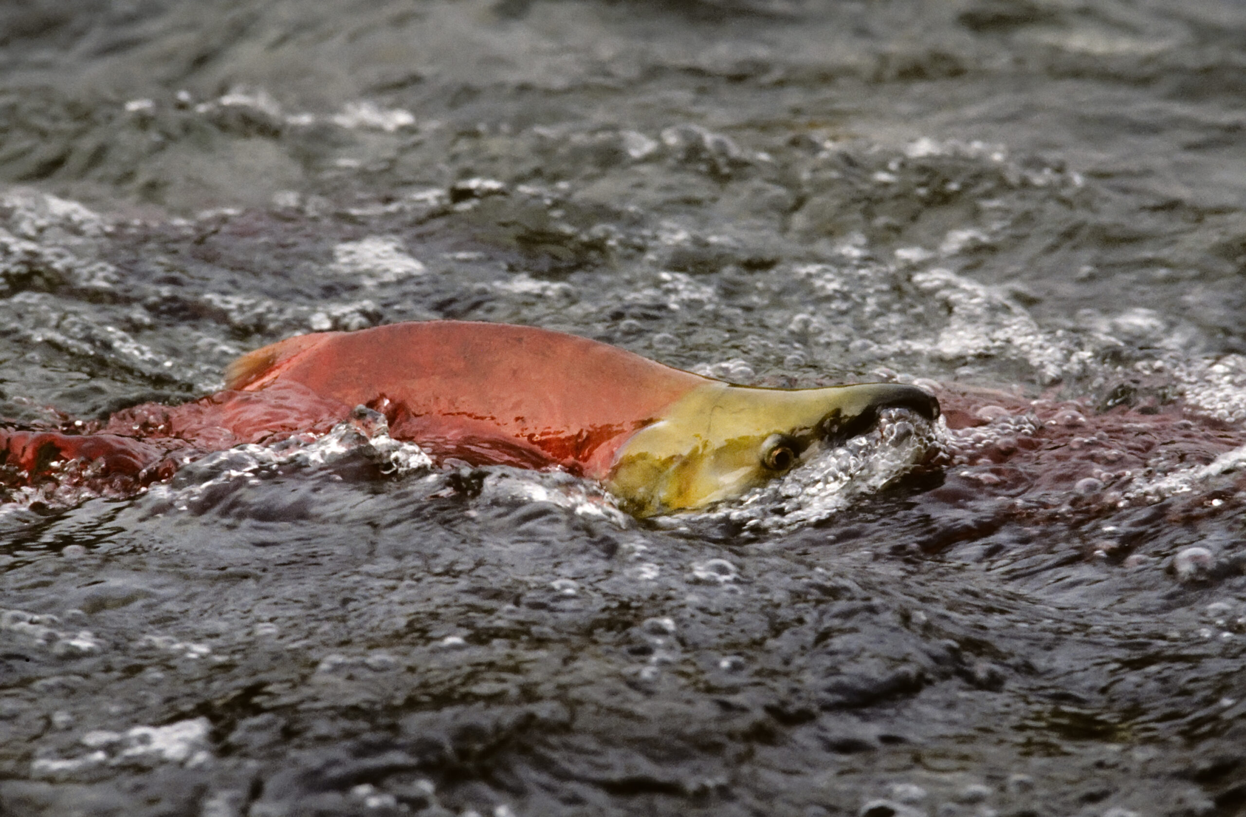
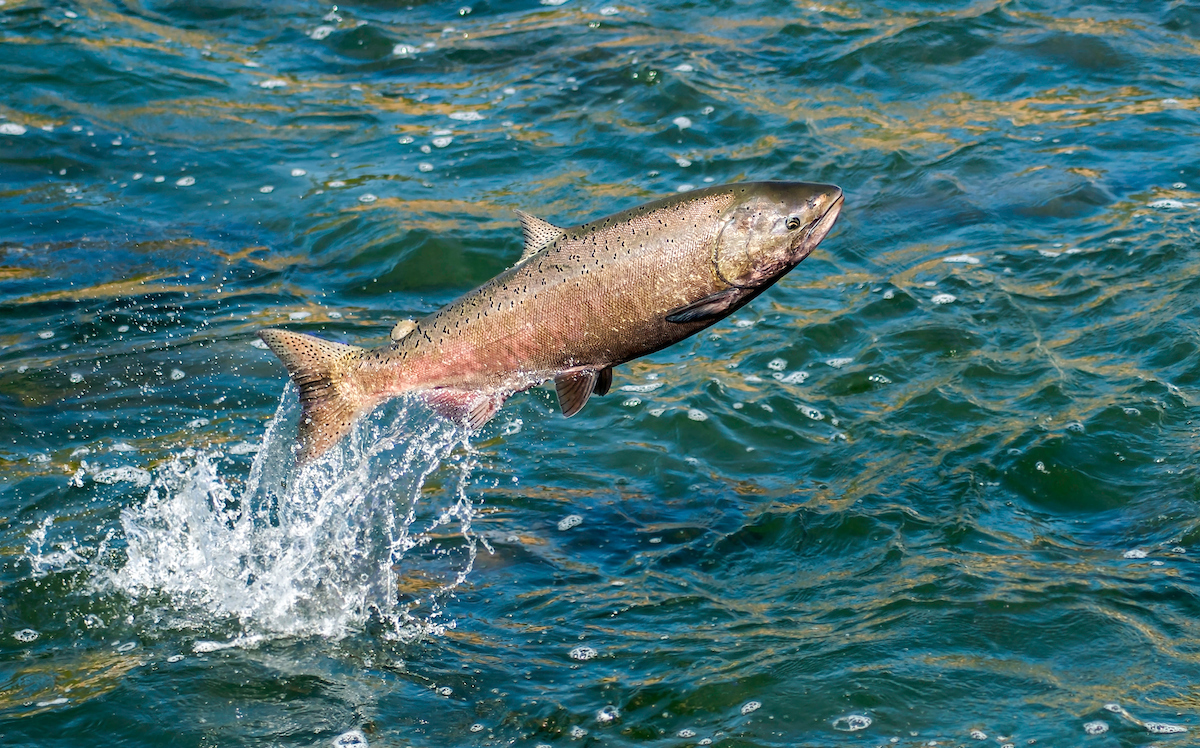
In the Pacific Northwest, salmon are so much a part of the landscape that their DNA is in the trees — literally.
Born in the small freshwater streams of the Northwest, the smolt, or young fish, migrate out to the ocean where they transform into sleek, strong predators, gorging themselves on the bounty of the sea. How long they spend there depends on the species and the individual fish. When they return — some traveling thousands of miles — to spawn in those very streams where they hatched many years before, salmon nourish ospreys, eagles, bears, otters, people and the forests themselves. It is an inbound and outbound web of anadromous fish that has gone on for millennia.
Some studies show that more than 130 wildlife species rely on salmon as a food source. This lies at the heart of the conundrum facing rivers as salmon populations continue to decline. Let the salmon disappear, and you threaten the existence of all life up and down the food chain, including people, economies, and the Indigenous cultures that orbit these irreplaceable fish.
“Salmon are critical to the cultural lifeways of Columbia-Snake River Basin tribes, like my own people of the Confederated Tribes of Warm Springs, Oregon,” says Alyssa Macy, CEO of Washington Environmental Council/ Washington Conservation Voters. “And they are integral to regional identity, economies, and even the orcas and the Puget Sound.”
An “extinction vortex”
A 2020 report from the state of Washington described the plunge of salmon populations as a crisis, citing both climate change and habitat loss as the primary culprits in that downward spiral. Of the 14 endangered species of salmon in the state, 10 lag in their recovery goals. Five species are in dire straits.
Throughout the Northwest, the decline of salmon has reached critical levels. In the Columbia Basin at large, salmon have become a mere whisper of their historical selves. Once home to the largest salmon run on earth, 30 million strong, rivers of the Columbia Basin now host only 1.5 million individual salmon per year. And just 400,000 of those are wild fish.
A Nimiipuu (Nez Perce) study on migratory fish, published in the spring of 2021, found that wild Snake River Basin populations of spring and summer Chinook were declining 19 percent every year, putting 77 percent of populations close to extinction by 2025. Historically, the Snake River Basin was the major producer of salmon and steelhead in the Pacific Northwest.
Climate change + dams = deadly for salmon
The threats facing salmon are as complex as the natural web salmon help to weave. First in line, as with so many species, are the threats posed by a changing climate.
Lower snowfall averages mean less water for everyone. Less water plus higher summer temperatures equal lethal conditions for fish. Warming ocean temperatures also impact the availability of marine food at a time in salmons’ life when they should be theoretically bellying up to the buffet, packing on pounds and muscle that will serve them in their massive migration to spawn. Hobbled by heat and hunger, disease and predators get the upper hand.
Dams make the problems ever more dire: Dams block adult salmon from migrating back to their historic spawning beds. Salmon that can’t migrate can’t procreate. Plus, the stagnate water in reservoirs held behind dams become hot bathtubs — a deadly recipe for outgoing smolt.
For Snake River salmon, four federal dams and reservoirs in eastern Washington kill up to 80 percent of juvenile fish. If the four dams remain in place, global warming could push the Snake River’s remaining wild salmon runs to extinction.
Even with such obstacles, there is room for hope. If we were to anthropomorphize salmon, it could be said that the entire species is characterized by a strong, unrelenting, almost maddening streak of stubborn.
Put another way, if you give salmon half a chance, they’re going to take it and — literally — run.
Salmon will return to healthier rivers
Take for example the restoration of the Elwha River. After decades of work, the Lower Elwha Klallam Tribe, American Rivers and other partners succeeded in authorizing dam removal and securing federal funding for the Elwha River restoration project. Elwha Dam removal began in 2011, and the river was fully reconnected with the final blast to the Glines Canyon Dam in 2014. Almost immediately there were salmon. Hundreds of thousands of them. The Elwha is on track to surpass 400,000 fish in the next 30 years, putting it back on track with historic run numbers.
The opportunities to restore Northwest salmon populations are numerous. Here are two that top the list.
Snake River: Tribes are advocating for the removal of the four federal dams on the Lower Snake River in eastern Washington to honor treaties and restore healthy salmon populations. Restoring a free-flowing lower Snake River would be the biggest river and salmon restoration effort in history.
“We view restoring the lower Snake River as urgent and overdue,” said Nez Perce Tribe Vice Chairman Shannon Wheeler. “To us, the lower Snake River is a living being, and, as stewards, we are compelled to speak the truth on behalf of this life force and the impacts these concrete barriers on the lower Snake have on salmon, steelhead, and lamprey, on a diverse ecosystem, on our Treaty-reserved way of life, and on our people.”
It’s now or never for meaningful action to recover the Columbia and Snake basin’s iconic wild salmon and steelhead runs and invest in the region’s future. American Rivers is supporting calls from Native American tribes across the region to remove the dams, and we named the Snake America’s Most Endangered River in 2021 to draw national attention to the issue.
Klamath River: On Oregon and California’s Klamath River, the Karuk, Yurok, Klamath and other tribes have led the effort to remove four dams to bring back salmon runs and improve water quality. Dam demolition is scheduled to begin in 2023.
“My worst day as chairman is when I said there were no fish available for our tribal members, our elders, our children,” says Karuk Chairman, Russell “Buster” Attebery. “I’m looking forward very much to having the best day as chairman of the Karuk Tribe when I can say we have restored those fish and we can enjoy those bonding times with our children, when we can go to the river and put the food on the table together.”
“We hope it is a benefit to everyone. Everyone who comes into contact with the Klamath River. Everyone who lives close to the river who wants to vacation here, the farmers and irrigators who live in the upper basin. We want to make sure there is enough water for everybody. Working together, we can do that.”
Salmon are truly one of the planet’s most incredible creatures — and they rely on healthy, clean, free-flowing rivers. We must do all we can to ensure the survival of both.
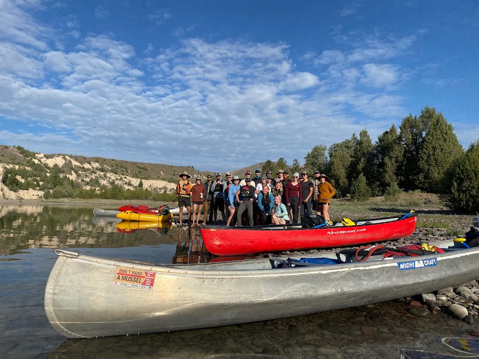
An assortment of canoes, kayaks, and packrafts lined the banks of the lower Flathead River near Buffalo Bridge. Early September sunlight glinted off the deep green water and illuminated clouds of dust that rose from the dirt road which disappeared into dry, golden hills on the other side of the river. A few of us drove the long shuttle between Buffalo Bridge and Dixon, swapping stories and getting to know one another, while the others loaded four days’ worth of food and gear into the boats.
Four years ago I was a student in Wilderness and Civilization, a semester-long program within the University of Montana’s Wilderness Institute that explores the relationships between Montana’s wild and working landscapes through a combination of classroom and field-based learning. Wilderness and Civ, as it’s more commonly called, has been around in one form or another since the 1970s and boasts a long list of notable alumni, including northwest poet Roger Dunsmore and our very own Scott Bosse.
The program is a little different each year but always includes a ten-day backpacking trip through some of the state’s most wild country, as well as a river trip of varying lengths. This year, a four-day trip down the lower Flathead River acted as a shakedown for the longer backpacking trip, giving students the opportunity to learn how to use, manage, and troubleshoot their gear. It also served as the ideal classroom to discuss river conservation in its many forms. I’ve been fortunate enough to lead and instruct for the program in the years since I was a student and this river trip provided the perfect opportunity to combine my work with American Rivers and my passion for experiential, place-based education.
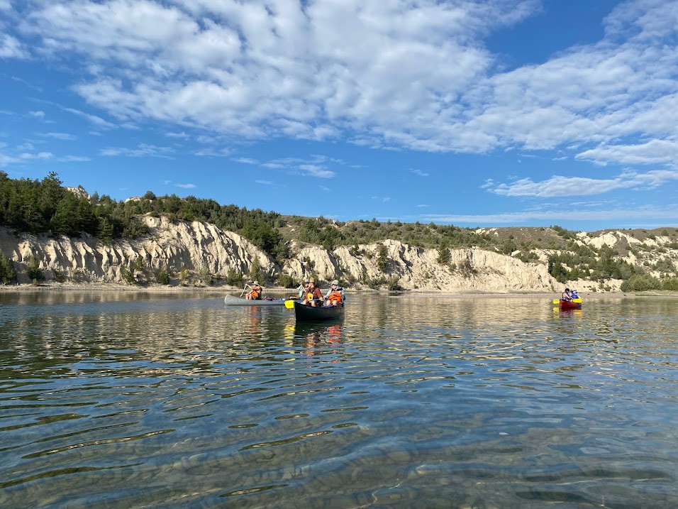
It didn’t take long to adopt the river’s pace as its slow, steady current carried us south. We moved more intentionally through places we might not otherwise notice and became intimate with the shape of the land. Chit chat faded and was replaced by the chatter of cliff swallows, darting from their precarious nests built high on embankments of white sediment, and the screeches of eagles and osprey from their perches in ancient cottonwoods and fire-scarred ponderosa pine.
I noticed a “Public Land Owner” sticker on a student’s water bottle that first day, overlapping a number of others showcasing National Parks and conservation organizations. I smiled. At a glance, this river and the surrounding landscape look a lot like the vast public lands of the Northern Rockies that flank it. But, we don’t own this land. We’re visitors here, in every way. The majority of the lower Flathead River runs through the Flathead Reservation, homelands of the Séliš (Salish), Ql̓ispé (Kallspel or Pend d’Oreille), and Ksanka (Kootenai) people and home to the Confederated Salish and Kootenai Tribes (CSKT). The Tribal Council granted us a special education permit for this trip and we were welcomed with a lesson on the area’s cultural history at the National Bison Range, which is owned and managed by CSKT.
Gathered on the banks of the river in the evenings, we talked about the history of the Wild and Scenic Rivers Act, signed into law by President Lyndon Johnson in 1968. We observed that the waters we made coffee with each morning and dipped our paddles into throughout the day flow from the North, Middle, and South Forks of the Flathead River, which inspired the creation of and are each designated under the Act.
Simultaneously, we acknowledged that those waters are known by other names and have been sacred to the tribes of this area far longer than they’ve been designated Wild and Scenic. We talked about the 1940s Paradise Dam proposal, which would have inundated 72 miles of the lower Flathead River, requiring the relocation of four small towns along with the National Bison Range. The proposal was ultimately defeated, in large part due to the many ways in which it would have infringed upon Native American rights, but not without a fight. Each day, students’ questions dug deeper into the intersections of conservation and equality – asking how we might build upon long-standing conservation legislation to create more equitable management tools and how voices that have traditionally been left out of those conversations might shape the future of places like this.
Little did we know, the very section of river we were paddling was making history as we asked those questions. Just a few weeks prior to our trip, on August 10, 2021, the CSKT Tribal Council quietly passed the Cultural Waterways Ordinance (CWO), a piece of tribal legislation aimed at protecting waterways that possess, “the physical, spiritual, and environmental resources and conditions necessary for the continuance of cultural practices and activities.”
Under the CWO, waterways may be nominated to the Tribal Council following consultation with Tribal elders and research into the waterway’s specific cultural history. Once nominated, the designation must be approved by resolution through Tribal Council votes. Following designation, the Tribal Council determines a period of time during which the CSKT Natural Resources Department and the Division of Fish, Wildlife, Recreation and Conservation must complete or update a management plan for the designated Cultural Waterway. Similar to the Wild and Scenic Rivers Act, the Cultural Waterways Ordinance prohibits the construction of man-made obstructions, such as dams, that threaten the free-flowing character of designated waterways, with a strong emphasis on protecting cultural values.
August 10th, 2021, marked not only the passage of the Cultural Waterways Ordinance but also the designation of the first Cultural Waterway – the Lower Flathead River, from Séliš Ksanka QÍispé Dam to the reservation boundary. The CWO states:
“Maintaining the remaining free-flowing stretches, and the open, wild character of the river and surrounding area is crucial to the survival and well-being of the Tribes and the perpetuation of our cultures, there is hereby established the Lower Flathead River Cultural Waterway, extending from its exit from Flathead Lake down to its point of exit from the Flathead Reservation; and this Waterway, described herein, shall be administered to protect, preserve, and restore its cultural and environmental values.”
It would be over two months from our time on the Lower Flathead before news of this groundbreaking legislation began to circulate more widely. My heart swelled when I finally had the opportunity to read through the full ordinance, which blends the legislative jargon you’d expect with more storied descriptions of the Lower Flathead River’s cultural values.
I thought back to the questions students had asked while we sat next to the river and paddled towards the snow-capped peaks of the Mission Mountains; questions, like so many others, that felt like they’d take decades to figure out. Now, right in front of us, is a piece of legislation that’s actively shaping the future of river protection and helping to rewrite the larger narrative of conservation.
To learn more about the CSKT Cultural Waterways Ordinance and what you can do to help protect rivers in the Northern Rockies, contact Jessy Stevenson at jstevenson@americanrivers.org.