Having moved from corporate America to American Rivers last year, one of the best things I’ve found about working for American Rivers is the increased appreciation I continue to gain for the importance of the work done by our conservation staff. Earlier this month, I had the opportunity to travel and fish with Scott Bosse, our Northern Rockies director, to meet with some of our supporters and while there had a chance to sample some of his favorite trout streams in the Greater Yellowstone area.
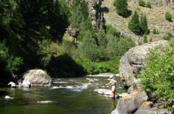
Our first river was the Gallatin near Yellowstone National Park, just south of Big Sky, Montana. Like many of the people we talked with in the area, I had the wrong impression that the Gallatin is protected from damming and development because of its proximity to the Park and its fabled history going back to Lewis and Clark.
What became clear was that as communities like Big Sky inevitably grow, so will the pressures on this wonderful river. There’s hope in the fact that the Gallatin has been found eligible for designation under the Wild and Scenic Rivers Act, and if we are successful in our Montana campaign, the Gallatin and many other rivers in this great state like it will be protected forever.
Bitch Creek, ID | Scott Bosse
The second river we fished was Bitch Creek in eastern Idaho. This river runs through a gorgeous steep-walled canyon, before joining the Teton River in a remote canyon that sees very few anglers. It is one of the last, best strongholds for Yellowstone cutthroats in the Teton Basin, as Scott notes. While the canyon is a source of beauty and wildness, it also makes the river attractive for damming. The Bureau of Reclamation and State of Idaho are currently studying the feasibility of building new water storage projects that would severely harm the native trout fisheries in Bitch Creek, Badger Creek, and the Teton River Canyon.
What a tragedy it would be to lose this fantastic trout stream, yet again there is hope in that these three rivers (Bitch, Badger, and Teton) are eligible for Wild and Scenic River designation. Several of the local landowners in the area support the designation, as do many local groups and fly shops. Hopefully with the support of more like them and the dedication of the American Rivers staff, it will gain the nation’s highest level of protection in the not-so-distant future.
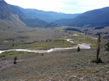
The last river we fished was the meadow section of Crystal Creek, a tributary of the Gros Ventre River in northwest Wyoming, where we were joined by colleague Liz Hennrikus. I’m tempted to not write about it to help keep it a secret, but it’s an important example of a beautiful stream that’s already been protected under the Wild and Scenic Rivers Act.
Neither I nor the picture added here, can begin to describe the strong impression this river makes as it winds through this high meadow. The cutthroats have been here since the Ice Age and are just as hungry as ever. They come up from their secret hiding places to sip an unsuspecting mayfly or a Parachute Adams off the surface before sliding down to their holding locations. If you think a river is alive on its own, you should see it when a 17” native cutthroat hits your fly.
Crystal Creek Meadows, WY | Steve White
The good news is that this stream, along with 12 others that make up the headwaters of the Snake, were protected as Wild and Scenic in 2009, when the former president of American Rivers, Rebecca Wodder, joined President Obama at the signing ceremony in the White House. With this protection, Crystal Creek, its cutthroat trout, and the other wildlife that thrives along it will remain as they are for future generations to enjoy. I’m hoping to take my son there in the next year or two, as an example.
The pressures on our beautiful rivers are real and present, whether from proposed dams, development, or dewatering. While there has been great work to save rivers like the Crystal, there is much more to be done on behalf of Bitch Creek, the Gallatin, and countless others. Learning what we, our staff and our supporters, can do to protect them gives me a stronger appreciation for both the work of our dedicated staff and the generous support of the members and foundations that make that work possible. When you see them and fish them, you understand that protecting streams like Castle Creek, Bitch Creek, and the Gallatin couldn’t be more important.
While staying with the family recently on the Middle Fork of Feather River near Graeagle, CA, I had some free time to spend on the river. This of course meant taking my fly rod and seeing what fish might be there. There are some remote stretches of the river that have tremendous wild trout fishing, but this stretch where we were staying is easily accessed with several towns nearby.
Steve White’s daughter fly fishing on the Feather River, CA
In past years, I usually hit one of three situations: the water would be low making for tough fishing, the State would have just stocked the section making it a good place to take the kids fishing, or there might be a wild trout or two holding in the pools.
Walking to the river, my expectations were low, since it had been hot, the river was low, and I hadn’t seen any signs of fish from the nearby bridges. I was really looking forward to the time on the river despite my low expectations. This made me wonder if you can have a successful fishing trip without catching fish. There’s a competitive part of me that feels that landing something is essential, and yet there’s another part of me that appreciates that there’s more to it.
As the trail took me past a small beaver pond, my attention turned to a large, healthy female deer foraging on the grass along the pond’s edge. She slowly looked up, shook her head, and trotted off.
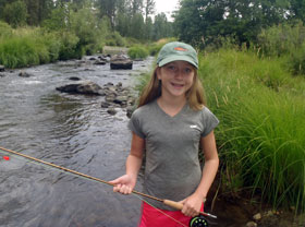
Part of my goal was to see if this would be a good spot to take my daughter fishing the next day. She is just learning to fly fish and has a really pretty pace to her casting. She’d have fun either way, but if I could put her on fish, that’d be even better.
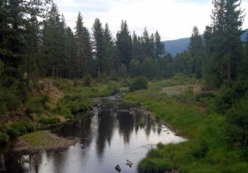
The Middle Fork of the Feather is designated as a National Wild and Scenic River, which means that, even though it flows through towns like Blairsden and past farms and other public and private uses, it’s protected from dams, mineral development, dewatering, or other threats. A significant part of American Rivers’ work in the west is focused on this type of protection, which is so important given the pressures western rivers face. The Middle Feather, like so many designated rivers, certainly is “scenic” and supports populations of deer, bear, osprey, heron, and other wildlife…even the occasional trout.
Feather Wild and Scenic River, CA
In this watershed, American Rivers has also worked to improve conservation and recreation downstream on the main stem of the Feather below the Oroville Dam, the tallest in the US. American Rivers has worked to ensure that adequate flows are released below the dam to support Chinook salmon runs and that river access and recreational opportunities are preserved and improved.
The fishing was as slow as I had expected it would be. I had several small fish hit and miss my fly, but nothing large enough to take it. Despite the lack of fish, it was just beautiful being on the river with its cool flow and quiet riffles. I fished for about 45 minutes, convincing myself that the fish from previous years had moved on and hoping the small fish I’d seen would grow up to be more interesting next summer.
As I reeled in and headed back to the cabin, something caught my eye in the water just above the beaver dam. Moving along the grass line, half in and half out of the water, was the beaver himself. His sleek, wet, black fur shone in the sunlight and made him look like he lives in the water, which of course he does. As I walked back up the trail, feeling completely satisfied and reflecting on the deer, the beaver, and the small trout, it occurred to me that, yes, you can have a successful fishing trip without catching. As the old line goes, “There more to fishing than fishing.”
Like many of the people I fish with these days, I grew up fishing. My dad taught me about salt water fish when we lived in Florida and then about largemouth bass and trout when we moved to North Carolina. While we liked all kinds of fishing, we pretty quickly settled into trout fishing in the mountains as our favorite.
Each year he would save up his vacation days to take me and sometimes my brother fly fishing, quoting T.S. Eliot with, “In the mountains, there you feel free.” Having studied at Sewanee and at Oxford, he would often bring his favorite authors into the long, comfortable conversations we’d have driving there.
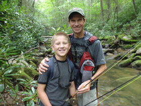
Fishing with my son at Green Cove Creek in Virginia
The streams we would fish had great Southern names, like Gragg Prong, North Harper, and Lost Cove Creek, and were usually small streams, only a few yards across. We would lay out the maps in the evenings to pick a new spot for the coming day. Driving to the streams would be like sitting in front of a pile of birthday presents, not knowing but hoping. We’d look down from the gravel road through the trees and brush to get an idea of whether we had found the right place.
As we would step into the water and look upstream, we would talk about how the trees would arch above the stream, reaching up with bright green branches towards the brighter light coming through the top. It felt like walking into church with the altar just a little farther upstream. And then we’d start our fishing and love it. At the end of the day, he would think back and say, “When you’ve caught a trout, you’ve really done something.”
I now take my son to the streams my dad took me to, and often think about how much he would love fishing with his grandson. I point out large rocks that he caught fish behind and tell stories about how his biggest smiles were always on the river. So now, since I can’t fish with my dad anymore, we have a different family tradition: when we’re having a particularly good time on a stream or river, we reach down into the shallow water for a nice smooth rock that looks like the rest of them.
Then when we get back home, not that week or even that month but sometime soon, we drive to the cemetery. We sit down on the hard ground with the fresh mown grass, lay the rock at his tombstone and tell him the story. There are lots of rocks at his tombstone.
Sometimes in the story we land the fish and sometimes the fish gets away, but it doesn’t matter. We’re just glad he’s with us.
There’s just something about the Smith River.
Other Montana rivers offer superior trout fishing, clearer and colder water, and flow through more pristine landscapes. But no river holds a bigger place in the heart of Montanans than this sparkling little gem that flows for 60 miles through a spectacular limestone canyon between the Little Belt and Big Belt Mountains.
For me, protecting the Smith River is deeply personal. For it was here, on the canyon rim overlooking the confluence of Tenderfoot Creek, where I first met the woman who would become my wife. That was more than twenty years ago.
So when I first heard that a tiny Canadian mining company, Tintina Resources, wanted to build a copper mine in the Smith’s headwaters, I was viscerally shaken.
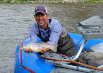
Scott Bosse with a brown trout
Not only would Tintina’s copper mine be built beneath and adjacent to Sheep Creek, the most important wild trout spawning tributary in the entire Smith River system, but the copper deposit is located in a massive sulfide ore body. That’s a huge concern because when sulfide ore is exposed to air and water, it invariably leads to acid mine drainage. And acid mine drainage kills fish and other aquatic organisms, as exemplified by the recent Gold King disaster on southwest Colorado’s Animas River.
When my American Rivers colleague, Mike Fiebig, and I took a field tour of Tintina’s proposed copper mine with the company’s CEO and Vice-President of Exploration last fall, they assured us that state-of-the-art technology would be used to ensure the mine would have zero impact on the Smith River’s water quality and wild trout fishery. In fact, they went so far as to say it actually would improve stream flows for trout. It all sounded so rosy.
But when we hired a team of experts to review Tintina’s permit application after they submitted it to the Montana Department of Environmental Quality last December, we learned that the proposed copper mine poses serious risks that simply can’t be mitigated, much less eliminated. Moreover, the permit application lacked basic information on fisheries, geochemistry, and groundwater-surface water interactions, without which it is impossible to accurately gauge the mine’s likely impacts.
Then, a few months ago, an avid angler from Yakima, Washington who has spent 40 years in the mining industry called me on the phone to warn me that the proposed copper mine is virtually certain to contaminate the Smith River and ruin its wild trout fishery. His name is Tyler Shepherd, and we’ll publish his guest blog on the Smith River later this month. Suffice it to say, it’s quite illuminating.
Whether you’ve come to know the Smith River as intimately as I have, or you simply want to keep one of Montana’s most cherished rivers clean and healthy for future generations to enjoy, I urge you to take action on its behalf. The stakes couldn’t be higher.
[metaslider id=31074]
In July, American Rivers teamed up with local groups and volunteers in Steamboat Springs, CO and to clean up the Yampa River. To talk more about the work we did and the importance of river cleanups, I asked Kent Vertrees of Friends of the Yampa to guest blog.
In early summer, once the high-water has receded, the Yampa River in Northwest Colorado becomes a beautiful, mellow river that attracts hundreds if not thousands of people each day. We call it the “tube hatch” and it mimics the mayfly and caddisfly hatches where people on inner tubes inundate the river, enjoying the natural amusement park ride that the Yampa has provided us.
The Yampa River, in Northwest Colorado, is known as one of the wildest rivers in North America. Snowmelt from the Continental Divide in its headwaters fills the river in the spring, overflowing its banks, creating habitats for endangered fish and allowing boaters to have an unique recreation experience floating on a river that isn’t highly managed by man.
The river is wild and free due to the remote nature of its location. It isn’t impacted by man in such a way that limits its cleanliness, its clarity and its flow. Still, we have our way of impacting even the wildest rivers and the most remote areas.
Small towns like Steamboat Springs and Craig, Colorado are positioned on the Yampa’s banks. As a community, we love this river, we respect it for its life-giving qualities and wild attributes. The Yampa provides us with water for agriculture, industrial use, and drinking. It allows us one-of-a-kind recreational opportunities that are loved by locals and vacationers alike.
[metaslider id=32969]
But, with this love and use of the river comes consequences. The river can’t clean itself and, unfortunately, not every person who enjoys the river does so with the utmost respect or care. People don’t get that flip flops are the first thing to fall off when they get in their tubes, or unsecured hats and water bottles will float away when they go upside down in a small hole or large wave.
So, what do we do?
The Friends of the Yampa along with partners like American Rivers, the City of Steamboat Springs, the Northwest Colorado Chapter of the Parrot Heads, the Colorado Water Trust and concerned citizens, organize river cleanups to help the river do what it can’t. The satisfaction, appreciation and community feeling you get from volunteering and organizing river cleanups connects us to rivers on a deep level.
On July 9, 2016, Friends of the Yampa (FOY) organized around 100 people in Steamboat Springs and Craig to put forth the largest river cleanup the Yampa River has ever seen. We have been holding river cleanups for over 30 years on the Yampa River and were excited to partner with American Rivers to celebrate the 25th anniversary of National River Cleanup® in our efforts to leave our hometown waterway cleaner and healthier than before. The cleanup was held on a perfect Colorado bluebird day and our volunteers cleaned up over a ton of trash and gained the satisfaction of knowing that they were helping this river become even more beautiful.
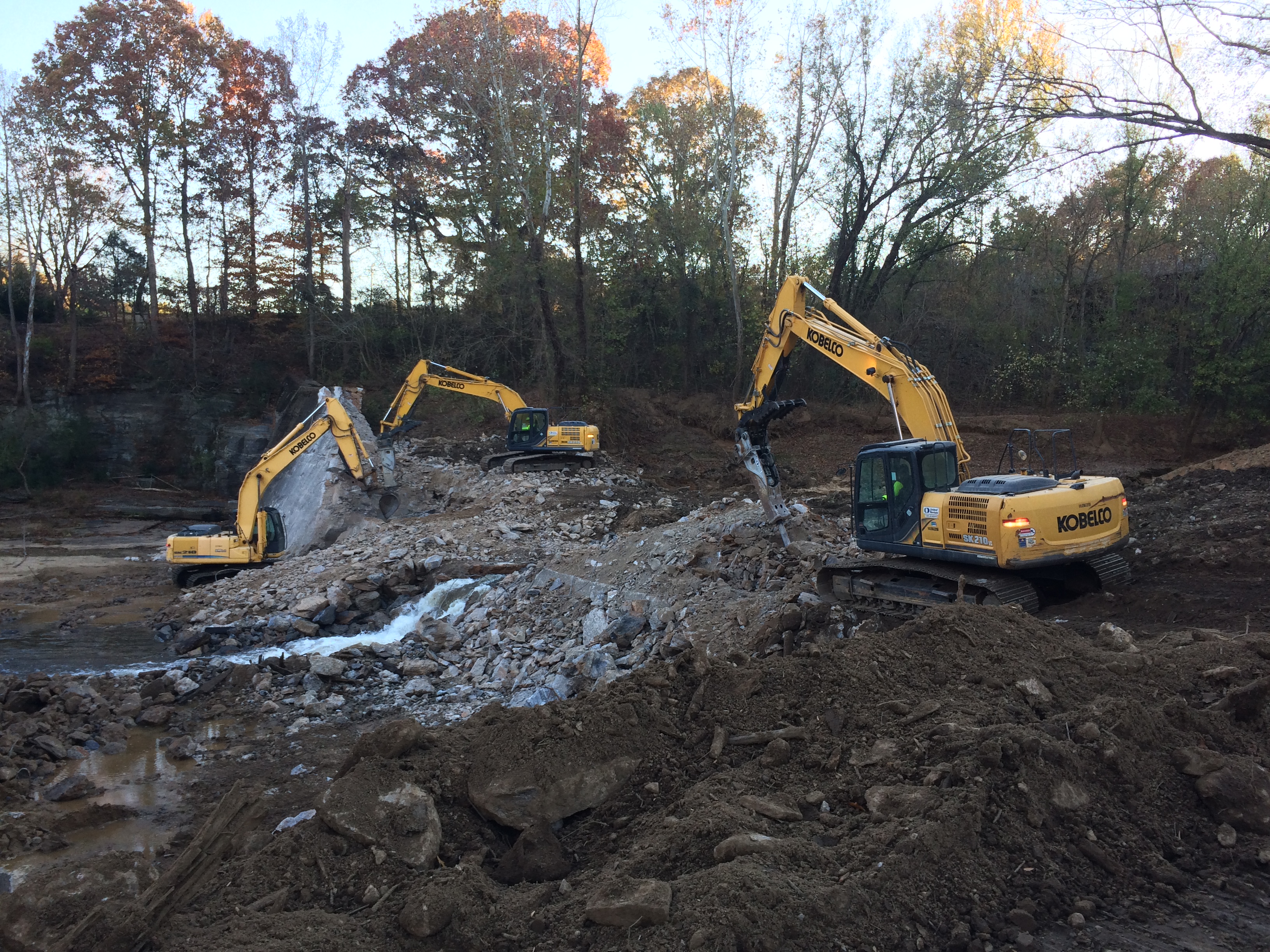
Some of our larger projects are made possible only through the help and engagement of great partners. The Shuford Dam removal project is an excellent example, where American Rivers partnered with Carolina Land and Lakes Resource Conservation and Development Council, the U.S. Fish and Wildlife Service and others to remove an old and outdated dam. The two phased demolition began in July 2016 and was completed in November of 2016. The project has been in development since 2012, so four years later we “go to construction” or demolish the dam.
[metaslider id=32928]
The Shuford Mill Dam, formerly a 35 ft. tall, 275 ft. wide masonry and concrete dam on the Henry Fork River in Brookford, NC, was constructed in the late 1800s to power an adjacent textile mill, but stopped being maintained years ago after the mill closed and the dam no longer served a purpose. The dam removal eliminates the public safety risk of an unmaintained dam, improves the local community’s ability to recreate safely on the Henry Fork River, and restores the river back to its natural free flowing state.
The ecological goals of the dam removal are to reconnect fish populations above and below the dam and improve the instream habitat by letting the river flow freely. The Henry Fork River drains portions of South Mountain State Park and joins the Jacobs Fork to form the South Fork of the Catawba River. Historically, freshwater mussels were found in the Henry Fork, but have been extirpated for about 100 years because of the impacts of dams and pollution. The N.C. Wildlife Resources Commission is interested in restoring freshwater mussels to this stream now that the dam removal will create suitable habitat once again.
Phase two of the Shuford Dam removal. | Erin Singer McCombs
Some of the challenges that contributed to the long timeline from inception to construction include concerns about existing infrastructure and managing sediment. A bridge is just upstream from the dam, so our design engineers had to address concerns that after the dam was removed and the sediment began to move downstream, the bridge may become unstable. Coordination over many months between the Department of Transportation and our team finally lead us to the conclusion that the bridge would remain stable. Additionally, our team needed to address how to appropriately manage the significant amount of sediment in the former impoundment. In the end, in cooperation with regulators, the construction crew at U.S. Fish and Wildlife and our design team, we decided to phase the removal in two parts to allow some sediment to be managed hands on with heavy machinery and to allow some of the sediment to flow downstream like in a natural storm event. While dam removals do create an impact on the landscape, our intent is to minimize the short term impact with a focus on the long term benefit of a free flowing river.
During Phase Two of the project, American Rivers and Carolina Land and Lakes hosted a dam removal celebration on-site in one of the few remaining mill buildings. In attendance were 75 people from across the region including local elected leaders, academics, regulators, funders, other project managers, resource practitioners, agency folks and community members. About 15 attendees lived right in Brookford, NC, the small community integrally linked to the Shuford Mill, and most either worked in the mill themselves or their parents and grandparents did before them. I enjoyed hearing the community member’s stories of their personal history with the mill. Community members expressed happiness in seeing progress at the site and optimism that the site of the old mill would be a boon for the community again.
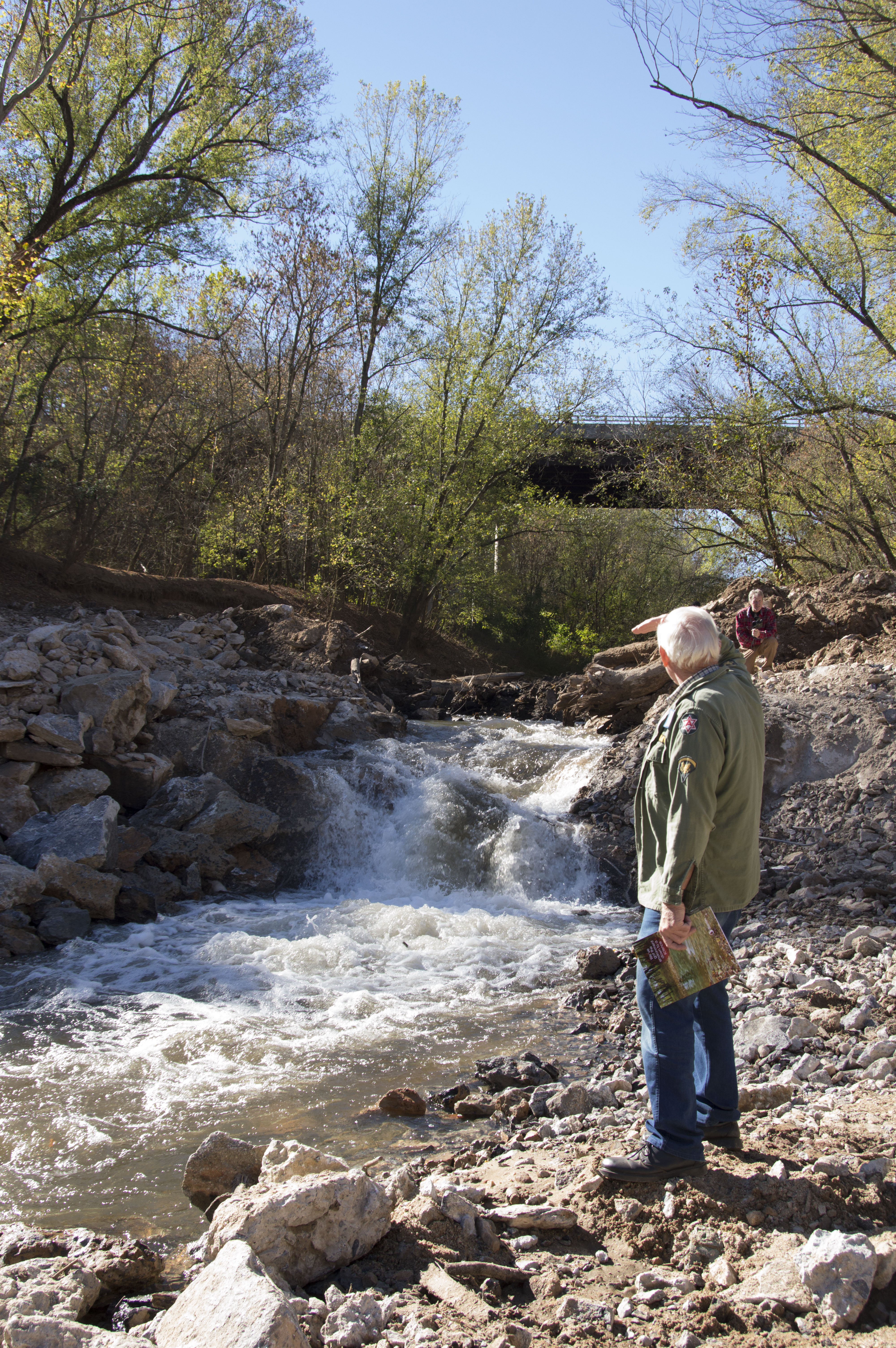
The Henry Fork River is free flowing again! | Rhonda Evans
American Rivers and Carolina Land and Lakes Resource Conservation and Development Council co-managed the project and the US Fish and Wildlife Service provided the construction/demolition services. The design engineering was contracted through Stantec Consulting. Biological monitoring is being conducted by the NC Wildlife Resources Commission and Appalachian State University. Physical geomorphological monitoring is being conducted by Stantec Consulting thanks to an internal grant they secured. Other partners include Catawba County Soil and Water Conservation district, the Western Piedmont Council of Governments, Jeffrey Rich, and Freshwaters Illustrated. Thanks to all our partners and supporters who share our vision of healthy free flowing streams that support people and nature.
Stay tuned for more pictures of the site.
If you liked this blog, check out the Citico Creek dam removal blog and video here highlighting American Rivers’ partnership with the U.S. Fish and Wildlife Service and the U.S. Forest Service.
Guest post by Merrimack River Watershed Council is a part of our America’s Most Endangered Rivers® series spotlighting the Merrimack River.
The Merrimack River Watershed Council, along with the Nashua River Watershed Association and the University of New Hampshire Cooperative Extension, has embarked on a three year grant funded project to protect water quality by restoring and protecting riverside buffers.
The Riparian Restoration project is a three year project funded with grants from the U.S. Forest Service and the National Fish and Wildlife Foundation that focuses on select sub-watersheds throughout Massachusetts and New Hampshire to combat stormwater pollution and water quality. These vital vegetative buffers protect the rivers and streams by filtering stormwater, absorbing and trapping pollutants, provide shade to keep waters cool, and provide important habitat for wildlife throughout the ecosystem.
Check out the video
[su_youtube_advanced url=”https://www.youtube.com/watch?v=PI2nTLhZ5YY” width=”1000″ height=”520″ rel=”no” modestbranding=”yes” https=”yes”]https://youtu.be/mbpmAJq4XWw[/su_youtube_advanced]
Partnerships like these can go a long way toward protecting and restoring watersheds, especially if they are well coordinated and funded. We need to build upon this good work in the Merrimack by urging the EPA to create a regional watershed partnership to prioritize smart land-use planning, green infrastructure and accelerate land protection now in order to protect the Merrimack River’s water for people and wildlife!
The Merrimack River Watershed Council was formed in 1976 to protect, improve and conserve the Merrimack River watershed for people and wildlife through education, recreation, advocacy and science
Guest post by Alyssa Donovan is a part of our America’s Most Endangered Rivers® series spotlighting the Merrimack River.
I have lived alongside the Merrimack River for my entire life. However, somehow I did not know this until I moved to North Andover in middle school. Soon after coming to North Andover, I was introduced to Lake Cochichewick, a reservoir connected to another tributary to the Merrimack River. I now spend an unnecessary amount of time there. It is really my favorite place to be. One of my favorite memories happened when I first went night skating along the surface.
It was mid-January and the lake had finally frozen. My friends, who had been in North Andover their whole lives, decided to drag me along to go ice skating. I had never skated on a natural surface and, after always being told not to skate on lakes, I naturally was very reluctant to follow them. But, after a lot of negotiating and convincing, I laced up my skates.
As we walked along the wooded trail leading to the lake, I felt a ball of anxiety growing in my chest. Skating on a lake was so demonized to me that I really thought I was going to fall in and drown. But, falling victim to peer pressure, my friends convinced me to follow through.
As we finally broke through the trees, the lake revealed itself in all its glowing glory. The sky was clear and the full moon’s light fell and ricocheted off the ice in a luminescent splendor. We slid onto the ice and made our way out of the small bay.
The further we went, the more beautiful everything appeared; the new snow blanket hugging the trees and hills sparkled and the sky was as clear as ever. As we slowed to a stop in the middle of the lake, a large air bubble floated beneath the ice, sounding like a gigantic yawn. It was at this moment that I understood the power and beauty of the lake. Being a part of nature in its rawest and purest form is something that everyone should experience. It changes the way you think about your environment; it inspires you to save and conserve the beauty around you.
Alyssa Donovan
Alyssa Donovan is a graphic design student, an intern at the Merrimack River Watershed Council, and an avid hiker. The Merrimack River Watershed Council’s mission is to protect, improve and conserve the Merrimack River watershed for people and wildlife through education, recreation, advocacy and science.
*Don’t try this at home. American Rivers does not encourage ice skating on rivers and lakes.
“What’s happening here?” I exclaim as I look at a large barren patch of dry ground surrounded by green corn lily, and steep banks leading down to the river channel. As I turn slowly in a circle, I see patches of wet meadow covered in sedges and rushes, and I can see dense willow thickets from where I stand. But the area around me is unexpectedly dry, dusty, and void of most plant life. Each meadow has a story – a unique combination of geomorphic characteristics and history.
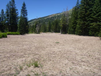
A large, barren patch of a meadow made us wonder what had happened here.
Recently, Max Odland (California Conservation Associate) and I embarked on a backpacking trip into the Granite Chief Wilderness, home to the headwaters of the American River. Over the course of the summer, we have been using the meadow scorecard (developed by American Rivers staff and colleagues) to assess mountain meadows in several different Sierra Nevada watersheds. This rapid assessment method requires us to take a lot of photos (which proves to be helpful in comparing changes to the stream channel size and shape), and GPS points, but the rest of our time spent in a meadow is relatively unstructured: mostly, we walk.
Conducting a meadow assessment turns out to be a lot like solving a mystery: putting together observations in order to see the most complete picture possible. To assemble this picture, I have found myself standing knee deep in small stream channels, estimating bank height. I’ve walked many, many transects across the mountain meadows, using my paces to estimate relative abundances of different plant categories. I’ve scrambled over boulder piles and slogged through beaver ponds.
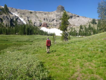
AR’s Max Odland conducts a meadow assessment in Granite Chief Wilderness in the American River watershed.
Being able to travel to and spend time in these remote areas has been incredibly rewarding. The plant lover in me has gazed upon deep purple fields of camas flowers, observed pink stalks of elephant’s head pushing out of pristine mountain springs, and crushed fragrant sagebrush underfoot as I make my way through meadows.
Time slows down during meadow assessment field days, when the most important task is to pay attention to what is right in front of me. Translating observations into scores for vegetation cover, presence of gullies and ditches, and upland shrub encroachment is one piece of the picture of each meadow; we’ll use the scores to help inform and prioritize restoration projects.
For now, we’ll keep assessing them, slowly putting together observations to tell their stories.
Guest post by Keith Curley is a part of our America’s Most Endangered Rivers® series spotlighting the Merrimack River.
“You fish in the Merrimack River?”
I can still remember the surprised reactions I got as a kid when I’d tell my parents’ friends where I liked to fish.
Fishing on the Merrimack
Many people in my home town of Concord, N.H., had become so used to the Merrimack being polluted in the years before the Clean Water Act that they seemed to think it would always be that way.
But the Merrimack River I knew as a kid was a vibrant place where my dad and I would catch smallmouth bass, and where my friends and I would cool off with a quick swim between football practices on hot August days. The success story of the Merrimack River cleanup was one of the things that led me to a career in conservation—I wanted to do for other rivers what had been done for the Merrimack.
That’s why it was so troubling to see the Merrimack listed as one of America’s Most Endangered Rivers® of 2016. We’ve come too far to let the Merrimack backslide.
Last summer I took my son fishing at one of my old favorite spots in the Merrimack for the first time. Let’s make sure his generation gets to experience the same vibrant river that I enjoyed as a kid.
Keith Curley is Trout Unlimited’s Vice President of Eastern Conservation. He is based in Arlington, VA. Trout Unlimited is a national organization dedicated to protecting and improving cold water fishing resources. The Merrimack River Chapter is a key building block and local members volunteer their time, money and energy to improving cold-water fishing resources in New Hampshire.
Guest post by Denise Hurt is a part of our America’s Most Endangered Rivers® series spotlighting the Merrimack River.
There is nothing better than viewing the world from the seat of a kayak. Take me away from the worries and concerns of the work day, put me on a river, and I’ll go from stress-creased-forehead mode to smile-lines-on-my-cheeks mode in about three paddle strokes. Spring, summer or fall, farmland, countryside or city scape, the Merrimack is a river with so many different personalities I can always find one to fit my mood-du-jour. Whether it’s a bright, sunny day or a crisp, foggy morning, it is one of the places that can turn things around for me. And it’s a river that has had a turnaround of its own.
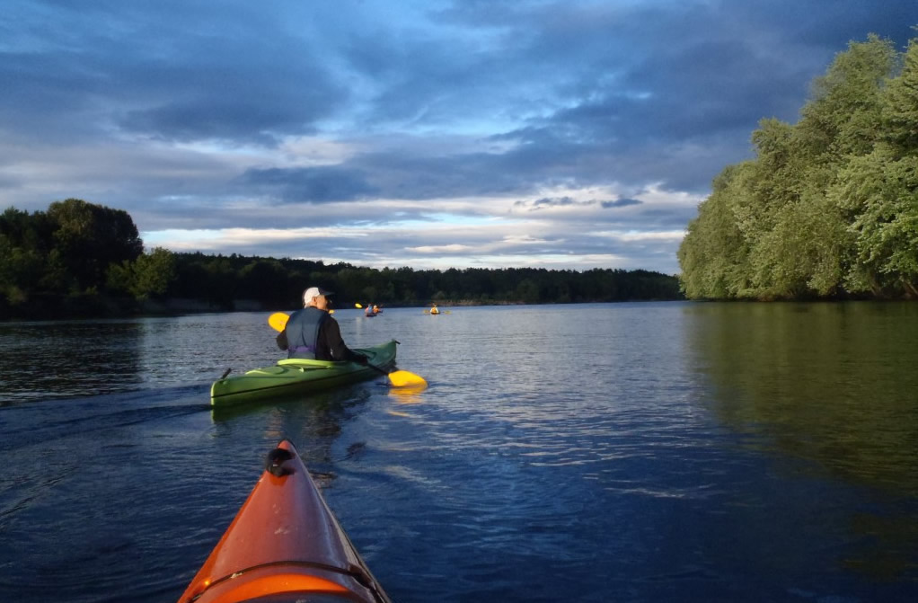
Merrimack River
Back in the 1970’s, the Merrimack River made the Top Ten List of the most polluted rivers in the country. Today it is considered a Class B waterway – suitable for swimming, boating, and fishing. The water quality improved so much because people came together to make it happen. People cared.
Building upon that progress, in 2013, the New Hampshire Appalachian Mountain Club paddler group started a Trash Patrol paddle series running on the first Saturday of every month from May to October. The Merrimack River Watershed Council has been a partner with the program from its inception. To date, we’ve removed over 6000 pieces of trash and recyclable items from our local rivers. You’ll find us out on the Merrimack River three times this year with crates strapped to the decks of our kayaks and canoes acting as trash barges.
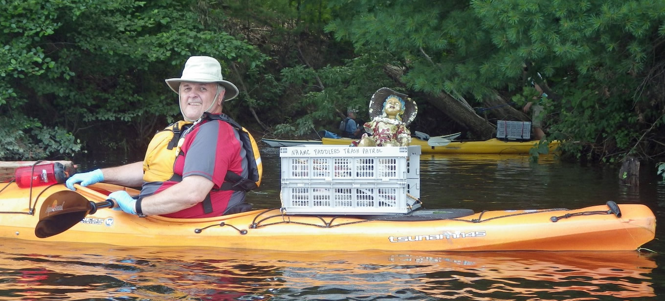
Cleaning up the Merrimack
It’s amazing what we pull out of the river – plastic bottles, aluminum cans and lots and lots of tennis balls, but also larger items like tires, construction debris, extension ladders, lawn ornaments, and furniture of all types. It’s become a tradition to see who will find the most unusual item. Someone even turned up with a beaver skull once which now resides in a friend’s biology classroom at Lowell Regional Technical High School.
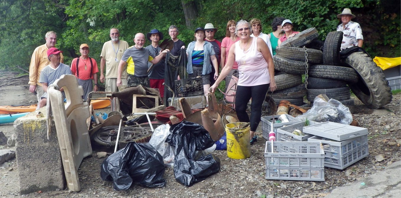
River Cleanup
The mighty Merrimack benefits from such excursions for sure. The biggest impact, however, is on the paddlers who take part in the program. They always leave a little tired, but with the biggest grins – feelin’ good. They’ll never look at a plastic water bottle drifting in the current quite the same way. In fact, they’ll probably go out of their way to paddle on over and throw it in their boat. This is their river and they’ll keep it clean. It’s an awareness thing.
At the end of the day, we’ve spent a lovely morning on the water with great blue heron, turtles, hawks and eagles, and have worked together to make the river a little bit cleaner for these beautiful creatures than it was when we came.
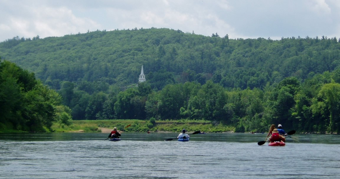
Enjoying the Merrimack
If you’d like to join one of these paddles, you can register at www.outdoors.org. But you don’t have to wait for an organized event! Next time you’re on the Merrimack River or another of your favorites, paddle on over to that beer can and pick it up! Maybe someone will see you and they’ll do the same, and before you know it we’ve got a movement going!
During my four years at Cornell, I was led to American Rivers time and again as I worked on research projects and essays. The American Rivers’ website and staff helped me answer questions on dam impacts, river conservation, and clean up strategies. With graduation looming, I set off on a quest to find an environmental NGO that focuses on the intersection of freshwater science and policy to gain experience in the field; again, I returned to the AR website to apply for a summer internship.
In May, I moved to DC to begin my internship with the Science & Economics Program. From day one I was exposed to AR staff’s diverse work and the motivating environment which attracted me to Washington, DC in the first place. I am currently summarizing peer-reviewed published science related to a variety of topics in order to inform AR’s current and future work. This keeps me engaged on the various topics that the dedicated and talented AR staff focuses on.
I am also organizing staff programming, including a reading group related to freshwater science. The science reading group will provide an opportunity for the staff to discuss how science can better inform all of their work and the future of river conservation. I want to work at the interface between science and policy to promote collaboration and remain engaged in both fields. After taking several science classes and policy classes I realized that each had a specific jargon and a lot to share. I became interested in the cross between science and policy because of the disconnect I perceived.
I want to be involved in bringing people together to collaborate and build strong, evidence-based policy. The interface is important because policies’ success derives from an understanding that policies are not made in isolation. Law, science, economics, politics and public opinion are all important factors that go into policy. But how science can inform policy such as the Waters of the United States Rule or decisions about ecosystem flow management is my primary interest.
AR is a recognized leader because their conservation work is informed by current scientific understanding. I have had a wonderful summer so far learning a wide range of skills and lessons – from the effects of hydrologic alterations to the willingness of freshwater scientists to participate in a conversation on Twitter. I am looking forward to contributing to AR’s continued success as I work towards my goal of having the skills to mediate science and policy, while living in a world where I can swim in any river because freshwater is a priority.
About the author: Meg Parker is an intern with the Science and Economics Program. She has a degree in Environmental Science and Sustainability from Cornell University and is originally from Miami, FL.