In 2015, I was invited to join our Northern Rockies director and a group of other local river advocates on a rafting trip down the Smith River. The purpose of the trip was to show this amazing place to a reporter who was writing an article for the New York Times about the threat that a proposed copper mine posed to this beloved river.
I had never even heard of the Smith River.
As a fly angler, I had fished the Blackfoot and the Clark Fork, and I had of course heard about other iconic Montana streams, such as the Madison, the Gallatin, and the Bitterroot. But the Smith? No idea.
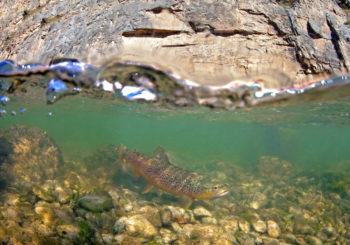
Brown Trout in the Smith River, MT. | Pat Clayton
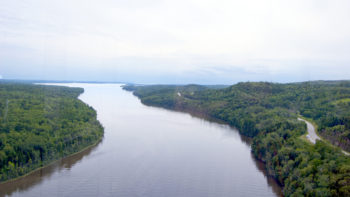
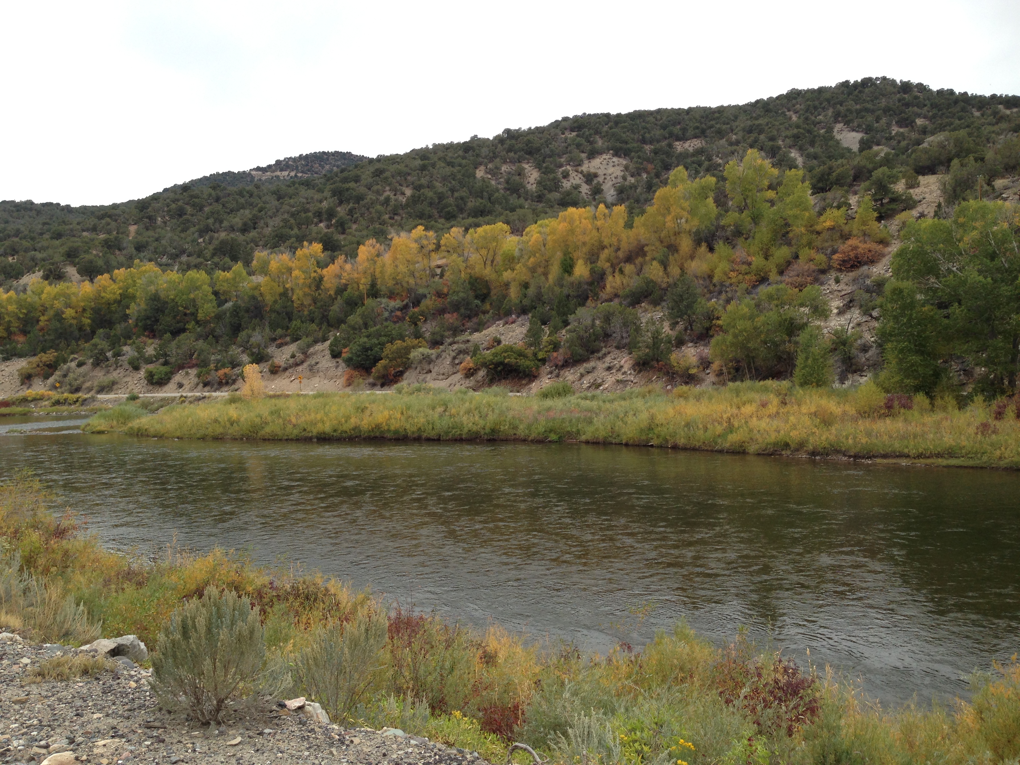
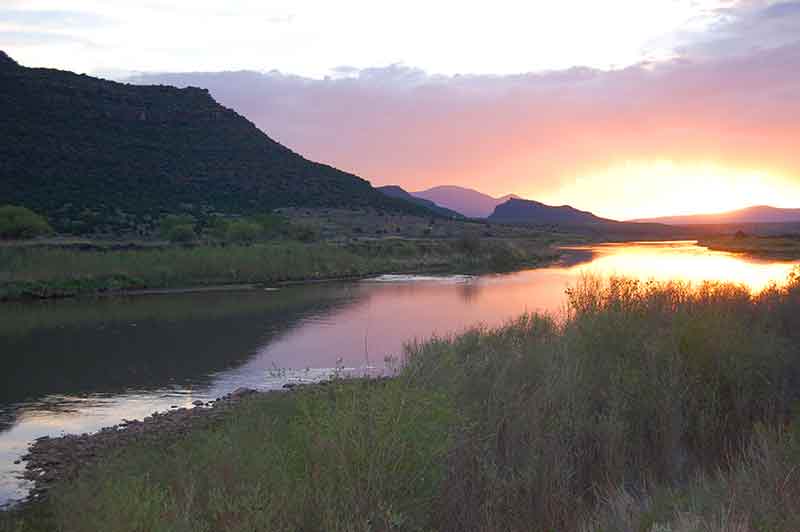
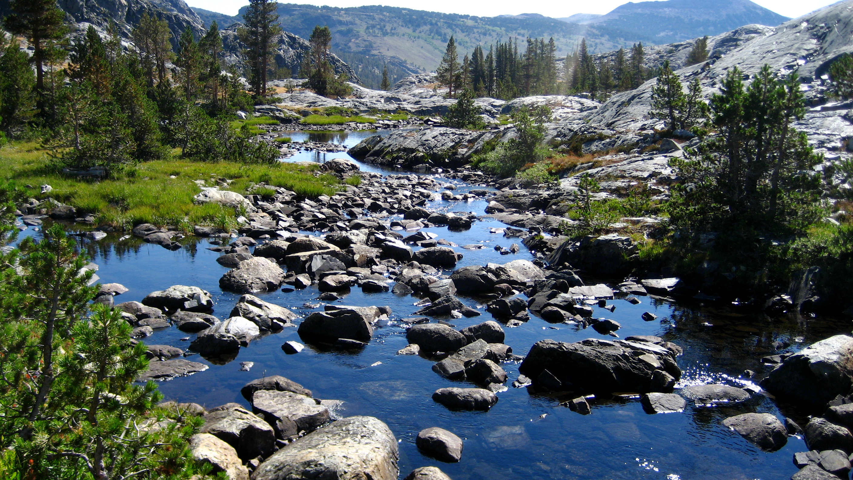
The Smith originates in the Castle Mountains near the town of White Sulphur Springs about an hour and a half northeast of Bozeman. Driving to the put-in, you gaze out across a basin and range landscape, eventually finding a river surrounded by khaki-colored rolling hills. Looking across the plains is indicative of the famous big skies that those of us from outside Montana talk about, but don’t truly understand until faced by towering cumulonimbus lumbering across the expansive blue horizon.
But it really wasn’t until we pushed off from the Camp Baker put-in that I began to grasp the allure of the Smith River. As the limestone cliffs rose skyward, and the river plunged into a deeper and deeper gorge, it occurred to me, “this place is really special.”
For the next 5 days we floated, we fished, we reflected on each day by a crackling campfire expressing its warmth. We got caught in a horrendous thunderstorm. We saw spectacular, watercolor sunsets. Archeological sites and dramatic overlooks were always right around the bend, and the water…wow it was clean and clear, just as every remote river should be. To get a sense of just how terrific this place is, just take a look at our new short film about the Smith.
Montana’s Smith River Stirs the Soul from American Rivers on Vimeo.
But back to the point of the trip – a foreign mining company has proposed to build an underground copper mine on the banks of one of the Smith’s primary headwaters tributaries, Sheep Creek. Tintina Resources has stated publicly that the mine will impact the purity of the water in the Smith – there is just no way around it. This should startle anyone who knows anything about the damaging and expensive mining legacy in Montana. It’s taken decades and over a billion dollars to clean up the toxic heavy metals in the Clark Fork River between Butte and Missoula, and the job is far from complete. The Big Blackfoot River of A River Runs Through It fame and Belt Creek are just a few of the other Montana rivers that have been heavily impacted by mining in the past. Do we really want to subject the Smith – arguably Montana’s most cherished river – to this kind of degradation?” Do we need to risk sacrificing this amazing place so an Australian-controlled company can mine for copper for 11-14 years and then potentially skip town?
Take action to protect Montana’s Smith River today.
Last year Gills Creek, which flows through the heart of Columbia, SC, was the epicenter of a 1000 year rain event and flood disaster like never seen before on Gills Creek. Five dams failed, hundreds of homes and businesses were destroyed, and tragically several people lost their lives.
Although we did have a tremendous amount of rainfall, the amount of impervious surface and stormwater runoff in the watershed greatly contributed to the disaster we experienced. Much of the Gills Creek Watershed was developed before modern stormwater ordinances and as such many commercial developments have little to no on-site detention to handle their stormwater during any rain event, much less the storm of the century!
Owens Field Park, an old airport runway, is one of the busiest parks in Columbia. Thousands gather to play soccer, baseball, run the trails, or play on the disc golf course. It is now becoming a success story for controlling runoff and stormwater pollution.
Creating bioretention ponds at Owens Field Park. | Erich Miarka
Owens Field Park is eroding. Stormwater runoff from the surrounding neighborhood and a large parking lot runs through the park, damaging trails and forest floor as it does so. In 2013 Richland County sought to improve the trails at Owens Field but couldn’t fix the trails without fixing the stormwater issue first. Gills Creek Watershed Association reached out to Richland County and applied for a nonpoint source pollution reduction grant from SC Department of Health and Environmental Control.
Fast forward three years and Owens Field is now in the final stages of construction. The Park is getting a facelift with new trails, fields, parking lots, bioretention areas, and even a Miracle Field.
To address the stormwater issues the site features two new bioretention cells and one renovated stormwater dry pond. Bioretention cells function much like a large raingarden; they are dry between storms and collect runoff during rainy periods. Maintenance was a major concern for the park managers so the slopes of the cells were kept low enough to allow a riding lawnmower to drive safely into the cell to cut the grass periodically. The largest biofiltration cell is designed to capture stormwater runoff from the large parking lot adjacent to the Park. The other cell is a more linear feature that was converted from an old ditch. This linear bioswale will accept water from within the park itself as well as any overflow coming from the first cell. The water will then be infiltrated back into the ground at a rate of about 2 inches per hour. This is not new technology nor is difficult to design or install, however, in Columbia we see few of these examples of green infrastructure.
Green infrastructure such as the bioretention project at Owens Field Park have the ability to help handle some of this stormwater runoff by trapping it and letting it soak back into the ground. This keeps water out of the streams and rivers during storms and recharges groundwater for healthier base stream flows during the periods between rain events. Urban streams are polluted and “flashy”. Bioretention can address both of these problems with little impact on site development. In fact, when done correctly, green infrastructure can add to the landscaping of a site.
Creeks and rivers flood – that’s natural. However, add thousands of acres of impervious surface to a small watershed and you will see a dramatic rise in flood prevalence, even from the most common summer storm. Integrating bioretention on a broad scale and retrofitting old developments with green infrastructure can go a long way to reduce peak stream flows, clean runoff, and help regulate base flows. The Owens Field Park project is just a small piece of that plan and will hopefully serve as an example for developers and property owners around the region. Green infrastructure does not have to be complicated or expensive. Nature does it best, green infrastructure simply tries to mimic nature to achieve some of the many ecosystem services that nature provides for free.
Erich Miarka is the Executive Director of the Gills Creek Watershed Association, a grassroots nonprofit in Columbia, South Carolina. Erich is an avid paddler and you can usually find him on one of the many creeks or rivers in the Carolinas.
American Rivers is a special organization. We work on important issues we are passionate about. But it’s not just the issues, or rivers, that make this a special place. It’s the people – our colleagues, partners, supporters, friends – people like you who are critical to keeping our conservation work going day after day, year after year.
It takes a wide range of partnerships to protect and restore rivers. Below, read about some of the friends and supporters who made a difference for rivers over the past year. And if you’re inspired by their stories, I hope you’ll share your own.
Thanks to them, and thanks to you – we couldn’t do it without you!
Maite Arce
Maite Arce (far right) | Photo courtesy Hispanic Access Foundation
One-third of the nation’s Latinos live and work in the Colorado River Basin. Healthy rivers and clean water are essential to the health and future of the basin’s families and communities.
“It’s critically important to engage the Latino community in river conservation, in the Colorado Basin and across the nation,” says Maite Arce, President and CEO of the Hispanic Access Foundation (HAF). “Our environmental values are strong and come from many generations.”
“We’re getting Latino youth out on the river, many for the first time. The beauty and the memories stay with us and make us into advocates. It’s an awesome experience,” she says.
American Rivers developed a strong partnership with HAF over the past year. We translated the short film “I Am Red” about the Colorado River into Spanish and distributed it to Latino audiences across the basin. HAF facilitated film screenings at 25 churches from Denver to Los Angeles and reached 4,000 Latino youth at special events. Spanish television stations including Telemundo Denver and Univision ran the short film as a public service announcement.
The response to the film has been overwhelming. “The impact has been so strong,” says Maite. “We’ve received thousands of postcards from children and adults, sharing their thoughts and hopes for the river.”
“Before we met American Rivers, HAF didn’t have a direct way to serve as advocates for the Colorado River. Now, working with American Rivers we have more opportunities for Latinos to be fully engaged on these issues that are so important to our communities.”
Ezra Field
Ezra Field
As a child, Ezra Field spent summers in Maine with his family and learned to fish. Among his first fly fishing experiences was the Penobscot River — home to the last wild Atlantic salmon run on the East Coast. He remembers the salmon runs dwindling then disappearing altogether — the culmination of years of habitat destruction from dams, pollution, and other impacts.
Years later, when he heard about the landmark Penobscot River Restoration Project, he was thrilled knowing the removal of outdated dams would restore salmon runs and river health. This kind of practical approach to conservation is one of the reasons why he supports American Rivers. “I love rivers and fishing. I appreciate American Rivers’ focused approach on preserving our remaining wild rivers and removing uneconomic dams in order to restore river habitats. I’m glad to be able to contribute to these efforts.”
This past June, thanks to the support of donors like Ezra, American Rivers and our partners celebrated the completion of the Penobscot restoration project.
The multi-year effort included the removal of the Great Works (2012) and Veazie (2013) dams, as well as improved fish passage at Milford and Howland dams. Now, Atlantic salmon and other sea-run fish have access to 1,000 miles of historic habitat for the first time in generations.
The Penobscot River viewed from the Penobscot Narrows Bridge Observatory at Prospect, ME. | Wiki Commons
As of the 2016 migration, American shad have rebounded from almost zero to nearly 8,000. Anglers now catch them in waters where the fish had been absent for a century. Nearly two million alewives and blueback herring — up from fewer than 100,000 before the dams were removed — have returned.
Osprey, eagles, striped and smallmouth bass are benefitting, feeding on the silvery fish. A healthy Penobscot River is strengthening the entire web of life.
In 2014, Ezra returned to the Penobscot under different circumstances. “My father was in the Eastern Maine Medical Center, and I remember being there with him. His room overlooked the river. It was the first time I had seen the Penobscot since the [Veazie] dam was removed. It brought back old memories of family and fishing. My father passed at EMMC, but seeing the river returned to its natural state helped me reflect on the circle of life. At a very difficult time, I was able to find some solace in wonderful memories and the river’s story of restoration.”
Paul Bruchez
Paul Bruchez | Photo by Russ Schnitzer
The Bruchez family has been ranching in Colorado for five generations. The Colorado River is the lifeblood of their business and their home. “Healthy ranches need healthy rivers,” says Paul Bruchez, whose Reeder Creek Ranch is benefitting from American Rivers’ efforts.
“We are fortunate to have American Rivers as a partner. For too long, agricultural and conservation interests have been at odds. But there is so much opportunity when we work together. I’m grateful for American Rivers’ commitment to restoring the Colorado River. It means the world to my family and I feel hopeful about our future.”
Check our annual report for more profiles of our outstanding partners and please consider supporting American Rivers with a donation today.
As we look back on 2016, we are grateful to you, our supporters.
You showed up again and again to take action on critical issues facing rivers and clean water. You stood up to save the Grand Canyon from the harmful Escalade development, showing a huge wave of support for this national treasure.

Chinook below Elwha Dam | Jeremy Monroe
And thanks to you, this past year brought major milestones in long-term river restoration efforts from Maine’s Penobscot to California’s Klamath to Washington’s Elwha.
We celebrated successes and inspired each other. Together, we shared stories, and new films.
Your commitment was critical as we faced new challenges, including the mining waste release in Colorado’s Animas River, the drinking water crisis in Flint, Michigan, and efforts in Congress to weaken river protections nationwide.
Your dedication means a lot to us as we confront the challenges ahead.
In this season of reflection, take a moment to appreciate all you helped accomplish for healthy rivers and clean water over the past year.
The following is a sampling of the successes we shared together. You made this possible and we are grateful for your support!
Key Successes in 2016
Restoring damaged rivers
- Helped revive efforts to remove four large dams on the Klamath River after Congress failed to authorize the project. As a result, the largest dam removal project in history is on track to begin in 2020.
- A federal court ruled in our favor in the long-running litigation to compel the federal government to give serious consideration to removing four dams on the lower Snake River in order to restore endangered salmon.
- Spearheaded the removal of 16 dams nationwide, including on tributaries to the Connecticut River, Citico Creek in North Carolina, and the Patapsco River in Maryland.
Conserving clean water
- Helped shape a landmark Colorado state water plan that recognizes the importance of healthy rivers and emphasizes conservation.
- Our call to move from water conflict to a new era of cooperation resonated in media stories nationwide when we named the Apalachicola-Chattahoochee-Flint river basin #1 on our annual list of America’s Most Endangered Rivers®.
- Partnered with the Toledo Mud Hens Baseball Club to capture and filter stormwater runoff from rooftops at Hensville Park near the downtown stadium.
Protecting wild rivers
East Rosebud Creek | Scott Bosse
- Due in large part to our advocacy, the bipartisan Montana congressional delegation lent its support to protection of East Rosebud Creek as a Wild and Scenic River. Legislation protecting the river has passed the Senate Energy and Natural Resources Committee.
- Senator Richard Durbin (D-IL) came out in opposition to the New Madrid Levee, which would drain an area of wetlands the size of Washington, DC and disconnect the last remaining piece of floodplain from the Mississippi River where it winds between Illinois, Kentucky and Missouri. We worked closely with the Senator’s staff as he developed his position.
Advancing national policy
- Opposed a concerted effort by the hydropower industry to weaken environmental requirements in dam licensing proceedings as part of the debate over federal energy legislation in Congress. American Rivers played a large part in convincing the Obama Administration to threaten a veto of the legislation.
- Successfully defended the Clean Water Rule, which restored federal protection to headwater streams and wetlands, from efforts to undo it in Congress.
Thank you for making these and other successes possible! We are truly grateful for you support. And if you’re able to make a donation, there’s still time to have your gift matched $2 for every $1 you give.
My “ah-ha!” moment happened at a presentation I attended a few years ago. A slide on the screen showed two rows of fish: on the left, smaller fish from a river with an urbanized floodplain, and on the right, fish of the same species and same age from a river with a natural, functioning floodplain. The fish on the right were almost twice the size as the ones on the left.
A healthy riparian corridor includes native trees and minimal disturbance within 100 feet of the streambank. Waccamaw River photo by Charles Slate.
Fish from rivers with healthy floodplains thrive, while those in rivers without a healthy floodplain merely survive.
The connection between thriving fish, healthy rivers, and functioning floodplains? Trees.
Forested watersheds have been shown much higher water quality than their urbanized counterparts. Trees provide a wide range of ecological services. Tree canopy lessens the erosive impact of rain and slows the velocity of stormwater flowing towards the river, as well as floodwaters spilling out onto the floodplain. Trees trap sediments that build the floodplain while the roots stabilize the riverbanks. Trees also provide shade for maintaining water temperature. Fallen leaves, limbs, and branches support the food web by providing food and habitat for the bugs that are in turn food for fish. Clean, cool water with more food equals bigger fish. Therefore, fish grow on trees.
The connection between fish and trees and rivers is now poised to emerge in our urban areas.
Many cities, from large to small, are recognizing the benefits of reestablishing the physical and emotional linkage between the river, trees and the community. For instance, San Antonio has its iconic River Walk, Chicago has just completed its riverfront, Washington DC has its Southwest Waterfront neighborhood, and Pittsburgh has reconnected neighborhoods to its three rivers via a network of urban trails. Furthermore, Hartford, Nashville, Providence, Denver, and Detroit all offer events on their downtown riverfronts that draw thousands, and Cincinnati, Columbus, Owensboro and many more are rediscovering their community-to-river reconnection. But when you look at images of these urban riverfronts, you notice they all have one thing in common: a lot of hardscape. Hard engineered solutions are meant to reduce maintenance and accommodate maximum access.
The trend in revitalizing urban riverfronts is a giant step forward, but our urban riverfronts also need soft green edges. They need the green space and trees that humans and fish, and all living things, require to thrive. It isn’t possible or desirable to return our urban rivers to forested watersheds, but we can reintroduce trees to our river corridors provide while also adding value to our urban communities.
Healthy for fish, healthy for people. Give trees to fish, and we’re also giving them to ourselves.
I’ve decided there needs to be a song about how fish grow on trees. Remember this folk song?
“…Oh, the limb on the tree,
And the tree in a hole
And the hole in the ground
And the green grass grew all around, all around
And the green grass grew all around…”
Let’s add “…and the green trees grew all around, all around…and big fish in the river are found.”
Earlier this month, I had the opportunity to celebrate a fantastic addition to protected land in Eagle County, Colorado – Dewey Park! With over a mile of Colorado River frontage permanently protected it was an excellent cause for celebration!
Dewey Park in Eagle County, Colorado. | Fay Augustyn
The Eagle Valley Land Trust, a grantee of the Connecting Communities to Rivers Grant Program, along with Eagle County Open Space, added another parcel of protected land along the upper Colorado River to the open space network. Dewey Park, a scenic, 38-acre property with 6,000 feet of Colorado River frontage was permanently preserved. Not only is this land visible from the Colorado River Road, but it can also be seen from nearby public lands.
Wildlife species such as bald eagles, osprey, great blue herons, and songbirds rely on this undeveloped land for habitat. The perpetual conservation easement ensures that development will never encroach on this scenic stretch of river. Just north of the Dotsero Landing Boat Ramp, the Dewey Park easement will preserve the scenic and iconic views of the Colorado River and surrounding area. Additionally, the easement will provide a buffer to the river, as well protect current agricultural uses and associated water rights for the property.
Dewey Park is now under a conservation easement that restricts development along the Colorado River | Fay Augustyn
The upper Colorado River lies at the heart of a nationally recognized recreational area in Eagle County, Colorado, home to Vail and Beaver Creek Ski Areas. The upper Colorado River is widely known as one of the most popular whitewater and fishing rivers in the country. Whether you enjoy pursuing a rainbow or brown trout, relaxing in a raft with friends, enjoying the Colorado River from its banks or along the Colorado River Road, the reach of the river from State Bridge to Dotsero in central Colorado is as scenic as it is adventurous!
Congratulations to the Eagle Valley Land Trust board and staff, the Eagle County Open Space Advisory Committee, and the Eagle Board of County Commissioners. Land protection was supported through funds from American Rivers and the Gates Family Foundation.
This month I started an eleven month term as an AmeriCorps member for the California Regional Office of American Rivers, and what a month it has been! I have helped with field work, traveled to different communities, and made allies with a multitude of passionate and knowledgeable people.
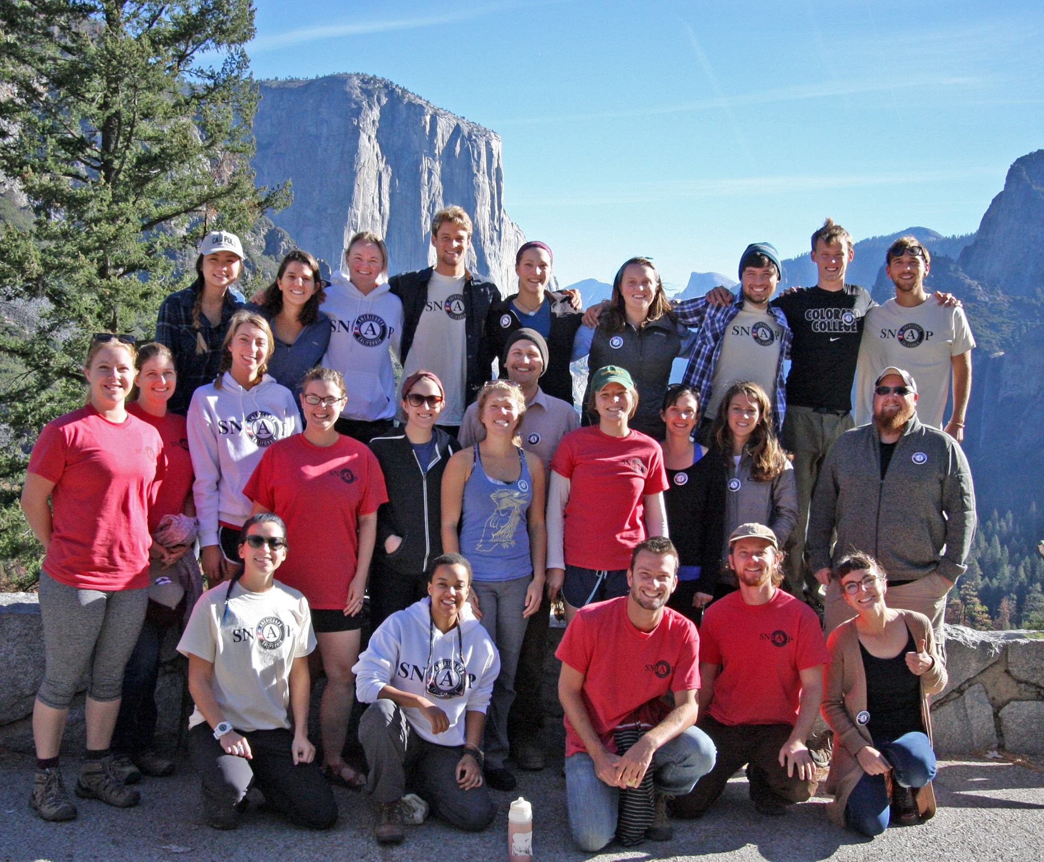
Members of the Sierra Nevada AmeriCorps Partnership 2016-17. | Maiya Greenwood
I am serving at American Rivers through the Sierra Nevada AmeriCorps Partnership (SNAP), whose focus is on watershed stewardship in the Sierra Nevada mountains. I grew up in Lake Tahoe, nestled in the Sierra Nevada mountain range and now, serving with American Rivers I finally have the chance to give back to the mountains that raised me. It is hard to believe that within two weeks I finished my laboratory technician job in Nevada, moved to California and started my new position as an AmeriCorps member in Nevada City. My first work week has been nothing short of exiting, and I am already grateful for this opportunity through American Rivers and SNAP!
It is important to understand the history and ideals of AmeriCorps in order to appreciate how great it is that American Rivers is supporting this program. In 1990, the independent government agency called the Corporation for National Community Service (CNCS) was formed, in order to manage three main programs: the Senior corps, Americorps and Learn and Serve America. Based off these programs’ missions, CNCS created six major focus areas: disaster services, economic opportunity, education, environmental stewardship, healthy futures, and veterans and military families. AmeriCorps, specifically, is a national network of hundreds of programs across the nation. Each program can be categorized within either the National Civilian Conservation Corps (NCCC), Volunteers in Service to America (VISTA), or AmeriCorps State and National. These three categories encompass programs that fall into the six focus areas, but in general, the NCCC and VISTA are managed nationally while AmeriCorps State and National provide funds to local and national organizations that manage AmeriCorps programs.
My position with American Rivers is possible because AmeriCorps State and National provides funding to a non-profit called the Sierra Nevada Alliance, which manages the SNAP program. SNAP started in 2009 and places 28 members in organizations across the Sierra Nevada mountain range. The focus of the program is environmental stewardship in the Sierras and places emphasis on three main categories: watershed restoration/monitoring, watershed education, and volunteer recruitment/support. This AmeriCorps program not only improves the environment, but it creates jobs and invaluable opportunities for people entering the workforce. The individuals who have entered these intensive service positions are exceptionally grateful to be exposed to differing environmental careers and mentored by people who are not only successful environmental professionals, but are also genuinely concerned for the environment.
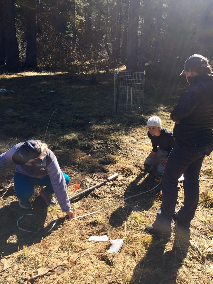
Soil sampling for carbon, density, and greenhouse gases on my third day of being an AmeriCorps member. Photo taken at Bear Trap Meadow in the Sierra Nevadas. | Maiya Greenwood
I know that within just my first week of working with American Rivers, my skill set and knowledge has already expanded. On my third day of service, I participated in a meadow monitoring day that is part of a larger effort to track the changes of greenhouse gas sequestration in meadows. We extracted soil samples to be tested for carbon, density and greenhouse gases.
It has always been an exciting prospect for me to be able to contribute to the preservation of natural resources in the Sierra and this program will be an incredible launching pad to a career as an environmental professional.
Water is deeply intertwined in Colorado’s way of life. The water we drink, the businesses supporting our economy and the recreation we enjoy depends on clean water and flowing rivers. Until last year, Colorado was one of the few states in the west without a plan for managing our water.
In 2013, Governor Hickenlooper recognized the state needed a long-term water plan and through executive order directed the Colorado Water Conservation Board (CWCB) to work with stakeholders across the state to develop a comprehensive water management plan. Last year, important conversations between farmers and ranchers, environmental groups, water suppliers, recreation advocates and concerned citizens at public meetings, at the grocery store, and on the river paid off. In November 2015, Governor Hickenlooper signed the Colorado Water Plan committing our state to coordinated and sustainable water management for the next 35 years.
Colorado River, CO | Matt Rice
Colorado is a headwaters state for the Colorado River basin. The Colorado River not only matters to the state and its economy, but it also downstream to the six other states and Mexico that also depend on snowpack that originates here. How and why we manage our water not only affects us, but also our neighbors downstream.
Healthy, flowing rivers support our thriving economies like agriculture and recreation, and our growing cities. Clean water, and enough of it, are essential to support our growing region. Colorado’s heritage and culture is built upon our natural resources and rivers are at the heart of it all. With an abnormally dry fall, it is clear how critical it is to protect and restore our rivers and solidify our commitment to water conservation. Drought volatility varies from year to year across the southwest, and the continuation of this 15-year drought across the basin in the coming years is not out of the realm of possibilities.
November 16, 2016 marked the first anniversary of signing of the Colorado Water Plan. To celebrate the work that has been done across the state, Governor Hickenlooper proclaimed this date as Colorado Water Plan Implementation Day. This proclamation applauds efforts over the past year, and further supports the important work that must continue to move forward goals and objectives contained within the Colorado Water Plan. While this milestone is something to celebrate, implementation thus far has been slower than anticipated. However, at a recent CWCB meeting, new energy was breathed into the plan’s implantation when the CWCB pledged to secure funds for implementation. The CWCB voted to:
- Secure $55 million as a part of the 2017 Colorado State Budget
- Direct the first $30 million of this request towards the creation of a loan guarantee fund
- Focus the other $25 million towards funding other important objectives of the Plan, including:
- $10 million in supplemental funding for the Water Supply Reserve Fund to fund water supply projects
- $5 million directed to the Watershed Restoration Program
- $10 million towards Water Plan Implementation Funding that will fund non reimbursable investments
How does this funding help support healthy rivers and streams here in Colorado?
![Colorado River | Jon Stow [FlickrCC]](https://www.americanrivers.org/wp-content/uploads/2016/07/colorado-river-credit-jon-stow.jpg)
Colorado River | Jon Stow [FlickrCC]
The Colorado Water Plan can only be as successful as its implementation. We congratulate the CWCB and the Hickenlooper Administration for restating their dedication in this first year of the Plan. The Colorado State Legislature has an opportunity to continue the progress of the state’s first water plan by supporting the funding for water conservation measures and stream management plans as they approve the state budget. We must keep the pressure on to ensure future funding and support needed to protect our rivers for communities, agriculture, business, and wildlife. Our state’s future, and the health of an entire region, depends on it.
I’ll never forget the first call I received from Dr. Yomi.
I’d only been at American Rivers a few months when a wise sounding gentleman with a Nigerian accent called my cell phone one evening. He was inviting me to discuss the findings of an American Rivers’ report at a meeting about flooding in Peoplestown, an area well outside of my geographic focus.
So, of course, I went. At the meeting, we watched videos about the flooding, the mayor’s commitment to solve the flooding, and all of the green stormwater infrastructure being installed in Southeast Atlanta. We also discussed what was going well, what wasn’t, and what could be done about it. I presented our findings—but more importantly—I learned about a grassroots movement for green stormwater infrastructure that existed within this low-income community, just in the shadow of downtown Atlanta.
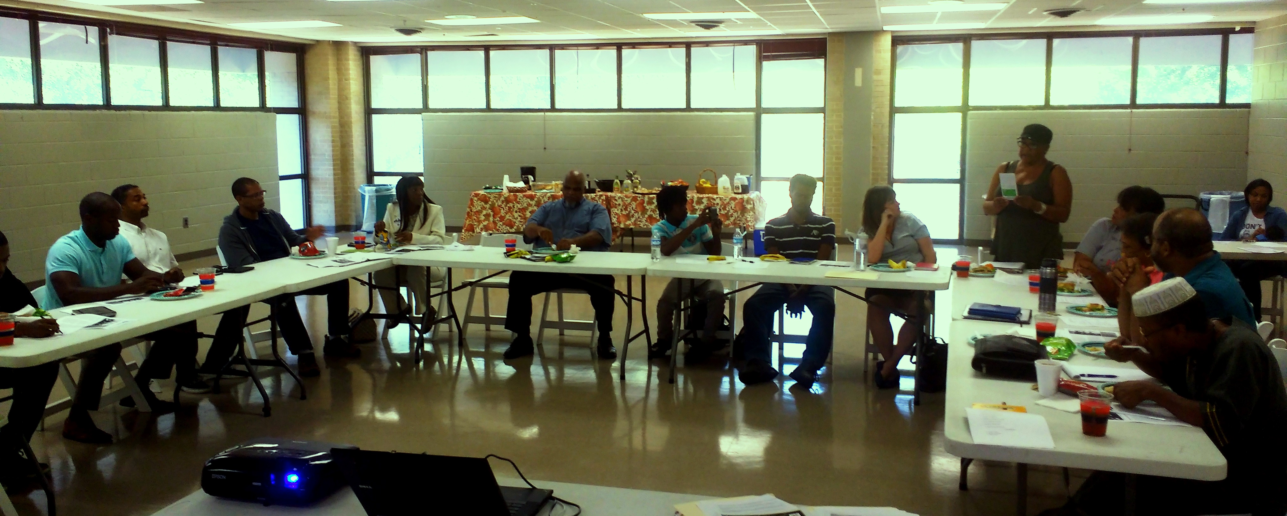
Local community leaders attend a lecture on green infrastructure possibilities in their neighborhoods. | Jeremy Diner
Over the course of the next year and a half, the partnership between Dr. Yomi’s organization ECO-Action and American Rivers has grown in many ways. Some of our work is described in my blog Beyond the Braves, which describes the first phase of our partnership.
The next phase was focused on providing a Watershed Advocacy Training to local community members, many of which are leaders in their respective neighborhood associations or community groups. The six monthly meetings included lectures and discussion led by expert speakers on subjects ranging from infrastructure and environmental justice to advocacy and community organizing. There was also required reading, like Earth to Atlanta, and homework assignments on topics ranging from writing an advocacy letter to having conversations with friends and family about green stormwater infrastructure. Through the support of the Kresge Foundation, we were able to provide stipends to the people taking part in the training. In September, 2016, seven people graduated from the training, having participated in all of the meetings, completed all of the homework, and demonstrated their knowledge through the co-creation of a newsletter called Green Infrastructure: Now, Forever, and Always. This newsletter brought together the reflections and experience of the advocates, as well as other activists of the community. Here’s what a few of them had to say:
“[Participants] learned much through this process, sharing their knowledge and reflections multiple times with the group. Writing and speaking are two of the most important tools that you have to advocate for Green Infrastructure.”
—Mr. Jason Dozier, Graduate of the Green Infrastructure Advocacy Training, member of the Steering Committee for the Turner Field Community Benefits Coalition, and serves on Board of Directors for the Mechanicsville Civic Association
“If we don’t care and do not stand up for ourselves, why should we expect other people to care and standup with us?”
—Ms. Bernice Brown, Graduate of the Green Infrastructure Advocacy Training and lifelong resident of the Turner Field neighborhoods
“I have started sharing my concerns at all the community meetings that I attend on why it is important to demand Green Infrastructure for all development and future development of our communities, also to start reaching to others to make this a priority to become advocates for Green Infrastructure in their neighborhood. Especially when we are dealing with environmental injustices for many years which have hurt our neighborhood.”
—Mr. Columbus Ward, Graduate of the Green Infrastructure Advocacy Training, President of Peoplestown Revitalization Corporation, member of Steering Committee for the Turner Field Community Benefits Coalition, Vice Chair of Neighborhood Planning Unit V.
My family was the first group of people I communicated with about green infrastructure. They were a sounding board and an opportunity to reach even more people on their jobs, schools, etc. We all became constantly aware of green infrastructure throughout the community to the point that it became a game in identify the evidence of green infrastructure presence or need of.
—Ms. Finney Wilkins, Graduate of the Green Infrastructure Advocacy Training and serves Board of Directors for Greanlea Commons in Summerhill
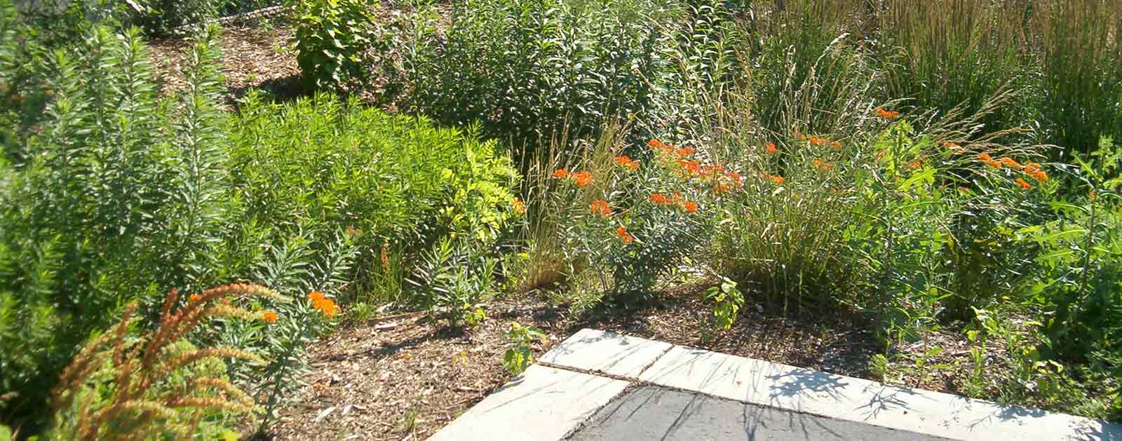
Rain garden showing the value of green infrastructure. | Brain Ash
While I never could have guessed that a quick phone call from a stranger over a year ago would have brought us here, I couldn’t be more excited about the path we’ve taken. As Turner Field is redeveloped, it will be crucial to have as many advocates on the ground as possible to stand strong for community benefits such as green infrastructure, affordable housing, and access to healthy food.
American Rivers and ECO-Action are enthusiastic about the results of this training and we’re collaboratively exploring ways to maintain momentum and build upon this work. We look forward to assisting this grassroots movement for environmental justice in Southeast Atlanta, and in other watersheds and neighborhoods across the country that are dealing with issues related to water, infrastructure, human health, and dignity.
This post by American Rivers’ Director of Conservation for California Flood Management, John Cain, is a part of our America’s Most Endangered Rivers® series spotlighting the San Joaquin River.
The San Joaquin River and its three principle tributaries– the Stanislaus, Tuolumne, and Merced– are some of the hardest working rivers in the world. In most years, 80 percent of their total flow is diverted for agriculture.
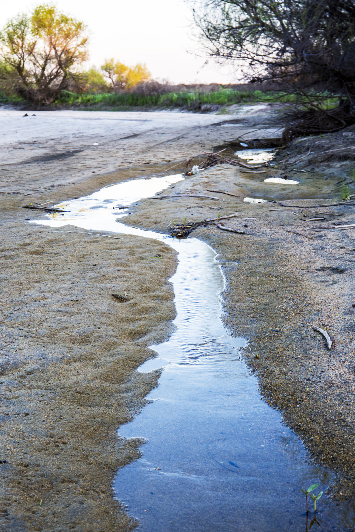
California’s San Joaquin River drying up at San Mateo Road. | Alison Jones
Portions of the San Joaquin mainstem have been dry for most of the last 50 years. As a result, the steelhead trout and Chinook salmon populations that thrived in these rivers for millennia are now on the verge of extinction. California’s commercial and recreational fishing industry has declined as water diversions have increased. In 2008 and 2009, the fishery decline was so severe that the Pacific Fisheries Management Council totally closed the salmon fishery.
After Friant Dam increased diversions in the 1950’s, the pacific salmon catch of the Central California coast declined precipitously. The historic fish processing industry depicted in John Steinbeck’s Cannery Row on Monterey Bay shuttered its doors. Today, the historic Cannery Row is the site of the Monterey Bay Aquarium, whose mission is to inspire ocean conservation. The decline of the Pacific salmon fishery exemplifies the interconnection between our rivers, estuaries, oceans, and human influence.

A dried up San Joaquin River as seen in Walt. | Justin
However, this isn’t a simple fish vs. farmers story. Water diversions for agriculture in the upper reaches of these rivers reduce the quantity and quality of water for downstream cities and farmers. Earlier this year, we shared the story of Walt Shubin, a farmer on the San Joaquin whose water supply has been harmed by the government’s decision to turn-off the San Joaquin River more than a century ago. Downstream in the San Joaquin Delta, excessive salts in the degraded river make it more difficult for Delta farmers to successfully grow crops. But this is only part of the story. The Sacramento-San Joaquin Delta also provides drinking water for over 23 million Californians. Poor water quality in the Delta harms farmers, drinking water, and fishermen.
American Rivers is working with partners across the watershed to restore flows and habitat to the San Joaquin River and its three tributaries. For several years, we have worked to persuade the California State Water Resources Control Board to increase flows to the river, and now the Board is scheduled to make a final decision in early 2017. The Board oversees water rights in the State of California; it is responsible for conditioning those rights in a manner that complies with the federal Clean Water Act and protects rivers for the benefit of all Californians.
California’s San Joaquin River. | jcookfisher
Earlier this year, the Board released a draft decision that would require upstream dam operators to release significantly more water back to the river to protect fisheries, downstream farmers, drinking water, and other beneficial uses. Not surprisingly, the political pressure on the Board is intense. That’s why American Rivers needs your help to speak for the rivers.
This guest post by Charles Scribner is a part of our America’s Most Endangered Rivers® series spotlighting the Black Warrior River.
Black Warrior Riverkeeper is pleased to report that Alabama citizens can now challenge decisions by the Alabama Surface Mining Commission without risking financial ruin. Thanks to the settlement of a lawsuit filed by Black Warrior Riverkeeper, citizens no longer risk the imposition of attorneys’ fees and costs when exercising their rights under the federal Surface Mining Control and Reclamation Act of 1977 (“SMCRA”).
Turkey Foot Creek in the Sipsey Wilderness
Nelson Brooke, Black Warrior Riverkeeper
SMCRA grants citizens broad rights when a mining permit is considered or issued, a right to go onto the mine site, a formal hearing on the merits of the decision, and judicial review of that decision. The citizen also has the right to request and participate in inspections of mine property if there is believed to be imminent harm to the environment or the public, to file a blasting complaint, to challenge an agency’s failure to take proper enforcement action, and to appeal any adverse decision to the courts.
Before this settlement, the Alabama Surface Mining Commission’s regulations authorized a coal mining operator or the Commission to recover attorneys’ fees and costs from a citizen challenging a regulatory decision, even where the challenge was meritorious and in good faith. This punitive regulation not only violated federal law, for the past forty years it also deterred Alabama’s coalfield citizens from challenging permitting and other regulatory decisions made at the Alabama Surface Mining Commission.
The federal Office of Surface Mining, Reclamation and Enforcement (OSMRE) previously required the states of Utah, Alaska and New Mexico to fix similar nonconforming provisions. Black Warrior Riverkeeper requested that OSMRE require the Alabama Surface Mining Commission to amend its regulation to comply with federal law. When they did not, Black Warrior Riverkeeper filed suit in July 2015.
Acid Mine drainage from Maxine Mine. | Nelson Brook, Black Warrior Riverkeeper
As a result of the suit, the Surface Mining Commission finally amended their regulation to explicitly state that coalfield citizens no longer risk an award of attorneys’ fees and costs unless their challenge is in bad faith. That regulation was approved by OSMRE on October 26, 2016. Even though the Commission had not awarded fees in the past, the possibility it could do so significantly inhibited the ability of coalfield citizens to exercise their rights under the law. For example, prior to the regulation’s amendment, Shepherd Bend, LLC sought the payment of $249,719.34 in attorneys’ fees and costs from the Birmingham Water Works Board under this provision when the Board challenged a surface mining permit which authorized coal mining adjacent to and upstream of one of Birmingham’s primary drinking water intakes.
Congress gave citizens the opportunity to protect their rights and to play a vital role in the implementation of the nation’s mining laws. However, these rights mean little when a fear of fees and costs prevents their exercise.
American Rivers included the Black Warrior River in America’s Most Endangered Rivers® of 2013, due to the threat of coal mining. This news today is progress, but we must persist in defending this river. We are still asking the University of Alabama to permanently ban mining on their Shepherd Bend property. Please take action to help today!

Charles Scribner
Author: Charles Scribner, Black Warrior Riverkeeper
Black Warrior Riverkeeper’s mission is to protect and restore the Black Warrior River and its tributaries. The citizen-based nonprofit organization promotes clean water for improved public health, recreation, and wildlife habitat throughout the Black Warrior River watershed.
Today’s blog is from Dan Omasta, Executive Director of River Restoration Adventures for Tomorrow (RRAFT). Based in Gunnison, Colorado, Dan and his team protect the long-term health of watersheds through community engagement and riparian restoration. RRAFT is a Connecting Communities to Rivers Grantee.
Do you remember that moment when you first stood along the bank of a river – staring into the endless rhythm of riffles and transposed yourself into that world of water? What must it be like to be an elk meandering down for a cool drink, that fish feeding upstream, or the willow bending in the current? Rivers breathe life into all they touch and support the awe-inspiring majesty we find in our outdoor world.
Cleaning up debris along the Gunnison River. | Dan Omasta
John Muir famously explored the idea that, “rivers flow not past, but through us” – a concept that embodies humanity’s unbreakable connection to its rivers. Even before European explorers spread across North America, wild rivers provided a source of food, travel, and cultural understanding to the indigenous peoples that traveled their banks. As Anglo settlers established their own way of life across these lands, rivers provided similar function – but were also harnessed to provide agriculture, power, and opportunities for mineral extraction. Today, we continue to place more strain on our rivers; demanding reliability, quality, and limitless application of their bounty.
With each new diversion or residential faucet, our communities are increasingly tied to the rivers that support our lifestyles. And yet, even with this growing dependency, more and more people find themselves disconnected from the source of their flows and the health of their watersheds. This divergence creates two distinct problems: first, blind demand and misunderstanding of the source of our water can lead to popular support of unwise storage projects; and second, perhaps more importantly, people are losing their identity and connection to the natural world that supports us all.
RRAFT participants pause for a photo along the Gunnison River. | Dan Omasta
Whether you live along the banks of a small alpine creek or in a suburb of a vast metropolitan area, rivers create a sense of place. They provide the recreational, economic, and social values that develop a particular drainage. From salmon fishing in Washington to agriculture on the Western Slope of Colorado, rivers provide a shared identity among people of a specific region. This common sense of place creates the foundation upon which we build the collaborative action necessary to protect our waterways – a base of support that erodes under the force of disconnection.
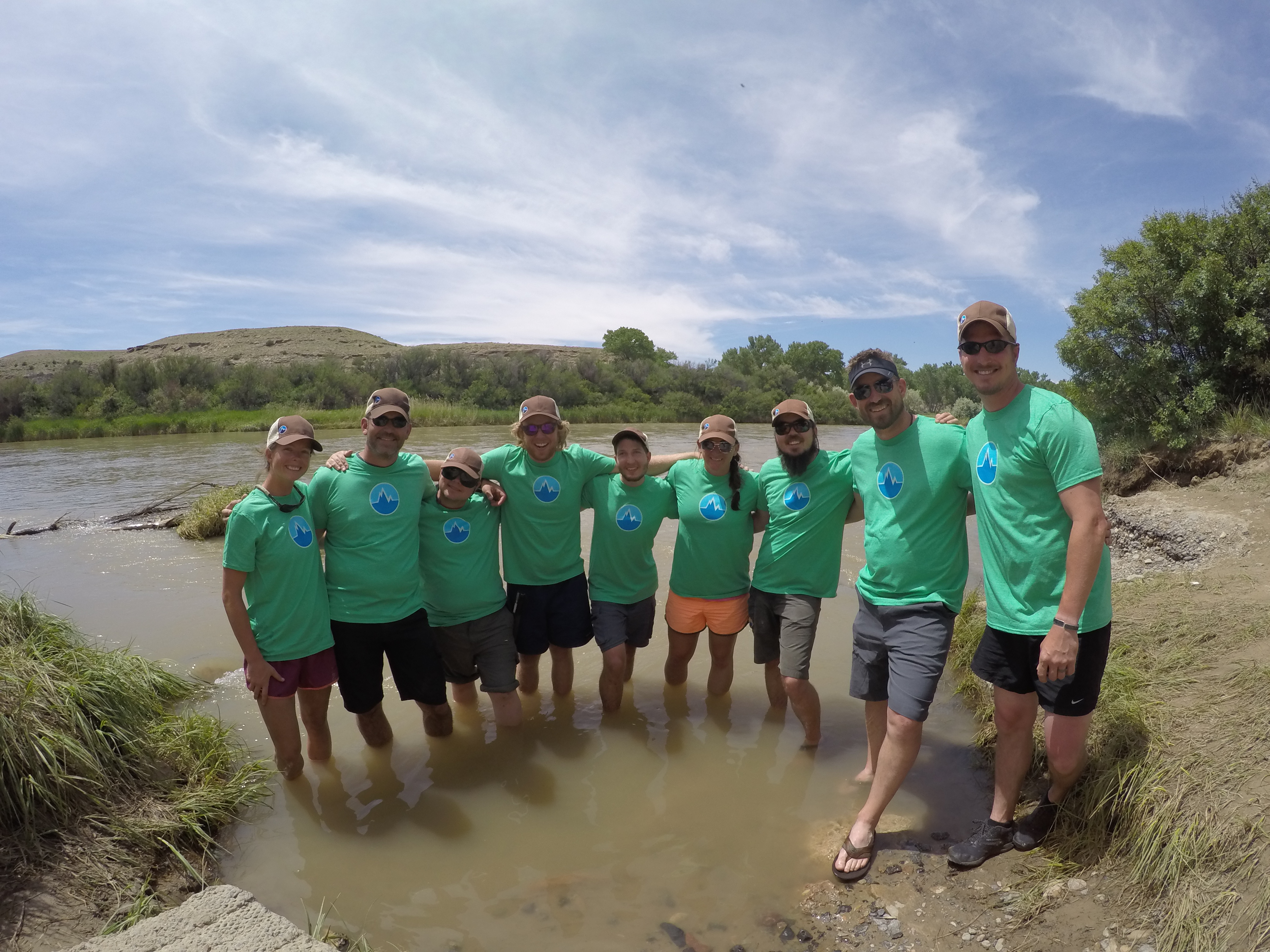
River Restoration Adventures for Tomorrow (RRAFT) is a small non-profit outfitter based in Gunnison, CO, whose mission is to protect the long-term health of watersheds through community engagement and riparian restoration. In 2016, we partnered with American Rivers to address the dangerous trend of disconnection in our watersheds. This past season, RRAFT worked to rebuild connection within the Gunnison River watershed by increasing opportunities for citizen participation, developing greater understanding of local ecological threats, and enabling hands-on protection of the river itself.
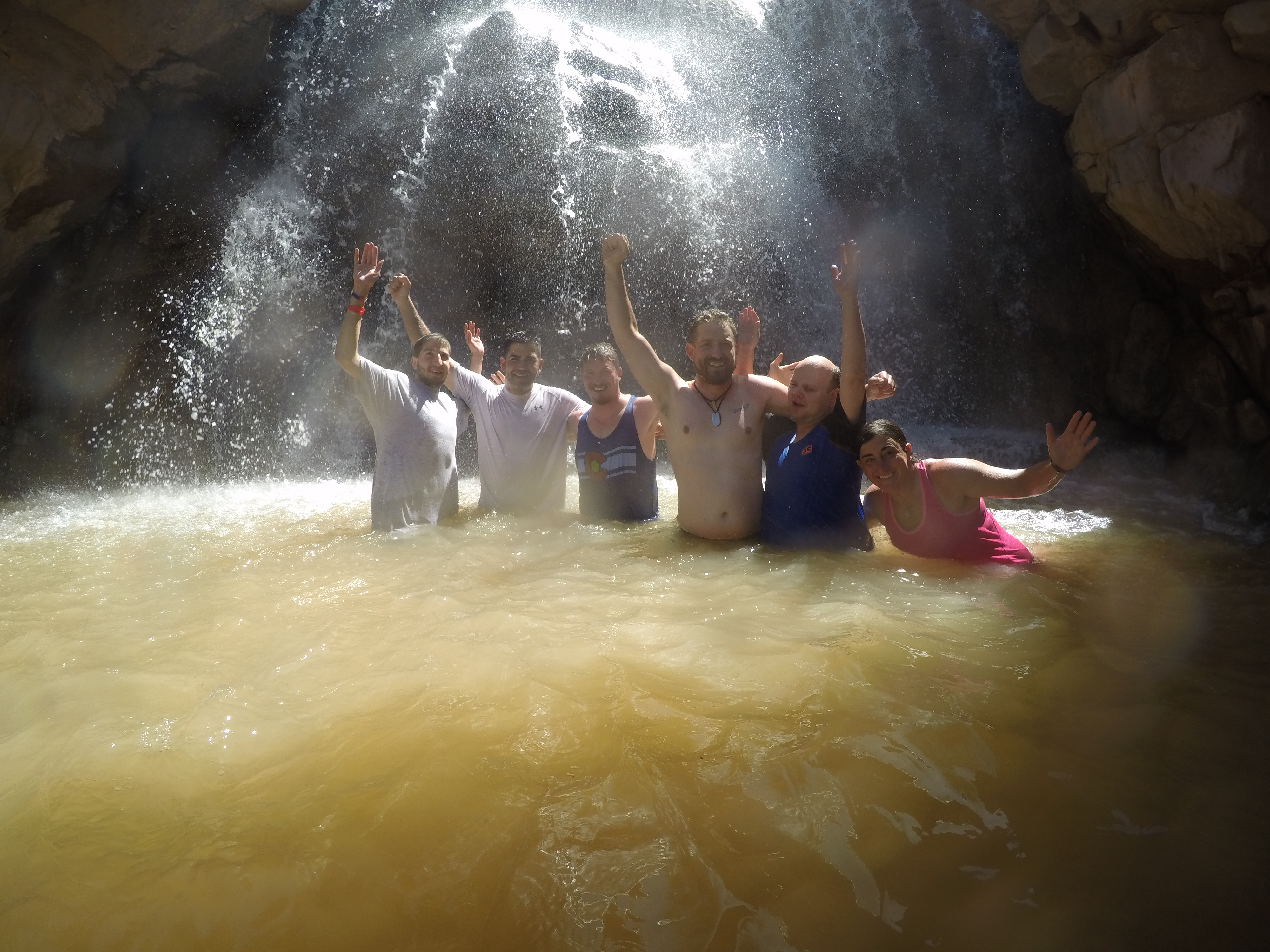
RRAFT participants enjoy a dip in a waterfall. | Dan Omasta
With support from American Rivers, RRAFT engaged more than 80 people on conservation-based float trips over the course of the summer. Participants came from widely diverse backgrounds but found common cause in the protection of the Gunnison River. Farmers worked alongside teachers to treat Russian Olive trees; veterans who served in Iraq and Afghanistan teamed up with visually impaired civilians to collect trash from riverside campsites; and BLM officers collaborated with local sportsmen and women to improve the health of the wildlife corridor. Local youth explored the wealth and adventure that the Gunnison provides for them and their families. In a time of such divisive politics and diverging approaches for river management, these citizens came together along the banks of the Gunnison and found common cause in the protection of their watershed. They are farmers, soldiers, immigrants, and youth – but they are also westerners. Their livelihood is inherently tied to the health of this watershed.
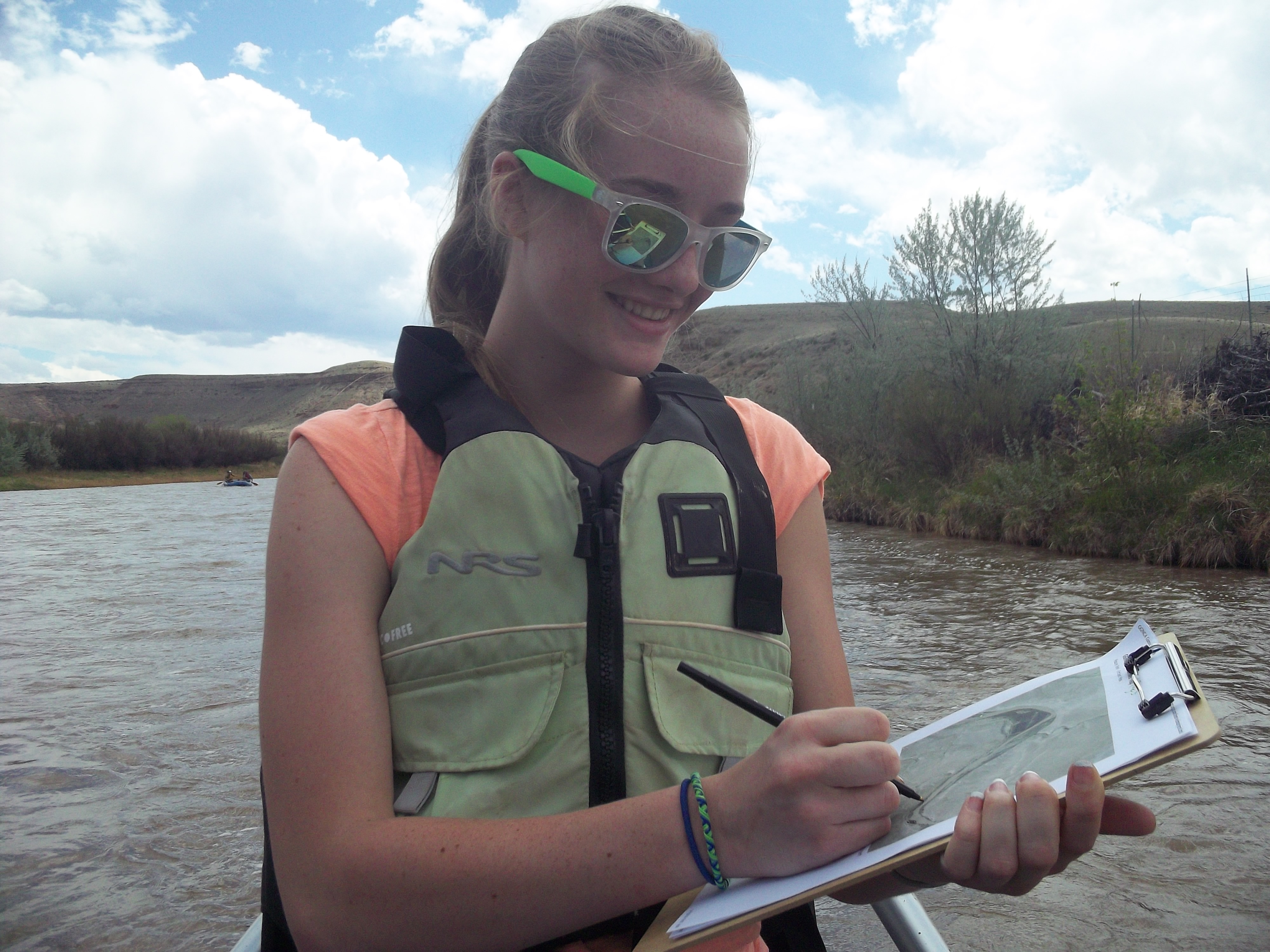
A young RRAFT participant maps the Gunnison on her rafting trip. | Dan Omasta
As the pressures of climate uncertainty, urban development, and resource extraction continue to affect our watersheds, this notion of a “shared sense of place” is even more critical to the community-based solutions necessary for river conservation. This collective interest in the health of regional watersheds echoes the truth in John Muir’s idea of rivers running “through us” all. Healthy watersheds are the heart that beats for our continued existence as a people, the lifeblood of our ancestors, and the cornerstone of future generations. By coming together along the banks of a local river, communities can strengthen their shared identity and fortify the critical connection to the watersheds that provide so much for us all.
