Twenty years ago, Tyler Tierney, River Cleanup Program Coordinator at Hackensack Riverkeeper, remembers cars being pulled out of the river during litter cleanups. Thanks to Hudson and Bergen County community efforts, this memory is no longer a reality.
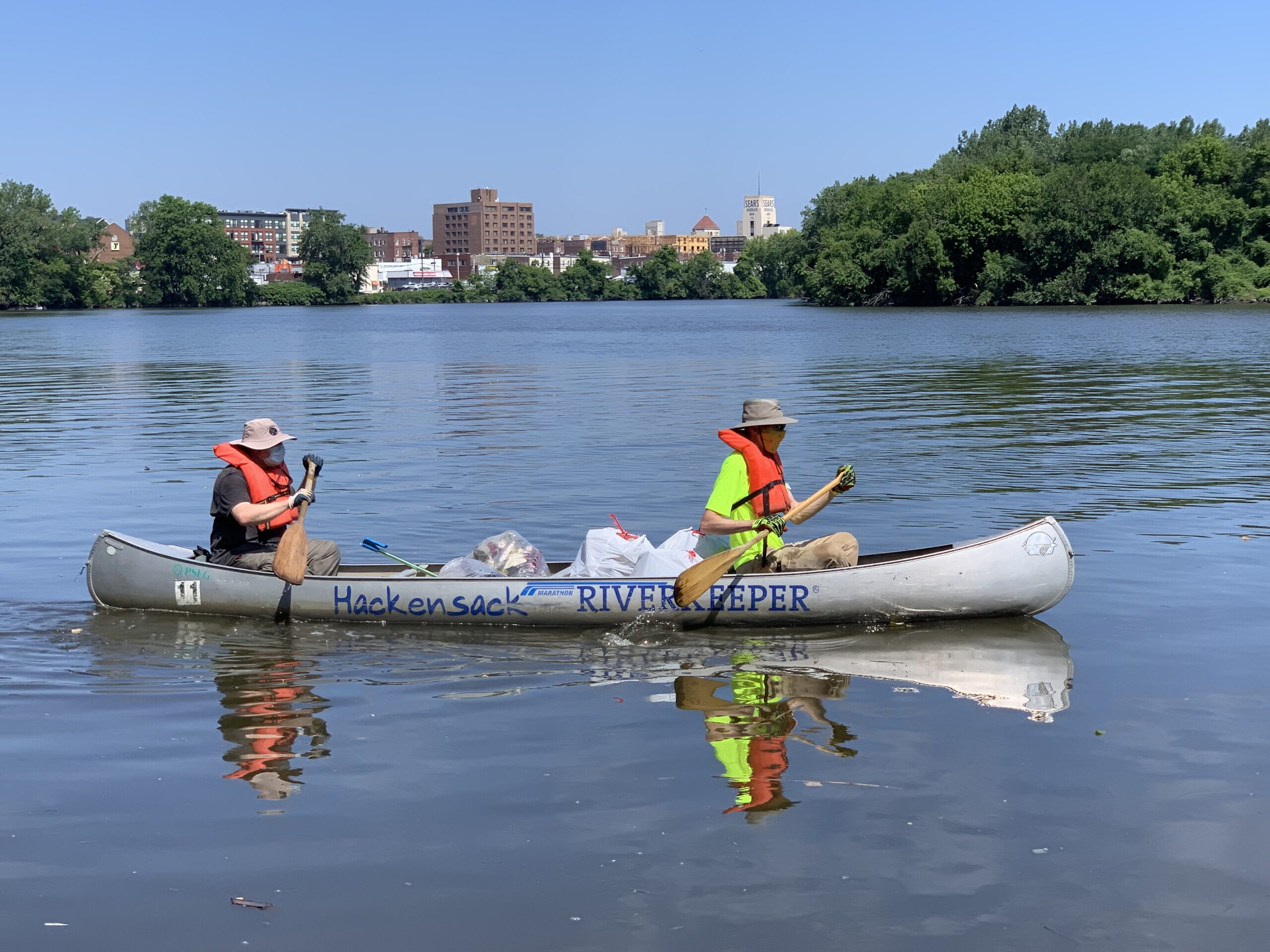
Hackensack Riverkeeper believes cleanups are successful because they are coupled with a heightened awareness of the impacts of litter within the communities Hackensack Riverkeeper serves.
Around 90% of litter collected during Hackensack River cleanups is Styrofoam and single-use plastics originating from a variety of locations. Understanding that litter ends up everywhere no matter where it starts encourages volunteers to be more cognizant of their everyday actions.
The goal of Hackensack Riverkeeper’s River Cleanup Program is to connect community members to their watershed. Tyler remarked, “The stronger our volunteer’s bond is with the Hackensack River Watershed as a whole, the more likely they will implement best management practices in their communities and continue participating in these types of events.” He wants to show volunteers they are part of the same community, regardless of municipal boundaries.
When asked about the most exciting part of a cleanup, Tyler mentioned the interesting debris generally found at the sites. Among the interesting cleanup finds were a collection of weathered dolls and an entire mismatched dining room set.
In 2021, Hackensack hosted 25 cleanups and removed over 34,000 pounds of trash from the river. Tyler believes there is no shortage of potential for Hackensack Riverkeeper’s River Cleanup Program.
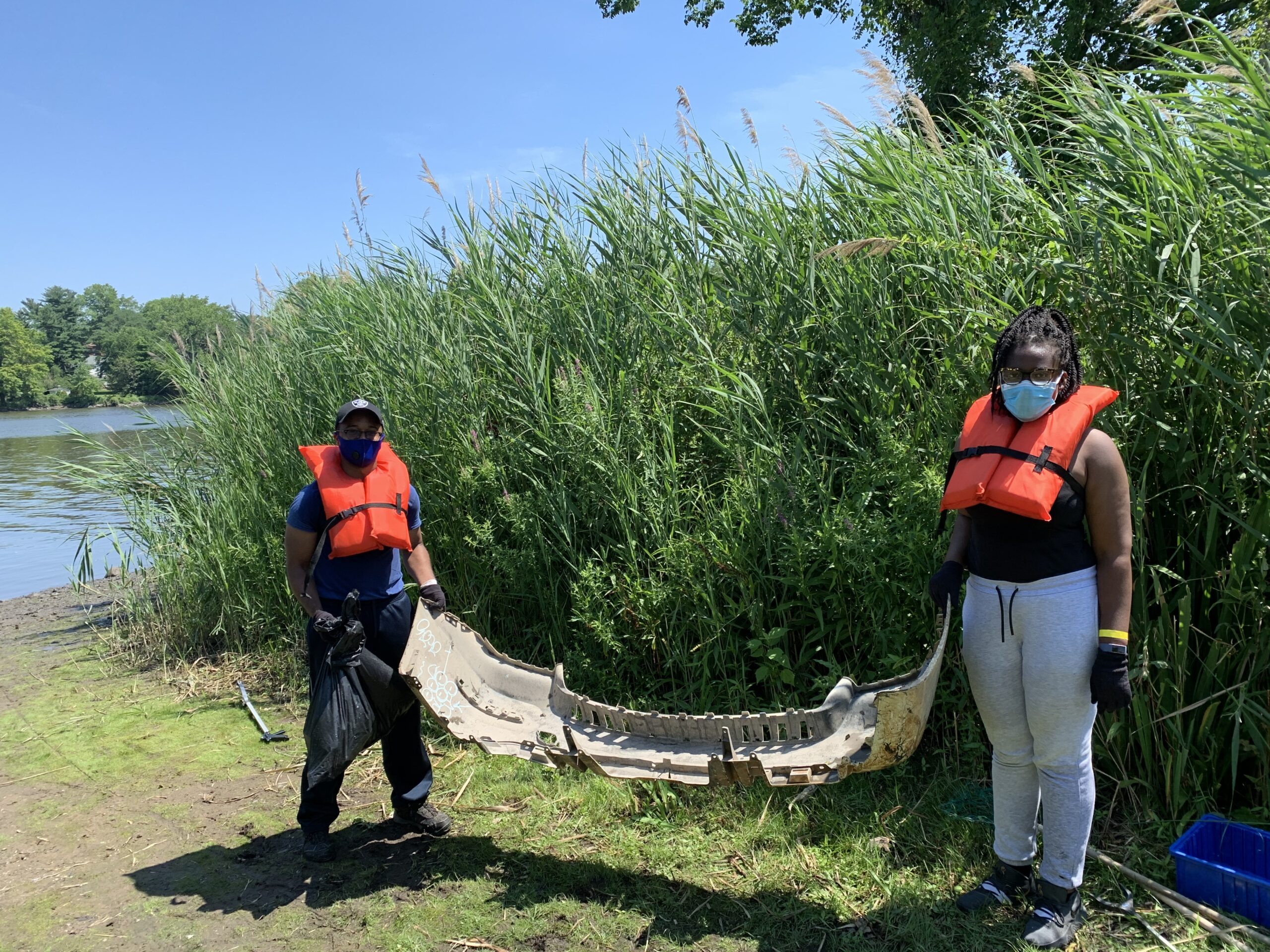
Despite holding smaller events with fewer participants due to COVID regulations, Tyler said he had no problem recruiting volunteers. He remarked, “In fact, through the height of the pandemic, it seemed that even more people than usual were looking to spend their time helping the environment!”
Moving forward, Tyler hopes to incorporate more small-scale cleanup events into Hackensack Riverkeeper’s River Cleanup Program. Specifically, he wants smaller groups to target less publicly accessible entrances to the watershed where cleanups are not usually held due to limited parking and distance to spread out. Tyler said, “Filling these gaps along the river would significantly decrease the number of plastics found downriver and lessen the chances of the tide carrying it through our watershed and out to the Atlantic Ocean.”
Want to get involved? If you live in the area, sign up to receive updates about volunteer opportunities. Don’t live in New Jersey but still want to contribute? You can use the link below to donate to support the River Cleanup Program. Congratulations to Hackensack Riverkeeper, winners of the 2020 National River Cleanup® Photo Contest. Thank you for your commitment to clean water and trash-free rivers!
Clean water is essential to all life. As we mark the 50th anniversary of the Clean Water Act this year, we should be moving forward – not backward – when it comes to safeguarding clean, accessible, safe, affordable water for all.
But the U.S. Supreme Court recently issued an unfortunate ruling on Section 401 of the Clean Water Act. Kelly Catlett, director of hydropower reform at American Rivers, breaks down what the ruling means, and what’s next:
Why is Section 401 of the Clean Water Act important – what does it do?
The Clean Water Act helps prevent water pollution. Section 401 of the Clean Water Act gives states and certain tribes authority to place conditions for the protection of water on permits and licenses for the construction and operation of projects that could harm rivers, streams, and other water bodies. These protections ensure that infrastructure projects, such as dams or pipelines, won’t pollute our water or otherwise negatively affect water quality. Section 401 also allows states and tribes to work with the federal government to ensure that rivers are protected and that projects meet the needs of local communities.
What did the Supreme Court rule, and what’s the impact for rivers?
In 2020, the Trump Administration’s EPA made drastic changes that limit the way states and tribes can apply Section 401. The changes unraveled 50 years of practice and cooperation between the federal government and states and tribes in the administration of these protections. American Rivers, along with our allies, sued to overturn the rules and successfully convinced a District Court to nullify the 2020 rule while the current EPA works to revise them. A few states, the fossil fuel industry and the hydropower industry appealed to the Supreme Court and asked that the Supreme Court reinstate the 2020 rule until the current EPA successfully completes its process to change the rules in 2023. The result of this decision is that it will be more difficult for states and tribes to protect water. For example, the 2020 rules prohibit states and tribes from weighing climate change and its impacts in making conditioning decisions and it restricts conditions to addressing only point source pollution.
What happens now — what are the next steps?
American Rivers is not giving up because these clean water protections are too important. The Supreme Court did not provide a rationale for why they reinstated the 2020 rule, but the message appears to be that they found it inappropriate for the lower courts to nullify the rule without making a determination on the merits of the arguments each side had raised. American Rivers and our partners at American Whitewater, Idaho Rivers United, and California Trout will continue to make our case in the federal courts for why this rule should be overturned. We will also work with the EPA to make sure that the new rule due in 2023 will fix the flaws in the 2020 rule.
California gets a lot of press for its natural beauty. The sheer granite walls of Yosemite and towering redwoods on the coastal slopes. Joshua Trees piercing a crisp blue sky, and the grand Pacific seascape. But what do you think of when you hear about California’s Central Valley? A tractor might come to mind. Big dust clouds kicked up into the air alongside a concrete aqueduct that funnels water from far away. It’s true. Over the past two centuries, 95% of the Central Valley’s wetlands have been lost to development, landscaped out of existence to satisfy the hunger of an urbanizing, growing nation. But that’s only part of the picture. California’s Central Valley extends far beyond what you can see from the freeways bisecting the belly of the state to connect the Redding to the Bay Area to Los Angeles. The region once boasted one of the largest and most biologically diverse wetlands on earth nourished by the mighty Sacramento and San Joaquin Rivers, and what is left remains true to its origins, providing a lush home for native species and open space for visitors to enjoy.
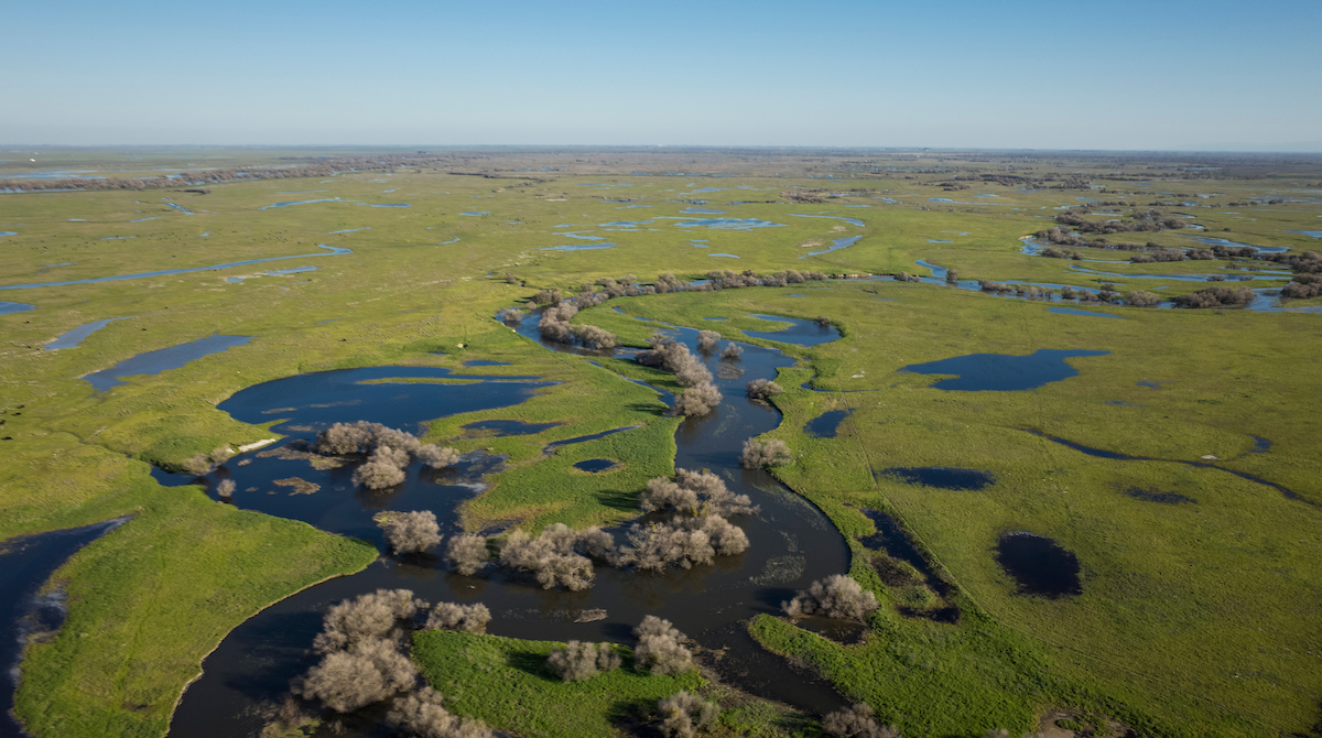
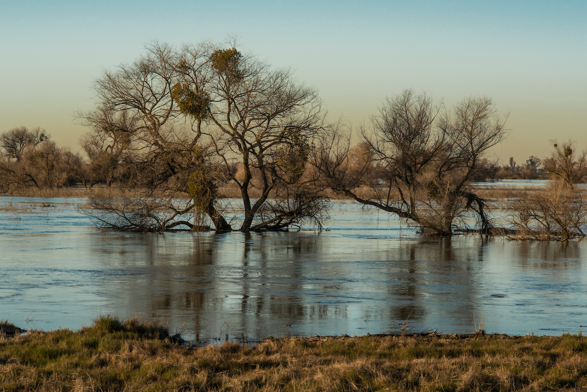
It is springtime in the Central Valley right now, and its rivers and floodplains are bursting with new life. Chinook salmon push up the San Joaquin River to spawn in their ancestral home and Swainson’s hawks migrating from afar perch above the fields waiting patiently for their next meal. Birdsong from cliff swallows fills the air; stay a while and you will see blue herons, egrets, king fishers, killdeer, and perhaps a coyote or some frolicking river otters. When you visit Great Valley Grasslands State Park in Merced County, which straddles the banks of the San Joaquin, you step into a different era. The hum of the freeway fades away. The horizon extends so far you wonder how Montana got the nickname ‘big sky’ and not California. A temperate breeze rustles the cottonwood leaves along the river and creates golden wavelets across the adjacent flower-studded vernal pools, a reminder that there is more than one type of jewel in the ground. That the Gold Rush can come with the seasons, not just the swing of a pickaxe.
But these areas need to be protected so that future generations of Californians can enjoy them. American Rivers is spearheading projects to conserve and restore this untapped natural beauty, opening access to the public so more can enjoy what the Central Valley has to offer, and taking critical measures to maintain the biodiversity and climate resilience of this unique region.
At Great Valley Grasslands State Park in Merced County, American Rivers is partnering with California State Parks to begin reconnecting the San Joaquin to its historic floodplain, with boots hitting the ground in Fall 2022. At Marsh Creek in Brentwood and Oakley, we restored one mile of urban creek, with plans to restore hometown creeks in Richmond and other urban areas in the Central Valley and Bay Area.
From multi-benefit floodplain restorations that sustain and revitalize ecosystems to creek restorations that beautify urban space and reconnect residents to the natural serenity of the Central Valley, we are building powerful partnerships that capitalize on the expertise and passion of environmental advocates and communities across the state. The next time you’re in California, stray off the beaten path. The Central Valley is waiting, and there is plenty of room to stretch your legs or dip your paddle if you know where to look.
Catastrophic drought. Disastrous floods. Fish and other freshwater species nearing extinction, as rivers heat up.
Many people in the United States have imagined climate change as a problem in the future. But it is here now, and the primary way that each of us is experiencing climate change is through water. The climate crisis is a water crisis.
Today we are announcing America’s Most Endangered Rivers® of 2022 and sounding the alarm that our nation’s rivers and clean water are in crisis. Topping the list this year is the Colorado River, which is threatened by climate change and outdated water management. Thirty federally-recognized Tribal Nations, seven states, Mexico and 40 million people who rely on the river for drinking water are being impacted by this crisis. Also threatened is vital habitat for wildlife, as the Basin is home to 30 native fish species, two-thirds of which are threatened or endangered, and more than 400 bird species.

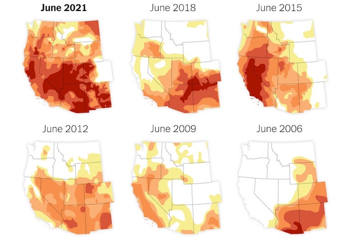
In March 2022, water levels at Lake Powell (the impoundment created by Glen Canyon Dam in Utah/Arizona) fell to the lowest point since the lake first filled in 1980. The Colorado River system is already operating at a deficit, and climate change is expected to further reduce the river’s flow by 10 to 30 percent by 2050. We’re calling on the Biden administration and the seven Basin states to work together to allocate funds from the Infrastructure Investment and Jobs Act to implement proven, equitable solutions that prioritize river health and water security.
Our country’s rivers need attention now. We must work better. Smarter. More equitably. We must elevate Tribal Nations and learn from their Traditional Ecological Knowledge. We must work collaboratively with frontline communities along the Mississippi River, and in places like the Mobile River (AL) and Tar Creek (OK), where residents deal with pollution on a regular basis. We must heed the calls of Tribal Nations to restore rivers like the Snake River.
California makes a prominent appearance in the report this year as well. In addition to the Colorado River (a key source of drinking water for some California residents), also featured are the Los Angeles River (threatened by inadequate management, climate change and pollution) and the Lower Kern River (threatened by excessive water withdrawals).
No matter where you live in the United States, your river and your drinking water are affected by climate change. Black, Indigenous, Latino/a/x and other communities of color feel these impacts most acutely, due to historical and contemporary policies, practices and norms that maintain inequities. It’s time to follow the lead of frontline communities that are advancing solutions for rivers and clean water — solutions that will make us all safer and healthier, and our nation stronger.
Did you know that later this year is the 50th anniversary of the passage of the Clean Water Act? How can it be that are we still battling over the importance of clean water? This battle comes to the ground on Arizona’s San Pedro River where rollbacks to the Clean Water Act initiated during the Trump administration have removed protections for seasonal and intermittent streams, which encompass almost 94 percent of the San Pedro River’s waterways and provide the lifeblood that sustains the river. We must protect the Waters of the U.S. now, before it is too late.
Rounding out this year’s report are Alabama’s COOSA RIVER, which is threatened by pollution from industrial poultry farming, and MAINE’S ATLANTIC SALMON RIVERS, where we have an opportunity to save Atlantic salmon by making better decisions during the upcoming relicensing of hydropower dams.
All of these rivers face critical decisions this year, and you can do something to help. Go check out your favorite river from this report and TAKE ACTION TODAY!
If we are to meet this moment and confront the challenges facing our clean water, environment and communities, we must come together as a powerful movement, speaking up for the rivers that give us life — for these 10 endangered rivers, and all of the rivers essential to our shared future.
America’s Most Endangered Rivers® of 2022
State: CO, UT, AZ, NV, CA, WY, NM, Mexico
Threat: Climate change, outdated water management
#2 Snake River
State: ID, WA, OR
Threat: Four federal dams
#3 Mobile River
State: AL
Threat: Coal ash contamination
#4 Maine’s Atlantic Salmon Rivers
State: ME
Threat: Dams
#5 Coosa River
State: TN, GA, AL
Threat: Agricultural pollution
State: MN, WI, IL, IA, MO, KY, TN, AR, MS, LA
Threat: Pollution, habitat loss
State: CA
Threat: Excessive water withdrawals
State: AZ
Threat: Excessive water pumping; loss of Clean Water Act protections
State: CA
Threat: Development, pollution
#10 Tar Creek
State: OK
Threat: Pollution
On a rainy day this last November, I stood on the bank of Idaho’s Lapwai Creek and witnessed the return of coho salmon with Shannon Wheeler, Vice Chairman of the Nez Perce Tribe. The Tribe has been a central leader in restoring Snake River basin salmon runs –these incredible fish swim hundreds of miles from the Pacific Ocean and climb thousands of feet in elevation to reach their spawning grounds.
Vice Chair Wheeler expressed how sacred salmon are to his people, the Nimiipuu, for food, culture, religion and their very identity. But now, Snake River salmon runs are on the brink of extinction, in large part because of four federal dams on eastern Washington’s lower Snake River.
The four lower Snake dams, built in the 1960’s and 1970’s, turned 140 miles of cool, free-flowing river into a series of slow-moving reservoirs, leading to lethally high water temperatures for salmon and steelhead, impeding migration of fish to and from the ocean and killing young fish attempting to pass through the dams to the ocean. The threat posed by the dams is exacerbated by climate change, which is warming up the Snake River and making conditions even more dire for salmon.
“As salmon and steelhead go, so do we,” Vice Chair Wheeler said to me.
This is why American Rivers is amplifying the calls of the Nez Perce Tribe, other Tribal Nations, and communities across the Northwest and the country to remove the four lower Snake dams and replace their services. Scientists estimate that by 2080 the Snake River Basin will provide the remaining two-thirds of the coldest, most climate-resilient stream habitats for salmon and steelhead on the West Coast. Restoring a healthy free-flowing river, and investing in affordable, equitable clean energy and agriculture solutions, will benefit the entire region.
Healthy rivers are a critical part of the climate change and extreme weather conversation. That’s because climate change is fueling more severe droughts and floods, and is exacerbating pollution and other ongoing threats to rivers. The burden of these impacts falls disproportionately on Tribal Nations, Black, Hispanic, Latinx, and Indigenous communities, and other communities of color.
The Snake River is just one example. Our report on America’s Most Endangered Rivers® of 2022 spotlights rivers across the country where climate change threatens clean water and people – and where the need for action is urgent.
On the Mississippi River, #6 on the list, pollution and increasingly severe floods are disproportionately impacting low-income and communities of color. It’s why we need Congress to pass the Mississippi River Restoration and Resilience Initiative (MRRRI), which would invest in protecting and rehabilitating the river that millions of people depend on. .”
On the #1 Most Endangered River for 2022, the Colorado River, we’re witnessing ground zero for the climate crisis as water levels plummet — threatening the lifeblood of 30 federally recognized Tribal Nations, seven states and Mexico. In addition to improving river management and using water more wisely, we must also prioritize collaboration over litigation. All interests along the river must work together, and Tribal Nations must be at the leadership table with other decision makers.
In the words of Daryl Vigil, water administrator for the Jicarilla Apache Nation, “The inclusion of Indigenous traditional values and knowledge is incredibly important … I think that’s something that we overlook in terms of the value of how thousands of years in the basin can bring to the current process. We have an opportunity to create a new paradigm of policy making of inclusive voices, where we jointly create a future together. What an opportunity for that to happen.”
Just climate resilient solutions for rivers and clean water are achievable and essential, on the Snake, Mississippi, Colorado and on every river across our nation. Let’s seize this opportunity together: take action for America’s Most Endangered Rivers of 2022.
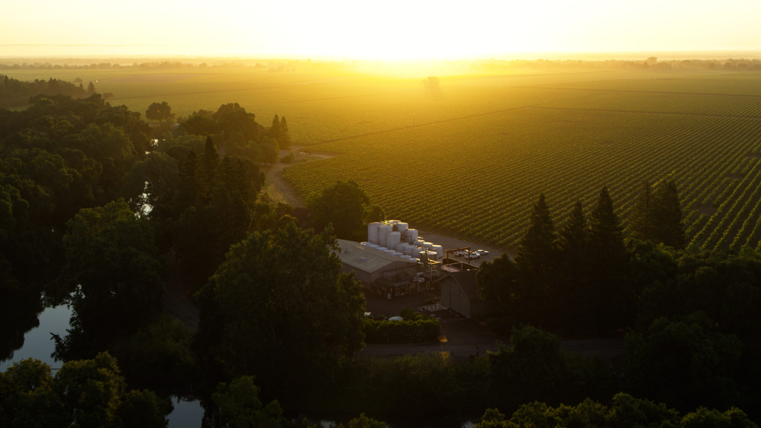
Bogle Vineyards has supported American Rivers since 2018 to ensure the health and vitality of our nation’s rivers so they continue to provide clean water, recreation and a connection to the greater outdoors.
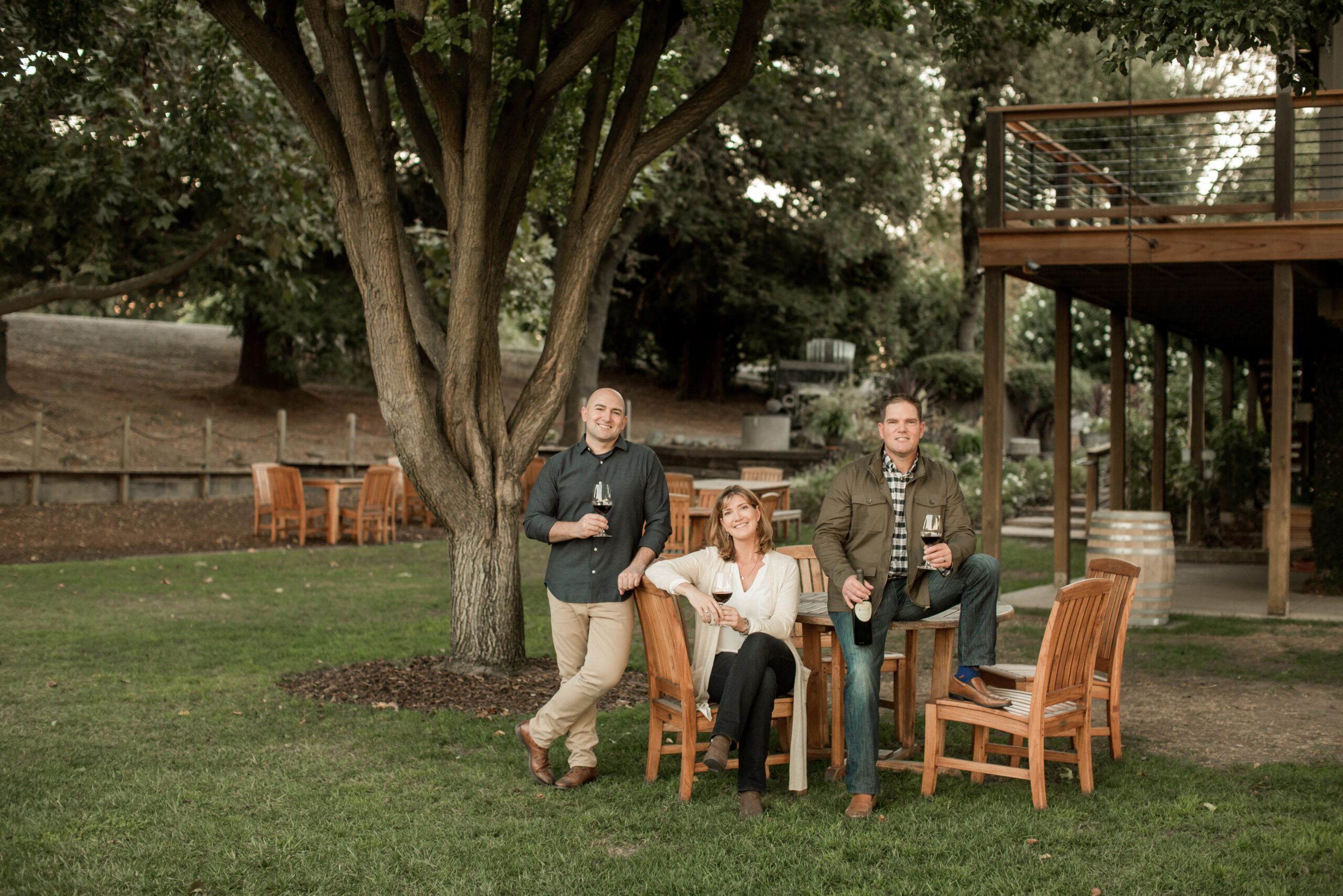
As a family-owned business that has farmed in the Clarksburg region of California since the late-1880s, Bogle has a long history and commitment to their community. This commitment includes being good stewards for future generations through their industry-leading sustainability practices. This includes the installation of high-efficiency drip irrigation in their estate vineyards and all water used on-site at the winery is reclaimed and reused for irrigation of on-site crops and landscaping.
In 2021, Bogle Vineyards contributed to American Rivers mission and also wanted to encourage others to give back to nature. In addition to their initial donation, Bogle committed to making a $5 contribution to American Rivers, up to $2,500 total, when the public completed the following three activities through March 31, 2022.
- Make an online contribution to American Rivers.
- Participate in the virtual Bogle Vineyards Cleanup to collect litter using the Litterati mobile application.
- Post a photo with a pledge to do good deed on Instagram with the hashtag #BogleGivesBack and tag @BogleVineyards.
Since launching the Bogle Give Back campaign in April 2021, we have raised nearly $1,000 in additional donations and more than 110 volunteers have collected 32,669 pieces of litter through virtual river cleanups on their hometown rivers located across America. The Bogle staff also got involved in an internal competition to see who collected the most litter in the Clarksburg and Sacramento areas, and nationwide through the participation of Bogle’s salesforce. All life needs healthy rivers and clean water to thrive. We are grateful that Bogle Vineyards and its employees share our commitment to protecting our nation’s rivers for everyone, everywhere.
Okii Nikso’kowaiksi, (Hello friends,)
Pushing off from the boat launch that first day was nothing short of a miracle. That’s right, a miracle. In a strange way, it is quite miraculous for an Indigenous Blackfeet person like myself to go on a multi-day float trip, even as an ex-fishing guide, on my own tribe’s namesake river.
A few months earlier, a friend and mentor of mine had suggested that I apply for the American Rivers Northern Rockies Indigenous Scholarship to spend a few days floating and writing with Freeflow Institute. I thought that sounded like a fun way to develop new skills while honing old ones, and a great opportunity for me to see new reaches of the Blackfoot River.
We loaded up on the bus, rafts in tow, and headed upriver to the Russell Gates Memorial fishing access, where we would enter the water for a three-day, two-night getaway into the great unknown. My first choice would be whether to ride in a large raft with others or to take a personal inflatable kayak, known in the rafting world as a “ducky.” I chose one of the duckies to start the journey and before long, I found myself thrilled to be weaving rock gardens, running rapids and slicing through waves.
I liked the idea of camping your way down a river but it was something that I’d never done before. I don’t actually know of many Native Americans that have been on multi-day float trips, and those that I do know of were usually…unplanned. Not only that, but I’d just completed a pretty intensive Bachelor’s of Science in Hydrology, which included a lengthy senior thesis, coupled with applying for the NSF’s Graduate Research Funding Program, and the creative writer had essentially been wrung out of me. Or so I thought…
***
So there I was, possibly sticking out like a sore thumb. But, as luck would have it, we were in the company of a fellow Little Shell Chippewa and writer – Chris La Tray – who would lead discussions and whose thought-provoking lead-ins to writing prompts would help better connect us to the past, the land and water – and to ourselves.
Looking back on my memories of fishing with friends who brought along notebooks, there was certainly always a romantic flair to writing that appealed to me, and that I was eager to tap into, and explore within myself. When it came time to circle up to reflect and write, all I could seem to access was factual information, and not much feeling. After hearing from the group, I saw different styles and forms of writing and sharing. Some poetry, some stories and all very interesting. I soaked it up and was ready to give creative writing another shot.
The next day would be our only full day on the river and we took to the water, eager to see what lay around each bend, feeling fortunate to be in the cool, narrow canyons of the Blackfoot River during this heat wave. I was back to navigating solo in the ducky and had time to reflect on places I had fished from shore with my old dog, a past love blossoming here, and of my ancestors, for whom this river was named.
While studying hydrology at Salish-Kootenai College, a tribal college in Western Montana, I learned of an intriguing coyote story and a valuable piece of tribal ecological knowledge (TEK) that I often think about.
Not that long ago, before satellites and modern-day gage stations reported readings back to us every 15 seconds, the Salish people relied on the presence of an intermittent snowpatch sitting high on a mountain side to gauge the flow of rivers in present-day Western Montana.
The story goes that a monster once took over the valley and tricked all of the animals to enter his body, where they would be doomed to certain death. He did this by laying so that he was covering the entire valley floor and, as the animals took the main thoroughfares into the area, they unknowingly became trapped. Coyote, being the cunning and brave hero that he is, slayed the beast – cutting the heart from the monster and casting it upon the mountainside where it remains as an anatomical-heart-shaped snowpatch throughout most of the year.
The melting of this snowpatch – “The Heart of the Monster” – coincides with the start of the falling limb of annual hydrographs on most all of Western Montana’s major rivers, and was the signal that buffalo hunters waited on to safely cross rivers as they journeyed east for provisions.
Nearing the end of our float, a guest ranch with portable cabins multiplying along the shore brought to mind how much had changed here – not in just the past two decades, but in the past two centuries. Meanwhile, stoneflies of all sizes and colors were our constant companions, as well as the hungry trout slamming these offerings of nature.
All of this combined and inspired the following poem:
Dippers dipping, trout are sipping.
Flies that land on waters rippling.
We’re pushing off, from the shore,
Russell’s Gates, an open door.
Feel alright, a beautiful sight.
Out here in the canyon light.
The freshets past, she’s clear at last.
The falling of the hydrograph.
Which brings to mind, another time.
Before the dams, the fences, the mines.
Of coyote stories, only told in winter.
When the snow stacks high, up front and center.
Of Salish gages, as a snow patch ages.
It’s disappearance signals lower stages.
For safer crossings, to bison roaming.
The heart of the monster, no longer showing.
The rivers clear, until next year.
An age-old cycle. We are still here.
So here I am, still living with the land,
Floating a ducky, fishing pole in hand.
Not only are Native American people underrepresented within the river corridors of Montana, but the likelihood of finding an Indigenous person on a multi-day float trip is a rare sight. Thank you, American Rivers and Freeflow Institute, for this opportunity. I would highly recommend this experience to writers of all levels and am already planning multi-day float trips for 2022. Sukapi, thank you.
Apply here for the 2022 American Rivers Northern Rockies Indigenous Scholarship – open to Indigenous artists, writers, leaders, students, and communicators, for the amount of $1500 to be put toward Freeflow experiences in Montana or Idaho.
Ross Putnam is the business development manager at Kuto and the former co-founder of Base Camp Brewing Company. He grew up in Southern Oregon and now lives in Portland, Oregon
When Oregon Senator Ron Wyden wrote a statement last year about the coming fire season having the potential to be the most devastating in our nation’s history, former wildland firefighter Ross Putnam thinks: “The worst part about that statement is that it is going to be true each and every year moving forward, unless we take bold action to actually do something and address climate change.”

“The science is in, and has been for decades,” Putnam says. “Anything less than a bold change in the way in which we live today is going to have lasting repercussions for every generation past ours.”
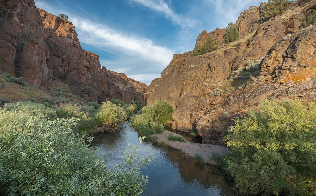
Still, Putnam has hope—which he draws from the very landscape around him. “To me, resilience means continuing to push forward no matter what,” he says. “Just like the Owyhee River has pushed forward for millions of years, cutting through some of the most beautiful and desolate lands this world has to offer. We must be resilient in these times to cut through all of the chaos in the world and protect our lands and give future generations a fighting chance to live good lives in this place we temporarily call home.”
Putnam, who grew up in Southeastern Oregon, now calls the Willamette Valley home. He loves the dichotomy of eastern and western Oregon. The fruitful lands growing food and ingredients for beer, wine and cider—as well as the remote areas providing a home to wildlife and some of the darkest night skies in the world. “The one thing that you will see on either side is mesmerizing rivers,” he says.
Growing up in Southeast Oregon, wildfires were a regular part of summers for Putnam. Four generations of his family had spent their lives in the woods there.
“I spent most of my high school summers working for my father as a fire watch,” he says.
The fire he remembers most distinctly, the one that changed his view on wildfires in general, was the Tool Box Complex in 2002.
“The smoke column was clearly visible and dominated the sky from where we were working that summer,” he says. “It seemed they had every airplane and helicopter in the nation flying around. They were pulling water from just about anywhere they could get it and our little airport in Klamath Falls turned into a mighty busy runway overnight.”
A downed air attack in Colorado grounded all fire planes for a few days, and one of the hand crews on that fire had to deploy shelter. “After those two events, it really struck me how dangerous wildfires can be,” Putnam says. “Not only to those who live in the affected areas, but also to the resources that get assigned to the fires.”
Since then, Putnam has worked for the Oregon Department of Forestry Fire Department on a dozer/tender crew, and as a Type 2 hand crew with the U.S. Forest Service. Thinking back to the hours of plotting his way through the dark with a map and headlamp to mark a way for a bulldozer to dig a hot line, felling trees, and digging hot lines himself, working 24+ hours in a shift during the summer heat, next to a raging fire, what Putnam comes back to is this:
“I have thought about this long and hard, and keep on coming back to the thought that we live in a world that is all connected. From the water we drink to the food that we eat—it’s all impacted by how we manage our land and our resources. Every single thing that we do has a lasting impact on our resources.”
To Putnam, rivers represent the very heart of those resources. “Rivers are everything, they are the lifeblood to our world,” he says. “Water is essential in everything that we do. We are so lucky to live in a place where we are surrounded by so many great rivers. I have been lucky enough over the course of time to get a chance to experience traveling by way of the river and see the world from inside the canyons.”
And as we make decisions as a community, knowing that the survival of our rivers and forests are connected, Putnam says there’s one thing he learned from a river guide that has always stuck with him: “There is only going forward, there is no going back.”
Learn how Oregon Senator Wyden’s River Democracy Act is fighting catastrophic wildfires and climate change here.
For Liz Hamilton, healthy rivers have been a key thread throughout the story of her family—from rafting and fishing to camping and hunting. “Over 20 years ago, on a fall raft, hunt and fish trip down the Rogue, I shot my first deer with my soon-to-be husband at my side,” she says. “While my kids were growing up, and now with our grandkids, one of our favorite vacations is rafting the Wild and Scenic section of the John Day River. It’s so much a part of who we are it is difficult to find words.” Hamilton added, “With luck, we’ll get a permit this year!”
And after a very close brush with wildfires last year, she knows the wildfire provisions in Senator Wyden and Senator Merkley’s River Democracy Act are essential. “Climate change is warming our rivers, and we must act now to protect the adjacent habitat from activities that degrade temperature and water quality,” Hamilton says.
Since 1979, Hamilton has lived in unincorporated Clackamas County, drawn to the area for the lifestyle, after leaving the west side of Portland, “We love this area because it is economically diverse, because we can grow most of our food—sheep, chickens and a large garden—on our small acreage, because we are within about a half-hour of over a dozen boat launches on the Willamette, Clackamas, Sandy, Molalla and Columbia Rivers where we fish, and there are many large parcels of public lands where we can hike, hunt and look for mushrooms and more.”
But despite the area seeming like a paradise, the wildfires in September 2020 were nothing short of terrifying. Hamilton watched through the night as the hillside nearby burned, trees looking like torches. Thankfully the first fire blew away from them, but with power lines down from the windstorm, the power was out for nine days. Without an internet connection for information, they worried about friends and neighbors.
The next day, however, when a contractor stopped by on a scheduled visit, he could barely find an open road to get there because of all the downed power lines in the area—and Hamilton later learned that both the contractor’s mother and brother had died in one of the fires. With no power, he was unaware at the time of his visit.
As other fires encroached the area, Hamilton eventually prepared to evacuate. It was no easy task. In the middle of a pandemic, she was caring for her father who has stage 4 kidney cancer. Packing their bags and arranging their home to leave, she also needed to care for their animals, including their two 120-pound livestock guard dogs. Neighbors were stopping by as they evacuated, and Hamilton was ready to go except for the very last essentials stashed on the front porch. Because of the dogs, they stayed one more night.
“With the power out, we didn’t have access to fire information,” she says. “We had no internet and nothing but texts worked on our phones without boosters, so my daughter in Bellevue stayed up all night monitoring the fire status and texting us pictures of its movement. In the end, we did not have to evacuate—we were so very lucky.”
Looking ahead, Hamilton says to recover from this, we’ll have to learn to live with practices that lower the impacts of climate change—both for humans and the resources we need and love. “We need to learn from past mistakes for a better future.”
Kyle Allred is a physician assistant who has practiced in both family medicine and urgent care. He also has a keen interest in wilderness and travel medicine and is an instructor at the National Conferences on Wilderness Medicine. Kyle lives in Ashland, Oregon.
Kyle Allred says he’ll never forget standing in 40 mph wind gusts as his neighbor told him a fire was heading toward them, and they needed to evacuate—now.
“It was frightening to see a massive, swirling, dark cloud of smoke heading toward us as I gathered a few things along with my car keys,” he says. “The magnitude of the fire didn’t sink in until I evacuated to a vantage point where I could see the town of Talent and house after house go up in flames. Intermittent explosions, presumably from propane tanks, sent shivers down my spine.”
Allred grew up in the small towns of Talent and Ashland in southwest Oregon, in the Rogue River Drainage that he was watching go up in flames that day. In fact, his parents took him down the Wild and Scenic section of the Rogue River for his first river trip when he was just six months old.
“I believe the river landscape had one of the biggest influences on my upbringing,” he says. He started raft guiding on the Lower Klamath River when he was 14 years old and spent nearly every summer in the Klamath drainage for over 20 years. “I developed a deep appreciation for the nature that lives in and around rivers,” he says.
Over the course of those years, like many others around the world, Allred began experiencing a significant increase in nearby wildfires and smoke there in the valley. But the most traumatic experience so far, he says, started on September 8, 2020, with what’s now known as the Alameda Fire.
After quickly evacuating his home, he watched from afar as flames consumed the town of Talent. Scattered communication with family and friends added to the sense of chaos. He describes bumper-to-bumper traffic and the relief that came with finding that everyone he knew in the fire’s projected path was OK.
“But the fire raged on and it was a helpless and humbling feeling to hunker down and watch,” he says. Allred was certain his house would be destroyed. About 24 hours later, he learned that the fire had burned within 100 yards of it—but his neighborhood had been spared.
Almost half of the structures in Talent and the next town north—Phoenix—were not so lucky. Amidst a pandemic, thousands of people lost nearly all of their possessions, were displaced, and needed a roof over their heads, he says. “The firefighters and first responders were nothing short of heroic in their response to the fires with limited resources.”
Less than a year later, Allred says the rebuilding effort continues, and the burned corridor along Bear Creek is regrowing a new post-fire character. But most people are nervous about upcoming fire seasons amidst historic drought conditions.
“As the climate and wildfire crisis worsens, the protection of rivers seems more important than ever,” Allred says. “Water is arguably our most precious resource—especially during times of drought and fire.”
In many of the communities Allred has lived and worked in, the health of the community is linked to the health of the rivers within them. “For example, ample fish populations allow Native communities, the fishing industries, and tourism industries to all sustain their respective livelihoods,” he says.
Senator Wyden, as part of his River Democracy Act, is including measures for fire management and funding. Drawing from his experience with the Alameda Fire, Allred is hoping to see that include incentives for home and business owners to use or upgrade to fire-resistant materials and incentives and grants for property owners to manage the vegetation on their land in a way that helps prevent fire growth/spread. And with his background as a medical professional, he’s hoping for more resources and education about air quality, safe outdoor activities amidst smoke, and smoke mitigation through air filters, purifiers, mask or respirator use.
Watching his community rebuild after the fire, Allred sees the need for a simple, integrated, perhaps statewide, fire and smoke warning system or app for communities. It could be the key to evacuating people safely—but it could also help connect people to opportunities to help in the aftermath of a fire.
“I’ve witnessed the impressive resilience of the people of Southern Oregon who’ve been affected by fire,” he says. “It takes incredible resilience to lose your home, be displaced, and navigate the many challenges to follow from finding a new place to live, to dealing with insurance companies, to finding a new job.”
Allred takes inspiration from his local rivers, which he says are incredible examples of resilience. “We’ve seen dam removal and other mitigation measures result in an amazing renewal of river health and riparian species. If given the opportunity to thrive, rivers will. And as a result, the surrounding communities will have a better shot at thriving as well.”
He hopes his community will lean into that sense of renewal, too, instead of anger, fear and sadness. “In the aftermath of the fire, I hope that the wonderful and resilient sentiment of ‘We will rebuild’ will be expanded to something like, ‘We will rebuild: effectively, creatively, and in a way that minimizes fire risk and spread.’”
Learn how Oregon Senator Wyden’s River Democracy Act is fighting catastrophic wildfires and climate change here.
The IPCC report released today is yet another urgent alarm bell, urging us to wake up to the real dangers of climate change that communities across the globe are already experiencing. Climate change is bringing severe consequences – from increasing floods and failing dams that endanger entire communities, to droughts and tapped-out water supplies that put people, industries, economies and ecosystems at risk.
What is clear is that the climate crisis is a water crisis. Failing dams, flooded homes and dried up rivers will be our future unless we take action now. Just, equitable adaptation for communities, rivers and clean water are achievable and are essential to our collective health, safety, and future.
The threats are real. To address them we must commit to climate adaptation now for communities and ecosystems to thrive in an era of climate change.
Here’s a breakdown:
Threats
Climate change is already wreaking havoc on communities and their rivers and water supplies
- Methane-Producing Dams: More than 90,000 dams turn free-flowing rivers across the U.S. into stagnant impoundments that release methane, a greenhouse gas 80 times more potent than carbon dioxide.
- Failing infrastructure: Major flooding and hurricanes have caused dozens of dams to fail in the Carolinas, and Michigan’s Edenville Dam failed catastrophically in 2020. Climate change is bringing more frequent and severe flooding at a time when U.S. dams are aging and outdated.
- Rivers running dry: The Colorado River – which supports a $1.4 trillion economy and drinking water for 40 million people – is in crisis due to climate change and decades of overallocation. The river is so over-burdened it no longer reaches the sea.
- Disastrous flooding: Record flooding along the Mississippi River in 2019 caused $20 billion in damage to people’s homes, farms and businesses in the floodplain. As flood risk grows with climate change, so does the risk to anyone living in harm’s way.
Solutions
Protecting and restoring our rivers and freshwater creates stronger communities and is key to climate resilience
- Safeguard clean water through green, natural infrastructure: To manage its increasingly intense rainstorms and related polluted stormwater and sewage spills, the City of Atlanta committed to investing in natural or “green’ infrastructure to slow, store and filter the water, protect intown communities from flooding and improve quality of life.
- Reconnect rivers through floodplain restoration: In California’s Central Valley, restoring the floodplain gives the San Joaquin River room to move, increasing capacity to hold floodwaters while creating wildlife habitat and recharging groundwater supplies.
- Protect healthy, free-flowing rivers: On South Carolina’s Waccamaw River, protecting land from development and establishing a blue trail has improved flood protection and increased access to nearby nature for community recreation.
- Remove harmful and unnecessary dams: More than 1,900 dams have been removed nationwide. Demolition of four dams on Oregon and California’s Klamath River is set to begin in 2023 to restore endangered salmon runs, thanks to leadership from the Yurok, Karuk, Klamath and other tribes. The Klamath is a prime example of how dismantling dams, reducing reservoir methane emissions, addressing historic injustices against Tribal Nations and building climate resilient rivers go hand-in-hand.
The IPCC report calls on us to focus our attention on climate change impacts and to finally make the commitment to adaptation to give communities, rivers, ecosystems a chance to thrive in the face of climate change. Decision makers at every level must prioritize protection of rivers and water resources and, in doing so, protect people and communities. This moment demands transformation in the way we manage, care for and connect with our rivers and clean water that are essential to all life.
American Rivers released a Rivers and Climate Policy Statement in November. Read more.
The dead of winter is usually the last time of year we think about wildfire but here we are wrapping up a historically dry February with several near record-setting warm temperatures in Oregon. Because of recent wildfires I now start to get nervous whenever we have a week or two without rain during the winter knowing our snowpack—our insurance policy for summer water and healthy forests—is dwindling.
Last month, United States Forest Service Chief Randy Moore announced a new strategy that will focus the Forest Service and it’s partners on protecting at-risk communities while improving forest resilience. The strategy brings together tribes, partners, states and communities to work across all boundaries. “We are ready to begin the work in a way that meets the urgency of the moment,” Moore says.
In a post last year, Oregon Senator Ron Wyden wrote, “This fire season has the potential to be the most devastating in our nation’s history.” The threats were so severe that Senator Wyden and fellow Oregon Senator Jeff Merkley sent a letter to federal agencies pressing them to “ensure our state has the resources it needs to fight these fires and keep communities safe.” In April. A time when the Willamette Valley used to be flush with precipitation. Senator Wyden is right, “The climate crisis is here, and we’re living it.”
Thankfully, Oregon’s senators have been at work crafting legislation to bolster wildland firefighting and resources. In February 2021, Senators Wyden and Merkley introduced federal legislation—the River Democracy Act—that will more than triple Oregon’s Wild and Scenic river miles and in doing so also strengthen wildfire preparedness statewide.
The River Democracy Act provides for stronger wildfire risk assessment and planning for homes and businesses near Wild and Scenic rivers, greater inter-agency coordination in fighting wildfire including with Native American Tribes, and more federal resources to repair wildfire damage to infrastructure, drinking water quality, and watersheds. The bill also provides $30,000,000 annually for Wild and Scenic Rivers that provide drinking water for downstream communities or those that have been degraded by catastrophic wildfire.
Most of us associate Wild and Scenic River designations with protecting the natural, recreational, cultural and ecological values of these waters—and we should. We should also understand the critical importance of national Wild and Scenic River designations as a tool to help us prepare and protect against an ever-increasing combined threat from catastrophic wildfire, warming climate, drought cycles and more people in harm’s way. Healthy, resilient rivers lead to healthy, resilient communities—and the importance of these life-giving rivers only becomes more vital in the face of climate change and fire seasons like the one we’re looking at this year.
But you don’t have to take my word for it. Over the next few weeks, we’ll be sharing guest posts from people who have been—and still are—on the front lines.
Stay tuned and stay safe.

