This guest blog contains a poem by Roxy Rose, and is a part of our America’s Most Endangered Rivers® series on the Buffalo National River.
Moonlight on Buffalo
Remembering who I am,
River Dragon,
Woman who would let this swift flow of water
take her blindly into darkness,
around bends guarded by majestic bluffs,
through tunnels of trees where moonlight dare not penetrate.
Exhilaration fills my soul
and boundless is the joy of knowing
I am part of this magic.
Surrounded by others who are also remembering
we belong to this river
and to each other.
We are the family chosen for ourselves,
as much a part of this place
as the silent fish swimming below,
the shy reptiles slithering between rock and water,
the birds that tend their nestlings,
the animals that take sustenance and shelter along point bars and cut banks.
The river gives all,
flowing freely towards the sea,
taking us along while
Luna bathes us in spectacular luminosity,
hanging high in a clear sky,
wearing her wild mane of starry tresses.
We beach, for a time,
by a flickering fire.
Drunk in jubilation songs ring out
as penny whistle and uke strings
vibrate the night air.
Clouds drift lined in silver.
The sky show intensifies while,
laughter rings bright and sparkly beneath grand planetary alignments,
until we reach the final run.
Scattering once more into separate lives,
we reflect silently of our strengthened bond,
our knowing reconfirmed as mist fades this mystical memory
while we give thanks for having been alive
during this perfect moment in time.
By Roxy Rose
19 June 2016 /Summer Solstice Full Moon Float on Buffalo National River
[su_button url=”https://act.americanrivers.org/page/692/action/1″ background=”#ef8c2d” size=”5″ center=”yes”]Take action »[/su_button]
 Author: Roxy Rose
Roxy Rose came to Arkansas 35 years ago to float the Buffalo River and has made it her home ever since. She worked as a park ranger on Buffalo National River for seven years and taught art and the gifted in the Ozarks for 21 years. Now residing in Hot Springs National Park, she works as an artist and regularly attends Wednesday night poetry sessions.
A couple of weeks ago in downtown Salt Lake City, the Trump administration announced a dramatic reduction in size of both Bears Ears and Grand Staircase-Escalante National Monuments. The blowback from supporters of National Monument protection was swift, and fierce.
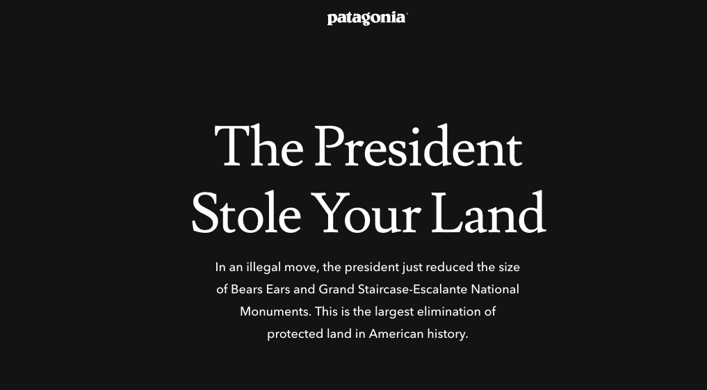
Patagonia’s response was the most prominent, as they ran a simple, yet forceful digital ad proclaiming “The President Stole Your Land” in bold white letters on a black background.
While much of the outcry was around Bears Ears due to both its recent designation under the Obama administration (which clearly Trump is trying to undue at every turn) and the fact that five Native American tribes came together to forge the agreement for management of the new monument, it was actually the shrinking of Grand Staircase that initially angered me the most. Now, don’t get me wrong, while I am really agitated about Bears Ears, especially due to the overt disrespect shown to the tribes who have called this land home for centuries, the fact that the administration would reverse a National Monument designation that had been in place for more than two decades was a bitter pill to swallow.
The day after President Trump’s announcement in Salt Lake, a news story came out about a new proposal for Grand Staircase, proposed by Utah Representative Chris Stewart, which would create a new National Park and three new monuments from the former Grand Staircase-Escalante Monument, and while that may sound good on the surface, the details are much different than the initial talking points.
The proposed legislation (H.R. 4558) creates a “Management Council” that would determine the management plan for all lands, including the new Park. The bill states: “Federal land managers shall adhere to the management plans created by the Management Council.” The Management Council shall consist of 7 members: 2 members from Kane County, 2 members from Garfield County, 1 Utah state representative, 1 Dept. of Interior representative, and 1 at large representative. In effect, this bill hands complete control of these lands to the State of Utah while all Americans fund the operating costs. That’s right, roughly 12,000 people in Garfield and Kane Counties will decide how these lands are managed, what is allowed and not allowed, while 330 million Americans pay for their decisions. To add insult to injury, the bill requires the Federal Government to transfer ownership of Hole in the Rock road to the State of Utah for FREE.
This opens the door to a lot of potential harm on these lands – more oil and gas development? More mining, grazing and logging? More fences, shutting off hiking, climbing, fishing and hunting access? It’s all up for grabs.
Now, in some ways, this too may not sound so bad, except that it is exactly the kind of theft that people have been warning that could happen if this federal land transfer business were allowed to commence. To add even more insult to injury, a friend of mine forwarded me a short video clip of some testimony between Garfield County Commissioner Leland Pollock, and a U.S. House of Representatives Federal Lands Subcommittee.
The upshot? This is exactly what conservationists and the outdoor industry have feared about a federal lands transfer since the days of James Watt (President Reagan’s Secretary of the Interior.) This bill, and the people behind this theft, have shown their true intent.
There are a number of ways that 2017 has been tough on the environment, rivers included. But in California, we did achieve a number of victories for rivers across the state. Below are a quick top five victories – but we aren’t done yet, we are excited to see how many meadows, rivers, and floodplains are restored thanks to your help in 2018!
· Major steps to improve flood management and restore Central Valley rivers and salmon
The 2017 Central Valley Flood Protection Plan Update embraces a dramatically different approach, which we have been advocating for over 10 years, called “multi-benefit” flood management. This approach recognizes that by expanding floodplains, floodways, and flood bypasses, we can reduce flood risk to people and property while providing benefits to fish, habitat, and recreation. American Rivers is leading and assisting on several large “multi-benefit” projects that the new plan identifies as priority projects.
· Completed restoration of Hope Valley Meadow and two other meadows
In the Sierra Nevada, we restored two miles of habitat for fish, beavers, and birds along the Carson River through Hope Valley. In two other Sierra meadows, we removed diversions to improve flow and we fixed eroded stream channels. We have already seen improvements to water quality and habitat for native fish and threatened species. Total: 3 miles and 450 acres restored.
· Formed the Central Valley Salmon Partnership
American Rivers and partners formally launched the Central Valley Salmon Partnership, which is designed to increase the pace and scale of salmon restoration in the Central Valley. American Rivers initiated this effort more than three years ago when we realized all sectors of the salmon restoration community face common challenges that can best be solved together, particularly with regard to permitting and funding.
· Important progress towards the most significant river restoration project in U.S. history
We are on track for the removal of four dams on the Klamath River in 2020. Over the past year, the Klamath River Renewal Corporation, a new organization that American Rivers helped create, finalized applications to the Federal Energy Regulatory Commission for approval to take ownership of the dams from the current owner PacifiCorp and start demolition within two years!
· Established the Sierra Meadows Partnership
We formed the Sierra Meadows Partnership and set restoration goals with 20 state, federal, and nonprofit partners. We also showed highly successful restoration projects to the leaders of the top four state and federal agencies that fund meadow restoration along Sierra Nevada rivers.
This guest blog by Patti Kent is a part of our America’s Most Endangered Rivers® series on the Buffalo National River.
The Buffalo National River is undammed and running free! It is one of the few remaining undammed and free-flowing rivers in the lower 48 states.
It runs through rapids and quiet pools; on a sunny day, it offers shimmering sparkles akin to jewels.
Bass, perch, and catfish are there for the catching. Laying within the Ozark Plateaus, it is one of the richest areas of the U.S. in terms of fish species. Seventy-four species of fish have been documented in the Buffalo National River.
The river is surrounded by massive bluffs. We are accustomed to calling out their names. There is Big Bluff, Jim’s Bluff, Red Bluff, and Goats Bluff to name a few.
I grew up among this magnificent feast to the senses. I swam, fished, and canoed this river long before it was saved from being dammed and then designated a National River.
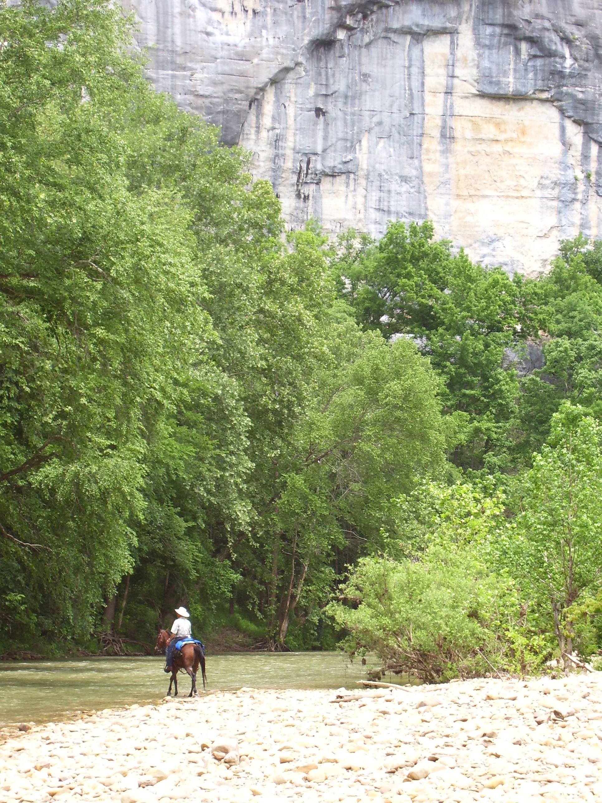
Horseback riding beneath the bluffs along the Buffalo National River. | Teresa Turk
I watched the sun dance and make patterns on the massive bluffs as I floated on my back in the river as a child. The water was clear then and if I flipped over I had a clear view of the rocky bottom. Peering down into the water and looking for little water creatures and colorful stones was a child’s delight.
Egrets, otters, turtles, and even some snakes made our heart skip a beat. The river teemed with life.
The Buffalo River has continued to be a sacred place and an integral part of my life for well over 60 years. I still swim and kayak in the spring and summer. I go there now for quiet moments and solace and just to sit on the river.
Unfortunately, I have seen the river grow increasingly murky and have seen more algae blooms. The stones on the river’s bottom are often not in clear view. Swallowing the water is not advised.
The river I once frolicked in so freely appears to be struggling for its life. My heart breaks, but my spirit soars as I hope to be able to somehow be a part of saving her for my grandchild and all the other children of the earth. I want them to see the stones on the bottom.
[su_button url=”https://act.americanrivers.org/page/692/action/1″ background=”#ef8c2d” size=”5″ center=”yes”]Take action »[/su_button]
Author: Patti Kent
Patti Kent spent a good part of her childhood near the Buffalo River. Her family roots run deep and she is an advocate for protecting the Buffalo River.
A new paper published this month by American Rivers’ Director of Science & Economics and 13 other freshwater scientists argues that if we are serious about protecting and restoring the rivers that are the lifeblood of our communities and economy, we should look broadly at how numerous and varied threats are interacting to affect river health.
Laura Craig, PhD, Director, Science & Economics at American Rivers is the lead author of the paper titled “Meeting the challenge of interacting threats in freshwater ecosystems: A call to scientists and managers,” which was published in Elementa: Science of the Anthropocene.
“Scientists and managers tend to focus on individual threats—for example urbanization, water withdrawals, or habitat fragmentation—but the vast majority of watersheds are experiencing multiple threats at the same time. We have a responsibility to face the challenges of studying and managing multiple threats so that we can make the best decisions,” said Craig.
“At American Rivers, we are committed to helping fill current knowledge gaps and to working collaboratively with scientists and river managers to choose the best solutions for rivers and the people and wildlife that depend on them.”
The paper highlights the value of thinking about multiple threats and offers suggestions for improving our understanding of how interacting threats affect freshwater ecosystems. It also offers advice on steps managers can take now to address the urgent management challenges presented by interacting threats, including applying what we have learned from managing individual threats, selecting approaches that are likely to succeed despite uncertainty about how threats may be interacting, avoiding unintended consequences while maximizing conservation benefits, and working in multidisciplinary teams to address challenges.
The authors of the paper chose to publish this paper in an open access journal, so it is available in full to the public.
In this episode of our We Are Rivers podcast, hear from Bob Irvin, President of American Rivers and other staff about challenges and successes for rivers in 2017, and our priorities for the coming year.
2017 brought many challenges for rivers and clean water, but thanks to you, our supporters, American Rivers was able to make significant progress for the rivers that connect us all.
We mounted a strong defense, sounding the alarm about attacks on our clean drinking water, public lands, and the rivers that flow through our communities. American Rivers supporters sent more than 286,000 letters sent to decision makers, making their voices heard loud and clear.
We removed 11 dams, restored more than 400 miles of rivers, and our volunteers cleaned up 2.58 million pounds of trash from local streams.
In this new episode of our We Are Rivers podcast, hear more about the threats we’re continuing to fight, victories we achieved, and what we’re focused on in 2018.
At American Rivers, we have a long history of protecting wild rivers, restoring damaged rivers, and conserving clean water for people and nature – and that legacy isn’t about to end now. If you’re inspired by what you hear in the podcast, please consider making a gift today. With your help, we will continue to make positive strides for the rivers that give us all so much.
As an alpine ski instructor for over twenty years and the son of a golf professional, I’ve always struggled to reconcile my job as a river advocate with my passions for skiing and golf. Let’s face it – both activities consume a lot of land and water.
So when I first got involved with water issues in the booming resort community of Big Sky, Montana over a decade ago, I wondered if there might be some way to protect the rivers I love while also maintaining the world-class recreational pursuits that local residents and millions of visitors come here to enjoy.
I had a chance to answer that question through American Rivers’ participation in the Big Sky Sustainable Water Solutions Forum over the past 18 months. The forum, which was comprised of a broad spectrum of stakeholders ranging from conservation groups to irrigators to developers and the two local ski resorts, was charged with coming up with a set of recommendations for how Big Sky can meet its future water supply and wastewater disposal needs while also protecting the Gallatin River and other local waterways that make the area such a spectacular natural wonderland.
As a headwaters community, Big Sky has a special responsibility to ensure that its growth and development don’t adversely impact those who live downstream. After all, what happens in Big Sky not only affects everyone who lives and recreates in the Gallatin Canyon, but also all the farmers and ranchers who irrigate their crops with river water and the 100,000 residents who live in the Gallatin Valley.
The elephant in the room at the forum’s monthly meetings was the specter of direct discharge of treated wastewater into the Gallatin River. The sad fact is, virtually every community in America dumps its treated wastewater into local waterways. Such is the case with my hometown of Bozeman, which discharges five million gallons of treated wastewater per day into the East Gallatin River. Not surprisingly, the river is nearing its tipping point in terms of nutrient pollution.
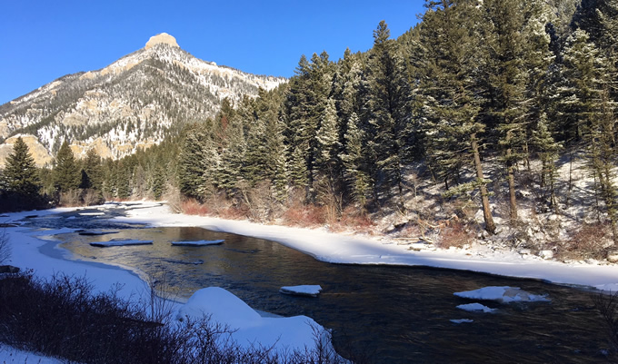
Gallatin River | Scott Bosse
Fortunately, the members of the forum agreed from the onset that rather than taking the easiest route, Big Sky should strive to become a model mountain community by reducing its water use and recycling as much water as possible so it can be put to other beneficial uses. At the end of the day, the forum stayed true to its goal when its members agreed, after some vigorous debate, to pursue alternative options for disposing of treated wastewater rather than just piping it into the Gallatin River. Those options center around upgrading the existing wastewater treatment plant so its end product attains, or comes close to attaining, a drinking water standard and using it to irrigate local golf courses and make snow at the local ski resorts.
While the forum was meeting to discuss water supply and wastewater disposal issues, the greater Big Sky community has rallied around the idea of protecting its most cherished local waterways under the federal Wild and Scenic Rivers Act. The Act, which will celebrate its 50th anniversary in 2018, is our nation’s most effective tool for protecting a river’s free-flowing character, clean water, and special values. Among the Big Sky area waterways that local residents and businesses want to see protected are the public lands reaches of the Gallatin River, Taylor Fork, Porcupine Creek, and Upper Madison River.
So while there’s no denying that Big Sky’s development has consumed a lot of land and water over the past four decades and its footprint will continue to expand in the coming years, the community has made a powerful statement that its growth must not come at the expense of the Gallatin River and other local waterways that make it such an attractive place. That’s a high bar it has set for itself, but our rivers deserve nothing less.
“Those who cannot remember the past are condemned to repeat it.”
– George Santayana
These words were first spoken over 100 years ago. At this time, the salmon fisheries of New England were still intact and the Pacific Northwest salmon were thriving. Lewis and Clark described “almost inconceivable” numbers of fish as they made their way down the Columbia River in 1805 – this was likely the largest salmon run in the world at the time. Today, a small fraction of these fish remain. Since then, the American dinner table has shifted from salmon to beef, and salmon populations have slowly marched toward oblivion across the continental United States.
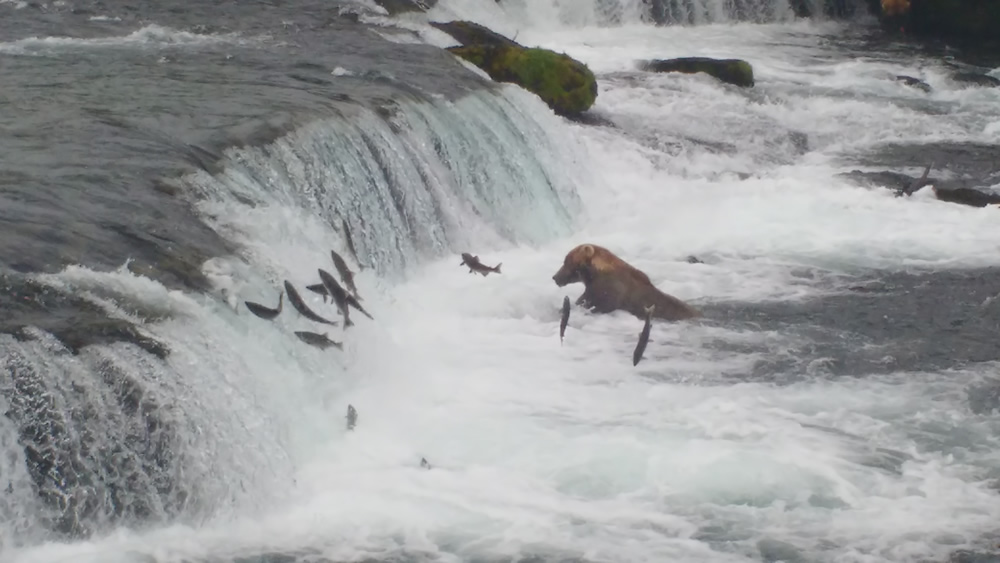 Alaska is home to the world’s last great salmon fisheries, accounting for 80% of the salmon caught in North America, and 80% of the high-value salmon caught across the entire world. The Bristol Bay fishery is valued at $1.5 billion and supports of 14,000 American jobs and a world-class recreational fishery. The majority of Bristol Bay residents are Native Alaskans, and salmon comprises 52% of the average Native family’s diet, the way of life associated with this harvest is invaluable.
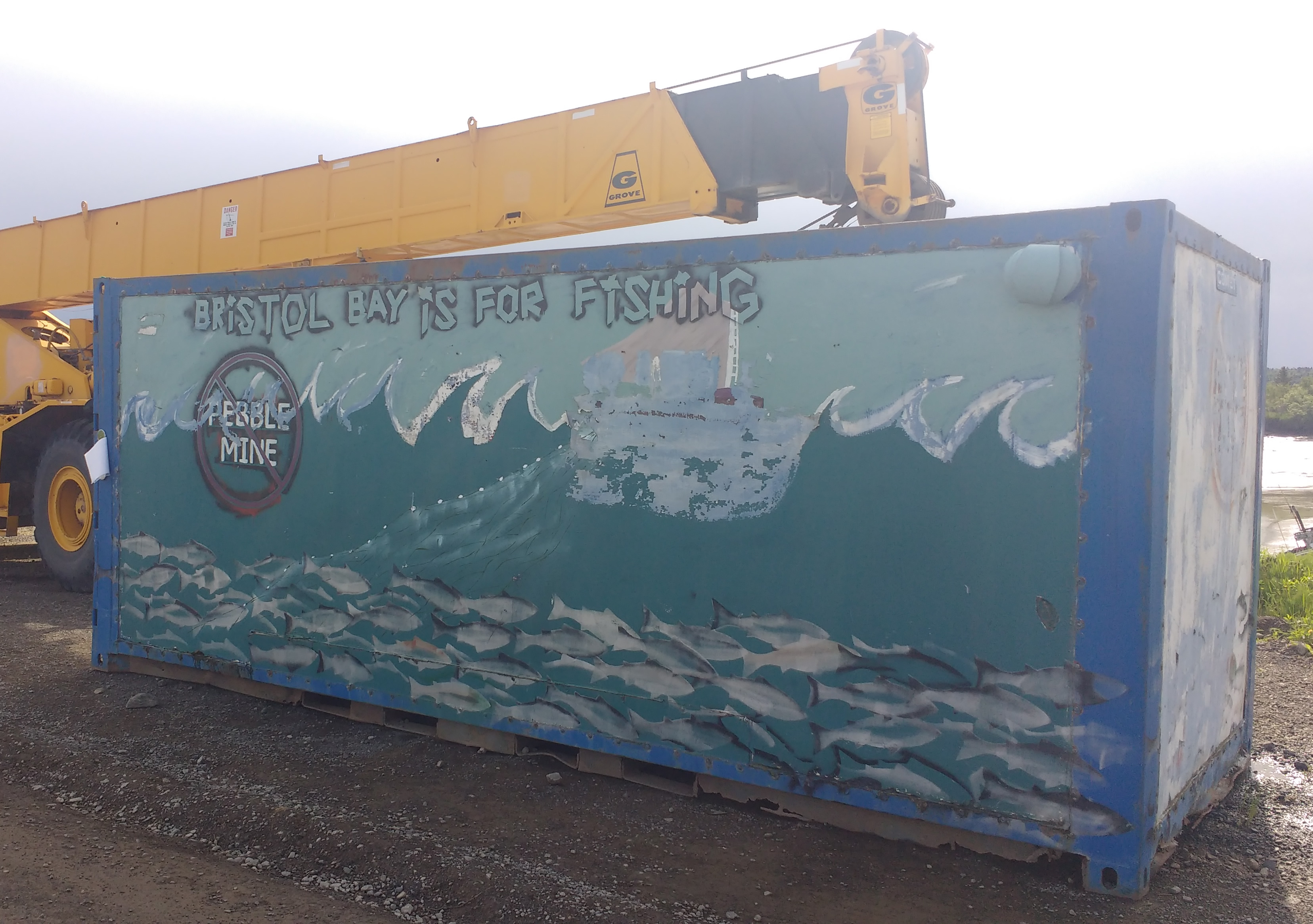
Can Salmon and Mining Coexist?
After 10 years of hearing fishing stories about Alaska from family and friends, I finally made the leap of faith and quit my job to go fishing this past summer. I have no ancestral knowledge of the salmon runs of yesteryear, but I read books and watched movies to prepare for what I expected to be the great debate of Bristol Bay: can salmon and mining coexist? One might imagine my surprise when I arrived in Dillingham (the regional center of governance for Bristol Bay) to discover a town absolutely united on an issue that is supposedly so divisive. I discovered that the Native Alaskans and the commercial fisherman agree. Republicans and Democrats agree. The old and young agree. The American and non-Americans agree. And they all have the exact same red and black sticker:
Pebble Mine
The Pebble Mine, proposed in the headwaters of the rivers of Bristol Bay, could become North America’s largest open pit mine and would include the world’s largest earthen dam – all in a seismically active region where the 2nd strongest recorded earthquake in the world occurred in 1960. The mine could end up bigger than the island of Manhattan and nearly as deep as the Grand Canyon. The Pebble Mine would create about 1,000 temporary mining jobs while threatening 14,000 fishery jobs. A three-year, twice peer reviewed scientific study concluded the Pebble Mine poses “catastrophic” and “irreversible” risks to the region.
 In May, 2017, EPA settled an important lawsuit with the mining company, Pebble Limited Partnership, agreeing to withdraw proposed protections in the watershed. Since then, the EPA accepted public comment on whether or not to withdraw the proposed restrictions and received over 750,000 comments supporting the proposed restrictions. In Dillingham, Alaska, over four hours of public testimony in mid-October demonstrated unanimous support of the proposed protections. Pebble Limited Partnership released plans for a smaller environmentally-optimized plan in October, but critics contend that this is just their strategy to get a foot in the door. The Pebble Limited Partnership is hoping to file the permit application in late 2017, and construction of the mine could begin as early as 2020.
The Fate of the World’s Salmon
While Alaska can seem far off and distant at times, it is truly America’s Last Frontier, and this is our last chance to be stewards of this mighty fish. Yet, this is more than a fight about fish. It’s about the economy. It’s about wild food. It’s about native cultures and their right to be stewards of their own environment. It’s about the livelihood of my family and friends.
With this decision on th horizon, the world stands at a precipice. Will the fate of salmon be bargained off to Canadian mining interests? Or will we learn from the past, and act to save the last great salmon run? Only time will tell.
The fight goes on. Will you join us?
Learn more and get involved:
http://www.savebristolbay.org/
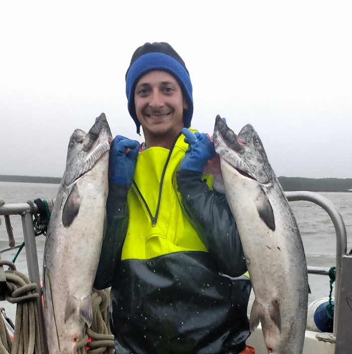 About the author: Jeremy Diner is a commercial salmon fisherman in Bristol Bay and an active volunteer at American Rivers. He has spent nearly a decade working for clean water, and the people that rely on it for health, happiness, and a way of life. He can be reached anytime at jjdiner@gmail.com.
Today, December 14, 2017, U.S. Representative Greg Gianforte (R), Montana’s lone congressman, introduced legislation to protect East Rosebud Creek as Montana’s next Wild & Scenic River. Rep. Gianforte’s bill, H.R. 4645, mirrors existing legislation in the Senate (S.501), introduced earlier this year by Montana’s senior Senator Jon Tester (D) and co-sponsored by Senator Steve Daines (R).
If it passes, East Rosebud Creek will be Montana’s first new Wild & Scenic River in over 40 years. This bipartisan bill, which would protect 20 miles of the stream on the Custer Gallatin National Forest, has received robust local support from area ranchers, business owners, sportsman, and conservationists who want to permanently protect the creek in its clean and free-flowing condition. With the introduction of Rep. Gianforte’s bill today, Montana’s entire congressional delegation shows again that it can transcend partisan politics to unanimously support protecting East Rosebud Creek under the Wild and Scenic Rivers Act.
What You Can Do
Please call Rep. Gianforte’s Office today at (202) 225-3211, and…
- Thank him for introducing the East Rosebud Wild & Scenic Rivers Act, H.R. 4645.
- Ask him to work with Montana’s U.S. Senators Jon Tester and Steve Daines to pass this bill in the current Congress, and to consider designating additional Wild and Scenic Rivers in Montana in 2018.
Not a Montanan? Contact your Representative and ask him/her to support H.R. 4645 by calling the U.S. Capitol Switchboard at (202) 224-3121.
Background and Future
East Rosebud Creek, MT | Mike Fiebig
East Rosebud Creek is one of Montana’s most rugged and picturesque streams. Its watershed provides important habitat for fish and wildlife, as well as incredible recreation opportunities including hiking, paddling, climbing and fly-fishing. Hydropower dams have been proposed on a public land section of the creek three times in recent decades.
A bipartisan, statewide natural resources poll conducted in 2016 shows that two-thirds of Montanans want to see more public lands streams protected under the Wild & Scenic Rivers Act. That’s roughly 700,000 people across the state that support more Wild & Scenic river designations. In the past two weeks, the East Rosebud Creek Wild & Scenic bill has received editorial endorsements from the Billings Gazette and Bozeman Daily Chronicle.
50th Anniversary of the Wild & Scenic Rivers Act
Passed on October 2, 1968, the Wild & Scenic Rivers Act is our nation’s strongest form of river protection. The Act turns 50 years old in 2018, and we can think of no better way to celebrate the anniversary of this bedrock environmental law than by designating new streams like East Rosebud Creek. Join American Rivers and partners in celebrating the 50th Anniversary of the Wild & Scenic Rivers Act by visiting 5000 Miles of Wild.
The North Cascade Mountains in Washington State are defined by their majestic beauty—wild forests, wild rivers, and stunning vistas. The jewel of North Puget Sound, the Nooksack River, is the backbone of Bellingham and Whatcom County’s outdoor industry supporting a $705 million-recreation economy that includes hiking, rafting, fishing, climbing, hunting, skiing, mountain biking, backpacking, and kayaking. And the Nooksack is one of a few river systems in our state that provides freshwater habitat for all five species of Pacific salmon, including endangered Chinook salmon, as well as endangered steelhead and bull trout.
Show, Don’t Tell
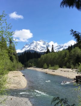
Mt Shuksan can be seen over the North Fork Nooksack River. | Wendy McDermott
Sure, I can tell you all about the Nooksack River’s beauty, splendor, and myriad recreation opportunities. Or describe what it’s like to run a raft through the thrilling Nozzle rapid on the North Fork, hike through the fern forest at Horseshoe Bend, or swing a fly in freezing January rain searching for that one wild, winter steelhead. It’s challenging to explain the exact reaches of the 113 river miles and nearly 35,000 acres of riverside land American Rivers is working to permanently protect in the upper Nooksack River system as Wild and Scenic. Sometimes it’s best to just take you there. So aside from an in-person tour of the watershed, we’ve put together a Story Map to show the why and the where of the work we’re doing in the Nooksack River basin.
A Guided Tour
As you scroll through the Story Map, you’ll see the river from top to bottom, from the high-gradient, glacially influenced North Fork, where whitewater boating and fishing are the norm to the steep, forested canyon of the Middle Fork where mostly expert kayakers lay claim, to the spring water fed, low gradient South Fork which flows through the agriculture landscape of the communities of Acme and Van Zandt. It’s about as close as you can get to the guided tour of the river Nooksack River basin and the natural, cultural, and recreational wonders that make it worth lasting protection under the Wild & Scenic Rivers Act.
Mapping It All Out
With such a diverse landscape and the multiple classifications within this potential Wild & Scenic designation, a static map won’t capture the entire story. The Nooksack Basin is a living landscape with diverse stakeholders, communities, and recreation opportunities, each with a particular interest in the basin. The Story Map shows in detail the 113 river miles proposed for Wild & Scenic designation, which include portions of the North, South, and Middle Forks of the river as well as the nine important tributaries.
While no technology can ever replace what it feels like to run a raft down the North Fork or swing a fly to willing bull trout, hike through the cedars in the shadow of Mt. Shuksan, or swim in the cool waters of the South Fork, our hope is that this Story Map shows why the Nooksack River and its tributaries are worthy of lasting protection under the Wild & Scenic Rivers Act. It should answer any questions you might have about specific information for each reach, maybe inspire you to take a river visit, and most importantly compel you to take action and sign our petition in support of our Nooksack Wild & Scenic River campaign.
[su_button url=”[su_button url=”https://www.nooksackwildandscenic.com/get-involved” background=”#ef8c2d” size=”5″ center=”yes”]Take action »[/su_button]
This effort is part of our 5,000 Miles of Wild campaign: In celebration of the 50th anniversary of the Wild and Scenic Rivers Act in 2018, American Rivers and partners are working to protect 5,000 new miles of Wild and Scenic Rivers and one million acres of riverside land nationwide. Learn more and get involved: www.5000Miles.org
IN
Having your member of Congress on speed dial
Enjoying the wild Grand Canyon
Defending public health
People
OUT
Deadbeat dams
Not joining the 286,209 people who spoke up for rivers this year
Presidents who attack public lands
Scarring the heart of the Grand Canyon
Trashing streams
Dismantling the Clean Water Rule
Books on tape
Going it alone
Climate change deniers
Building walls
Help us keep the ins in, and the outs out in 2018, please donate today – all gifts tripled through December 31st.
[su_button url=”https://act.americanrivers.org/page/4047/donate/1″ background=”#ef8c2d” size=”5″ center=”yes”]Donate today »[/su_button]
There are a number of ways that 2017 has been tough on the environment, rivers included. From the proposed repeal of the clean water rule to rolling back protections from mining waste, the fight for clean water and our wild rivers has never been more urgent. But here in Montana, we did achieve a number of victories for rivers across our state. Here are a quick Top Five Conservation victories – and we aren’t done yet!
1) Secured formal endorsements from more than 2,000 Montanans and 1,000 Montana businesses for a comprehensive Wild & Scenic Rivers bill that would protect 50+ rivers in the Crown of the Continent and Greater Yellowstone ecosystems.
2) Won key administrative protections for 105 streams, 1,071 stream miles, and 343,000 acres of riverside lands on three national forests in western Montana.
3) Inspired 9,300 river advocates from Montana and across the nation to submit comments on the proposal by a Canadian mining company to build a copper mine in the headwaters of Montana’s famed Smith River.
4) Played a major role in convincing an influential stakeholder group to quash the idea of discharging treated wastewater from the resort community of Big Sky into Montana’s Gallatin River.
5) Met with, trained, and presented to 5,475 people in Montana, Wyoming, and Idaho to build support for our river protection efforts in the Northern Rockies.