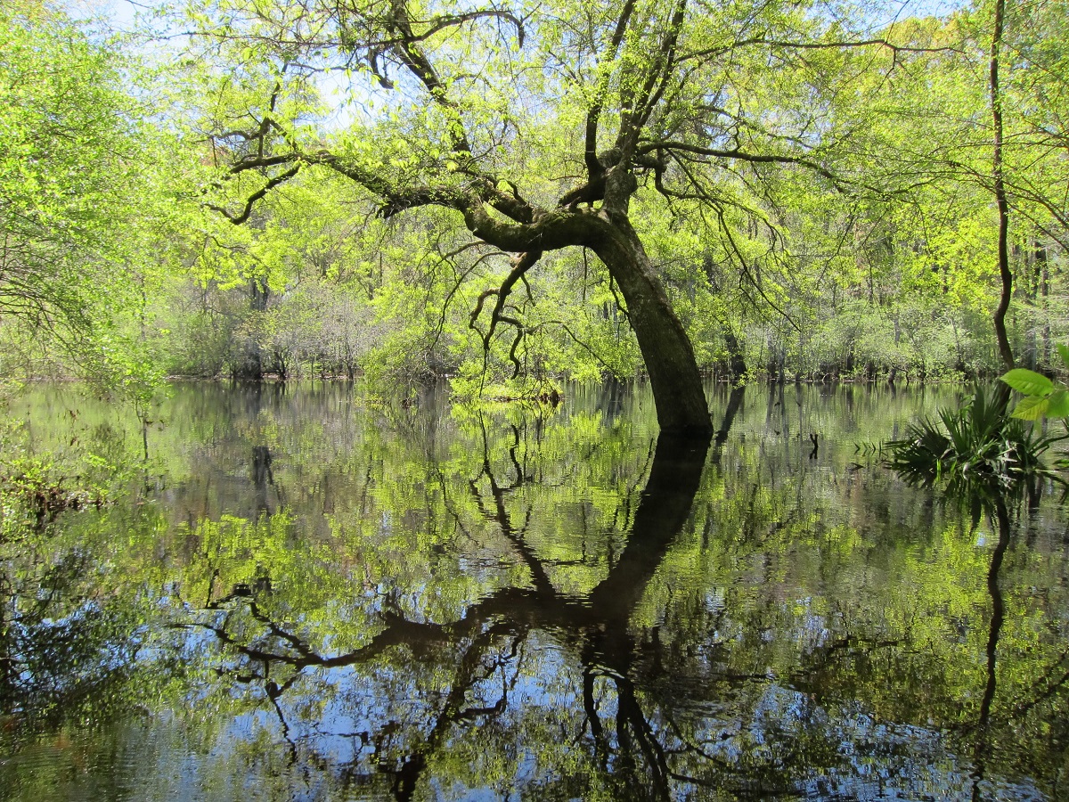
Rivers run through our lives in many ways, and each of us has a river story. To celebrate the 50th anniversary of the Wild and Scenic Rivers Act, we’re collecting and sharing 5,000 personal river stories.
Your stories: diverse voices from across the country, showing decision makers the importance of healthy rivers, and demonstrating a wave of support for new river protections.
Here are some recent stories shared from rivers across Oregon. Explore more stories from your own backyard at www.5000Miles.org and share your unique story with us today!
Faith Briggs, Deschutes River
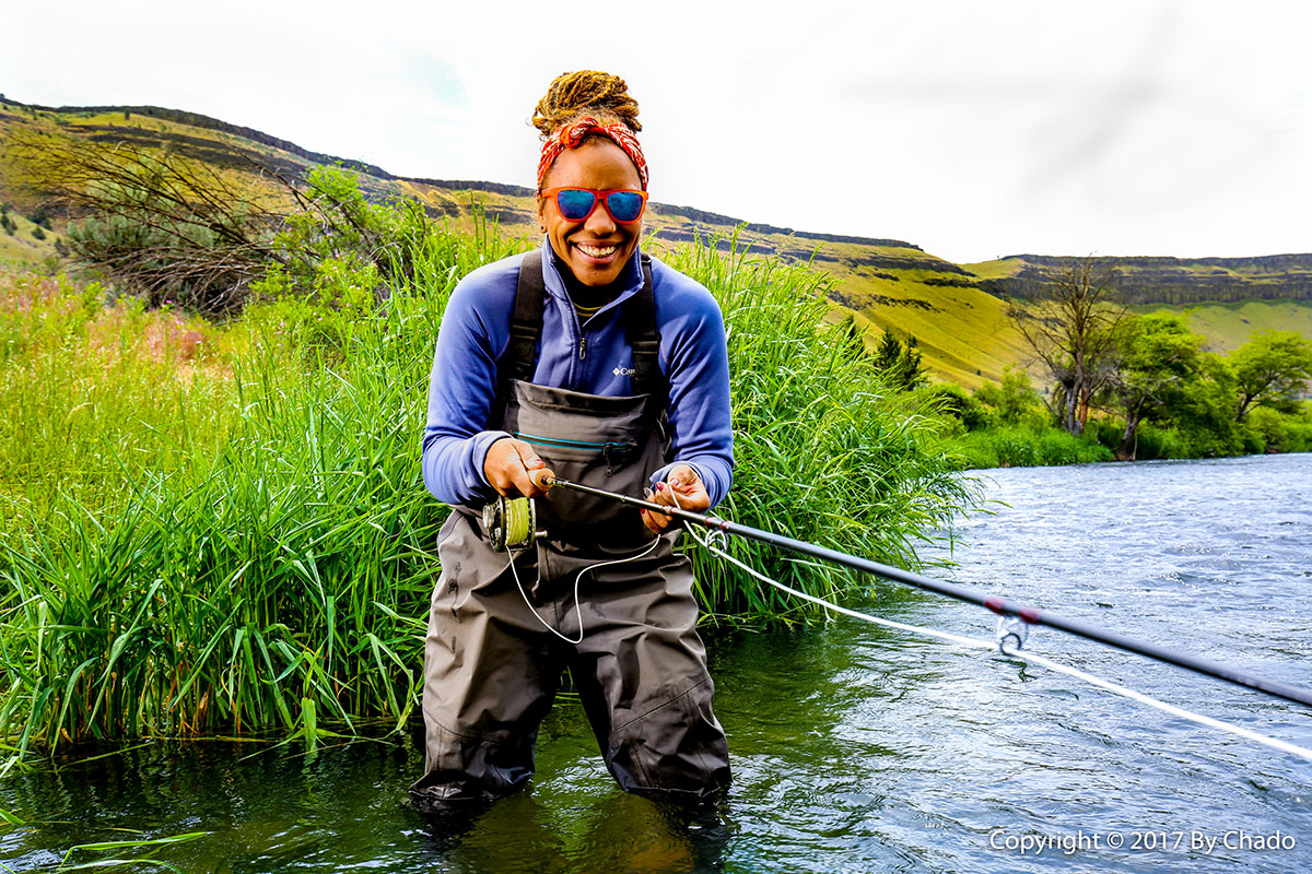 I’ve had an absolutely magical time exploring Oregon’s rivers and the first thing that brought me out into a river, was fly fishing. I started learning to fly fish with Chad Brown this year and I fell in love. It was so incredible to spend that time out in the river, just being quiet and feeling the water moving around you. I don’t tend to give myself enough quiet time, so I appreciate those moments. It’s led me to join Chad’s non-profit organization, Soul River Inc, so I can share that love with others.
Billy aka Sweet William aka The World’s Greatest , Willamette River
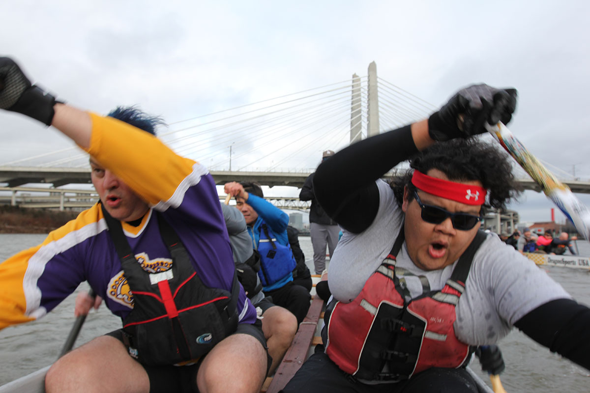 One of my favorite memories of coming here and paddling with Bridge City Paddling Club probably has to be during the winter time when it gets dark out early and you’re out there with your team and you’re putting everything you got out on the water and you know the people right next to you are working just as hard as you. You’re all doing it together and then you look up and you see the city lights are right there in front of you and you know, it feels like you’re alive.
Chris Franklin, Rogue River
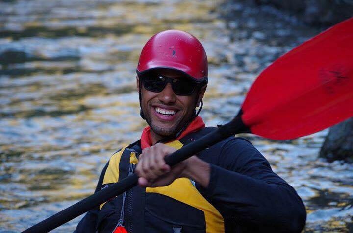 Late summer of 2016 I was invited on a trip of a lifetime. My friend suggested I join a group of 20 strangers to kayak down the Rogue River for 4 days. I grew up in Southern California where my idea of an outdoor adventure included roller coasters and corn dogs. I had never spent 4 days camping let alone traversing down a river with my paddle in hand.
I remember the nervous feeling before I got in my inflatable kayak for the first time. My hands gripping the paddle as I run through my safety instructions over and over in my head. Feeling unsure of my balance and thinking; how did I get myself into this.
We hit our first rapid, I lean forward, paddle fast and point my boat to the eddy as instructed. Whoa, I’m in the clear! I made it. We paddle for about 8 hours that day; I am learning new skills with every stroke I take. I take my first swim and jump back in the boat just to do it again. By the end of the day you couldn’t wipe the smile off of my face.
We set up camp, eat dinner and lay under the stars in the wild and scenic sectioned the Rogue River in southern Oregon. My mind racing with the challenges I had overcome that day and the confidence to jump back in my boat and do it all again the next morning. Life long friendships were made on that trip. New talents were forged through trial and my life will never be the same. I experienced the power of the river while also discovering the power that lives within me.
Sophiea Tyler, Willamette River
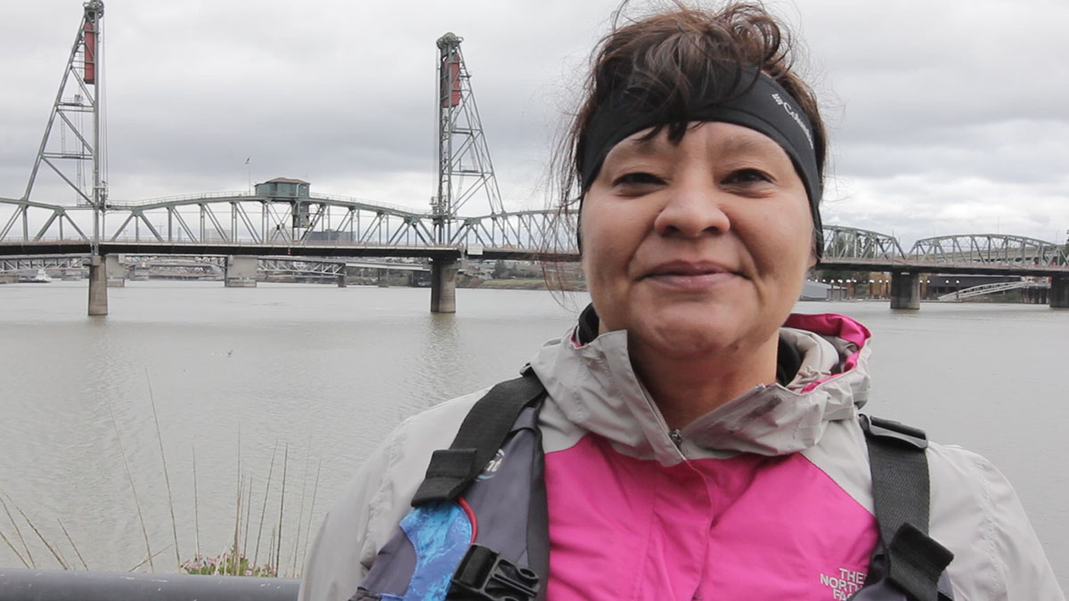 People always ask me why do you do this? I mean, how could you go out on the water when it’s freaking cold and it’s just really miserable? But it’s not! I mean this sport truly is all about heart, and I think that’s what I love about it the most. You have 20 people – this sport isn’t like football where you have a star quarterback or a running back – and every single person is valuable. Every single person commits to the team, to the boat, and it’s all 20 of us paddling together that makes us cross the finish line in first. So it’s just something that I think about and it’s a philosophy I like to carry off the water as well; we always cross the finish line better when we’re working together, as opposed to just trying to go solo. That’s kinda why I do it.
[su_button url=”https://www.5000miles.org/share-your-story/” background=”#ef8c2d” size=”5″ center=”yes”]Share your story »[/su_button]
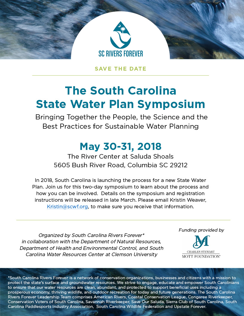
South Carolina last updated its State Water Plan fourteen years ago. Since that time the state has grown by more than 15% adding some 750,000 people, endured its most severe drought during 2008-2009, passed a water withdrawal law that for the first time created regulations for water withdrawals from rivers and other surface waters, and witnessed controversy regarding the amount of water being taken from river and groundwater sources.
Four Hole Swamp, SC | Gerrit Jobsis
During 2018, South Carolina will embark on completing the second and final phase for a new State Water Plan. Authorized by the South Carolina Water Resources Planning and Coordination Act of 1967 as amended, the South Carolina Department of Natural Resources is assigned overall responsibility for developing a comprehensive water resources policy for the State, including coordination of policies and activities among State departments and agencies. The Department of Health and Environmental Control, the state regulatory agency for water issues, will be working closely with the Department of Natural Resources as the new plan is developed.
Last updated in 2004, the Water Plan can include policies and practices to address:
- Water supplies for domestic, municipal, agricultural, and industrial uses
- Facilities and controls for suitable water quality for all purposes
- Water needs for recreational and commercial navigation
- Hydroelectric power operations
- Flood damage control or prevention measures
- Salinity control measures
- Watershed protection and management measures
- Water needs for outdoor recreational and fish and wildlife opportunities
- Water related measures for economic growth and development
- The long-term preservation of water resources, and
- The general well-being of all the people of the State
Broad River, SC | Ron Ahle
For the first time the Department of Natural Resources will develop Basin Advisory Councils for each of the state’s eight major river basins – the Broad, Catawba, Edisto, Pee Dee, Salkehatchie, Saluda, Santee, and Savannah. These advisory councils will be tasked with providing local input to the water plan. What are the water management priorities for these regions and what actions need to be taken to ensure they will be met?
Questions that will need to be addressed by the new State Water Plan include:
- What can South Carolina do to ensure it has sustainable water supplies today and for future generations?
- What are sustainable practices that can be implemented for water utilities, agribusinesses, and industrial water users?
- Are their limits on how much groundwater should be pumped?
- What river flows are essential for healthy fish and wildlife, boating, and other outdoor recreational uses?
- How do we balance competing needs?
The culmination of the State Water Plan process, which is expected to take two to three years, is a comprehensive water resources policy for the State that will be submitted to the General Assembly and Governor for approval. It can also include recommendations to the General Assembly for any changes in state law needed to implement the plan.
American Rivers and other members of South Carolina Rivers Forever share a goal of ensuring an open and inclusive state water planning process. We are a network conservation organizations, business, and citizens in the state with a mission to protect the state’s surface and groundwater resources. South Carolina Rivers Forever strives to engage, educate, and empower South Carolinians to ensure that our water resources are clean, abundant, and protected to support beneficial uses including a prosperous economy, thriving wildlife, and outdoor recreation for today and future generations.
On May 30 and 31, 2018, South Carolina Rivers Forever will host the South Carolina State Water Plan Symposium: Bringing Together the People, the Science and the Best Practices for Sustainable Water Planning. Details on the symposium and registration instructions will be released in late March. To ensure you receive this information, please email me at gjobsis@americanrivers.org or Kristin Weaver of the South Carolina Wildlife Federation at Kristin@scwf.org.
Nestled in the shadows of the Great Smoky Mountains National Park, the Tuckasegee River meanders through southwestern North Carolina for nearly 60-miles from its point of origin in Panthertown Valley through Cullowhee, Dillsboro, and Bryson City before joining the Little Tennessee River. The “Tuck” is also American Rivers’ newest Blue Trails project, where we are working with the community to improve family friendly recreation and protect the river and its surrounding lands.
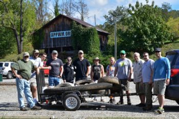
An important part of Blue Trails work is planning to keep the river clean and safe. In September 2017, American Rivers hosted a National River Cleanup® event on the Tuckasegee River where we worked with the community to remove trash and celebrate the river.
We partnered with the Watershed Association of the Tuckasegee River (WATR), the Tuckasegee Chapter of Trout Unlimited, and more than 20 volunteers including members of the Western Carolina University Fly Fishing Club.
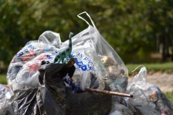 Thanks to these dedicated volunteers, we removed 340 lbs of trash from the water and stream bank. Several items were salvaged and not included in the weigh in, such as rebar that will be repurposed in the construction of an educational display and several toys that were “rescued”, including the dinosaur in the photos and several basketballs.
Following the cleanup, we held a riverside celebration and pizza party on Scotts Creek at Monteith Farmstead and Park in Sylva, NC.
Every chance we get to help clean up the river is great but for groups like Trout Unlimited and WATR, a river cleanup isn’t a one off event. Both organizations have dedicated themselves to organize regular cleanups in the watershed.
 WATR maintains a series of self-guided educational trails at Monteith Park that teach the public about river health which includes the importance of maintaining a riparian buffer and keeping the stream clean and alive. The salvaged rebar from the cleanup will be repurposed to help build a new display that will feature macro-invertebrates and their significance to river health. Part of their mission at Monteith Park includes hosting monthly cleanups.
The Tuckasegee Chapter of Trout Unlimited has adopted a portion of the Tuck where they host regularly scheduled cleanups. They also scout out the trout fishing waters in the basin and host opportunistic cleanups where they are needed most. Recently, Trout Unlimited partnered with the Town of Sylva, NC, and the WCU Fly Fishing Club to remove more than 3.5 tons of trash from Scotts Creek.
Many thanks to the awesome volunteers and all those dedicated to keeping our rivers clean and healthy. We can’t wait to see you on the river!
On a cold winter day in January, a caravan of diverse partners gathered in northeastern Tennessee to celebrate a partnership success to connect native trout habitat and ensure public infrastructure is resilient to floods.
American Rivers is proud to have partnered with the US Forest Service Cherokee National Forest, the US Fish and Wildlife, Trout Unlimited, the Tennessee Valley Authority, and The Nature Conservancy on the Briar Creek culvert replacement project. The project took a perched, too-small, problematic culvert under a Forest Service road and replaced it with a bottomless arched culvert that provided the following benefits:
- Better fishing: Allows native Southern Appalachian Brook trout to move easily up and downstream of the road crossing to access important habitat to better support population diversity and size.
- Better Habitat: Provides natural habitat through the road crossing (instead of a metal or concrete bottom) to maintain natural continuous stream function.
- Secure Infrastructure: During floods, the structure has room for high flows like a natural stream does which allows the road infrastructure to be more resilient into the future to storm events.
Thanks to the skilled and collaborative efforts of our partners. The best projects happen when partners offer their resources and expertise, communicate openly, and learn from each project to make the next one better. This project was successful because our partners offered their best!
Check out the slideshow of before and after images, and the video from the celebration event.
[metaslider id=41531]
With the 90th Academy Awards quickly approaching, why not take a break and spend a few days lounging on the couch watching some of the best river movies out there? Our staff has put together a list of their favorite river movies for you to enjoy, no scrolling through Netflix needed.
Deliverance
Despite outdated stereotypes of mountain people, and in addition to being an awesome thriller of a movie, this incorporates a bunch of relevant river issues. From the power of free-flowing rivers, the importance of wilderness to our souls, and the destructive potential of dams. American Rivers founder Claude Terry was also a consultant for the river scenes and a “river double” during filming.
The Good Dinosaur
Kid friendly, the importance of river safety (specifically heeding flash flood warnings), and dinosaurs – what’s not to love?
Lord of the Rings: The Two Towers
Did you know this 2002 Tolkien masterpiece features a dam removal scene? It’s when the Ents – along with the Hobbits we know and love – attack Isengard. Our dam removals aren’t as dramatic, but still cool nonetheless.
A River Runs Through It
Or as our Northern Rockies Director said, “Montanans simply call it, “the movie.” The film follows the complicated relationship of two brothers and the magic of fly fishing for trout in the Blackfoot River. We highly recommend it, especially for a young Brad Pitt and for the acting of our former Board member, Tom Skerritt.
Cape Fear (1991 remake)
While most of this thriller was filmed in Florida, it’s supposed to take place in Essex, NC and along the Cape Fear River. The Cape Fear was named one of America’s Most Endangered Rivers® of 2017. We’re not sure Robert DeNiro would want to cruise down the Cape Fear in a boat if he knew how threatened the river is from industrial agriculture waste.
Red Gold
Love a good documentary? This one follows the subsistence and commercial salmon fishermen of Bristol Bay, Alaska, as they work tirelessly to make their living off the land and water, and combat the proposed open pit gold and copper Pebble Mine.
Ola i ka Wai: Water is Life
As the opening line of the movie says, “fair access to water is going to be one of the pivotal issues of our time.” The short film looks into Hawaiʻi’s water resources and whether the state is following the laws written into its constitution.
The Memory of Fish
One man, the wild salmon he loves, and his fight to free a river. This beautiful, award-winning documentary follows the fight to remove dams along Washington’s Elwha River. Who doesn’t love a good dam removal?
Chinatown
The 1974 Jack Nicholson and Faye Dunaway classic was inspired by the California water wars, a series of disputes over southern California water at the beginning of the 20th century, by which Los Angeles interests secured water rights in the Owens Valley.
African Queen

With a 100% “Fresh” rating on Rotten Tomatoes, this movie follows a riverboat captain who’s convinced by a missionary to attack an enemy warship during World War I. The film was selected for preservation in the United States National Film Registry in 1994, with the Library of Congress deeming it “culturally, historically or aesthetically significant”.
Salmon Fishing in the Yemen
This RomCom-Drama is about a fisheries expert who is recruited by a consultant to help realize a sheikh’s vision of bringing the sport of fly fishing to the Yemen desert. Will the river be suitable for salmon populations and who ends up with Emily Blunt? You’ll have to watch to find out.
Ocean’s 11
Our Communications Director in the Colorado River Basin recommended this one “since it is set in Vegas and as we know, that is 100% Colorado River water.”
The River Wild
A family on a whitewater rafting trip encountering two violent criminals in the wilderness which also includes Meryl Streep whitewater rafting? Count us in. It also includes Kevin Bacon, since we all have some six degree connection to him. Spoiler alert, the “Salmon River” they’re rafting is actually parts of the Kootenai, Colorado, and Rogue rivers.
White Water Summer
An even younger Kevin Bacon in the wilderness with teenage guys (including Sean Astin), and of course something will go wrong. Please take notes on canoe safety during this film.
The Bridge of the River Kwai
With the most Academy Awards of any on this list, The Bridge on the River Kwai, is a true classic. In 1997, the film was deemed “culturally, historically, or aesthetically significant” and selected for preservation in the National Film Registry by the United States Library of Congress. It is included on the American Film Institute’s list of best American films ever made. Go. Watch. It.
As California appears to be headed into another year of drought, a debate is raging about how to spend the $2.7 billion provided for increasing the state’s water supply by the 2014 Proposition 1. The California Water Commission, through the new Water Storage Investment Program (WSIP), must allocate the funding with a competitive application process by 2022. Water agencies, and one NGO, have submitted 12 proposed projects to the WSIP, ranging from a $22 million groundwater project near the San Joaquin River National Wildlife Refuge, to the $5.2 billion Sites Reservoir to be located in Antelope Valley some 10 miles west of the Sacramento River. Click here to see an interactive map of the projects.
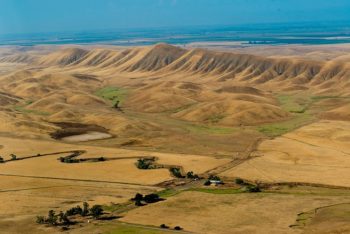
Proposed Sites Reservoir location | Photo: Sacramento River Preservation Trust
The Water Commission worked with staff and stakeholders, including American Rivers, for over a year to develop regulations for spending the money. The WSIP can only fund costs associated with the “public benefits” of projects, defined as: ecosystem improvements, water quality improvements, flood control, emergency response, and recreation.
The Water Commission also established numerous eligibility criteria, and therein lies the rub. The criteria require that the “public benefit ratio” must be greater than 1, meaning the value of the public benefit provided by the project must be greater than the cost of providing it. Project applicants provided estimates of their public benefit ratios that ranged from 1.47 to 6.10. However, the Water Commission evaluated the ratios according to their stated methodology, and revised all of them downward, dramatically. The Commission gave four projects a score of zero – meaning they saw no credible benefit to the public – and no project scored above 1.
Bear River (Proposed Centennial Dam) | Photo: Gary Moon
Project proponents had until Friday, February 23 to appeal the revised public benefit ratio, and the Commission will make final determinations on the ratios by May 3rd. The Water Commission will determine by the end of July 2018 how much funding any proposed project could receive.
The prospect that no project would receive funding from Proposition 1 has caused a predictable ruckus in Sacramento, with eight pro-dam legislators sending a letter recently to the Water Commission urging it to fund new dams, and the leaders of the Assembly and Senate applauding the Water Commission for its rigorous review of applications.
If this winter continues its current pace as the third driest on record, the Water Commission can expect to face increasingly desperate calls to fund new dams.
The Arizona Legislature last week proposed a set of water policy bills that are more notable for the issues they don’t address than for the ones they do. The bills are silent on the most pressing water challenge Arizonans face – the declining levels of water stored in Lake Mead, and the impending probability that this long-term decline will force cutbacks in the state’s water supply. This is unfortunate, as it’s Arizona’s relationship with the Colorado River which has most strongly sustained the state’s economic growth, and prevented the collapse of its native groundwater supply. Increasingly, that relationship is becoming strained by the likelihood that the Colorado River will not be able to supply all of the water Arizona has taken from it, and the need for Arizonans to adapt to likely future shortages.
Arizona relies on the Colorado River in many ways. Communities, farms and tribes along the course of the river have direct access to its waters, and some of the highest priority claims to use them. River water also flows hundreds of miles across the desert through the Central Arizona Project canal to supply residents of Phoenix and Tucson, as well as farms across Maricopa, Pinal, and Pima Counties. In the 1960’s, in exchange for federal funds to build the canal, Arizona agreed that this water would have lower priority than water delivered to other users in California and Nevada. Complicating this picture, water delivered by CAP is also broken into higher and lower priority tiers. The important take home from all of this complexity is that Arizona is first in line for water supply cutbacks when there’s a shortage on the Colorado River.
Fortunately, the three states, the federal government, tribes, and Mexico have been working on solutions to sustain levels in Lake Mead, and prevent the deepest cutbacks to water users. Known as the Drought Contingency Plan, or DCP, this effort envisions an initial level of voluntary cutback in Arizona that will hopefully be enough to stave off deeper shortages, and more painful mandatory cuts. But in order to make this work, Arizona needs to have a difficult conversation about its water use, and how its future CAP supply will be used. In short, Arizona must cooperatively reach an agreement about how it will invest its water portfolio and create a fair solution for future water use. Inevitably, there will be challenges as some water users will lose their accustomed access, but without this Arizona dialogue and solution, the outcome could be more difficult for the state to bear.
Which is why the bills currently in the Legislature are so troubling. They don’t pose any solutions; they don’t reflect the progress made in discussions between water users, water providers and state leaders; they don’t show leadership on behalf of all Arizonans or the Colorado River. Arizonans can’t afford to delay a challenging conversation about the future of the River and the state’s communities for much longer. All of us should get to know our water, and the real concerns about this security of this lifeline. By knowing your water, we’ll be better able to cooperatively develop solutions and to become more flexible and efficient in the way we use our Colorado River supply. While there are undoubtedly difficult challenges ahead, there’s also an opportunity to build a better relationship with our Colorado River supply, and a better future for Arizona and the River.
Last year was a banner year for dam removals across the country. Eighty-six dams were torn down in 2017, beating the previous high number of 78 dams in 2014. Communities in 21 states, working in partnership with non-profit organizations and state and federal agencies, removed the dams to reconnect more than 550 miles of streams.
Dams were removed in the following states: Alaska, California, Connecticut, Iowa, Indiana, Kentucky, Massachusetts, Maine, Michigan, Minnesota, Nevada, New Hampshire, New Jersey, North Carolina, Ohio, Oregon, Pennsylvania, Tennessee, Vermont, Washington, and Wisconsin.
In 2017, Pennsylvania had the highest number of removals for the fifteenth year in a row. The top three states removing outdated dams in 2017 were:
- Pennsylvania – 16 dams removed
- California – 10 dams removed
- Massachusetts– 9 dams removed
American Rivers is the only organization maintaining a record of dam removals in the United States. The database includes information on 1,492 dams that have been removed across the country since 1912. Most of those dams (1,275) were removed in the past 30 years.
American Rivers played a role in 14 of the dam removals on this year’s list. The list includes all known dam removals, regardless of the extent of American Rivers’ involvement.
Factors that contributed to the record number of dams removed in 2017 include increased awareness about the benefits of removing outdated, unsafe dams; efforts by American Rivers and others to train organizations and increase capacity to manage dam removal projects; and the cost of maintaining aging dams, which pose liability and safety hazards for their owners.
The American Society of Civil Engineers gives the nation’s dams a D grade in its report card on the nation’s infrastructure. One of the most cost-effective ways to deal with outdated, unsafe dams is to remove them. When a dam is removed, a river can flow naturally, which can have benefits for water supply and flood protection.
To accompany the 2017 list of dams removed, American Rivers updated the interactive map that includes all known dam removals in the United States since 1916. Visit www.AmericanRivers.org/DamRemovalsMap
American Rivers’ database of all dam removals since 1916 can be found at: www.AmericanRivers.org/DamRemovalDatabase
Highlights of dam removal and river restoration efforts in 2017 include:
Lock and Dam No. 6, Green River, KY
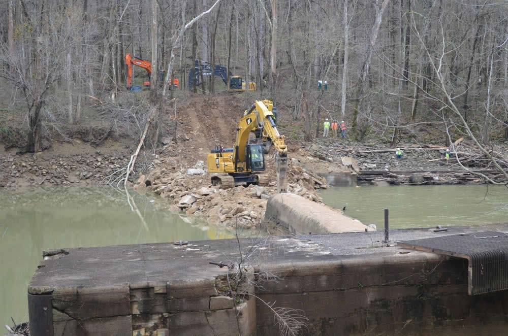
Green River Dam removal | The Nature Conservancy
In recent years, the U.S. Army Corps of Engineers’ Louisville District undertook an economic assessment of navigation dams on the Green and Barren rivers in Kentucky, and received Congressional approval to de-authorize (i.e., retire) five little-used locks and dams. Lock and Dam No. 6 was quickly removed from the Green River by the U.S. Fish and Wildlife Service (USFWS) – utilizing a construction crew that has successfully removed several dams throughout the southeast – in April 2017, due to its deteriorated condition and safety hazard. Other project partners included: Kentucky Department of Fish and Wildlife Resources, Mammoth Cave National Park, The Nature Conservancy and Kentucky Waterways Alliance. In addition to the project improving habitat for fish, mussels and invertebrates, the dam’s impoundment was filling a portion of Mammoth Cave National Park with water and sediment, and that part of the caves will now be accessible for important archaeological study. The project is precedent-setting for removing uneconomical, expensive federal navigation infrastructure and for the federal partnership between the Army Corps and USFWS.
Lower Eklutna River Dam, Eklutna River, AK
Originally built to provide hydropower, but no longer in use, the Lower Eklutna River Dam was removed in October 2017 in one of Alaska’s most ambitious habitat restoration projects ever. The Eklutna Native Corporation and the Native Village of Eklutna partnered with The Conservation Fund to work within a brief construction window in a 300-foot deep steep-walled canyon to open seven miles of the Eklutna River for salmon migration. This project has provided construction work for the local community, boosting the economy and helping to restore salmon runs that are vital for cultural heritage and sustenance.
Hamant Brook Lower, Middle, and Upper Pond Dams, Hamant Brook, MA
Hamant Brook after dam removal.
Three dams on Hamant Brook in Massachusetts were removed in Fall 2017 to allow native trout and endangered turtles access to important habitat. Hamant Brook runs through the Leadmine Conservation Area – 880 acres of protected municipal conservation land. The project includes work to improve public access to the protected lands, while removing a public safety hazard and improving habitat for fish and wildlife. The Hamant Brook Restoration Project is supported by the landowners (Town of Sturbridge and Old Sturbridge Village), in partnership with the Massachusetts Division of Fisheries and Wildlife, American Rivers, and the Massachusetts Division of Ecological Restoration.
Boardman Dam, Boardman River, MI
The Boardman River Dam removal is part of a larger restoration effort to address four barriers along the Boardman River in Michigan. This project not only removed an impediment to fish passage, but also improved a river crossing for local residents. Previously, the Brown Bridge Dam was removed in 2013, and plans are in place to remove Sabin Dam and modify Union Street Dam in the near future. The largest river restoration project in Michigan’s history, collectively the project will restore more than three river miles of native coldwater fish habitat, more than 250 acres of wetlands and nearly 60 acres of upland habitat.
For more information on 2017 dam removals, please see our full list.
American Rivers congratulates Erin McCombs as the winner of the 2018 Fred A. Harris Fisheries Conservation Award which is presented by the NC Chapter of the American Fisheries Society to individuals or organizations who have distinguished themselves in the conservation of fisheries and aquatic resources in North Carolina.

Photo by Nicole McConville (www.nicolemcconville.com)
This award recognizes her significant contributions to protect and enhance the natural resources and stream habitats in North Carolina. Erin will be presented the award at the Chapter’s Annual Meeting in February in recognition of her achievements under American Rivers’ River Restoration and Riverside Land Protection programs.
Erin works in American Rivers’ Southeast Region, largely in the Carolinas and Tennessee, to provide program development, technical assistance, project management, and general guidance in the planning, development and implementation of projects like dam removals and Blue Trails for the River Restoration and Riverside Land Protection programs. Read more about Erin’s work here.
The City of Fayetteville began as a small trading post named for the creek it was on: Cross Creek. In 1783, it was incorporated and renamed in honor of Marquis de Lafayette to celebrate his support during the American Revolution. The city grew over Cross Creek and began to embrace its location along the Cape Fear River.
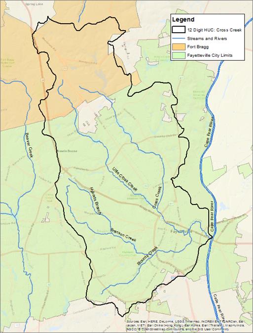
Cross Creek watershed, NC (click to enlarge)
Fayetteville was one of the most inland commercial ports in North Carolina with three locks along the Cape Fear allowing ships to make the trek. This commerce drove development in the City and eventually lured the U.S. Army to establish Fort Bragg there. Pope Air Force base was collocated there making the area one of the largest and fastest growing military installation in the country. It is home to the U.S. Army Forces Command as well has home base for the 18th Airborne Corps, the 82 Airborne Division, and U.S. Army Special Operations Command.
The growth of Fayetteville over the years consumed most of Cross Creek, ditching and channelizing it as it flows to the Cape Fear. As the city grew it put in a drainage system that sends all of its untreated stormwater runoff into the river and on downstream. Over the last five years the City has begun to realize the impact it is having on water quality and has begun to develop plans to reduce that negative impact.
Spurred by requirements of the federal Clean Water Act, in 2013 the City developed new goals to reduce stormwater pollution going into the Cape Fear River and creating an opportunity for our engagement with them to reinvent the way they manage stormwater. The leadership within the City has also embraced looking at how it manages its water resources in new ways which is best seen with the development and implementation of a Green Street retrofit of Person Street which runs through the core of downtown Fayetteville and drains to Cross Creek.
We have been working with the City and local and regional partners to develop a plan to restore Cross Creek and reconnect with the Cape Fear River. We are working with the City to fully embrace the use of green stormwater infrastructure to reduced polluted stormwater run-off into Cross Creek. The stream is also part of Fayetteville’s water supply network, using green infrastructure will help to protect its supplies from pollution while also regulating the amount of water that is available for water supplies. Flooding has become endemic in parts of the city due to huge amounts of run-off from the paved surfaces that have come to dominate the urban landscape, the use of green stormwater infrastructure will be focuses in area that are suffering from flooding as a way to mitigate those impacts. Our partnership with the City will yield both policy changes to reduce the barriers to using smarter green stormwater infrastructure and also incentives for the construction of on the ground projects. The end product will be an urban stream that is approachable by the community and is an enjoyable resource for everyone that encounters it.
This blog was co-authored by Fay Augustyn and Annemarie Lewis.
Every river, from the unsuspected stream trickling by to the largest river spanning a mile from bank to bank, has shaped memories and fueled stories between family and friends. Many of my fondest memories take place on or near a river. One of my favorites that I think back to often was a trip some time ago with my grandfather in Rocky Mountain National Park. As we hiked along the small stream that eventually grows into the mighty Colorado River, he shared with me many of his adventures, and how outdoor spaces like this make Colorado such a special place.
This past summer, I revisited this hike for the first time in over a decade. As I retraced our footsteps along this tiny stream, admiring the small trout moving from pool to pool, I was transported back to my teenage self and those moments with my grandfather. He was right – outdoor spaces, like rivers, whether in quiet, wild environments, or busier urban settings – connect us to the people we are with and the spaces we are in. These outdoor spaces deserve to be protected and enjoyed.
2018 marks the 50th anniversary of the Wild and Scenic Rivers Act, and today, thanks to the work of river advocates across the country, the National Wild and Scenic Rivers System safeguards more than 12,700 miles along parts of 208 rivers. Because 2018 marks the 50th anniversary of the act, American Rivers, American Whitewater, and other partners are launching their boldest river protection effort ever: 5,000 Miles of Wild.
In this week’s episode of We Are Rivers, we describe the impact we will make through the 5,000 Miles of Wild® campaign – including the protection of an additional 5,000 river miles and collecting 5,000 of your river stories. Stories cultivate and spread passion: your stories will illustrate the personal and cultural values of rivers to policy makers, and you can help the campaign by posting your own story here!
In the spirit of 5,000 Miles of Wild®, We Are Rivers host, Annemarie Lewis shared her river story with me, which involved the scariest moment of her life.
I was darkly submerged under water, inverted and struggling to unjam my foot from a crevasse in the bottom of a flipped dory. Over 200 river miles into the heart of The Grand Canyon, I will never forget how long seconds can drag when blood craves oxygen. This may not sound like a reasonable favorite river memory, but everything ended up okay, and, that night, I wrote in my journal: “To be reminded of a river’s raw power, I am humbled.” Somehow, I feel further impassioned to pursue adventures involving water. Perhaps this is why so many return to the river year after year, not for the comfort or for the luxury or pictures, but for the rawness of the moment and the uninsured outcome. This is incredibly grounding: the pull of the incalculable unknown, the pull that can be complex and dangerous, but also as simple as sitting by a river’s edge and contemplating the story of passing water. Let these moments be enough.”
Whatever your river story may be – a particularly joyful moment, a humbling experience, or a wild adventure, American Rivers looks forward to reading your own river story! Join us in listening to our new podcast episode to learn more about the 5,000 Miles of Wild® campaign and hear stories from river advocates and lovers from across the country.
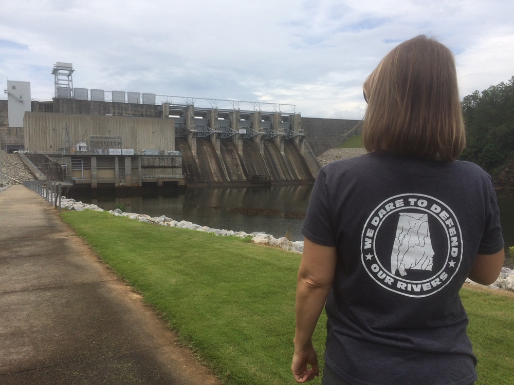
This is a guest blog by Alabama Rivers Alliance’s Cindy Lowry.
This may surprise you, but I had never been in a real live court room until January 12, 2018. That was the day I attended the oral arguments for American Rivers, Alabama Rivers Alliance, et al. v Federal Energy Regulatory Commission (FERC) and U.S. Fish and Wildlife Service. Before I tell you how exhilarating my court experience was (and I was merely a spectator), I should tell you how we all ended up there in the first place.
Dams and the Coosa River
From its headwaters in Georgia, the Coosa River flows through Alabama to form the Alabama River. These mighty waters flow on through the Tensaw Delta into Mobile Bay and, ultimately, the Gulf of Mexico. Rich in aquatic biodiversity, it is the fourth largest basin in the country with regards to stream flow.
Construction of the dams on the Coosa River wiped out more than 30 freshwater species – one of the biggest extinction events in North America during the 20th century. The decades that followed have seen a continuing decline in biodiversity and the loss of endangered species and habitat due to the dams’ impact on the flow of water and the river’s lack of oxygen.
The Basics of Hydropower Relicensing
 The relicensing of a hydropower dam is a great example of our nation’s environmental laws put into practice to protect our water and wildlife. From the National Environmental Policy Act to the Endangered Species Act to the Clean Water Act, this process “touches” them all. This is not by accident, of course. When you place a large structure like a dam in the middle of a flowing river, you permanently alter the habitat and the lives of all things that live in and around that body of water. These licenses can last anywhere from 30 to 50 years, so stakeholder participation happens once in a generation. The initial licenses occurred before most environmental laws were enacted. This is why participating in the process now is so important.
The FERC relicensing process requires multiple stakeholder meetings, a series of official steps from appropriate state and federal agencies (such as a water quality certification from the state and a biological opinion from the U.S. Fish and Wildlife Service if endangered species are affected) as well as opportunities for public comments from stakeholders. The company seeking the license is central to the process and has many requirements to meet in order to complete the steps to get a new license. The process is designed to allow for necessary studies to be conducted and the concerns raised to be addressed before the final license is issued.
Alabama Rivers Alliance Involvement in Relicensing
My organization, the Alabama Rivers Alliance, became involved in the relicensing of the Alabama Power hydropower dams on the Coosa River from its beginning, in the early 2000s. The license for this river is not for just one dam, but SEVEN dams. Our interest is and has always been ensuring that there is a balance between the power and non-power uses of the river, such as aquatic species habitat, water quality, and recreation. American Rivers has been a vital partner throughout this process.
On June 2, 2010, American Rivers rated the Coosa as the tenth most endangered river in the United States. The main threat, they said, was the hydropower dams. In its 2013 report The Seven Sins of Dam Building, the World Wildlife Fund included the Coosa River’s dams as one of the world’s worst examples of the impacts of dams to biodiversity.
Since the beginning of our participation in the stakeholder meetings and public comment opportunities for this license more than 15 years ago, we have asked for more thorough environmental studies to ensure protections are in place to balance the river’s ecological needs with hydropower production.
You can imagine our surprise when the biological opinion was issued with a finding of “no significant impact”, despite clear impacts to rare, threatened and endangered species. Then in 2013, FERC issued the new license with inadequate requirements for improving dissolved oxygen and river flows below the dams, and none of the studies needed to show that these dams would not continue to contribute to the further decline of the Coosa River system.
After a series of legal steps, we found ourselves in front of three judges in Washington D.C. with our lawyers making the same arguments and the same requests for remedy that the river has always needed and that we have been asking for more than a decade. I found myself exhilarated by the legal process happening all around me.
Our Day in Court
My first stop in Washington D.C. was the hotel where our attorneys with the Southern Environmental Law Center were prepping for the case. Not being a lawyer myself, I was fascinated about how all of this works. I learned that they only have 15 minutes to make our case to the judges and in that time period, the judges will be firing questions at them for clarification and understanding. I quickly assessed that my decision early in life to not become a lawyer was the right one, and I was proud to watch the two female attorneys who were around my age working so diligently on our case. I was glad they made the decision they did. I felt very good about our chances after watching Megan Huynh and Sarah Stokes in action.
The next day we gathered in the courtroom to watch with much anticipation. The action did not disappoint. Once again Megan and Sarah impressed me and the judges did exactly as I was told they would in asking their questions, assessing the arguments, and remaining professional yet expressionless in the process. I was encouraged by the number of pointed questions the judges asked attorneys representing FERC and the US Fish and Wildlife Service. The entire hearing was over in less than an hour. All I could think was how badly I wanted a decision after more than 15 years of trying to get what we strongly believe this river system truly needs.
Unfortunately, the law is a complicated process and the wheels of justice grind slowly, so we will have to wait – perhaps for months – to hear the judges’ decision. We will be ready.
It’s All Worth It
I spent some time after the courtroom adventure trying to reflect on why the whole thing gave me such intense energy and excitement. I realized it was because I was experiencing the feeling of actually contributing to something that could possibly save entire species of freshwater snails and mussels from extinction and it felt real to me. This is one of the reasons I do what I do. In her book, Immersion: The Science and Mystery of Freshwater Mussels, Abbie Landis writes: “When a waterway changes, mussels are the first to know….mussels’ peril is our own. We need the same thing – plentiful clean water in healthy creeks and rivers.” I felt this peril in that courtroom that day and I left with the hope that all of our time was worth it if we can improve this license and, thus, the health of the Coosa River for generations to come.
 Author: Cindy Lowry
Cindy Lowry is the executive director of the Alabama Rivers Alliance. She joined the staff in 2005 as Watershed Leadership Coordinator and took the helm as Executive Director in 2007.