Dams! Be they small ones that clog tributary streams or vast hydropower developments that impact hundreds of river miles, dams profoundly impact rivers by altering natural flows, impairing clean water, harming wildlife, and limiting river recreation.
This summer American Rivers and our partners celebrated two great successes for rivers in the Southeast involving hydropower dams. Benefits to the Broad River in South Carolina and the Coosa River in Alabama were achieved through the federal relicensing process for hydropower dams. Yet, how those victories came about differs greatly.
Federal licenses for dams last a generation or longer
The relicensing process for non-federal hydropower dams, those operated by electric utilities, municipalities or private entities, provides a once in a generation opportunity to improve the way these dams operate and undo environmental damages. Conditions for new operating licenses can be one of the most effective tools for improving the health of rivers that have been impacted by hydropower dams.
Non-federal hydropower dam operators are required to get licenses that balance hydroelectric generation with environmental protections such as improving downstream river flows, safely passing migratory fish around (or over) dams, enhancing dissolved oxygen levels in water discharges, and creating new recreational opportunities. The licenses are issued by the Federal Energy Regulatory Commission (Commission) and last from 30 to 50 years! Relicensing dams when their current licenses are set to expire provides opportunities to improve for decades the way these dams operate to protect, restore and enhance rivers.
Perhaps in no other region is this more important than in the Southeast where new licenses have been required for a myriad of large dams built primarily from the early 1900s to the 1950s.
Reaching agreement for improving the Broad River
One highlight of the settlement is a nearly three-fold increase in downstream flow requirements during spring months on the Broad River. | Ron Ahle
Our first reason for celebration is the signing of a comprehensive relicensing settlement agreement for the Parr Shoals Hydropower Project on the Broad River upstream of Columbia. Operated by South Carolina Electric and Gas Company, flows passing through the dam contribute virtually all water for 26 miles of the Broad River and most of the water for 50 miles of the Congaree River. The dam also creates Parr and Monticello Reservoirs, totaling 11,100 acres. The settlement agreement provides a set of consolidated recommendations for new license conditions to the Commission. Signatories include the power company, American Rivers, Congaree Riverkeeper, US Fish and Wildlife Service, National Marine Fisheries Service, SC Department of Natural Resources and other stakeholders.
Highlights of the settlement include:
- a nearly three-fold increase in downstream flow requirements during spring months from the current 800 cubic feet per second to 2,300 cubic feet per second
- downstream flow requirements of 1,000 cubic feet per second during the remainder of the year, more than six times more water than currently required
- fish passage for American shad
- extensive investment in new equipment by the power company to reduce unnatural downstream flow fluctuations and meet state dissolved oxygen standards in flow releases
- protection of over 1,000 acres of riverside lands
- improved recreation facilities for boaters, anglers and campers
The settlement also establishes a mitigation fund for environmental enhancements to offset impacts to fish and wildlife and recreation caused by Parr Reservoir water level fluctuations. Tied to the amount of generation, the fund would be valued at approximately $4 million if a 40-year license were issued.
If accepted by the Commission, which usually adopts recommended terms of comprehensive settlement agreements, the above improvements would start after a new license is issued. The current project license expires in 2020.
The Parr Shoals relicensing process is a testament to the collaborative approach adopted by South Carolina Electric and Gas Company so that a comprehensive settlement agreement could be reached with local stakeholders that balances environmental benefits with power generation.
Winning in Court to Protect the Coosa River
The construction and operation of the Coosa River dams resulted in one of the largest mass extinctions of the 20th Century. | Coosa Riverkeeper
Our Alabama success followed a much different path. The Coosa Hydroelectric Project consists of seven dams affecting 225 miles of the Coosa River. The construction and operation of these dams resulted in one of the largest mass extinctions of the 20th Century with over 30 aquatic species being lost. Once one of the most biodiverse rivers in North America, additional species of freshwater mussels, snails and fish continue to be threatened by these dams. Several of these species are either listed or are being considered for listing under the federal Endangered Species Act.
The Coosa relicensing was derailed by distrust and non-cooperation. Rather than take the collaborative approach used by South Carolina Electric and Gas Company, Alabama Power Company – which operates the dams – ignored issues raised by stakeholders and didn’t complete adequate studies for a new license.
American Rivers and our conservation partners Alabama Rivers Alliance and Southern Environmental Law Center were actively engaged in the relicensing of these seven dams from the initial meetings through the new license being issued. Throughout the process we recommended studies to assess impacts of the dams, reviewed technical reports and issued written comments which consistently called for sound scientific information, thorough assessment of impacts, rare species protection, healthy river flows, and improved dissolved oxygen levels. Our recommendations were ignored first by Alabama Power, then by US Fish and Wildlife Service and finally by the Commission.
The Coosa was once one of the most biodiverse rivers in North America.View of the Coosa River in Wetumpka, Alabama. | Southern Environmental Law Center
Alabama Power submitted a license application to the Commission that failed to protect the region’s rich biodiversity. Analysis showed that the company’s proposed operations could harm up to 100% of certain species protected under the Endangered Species Act. The license application also failed to include measures for raising dissolved oxygen levels to meet state standards and would only minimally increase flows in the Weiss Bypass, a 20-mile river reach that harbors endangered species from which most all flow is diverted by the hydropower dams.
The Fish and Wildlife Service did no better. The Service kotowed to Alabama Power and issued a biological opinion that ignored the impacts to species protected under the Endangered Species Act and supported the power company’s flawed license application.
The Federal Energy Regulatory Commission also failed to live up to its regulatory responsibilities and issued a 30-year license to Alabama Power that by and large adopted the harmful terms favored by the power company.
So how is this something worth celebrating?
Instead of folding, the conservation groups acted. We filed a lawsuit in federal court against the Commission and Fish and Wildlife Service for violations of the Endangered Species Act, Federal Hydropower Act, and National Environmental Policy Act.
Weiss Reservoir behind Weiss Hydropower Dam. | Pamela [Flickr CC]
A most effective tool for improving river health
Be it through settlement agreements or legal challenges, these examples demonstrate how relicensing can be one of the most effective tools for improving the health of large rivers damaged by hydropower dams. Recognizing this, American Rivers has been the national leader for reforming hydropower dam operations since the 1990s. These new licenses will help protect endangered species, restore river flows, improve oxygen levels and enhance recreation opportunities after more than 80 years of impacts to rivers in South Carolina and Alabama. These successes which came after years of hard work by American Rivers and our partners are surely worth celebrating!
This guest blog was written by Louise and Reese Partridge. It is a part of our blog series on America’s Most Endangered Rivers® – Pearl River.
The Rankin-Hinds Pearl River Flood Control and Drainage Control District has proposed a dam and lake construction project to manage flooding along Jackson, Mississippi’s urban reach of the Pearl River. This project would widen the river and fill 1,000 acres of wetland habitat now home to mammals, fish and birds.
Lower Pearl River | Photo: Bonny Schumaker, via On Wings of Care
The Jackson Audubon Society (JAS) is concerned about Prothonotary Warbler habitat being lost to the lake development, which would condemn preferred nesting areas along the Pearl River at Lefleur’s Bluff. It would represent another incremental loss of unique and vanishing natural habitat to developers — trading our natural heritage for a return on capital.
In 1998, JAS members embarked on a new bird conservation project to benefit one of the signature migratory songbirds of the southern swamplands: the bright yellow, highly vocal Prothonotary Warbler. No song is more pervasive and insistent than the, “zweet zweet zweet,” of these vividly-colored birds known affectionately as swamp canaries.
Prothonotaries use nest cavities in decaying trees which they line with fresh moss. Nest boxes offer reliable substitutes when cavities are scarce. In Jackson, the suitable nesting area includes the backwater swamps along the Pearl River as it flows through LeFleur’s Bluff State Park. The park is designated as an Important Bird Area (IBA) by the Audubon Society.
Each February, Audubon members make a pilgrimage to the park’s wetlands to clean out and repair the boxes before the birds begin arriving from their wintering grounds in Central and South America. Volunteers have observed nesting success in about 2/3 of boxes.
Cornell University considers the Prothonotary Warbler a species of, “high conservation concern.” The American Bird Conservancy’s watchlist states, “restoration of forested wetlands in the southeastern U.S. (is) the most important conservation measure(s) that would protect this warbler.”
We hope that the U.S. Army Corps of Engineers, public officials and park users will come to understand the full implications of this potential loss of priceless riverside habitat.
Please join American Rivers by September 6, 2018, in asking the U.S. Army Corps of Engineers to reject the Rankin-Hinds Pearl River Flood Control and Drainage Control District’s new dam project.
[su_button url=”https://act.americanrivers.org/page/6408/action/1″ background=”#ef8c2d” size=”4″ center=”yes”]Take Action »[/su_button]
Author: Louise and Reese Partridge
Reese Partridge is a retired attorney and member of the Jackson Audubon Society. The Partridges live near Jackson, Mississippi.
Dam removal can be simple. Or complicated. Or somewhere in between.
Here at American Rivers, our River Restoration Team likes to celebrate our successes with a boisterous WOO HOO! I think everyone somehow feels invested in the WOO HOOs of our teammates. We’re out there making things happen on the ground. Bringing rivers back to life. That deserves a WOO HOO, right?
Delp Dam Project
In June, I worked on a project up in Telford, Pennsylvania, removing the Delp Dam (aka Swartley Mill Dam and Keller Creamery Dam) on Indian Creek, a Delaware River tributary. This structure was part of an old mill that was no longer in use and in poor shape. In fact, about a week before construction began, a storm carved around the end of the dam to the bedrock, forming a breach and draining the impoundment. That made our lives a bit easier, as most of the dam removal itself was able to be completed on more or less dry land (woo hoo!).
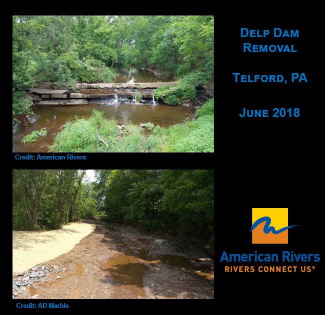
This concrete dam was removed as compensatory mitigation for construction on the Northeast Extension of the Pennsylvania Turnpike. Removal of Delp Dam will open 2,600 linear feet of Indian Creek and restore natural form and function to a stream that supports habitat for fish and wildlife. American Rivers, the PA Turnpike Commission and the PA Fish and Boat Commission are the primary partners for this project.
In this first phase of the project, we removed the dam and stabilized the banks, although we were happy to discover that one of the banks was largely bedrock near the dam (that means it won’t be undercut by river flows). Over the course of the next year, we will see how the river adjusts itself through storm events and see if any additional work needs to be done to ensure a solid sustainable project. Directly downstream of this dam is a bridge crossing, so we want to be sure that the dam removal does not compromise that structure in the long-term. So far, everything looks great! Woo hoo!
Krady Mill Dam Project
In July, I hopped on over to Columbia, Pennsylvania, home of the National Watch and Clock Museum and home base of Turkey Hill (for any iced tea and ice cream lovers out there). This was another low-head former mill dam removal project on Chiques Creek, a Susquehanna River tributary, known as the Krady Mill Dam. This dam was built in the late 1800s to provide water power to a historic mill (still onsite). The concrete dam was approximately 5 feet high by 100 feet long. The dam was disconnected from the mill and no longer was serving a useful purpose.
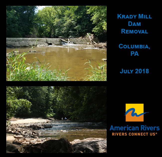
Removal of Krady Mill Dam has opened 2.9 river miles and restored natural form and function to a stream that supports American eel, resident fish and historic migratory fish runs. Woo hoo! American Rivers, the PA Fish and Boat Commission and the National Fish and Wildlife Foundation are the primary partners for this project.
Both of these projects removed safety hazards for their communities and eliminated the liability for owners. So many low-head dams have injured or killed people recreating around them. In fact, American Rivers is going to be removing a killer dam in Patapsco Valley State Park in Maryland starting in a couple of weeks! Woo hoo! (Stay tuned for more information on that project soon.)
ENTER: Storms for days. And days. And days.
The best laid plans… something something… woah.
Anyone living in the Mid-Atlantic region of the U.S. likely has experienced a deluge of rain this spring and summer. Well, as soon as we completed the Krady Mill Dam removal last month, Pennsylvania got hit with a major flood in many watersheds, including Indian and Chiques creeks.
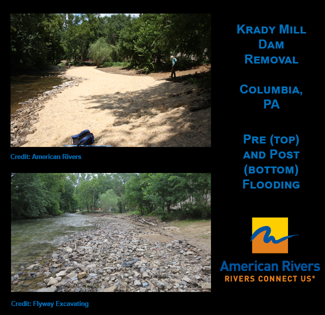
It was frustrating that we didn’t have more time for vegetation to establish at Krady Mill. As you can see, a lot of our matting washed up and got tangled with debris (woah!). In this case, we have decided to clean up the site and let nature take its course for a while. We will revisit the site next summer to see if any additional work needs to be done once the river channel settles a bit. In reality, our floodplain seemed to act as it was designed, so we were happy to see that (woo hoo!). We will see what Mother Nature sends our way in the coming months.
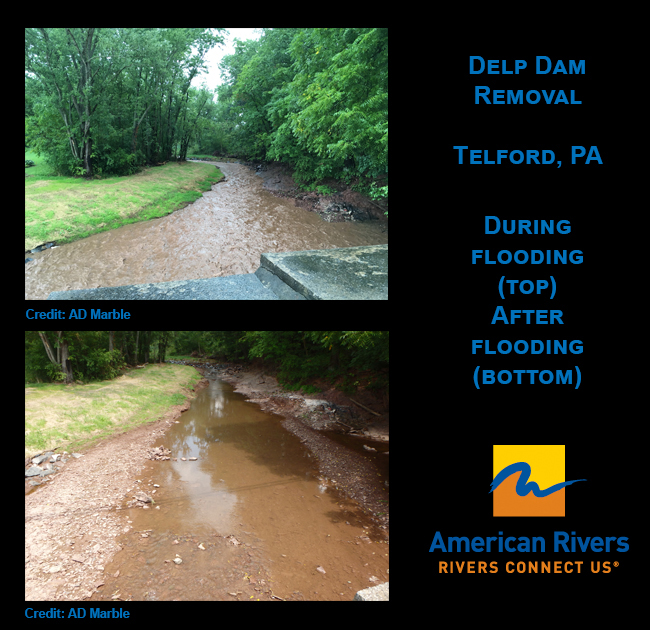
At the site of the former Delp Dam, things faired pretty well. Our dam owners did not experience flooding in the mill building, as they would have in the past, so they were happy about that (woo hoo!). The river will likely continue to adjust and move a little bit as storms come through until it finds its new normal. We will also revisit this site in summer 2019 to see if any further work needs to be done to ensure the long-term sustainability of the restoration work. It is great to see this site greening up already! WOO HOO!
Hooray – National Public Lands Day is on September 22 this year! Whether you’re looking to gain service hours, meet new people or spend a day outside with your family and friends, this is the opportunity for you! National Public Lands Day combines two of our favorite things: free access to our favorite public lands and waters AND hundreds of opportunities to volunteer.
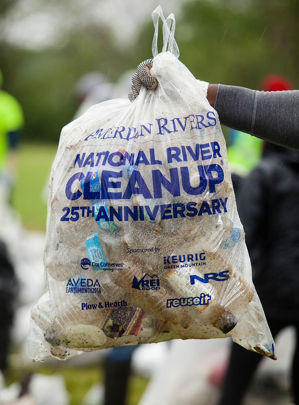
In 1994, this day was established as a day of service. Starting with 3 sites and 700 volunteers (yes, only 700), the day has turned into one of the largest volunteer days in the country. According to National Environmental Education Foundation, 169,000 volunteers participated and contributed 680,000 hours of service at over 2,100 sites across the U.S. in 2017.
A volunteer cleans up trash on Theodore Roosevelt Island (U.S. National Park Service). | Rebecca Long
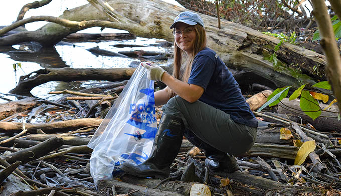
Volunteers can participate in public land improvement projects such as trash cleanups, trail maintenance, tree plantings and other restoration projects. Many volunteer opportunities are provided through participating federal agencies, including Bureau of Land Management, Department of Defense, Environmental Protection Agency, National Park Service, U.S. Army Corps of Engineers, Fish and Wildlife Service and Forest Service. Volunteer opportunities can also be found through your city, state, county, school and local park departments. American Rivers encourages everyone to sign up to volunteer or organize your own public lands cleanup through our National River Cleanup© program. Cleaning up our public lands and waters helps remove hazardous debris which threatens our wildlife, rivers and each other.
More Fun Facts about National Public Lands Day:
- National Public Lands Day is celebrated every year on the 4th Saturday in September. This year marks the 25th anniversary of National Public Lands Day and is also the first day of fall!
- The National Park Service is one of the largest providers of volunteer opportunities on this day.
- Some agencies and groups celebrate by providing volunteer and educational opportunities throughout September and October.
- This day is organized by the National Environmental Education Foundation in partnership with several federal agencies including Bureau of Land Management, Department of Defense, National Park Service, U.S. Army Corps of Engineers, U.S. Environmental Protection Agency, U.S. Fish and Wildlife Service, and U.S. Forest Service.
Register your cleanup with us and we can send you free bags! | Chesapeake Bay Program
So mark your calendars for September 22 and join American Rivers and our partners to help clean up our public lands and waters. Thinking of hosting your own cleanup? American Rivers offers free trash bags to anyone who registers their cleanup with us.
- Organize a cleanup with National River Cleanup, or sign up for an existing cleanup near you.
- Learn more about recycling with our National River Cleanup recycling guide.
- And more!
This guest blog was written by Dr. Jennifer Coulson. It is a part of our blog series on America’s Most Endangered Rivers® – Pearl River.
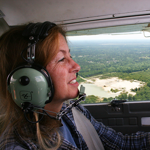
The lower Pearl River feels like home to me — I’ve been surveying it for over two decades.
My work involves searching for the Swallow-tailed Kite, a rare, breathtakingly beautiful raptor. The lower Pearl River Basin is one of its few remaining strongholds along the Gulf Coastal Plain. From a Cessna 150 (a small, two-seater airplane), a bald cypress full of roosting kites resembles a Christmas tree, where the kites’ white heads gleam in the early morning light like glowing ornaments.
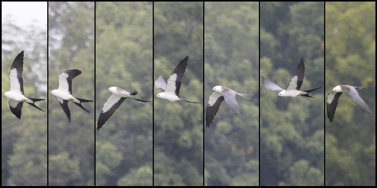
Swallow Tailed Kite in flight | Paul Hurtado
A bird’s eye view from the airplane makes it easy to appreciate how the habitat changes with decreasing elevation. As we follow the Pearl River southward, upland pine and mixed pine-oak-hickory forests with their red, earthen bluffs, give way to flatter, seasonally flooded bottomland hardwood forests. Farther south, the bottomlands are replaced by lower, permanently flooded cypress-tupelo swamps. Where the elevation drops so low that it can no longer support trees, the grassy, freshwater marshes thrive. Nearing the coast, these are replaced by brackish and then salt marshes and open water.
Along our survey route, the Pearl River splits into several Pearls (East, Middle, West), as its braided system nourishes vast expanses of wetlands with life-giving nutrients, sediment and freshwater. The rivers of the Pearl eventually feed the fisheries present in Lake Borgne, the Mississippi Sound and the Rigolets. The Rigolets estuary is a particularly important nursery for fish, crabs and shrimp.
Although upstream, the proposed One Lake project’s dam and reservoir would disrupt the lower Pearl’s elevational gradient by reducing the downstream flow of freshwater and sediment. These losses would exacerbate the existing threats of subsidence, sea level rise and salt water intrusion. The end result would be degradation and loss of wetland habitats and wildlife.
Other problems are the low water sills and a defunct bypass, the Pearl River Navigational Canal. These structures impede the migration of 15 species of fish including the paddlefish, striped bass, several species of catfish, and the federally threatened Gulf Sturgeon. The proposed reservoir could further impact the ecosystem functions of the Pearl. Instead, we need to demand its restoration and protection.
Please join American Rivers and Gulf Restoration Network by September 6, 2018, in asking the U.S. Army Corps of Engineers to reject the Rankin-Hinds Pearl River Flood Control and Drainage Control District’s new dam project.
[su_button url=”https://act.americanrivers.org/page/6408/action/1″ background=”#ef8c2d” size=”4″ center=”yes”]Take Action »[/su_button]
 Author: Jennifer Coulson, Ph.D.
Jennifer Coulson, Ph.D., is the President of the Orleans Audubon Society whose mission is dedicated to the preservation and conservation of wildlife and wild places of the southeastern U.S. and to fostering an understanding and appreciation of nature.
On August 16, American Rivers won a huge victory in our lawsuit challenging the Trump administration’s attempt to suspend the Clean Water Rule.
This was a tremendous win for protecting rivers, wetlands and clean drinking water nationwide. The court made clear that the Trump administration cannot ignore the law, science, or the views of the American people in its rush to undermine protection of rivers and clean water.
What’s the Clean Water Rule?
The Clean Water Rule is an Obama-era rule that protects the small streams and wetlands that are the drinking water sources for one in three Americans. Safeguarding these waters is critical, not only for our drinking water, but for flood protection and fish and wildlife habitat. The rule protects streams and wetlands from pollution, filling, and other degradation that would harm the environment and downstream communities.
The Court Ruling
The federal district court in South Carolina granted our motion for summary judgment, ruling that the administration’s attempted suspension of the rule failed to comply with the rulemaking requirements of the Administrative Procedure Act.
Specifically, the court ruled that the administration failed to provide adequate opportunity for the public to comment on the proposed suspension and failed to consider the merits of the Clean Water Rule before trying to suspend it. The court said that, while administrations and regulatory priorities may change, they must comply with the law in making those changes. The court issued a nationwide injunction against the suspension of the Clean Water Rule because of the national impact on rivers and wetlands. The court cited my affidavit as American Rivers CEO, in which I listed the many different states where I have fished that would be affected by the suspension of the Clean Water Rule.
What’s next?
The federal district court’s decision is not the final word. The administration or industry will likely appeal the decision, other litigation is ongoing, and the administration will undoubtedly continue its efforts to repeal and replace the Clean Water Rule. Also, there are other injunctions in place from two other lawsuits brought by several states, blocking the implementation of the Clean Water Rule in 24 states. Ultimately, these issues will be resolved by the Supreme Court, by Congress, or by a future administration. But today’s ruling makes clear that the current administration, like any other, is bound by law in pursuing its effort to repeal and replace the Clean Water Rule.
Thank you to all of our supporters who make possible our ongoing work defending rivers and clean water. We are also grateful to the Southern Environmental Law Center which is representing American Rivers in this litigation.
Water in the West is inherently complicated. A complex web of laws, compacts, and a little thing called “prior appropriation” dictates how and when people and entities are allowed to use water in the West, such as cities and towns, farms and ranches, and industry. This ability is what we call “owning a water right,” and explains much of how the West has been settled over the last century, and how many of the economic forces that affect our daily lives are driven by these water rights. Listen in to learn more about how water law affects you and the rivers you love.
Prior appropriation is the backbone of our water law system. Perhaps you’ve heard of “first in time, first in right,” – this phrase refers to the water law system. Prior appropriation allows individuals or entities who first apply water for a beneficial use to be entitled to that appropriation into the future (and has priority over subsequent users). Holding a water right doesn’t actually imply ownership over the water (water in Colorado is “owned” by the people) but is instead the right to use the people’s water for a beneficial use like agriculture, municipal water, and now more recently, in benefit of the environment as in-stream flows.
Even if the term “water rights” leaves you scratching your head, and you call a western state your home, you still are impacted by them. There’s a fairly high chance that you use water connected to a water right, (unless you have your own well or diversion). Water running through pipes in cities and towns across the West are likely municipal water obtained through a water right held by city or town. Your community has to have a water right themselves to divert and distribute the water that ends up in your home. Agriculture, industry, and even our rivers and streams all depend on the legal structure managing our water.
Join us in this month’s episode of We Are Rivers as we navigate through the complicated nature of water law in the West, including prior appropriation, instream flow rights, and the history of water law.
This is a guest blog by Gregory Fitz.
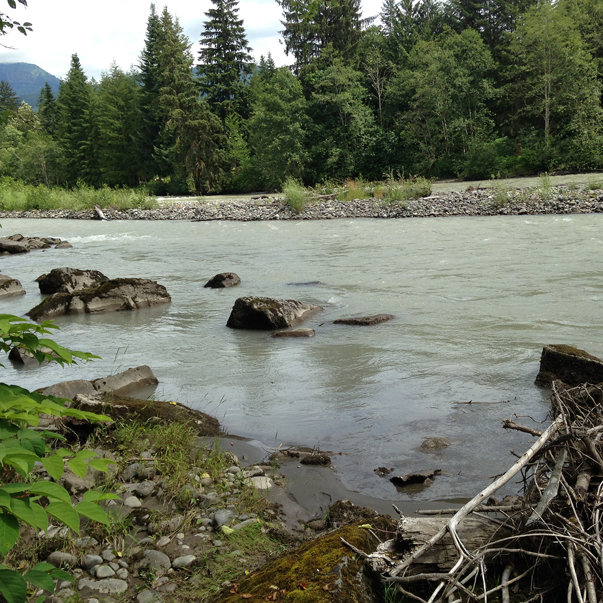
In October of 1968, President Lyndon B. Johnson signed the National Wild and Scenic Rivers Act into law. The legislation had been sponsored in Congress by Senator Frank Church of Idaho. The National Wild and Scenic Rivers system was conceived around the remarkable idea that some rivers were so valuable to the cultural and environmental legacy of a region that they, and some of their surrounding area, should be preserved as natural, free-flowing waterways for the benefit and enjoyment of future generations. Since then, almost 13,000 miles of 208 rivers across the country have been protected. Six of those rivers are in Washington.
To celebrate the 50th Anniversary of the National Wild and Scenic Rivers Act, we’re going to spend some time over the course the year telling the stories of Washington’s designated rivers: Illabot Creek, the Klickitat River, the Pratt River, the Skagit River, the White Salmon River and the Middle Fork of the Snoqualmie River. Each is a unique part of Washington’s astounding network of rivers and each earned its designation in the national system through the hard work and foresight of advocates.
In this second installment of our series, we’ll take a closer look at Southwest Washington’s beautiful Klickitat River.
The Klickitat River
The headwaters of the Klickitat River originate in the Goat Rocks Wilderness on the east side of the Cascade Range. It flows south through the Yakama Indian Reservation and gains water from the glaciers of Mount Adams and Gilbert Peak along the way. In the heat of summer, those melting glaciers raise the flows and stain the water with till. The river is approximately 95 miles long and the watershed drains almost 1300 square miles. It joins the Columbia River near the town of Lyle, Washington.
The Klickitat River hosts a popular summer steelhead and fall chinook fishery. | Photo: Brian Bennett/Moldy Chum.
The mouth of the Klickitat is upstream of the White Salmon River on the Columbia River and downstream of the historic Celilo Falls, which is now submerged behind the Dalles Dam. Along most of its route, it tumbles through a broad valley filled with dry pine forest. In its final few miles, the river constricts through a narrow, rocky gorge before pouring over Lyle Falls.
The river is named for the Klickitat people, the Shahaptian Tribe who inhabited the area before the arrival of people of European descent. The Klickitat people fished the river for generations, and like Celilo Falls once was, the river’s gorge remains an important site of Native American dip-net fishing.
National Wild and Scenic Rivers Designation
The final 10.8 miles of the lower Klickitat River were added to the National Wild and Scenic Rivers System in November of 1986. This section of the river runs from the confluence with Wheeler Creek to the Klickitat’s mouth at the Columbia River. It, and the first section designated on the White Salmon River, were recommended for protection following the establishment of the Columbia River Gorge National Scenic Area.
In the Environmental Impact Statements recommending Wild and Scenic designation for the lower Klickitat, the river’s fish habitat, dramatic basalt gorge and the cultural significance of the dip-netting fishery were listed as outstanding and remarkable reasons to keep the river free-flowing and protected. To gain further insights into the process, we spoke with Bob Ratcliffe at the National Park Service (NPS) in Washington, DC.
When the Klickitat was being considered for Wild and Scenic River designation in the mid-1980s, Ratcliffe was working for a company called Land and Water Associates. He was among the large team of advocates and researchers who would go on to complete the Environmental Impact Statement and draft the Management Plan for the Klickitat River. The team recognized that a grassroots effort and close collaboration with the local communities would be the best way to encourage investment and participation in the program. They held public meetings and met with local constituencies. Over the course of a couple years, they had conversations with tribes concerned about protecting fishing rights on traditional grounds, sport anglers, loggers, ranchers and other people living and working in the Klickitat basin.
A late fall day with a wild Klickitat River summer steelhead to hand. Photo: Brian Bennett/Moldy Chum.
Throughout the process, Ratcliffe and his peers looked to the “Partnership” Wild and Scenic Rivers in the eastern part of the U.S. as inspiration. That management model seeks to bring county land managers, private land owners, watershed groups and other vested communities into dialogue around rivers that would benefit immensely from protection and free-flowing status, but aren’t primarily encompassed by federal land. Those rivers depended on local partners and collaborators to opt to preserve the watershed in Wild and Scenic status and commit to co-manage the river with a combination of federal, state and local agencies.
In the end, the process was a success. After many hours of meetings and negotiations among user groups and local communities, the U.S. Forest Service (USFS) accepted the management plan’s recommendation to designate the lower 10.8 miles of the Klickitat River as a Wild and Scenic River.
The Wild and Scenic Klickitat River: Today
The Klickitat River remains a beloved and well-traveled tributary of the Columbia River Gorge. Its proximity to Portland, Hood River and even Seattle means that it is a popular destination among kayakers, rafters and fisherman. It has great habitat and good water quality. There are a number of small communities along its length, but it also has long sections with little or no development in the riparian zone. Logging has been relatively limited in the river valley in recent years.
Summer and winter steelhead are native to the Klickitat. It used to host a strong native run of spring Chinook as well, but those populations are struggling, along with both runs of steelhead. Seasons for those species are truncated or closed. Hatchery produced summer steelhead, fall chinook and coho have been introduced to the watershed and are now successfully spawning, with mixed results in terms of intermingling with the wild fish populations. The river still supports a tribal dip-net fishery at Lyle Falls.
Popular with hikers and fisherman, a rail line between the towns of Lyle and Goldendale was abandoned by the railroad company in 1992 and soon reborn as the Klickitat Rails-to-Trail. It is a wonderful way to walk a long stretch of this beautiful Washington Wild and Scenic River.
Next month, we’ll be profiling the Middle Fork Snoqualmie and Pratt Rivers, two more of the six Wild and Scenic designated rivers in Washington.
In celebration of the 50th Anniversary of the Wild and Scenic Rivers Act, we have teamed up with a number of partners and outdoor gear companies to collect 5,000 wild-river stories and to protect 5,000 more miles of such rivers nationwide. Share your story and learn more.
For the past two-and-a-half years, American Rivers has been actively participating in the Washington Department of Natural Resources’ (DNR) Baker To Bellingham Recreation Planning, a process developed with local community input and the help of a citizen-based recreation planning committee, with the end goal of developing a plan to guide hiking, mountain biking, river recreation and horseback riding on approximately 86,000-acres of DNR-managed working forests across the Whatcom County area for the next 10 to 15 years.
From now through August 26, 2018, DNR is accepting comments on the Draft Baker to Bellingham Non-Motorized Recreation Plan.
While the majority of this plan focuses on access to hiking, mountain biking and horseback riding trails, a two-acre river access site on the North Fork Nooksack River near the community of Maple Falls was identified and recommended by the planning committee, and included on the final concept map found in the draft plan.
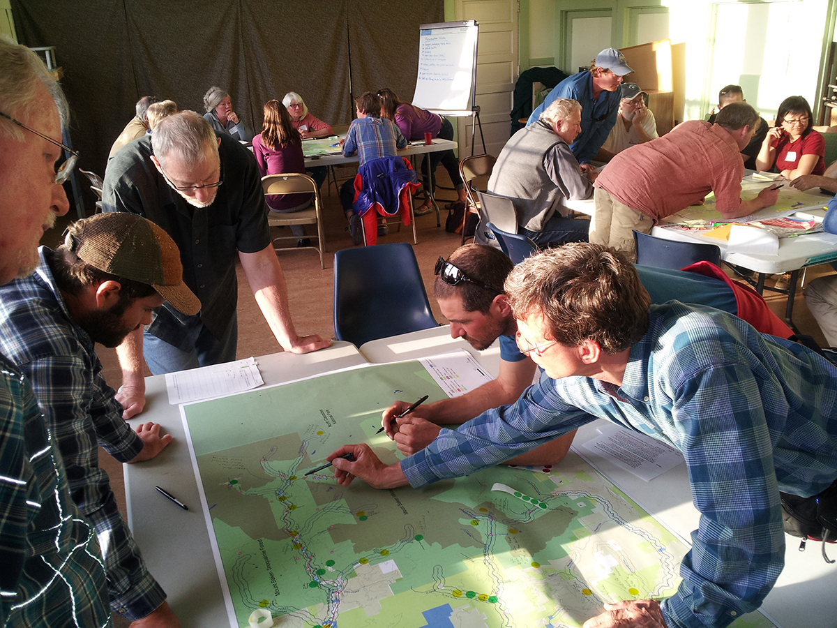
Focus group discusses river access points through the Upper Nooksack River Recreation Plan.
This river access site was originally identified and recommended in the Upper Nooksack River Recreation Plan (UNRRP), which was finalized in March 2015. This process was coordinated by American Rivers with assistance from the National Park Service’s (NPS) Rivers, Trails, and Conservation Assistance program, and was the result of nearly 600 individuals and organizations, including landowners, tribes, land managers, businesses, paddlers, anglers, hikers, skiers and equestrians contributing to the development of the plan over a two-year period through an online survey, focus group workshops, and field tours.
American Rivers is working, along with a few key partners and community members, to develop a concept for the site that could provide paddlers and boaters an unimproved put-in and take-out along this popular stretch of whitewater with a small parking area for a few vehicles, trash reciprocals, and a portable restroom. Additionally, it could serve as a walk-in access point to the Whatcom Land Trust’s 110-acre Maple Reach property.
Maple Falls, the site of the proposed river access point.
With the addition of the Maple Falls river access in the Draft Rec Plan, the boating, angling, and overall river community have a unique opportunity to enhance their connection to NF Nooksack watershed — an eligible Wild and Scenic river that we are working to protect — and in the process, grow our appreciation for this gem of the North Cascades.
Please take a moment and send your comments to the DNR, using these brief talking points in your own words that we’ve included below (If submitting comments by email, use “SEPA File No. 18-072701” for the subject line):
- State that you support the river access site identified in DNR’s plan – Objective D under North Fork Unit (pg 15)
- State that you’ve been tracking the Baker To Bellingham Recreation Planning Process and it is your understanding the committee has been supportive of river access and it emerged as a Tier 1 implementation project in the plan (pg 19-20)
- Please include SEPA File No. 18-072701 in all written comments
Comments should be submitted to the SEPA Center:
Email: sepacenter@dnr.wa.gov
Mail: DNR Sepa Center, P.O. Box 47015, Olympia, Washington 98504-7015
The story of the Cape Fear River is the story of North Carolina. Even the nickname for the state – the Tar Heel State – has its origin from the pine plantations that lined the river in the early history of North Carolina.
The Cape Fear is the largest river system within the state connecting communities from Greensboro to Wilmington. Its history is of a working river, being used as a mode of transportation for goods and a dumping ground for early industry. There are numerous stories from that era about neighbors of the river telling what day it was by the color of the river due to the dumping of dye waste from the mills along the river. Today, the river still faces chemical threats from perfluorinated compounds like GenX and 1,4 dioxane, coal ash ponds, and excessive nutrient inputs from urban and agricultural practices.
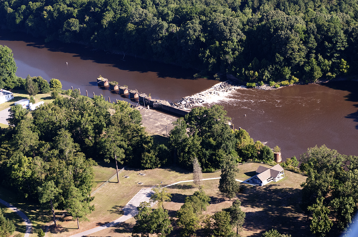
Lock and Dam 2 along North Carolina’s Cape Fear River | Alan Cradick
The river’s connection to its communities has been changing over the last two decades as significant efforts have been in place to restore the river to be a natural and recreational resource. The latest effort is by the U.S. Army Corps of Engineers which has begun a disposition study of the three locks and dams along the river. Across the country a significant amount of our water infrastructure has reached the end of its usable life span, some are no longer serving the purpose for which it was built; these studies by the Corps are designed to determine if these older structures are still serving their authorized purpose.
The locks and dams on the Cape Fear River were constructed to provide commercial navigation from the Port of Wilmington up to the City of Fayetteville, North Carolina’s most inland port. The first dam was constructed in 1915 and the final lock and dam was completed in 1935. They were a major boon to the economic strength of the region, creating a reliable navigation channel out to the ocean. The recent rehabilitation of the locks would allow for continued navigation if there was demand, but commercial navigation (barges) became obsolete along the Cape Fear with the advancement of the rail road and interstate highway system. The final commercial shipment along the Cape Fear was more than a decade ago and since then the project has sat idle with only minimal financial support.
The locks and dams have been used for more than just the navigation for which they were authorized. Communities and industries have used the impoundments behind the dams as a cheap source of water supply and have built their long-term water supply plans on those impoundments being in place.
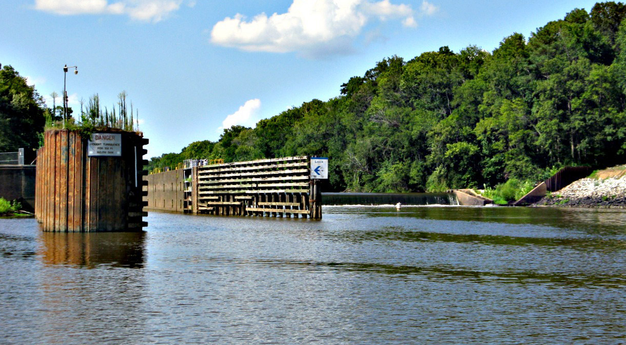
Cape Fear River’s Huske Lock and Dam | Don Adams
The locks and dam create a major problem on the Cape Fear River, they have been blocking fish migration up stream to spawning habitat for more than a century. This disconnection has negatively impacted the native fish species in the river and is putting some threatened and endangered species even more at risk. American Rivers is part of a coalition that is attempting to resolve this threat – the Cape Fear River Partnership – which was able to raise $13 million to install a rock ramp on the first lock and dam.
Now the question is what to do with the other two locks and dams? The Corps’ disposition study will primarily look at the commercial navigation value of the locks and dams and whether it is an ongoing need. It seems unlikely the answer will be ‘yes.’ The study will also consider the other non-authorized uses of the structures and the ecological health of the river, which is the part of the study that can prove most impactful.
American Rivers is committed to supporting an outcome of that study that restores the ecological health, assures reliable water supply and improves water quality within the river. This study can be a catalyst for a grander vision of a healthy Cape Fear River.
This article by Bob Irvin, President of American Rivers and Marc Berejka, President of the REI Foundation, originally appeared in the Denver Post on July 20, 2018.
Upon signing the Wild and Scenic Rivers Act on October 2, 1968, President Lyndon Johnson said, “Every individual and every family should get to know at least one river.”
Rivers have always been central to our country’s greatest outdoor adventure stories, both real and fictional: John Wesley Powell’s descent down the Green and Colorado rivers; Lewis and Clark exploring the Missouri, Snake and Columbia; and Huck Finn floating the mighty Mississippi.
Today, as we celebrate the 50th anniversary of the Wild and Scenic Rivers Act, rivers are still pathways to discovery and connection: A grandparent takes a child fishing for the first time. Friends enjoy a multi-day rafting trip. A family shares a weekend picnic at a waterfront park.
From the heart of our busiest cities to our most remote wilderness, rivers give us opportunities to fish, float, swim and explore. Healthy rivers are vital to the outdoor industry, and every year Americans spend $86 billion on watersports. Rivers nationwide provide two-thirds of our clean drinking water supplies — essential to our health and communities. Here in the west, the Colorado River is vital to the economies of seven states, supporting $1.4 trillion in economic output, $871 billion in wages and 16 million jobs annually.
The importance of healthy rivers and clean water to our economy will be front and center this week, as thousands gather in Denver for the Outdoor Retailer Summer Market, North America’s largest tradeshow in the outdoor industry.
These brands, retailers, suppliers, athletes and conservation leaders are a powerful force. And now is the time to put our power to work on behalf of healthy rivers. Coast to coast, rivers and water supplies face increasing threats — including development on our public lands; new dams and diversions and drought; and other impacts from climate change.
The impacts have been particularly noticeable in Colorado in recent weeks as rivers from Denver to Steamboat have been closed to recreation due to low flows and warm temperatures. State wildlife officials have advised anglers to avoid fishing when water temperatures increase in the afternoon.
Those gathering in Denver this week are in the business of helping people get to know rivers and the great outdoors. We also all need to be in the business of river conservation, to ensure these special places endure for our children and grandchildren.
There are many ways business, nonprofit and elected leaders can make a difference. We have seen, first-hand, how efforts to embrace water conservation, support river cleanups and lead restoration projects create positive, lasting change. Now is the time to take action, together. Because rivers nurture our spirits, they power our economy, and they will carry us into the future.
Bob Irvin is President of American Rivers, which works to protect wild rivers, restore damaged rivers, and conserve clean water for people and nature. Marc Berejka is President of the REI Foundation, which works to help ensure that tomorrow’s outdoor enthusiasts and conservation stewards reflect the diversity of America.
To send a letter to the editor about this article, submit online or check out our guidelines for how to submit by email or mail.
This guest blog was written by Chris King. It is a part of our blog series on America’s Most Endangered Rivers® – Pearl River.
When I arrived in Mississippi, I sought a suitable place to bird watch. I became acquainted with the local Audubon Society chapter and was quickly told that LeFleur’s Bluff State Park was listed as an Important Bird Area by Audubon.
Upon my arrival at the park, I was stunned.
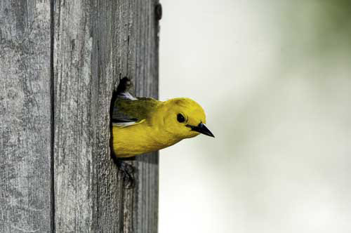
Prothonotary warbler looks out of a box in LeFleur’s Bluff State Park. | Bill Stripling
Like New York City’s Central Park and other green spaces in cities, it was an oasis of bird habitat. The park’s trails are wonderful as they snake through wetlands and skirt the Pearl River. The park’s bird checklist, created by Jackson Audubon and the Mississippi Museum of Natural Science, lists over 200 birds.
When I learned that this state park (Mississippi’s only urban state park) is threatened with having a considerable section of its southeast corner dredged and changed into lake bottom, I was shocked. Maps of a proposed new Pearl River lake and dam, drawn by the Rankin Hinds Pearl River Flood and Drainage Control District, show open water where 20-30 acres of forested sloughs, ridges and riverbank now exist. For me, public land with excellent bird habitat is a great asset in the middle of a city. It’s something to be valued.
It did not take me long to become the volunteer teacher for a birding summer camp run by Millsaps College for children ages 8-14. A large portion of the attendees are from families of lesser means and they attend on scholarship. This park is the first exposure to nature for many of my campers.
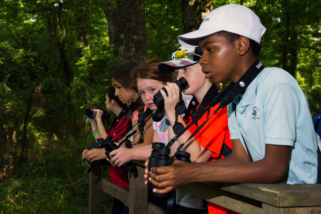
Children watch for birds along the Pearl River in LeFleur’s Bluff State Park. | Chris King
This park is a vital stop-over point for neotropical migrants passing through and a dynamically active nesting area for our state’s breeding bird population. Most importantly, due to its location, the park is a vital link for our inner-city youth to connect to nature.
To destroy the wild natural state of this park would be to steal opportunities away from the children of Jackson: opportunities to become inspired to study the sciences, opportunities to forge a bond with nature, and opportunities for a respite from the chaos of a large metropolitan city. Avoiding excessive damage to this park should be a priority in any flood control plans for Jackson.
Please join American Rivers by September 6, 2018, in asking the U.S. Army Corps of Engineers to reject the Rankin-Hinds Pearl River Flood Control and Drainage Control District’s new dam project.
[su_button url=”https://act.americanrivers.org/page/6408/action/1″ background=”#ef8c2d” size=”4″ center=”yes”]Take Action »[/su_button]
 Author: Chris King
Chris King lives in Brookhaven, Mississippi, and is president of Jackson Audubon Society whose mission is to instill in the people of Jackson County an interest, knowledge, and appreciation of birds and other wildlife.