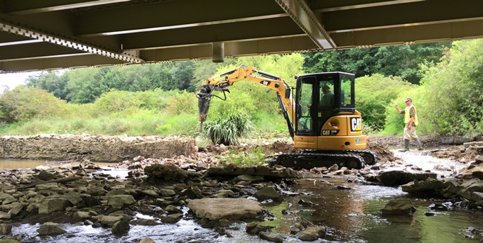
The sound of the vibrator on the track hoe pulling sheet piles out of Congaree Creek only lasted one day as the US Fish and Wildlife Service Aquatic Habitat Restoration Team removed the dam on a beautiful day in May 2019.
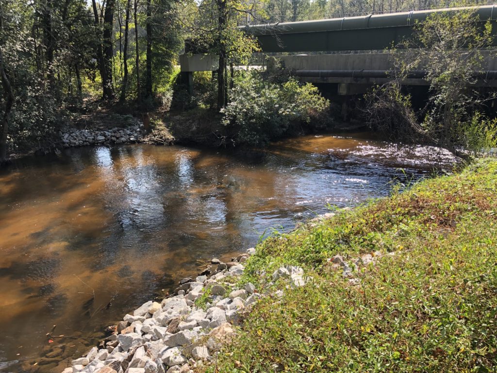
removal | Photo by Gerrit Jobsis
American Rivers partnered with the Congaree Riverkeeper, the South Carolina Department of Natural Resources, the City of Cayce, and the US Fish and Wildlife Service on this successful dam removal project.
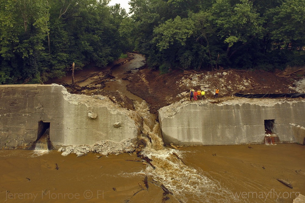
About 15 feet high and 40 feet across, this outdated, relic dam created a dangerous hydraulic current at the start of a canoe trail. Now ten miles of mainstem Congaree Creek are reconnected which supports paddlers and aquatic life like herring, shiners, and darters alike who need access to different parts of the stream.
Many dams like the Congaree Creek dam have outlived their useful life, and dam removal is often the most economical option compared to repair. At least 82 dams were removed in 2018 restoring more than 1,230 miles of stream which brings the grand total of dams removed in the US to over 1,600!
Congaree Creek in Cayce, SC, is now flowing freely now thanks to the efforts of a strong partnership to remove a dam. Check out this short film about this dam removal.
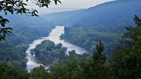
White River, Vermont
“This is the best place I know of to see sugar maples. Driving up the valley one time, I completely missed an exit because everyone in the car was looking at the mix of reds, oranges and yellows. We had to drive 20 minutes to the next exit.”
– Amy Singler, director of River Restoration, Connecticut River Basin
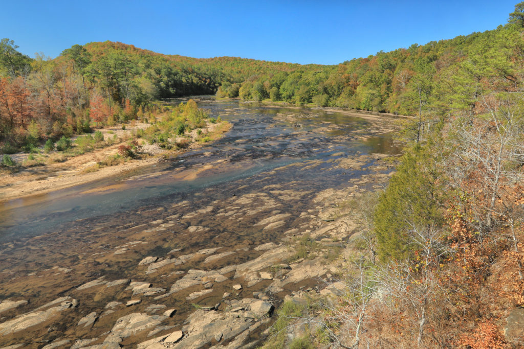
Upper Youghiogheny, Maryland and Pennsylvania
“The first weekend of October can bring snow squalls, heat waves and often glorious fall colors from the diverse hardwoods lining the riverbanks. It’s why I chose to get married on this river.”
– Liz Deardorff, director of Clean Water Supply, Delaware River Basin
Merced River, California
“I love autumn in Yosemite National Park and especially seeing fall colors reflected in the Merced River. Hiking close to the bank, you’re covered in mist from the river as it drops over two massive waterfalls and flows right through Yosemite Valley. Incredible!”
– Amber Taxiera, associate director for California Major Gifts and Communications
Yakima River, Washington
“There’s nothing like an early fall float through the high desert canyon. With flows settling down from their peak summer irrigation demands, the fish are looking to gobble some meat, and the streamer action for fat 18-inch trout can be ridiculous.”
– Jonathan Stumpf, associate director of River Protection, Rivers of Puget Sound and Columbia Basin
Swannanoa River, North Carolina
“After ushering my eldest daughter off to college, I have a vivid memory of watching the bright leaves float downstream on a warm day with the sun low. On that day, looking for migrating butterflies and watching leaves, it was the perfect spot to be.”
– Gail Lazarus, associate director, Rivers of Southern Appaachia and the Carolinas
For nearly 100 years, dams on the Klamath have blocked salmon and steelhead from reaching hundreds of miles of habitat, and have harmed water quality for people and wildlife. Four dams – J.C. Boyle, Copco No. 1, Copco No. 2 and Iron Gate – built between 1908 and 1962, will soon be coming down. This river restoration project that will have lasting benefits for the river, salmon and communities throughout the Klamath Basin.
American Rivers and more than 40 stakeholders – including tribes, irrigators, commercial fishing interests and conservationists – helped craft the original Klamath agreements to remove the dams, restore habitat and resolve decades-long water management disputes.
Dam removal will restore access to more than 300 miles of habitat for salmon. It will also improve water quality – currently, toxic algae in the reservoirs behind the dams threatens the health of people as well as fish.
Read more about why this dam removal and river restoration effort will be one of the most significant the world has ever seen.
American Rivers and our partners are challenging in court the Trump administration’s effort to strip away crucial clean water protections from rivers, lakes, streams and other waters that feed drinking-water sources for 200 million Americans.
The legal challenge, filed on October 23 in the U.S. District Court for the District of South Carolina, opens a major court battle over the U.S. Environmental Protection Agency’s and U.S. Army Corps of Engineers’ repeal of clean water protections under the Clean Water Act, one of the nation’s bedrock environmental laws. The repeal of these standards is one of several steps announced by the administration to gut long-standing clean water protections, including a proposal currently subject to public comment that would leave many waters vulnerable to pollution and fill by redefining what waters are protected.
The Southern Environmental Law Center filed the challenge on behalf of American Rivers, Charleston Waterkeeper, Chattahoochee Riverkeeper, Clean Water Action, Defenders of Wildlife, Friends of the Rappahannock, National Wildlife Federation, Natural Resources Defense Council, North Carolina Coastal Federation, North Carolina Wildlife Federation, and South Carolina Coastal Conservation League.
The lawsuit contends that EPA and the U.S. Army Corps of Engineers violated a long-standing law that prohibits agencies from altering basic environmental safeguards without giving the public adequate notice and a chance to weigh in. According to the lawsuit, the agencies failed at their most basic responsibilities: evaluating the effect of their reckless actions and giving the public a meaningful opportunity to comment on their decision to eliminate scientifically backed protections for streams and wetlands.
“Without the Clean Water Rule’s critical protections, innumerable small streams and wetlands that are essential for drinking water supplies, flood protection, and fish and wildlife habitat would be vulnerable to unregulated pollution, dredging and filling,” said Bob Irvin, president and CEO of American Rivers.
“We will keep fighting for the Clean Water Rule because every American should have clean drinking water and healthy rivers.”
It was the summer that felt like it would never end. Here in Atlanta, we had a nearly unbroken heat wave through August and September, with record-high daytime temperatures steadily hitting the mid-90s. Fall has finally arrived, bringing cool temperatures and even a little rain—but the drought conditions that arrived in force in September remain with us.
In fact, overall it has felt a lot like fall 2016, when wildfires raged over large swaths of the north Georgia mountains. That year, for much of the state, the rain quit in about May. This year, the weather really started drying out in north Georgia in late August. But conditions have been largely similar: hot and dry, with rivers and reservoirs dropping fast. The upper reach of the Flint River here in Georgia dropped quickly to very low levels just like in fall 2016—and lower than the river had been in any recorded droughts before 2000.
Welcome to the era of “hot drought.”
Hot drought is the deeply concerning phenomenon that increased temperatures exacerbate the impact of drought. It is natural for water to be lost from the landscape into the atmosphere. But the many ways in which this occurs are amped up in a hotter world. For example, hot sun bakes the moisture out of surface soils and (during the growing season) draws more water out of plants through transpiration—plants’ process of “breathing” water out through their leaves.
In some climates (not Georgia!), hot drought accelerates snowpack melt. And in many places, Georgia included, hot drought results in increased evaporation of water from reservoirs, rivers and wetlands. In fact, in the middle of September a municipal water provider in the upper Flint River basin here in Georgia startled me by reporting that one of his reservoirs had lost 6 inches of elevation in three days—all of it from evaporation. Yikes.
Unfortunate Vanguard
In fact, yet again the communities of the upper Flint River basin find themselves in the bullseye of oncoming drought. Although currently rainy weather might alleviate drought conditions, two communities in the basin are the only communities in the state currently at “Level 2” drought response, enforcing constraints on outdoor water use beyond the standard schedule in Georgia state law. (Much of the state moved into to “Level 1” drought response with a recent State of Georgia announcement.)
The upper Flint River basin, thanks in part to its heavily developed headwaters area and with many communities depending on the river system for water supply, often feels the brunt of drought conditions earlier than the rest of the state. That’s why American Rivers has worked with water providers throughout the basin since 2013 to be sure we’re all communicating about oncoming drought conditions, and to find ways to balance the water needs of communities with the water needs of the river itself.
Similarly, next-door in the Carolinas, we’re helping communities use the precious water we do have more wisely, and making sure all voices are heard when it comes to decisions about our water supplies. Because everyone deserves a future of ample clean water and healthy rivers, year in and year out.
An Uncertain Season
This fall’s conditions in the Southeast are being called “flash drought,” because of the quickness with which the recent hot weather dried out the landscape. Plants show a flash drought, badly and quickly. And as I’ve watched the river drop, it makes me think about the warnings we hear from climate science, the impacts of a warming world on our rivers and water supplies.
It is hard to say how long our newest Southeastern drought will last. Will we get good rain this winter, and start off next spring in better shape? Will this be a one-year affair, like 2016-17? Or will this be a three-year deal, like in 2006-2008, when Metro Atlanta was counting the days of water supply remaining in the Chattahoochee River’s Lake Lanier? Or could it be even longer?
That’s the thing about drought: We know when we’re coming into another one, but we don’t know how long it will last. Our extra-long summer heat wave has ended. But the drought outlook for the rest of this fall is not clear. Even with recent rains, it will be a little while longer before we know just how long our newest drought—hot or not—will last.
Today the Supreme Court heard arguments in the case of County of Maui v. Hawai’i Wildlife Fund, a case that could fundamentally change how the Clean Water Act (CWA) has been implemented for decades. At issue is whether the CWA has jurisdiction over pollution that discharges from a point source and takes an “indirect” route to a navigable water. Maui County operates a wastewater treatment plant that discharges millions of gallons of treated sewage into groundwater beneath the facility, which then seeps into the Pacific Ocean. No one is contesting the fact that the treated sewage is coming from the plant and is visibly damaging a nearby coral reef. Rather, the County is making the legally dubious and, as a practical matter, non-sensical argument that the plant is not directly discharging from a point source into a navigable water – the treated sewage is travelling through groundwater first – and therefore does not require a Clean Water Act permit.
The plain language of the CWA prohibits “any addition of any pollutant to navigable waters from any point source” without regard to whether it is direct or “indirect.” The Hawai’i District Court and 9th Circuit Court agreed with Hawai’i Wildlife Fund that the plant’s injection wells are a point source that sent pollutants to the definitely navigable Pacific Ocean in violation of the CWA. The argument that the CWA does not apply because the pollutants were transported from the point source by groundwater to the ocean was condemned by the district court as “mak[ing] a mockery” of the Clean Water Act by essentially allowing groundwater to be used as unregulated “open sewers” for moving pollution to rivers, streams and oceans.
Nevertheless, the Supreme Court took up the case and the Trump administration, reversing the EPA’s long-held position, filed a brief supporting Maui County’s cramped interpretation of the CWA – another assault in the Trump administration’s continuing war on the Clean Water Act. If the Court rules in favor of Maui County, it would open what a bipartisan group of former EPA administrators describe as an “enormous loophole” in the CWA, allowing polluters across the country to bypass the Act by directing point sources into groundwater or simply dumping waste on the ground and allowing it to seep into nearby streams(!) This is an absurd result, of course, but a terrifying one; hopefully the Supreme Court will agree and prevent this loophole from ever opening. If not, champions for clean water everywhere will have yet another fight on our hands.
SPONSORED BY CASCADE BLONDE
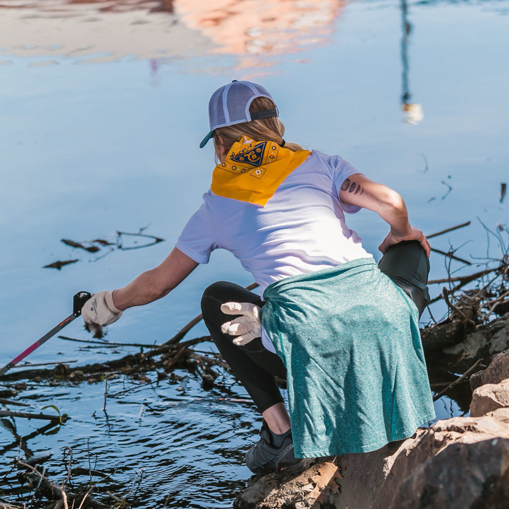
Without clean water, great whiskey isn’t possible, and Cascade Blonde is matching its words with action. The whiskey brand has committed to cleaning America’s waterways as part of its brand promise. Working with American Rivers, Cascade Blonde pledged this past Earth Day to collect 100,000 pounds of waste through National River Cleanup® to have a positive, lasting impact on waterways nationwide.
Cascade Blonde kicked off Earth month with the Great Indy Cleanup in Indianapolis in April 2019, where 400 volunteers collected more than 25,000 pounds of litter.
| Photo Courtesy of Cascade Blonde
Litter is more than just an eyesore. It’s also harmful to wildlife and contaminates rivers, which provide 60 percent of our drinking water. Even more, nearly half of U.S. waterways are too polluted for fishing and swimming. American Rivers and Cascade Blonde’s partnership will continue to organize thousands of volunteers to protect, restore and conserve rivers and the clean water they provide for people and nature.
Cascade Blonde followed up its efforts with a cleanup in Austin in June that involved 367 volunteers, who collected more than 2,000 pounds of litter. Later in September, the whiskey brand removed more than 10,000 pounds of trash and recyclables during the Mayors’ Grand River Cleanup — the largest river cleanup event in west Michigan — proving the event’s motto that “small acts have grand impacts” on the river.

Blonde
Clean water is so important to Cascade Blonde not only because the whiskey is made by the water, but also because it’s finished off with Tennessee limestone filtered spring water. Whether you’re an avid water skier, enjoy a relaxed innertube float downstream or just sitting by the dock, the brand encourages like-minded friends to join their cleanup efforts.
Recently Cascade Blonde participated in the fall South Platte Stewardship Day in Denver after joining the group for another cleanup earlier in the spring. The two events mobilized 458 volunteers to collect 3,700 pounds of debris.
Cascade Blonde will continue to team up with American Rivers to sponsor four more river cleanup events into the new year. To join them at these events and to learn more about their commitment to protecting America’s waterways, follow the brand on Instagram (@CascadeBlonde).

Cascade Blonde American Whiskey proudly supports American Rivers in the fight to protect and restore our nation’s rivers. The company has sponsored National River Cleanup® since 2018 to celebrate clean water and provide opportunities for people to help keep the waters they enjoy healthy.
Learn more about Cascade Blonde American Whiskey by visiting www.cascadeblonde.com.
You know that look- when a little kid sees a dump truck, track hoe, or any piece of construction equipment and their eyes sparkle and the enthusiasm is electric.
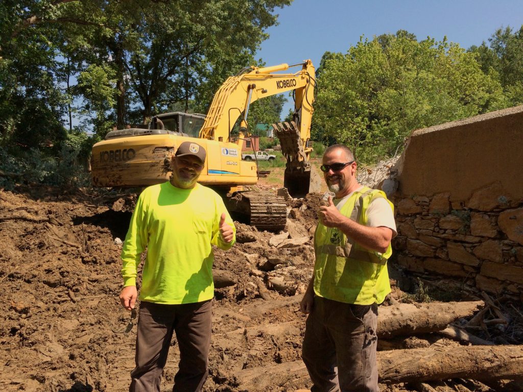
The US Fish and Wildlife Service Aquatic Habitat Restoration Team never lost that spark and are living the dream of kids (and let’s be honest many adults) across America in their work to demolish dams to bring streams back to life. American Rivers applauds the US Fish and Wildlife Service (FWS) for their immense contributions to restoring rivers in the Southeast. This team has removed 24 dams and counting including the Shuford dam in North Carolina, the Green River Lock and Dam #6 in Kentucky, and the Congaree Creek dam and Matthews Creek dam in South Carolina.
Freshwaters Illustrated
Restoration projects can be complicated, lengthy, and expensive, but when partners collaborate, projects become easier, cheaper, faster, and more fun. American Rivers admires the FWS ability to collaborate and get work done and counts on them as a partner in dam removal. Typically, the partnership on dam removals starts with finding a project. American Rivers and partners identify prospective projects, communicate with landowners, raise funding, collaborate on design and permitting, and once we have the permits in place, that’s when the fun begins. We set a demolition date with the FWS Aquatic Habitat Restoration Team and the dam is removed leaving a river restored.
The demolition support from the FWS has allowed the movement of dam removal grow in the Southeast. Dam removal makes rivers safer to recreate, improves cultural and ecological relationships with the river, and supports aquatic species and the habitat they depend. American Rivers and our partners have more than 14 more dams slated for removal in the next few years, and we hope that the FWS is ready to continue our fruitful partnership to free rivers.
Singer McCombs
More than 1,000 dams have come down in the U.S. since 1999 when the Edwards Dam on the Kennebec River in Maine was removed and sparked the modern dam removal movement. Since then, no other river restoration technique has been nearly as effective. Today, resilience of aquatic habitats is more important than ever, and the FWS Aquatic Habitat Restoration Team is one of the most important components of achieving resiliency of aquatic habitats in the Southeast.
Check out this short film on dam removal in the Southeast by Freshwaters Illustrated which includes footage from the Shuford dam removal project and amazing underwater videography.
Do you have a dam that isn’t serving its purpose anymore? If dam removal may be right for you or your community, please contact us today.
This is a guest blog by our Fall 2019 National River Cleanup intern, Callen Creeden.
October is in full swing and with it, the smell of pumpkin spice is in the air, sweater weather is finally here, and neighborhoods are preparing for a takeover of excited trick-or-treaters. Halloween is the fall holiday that every kid looks forward to– dressing up as your favorite character, thrills, and spooky stories, but most of all… free candy! Now, I love Halloween and candy as much as the next person; however, the exorbitant amounts of plastic waste in our landfills, and worse, our waterways is enough to make the ghastliest ghoul shudder. Last year, National River Cleanup® removed 2 million pounds of trash from nearly 3,166 cleanup sites.
By making these simple changes to your Halloween celebration habits, you can stop the trash before it reaches our rivers:
- Purchase candies packaged in cardboard boxes, like the type you find at movie theatre concession stands. Look for them in your local grocery store or online. Remind kids to recycle the boxes by writing a little message on the side of it!
- Buy chocolate wrapped in aluminum foil. This is another great candy that is packaged in completely recyclable material, let’s be honest, you can’t go wrong with giving out chocolate.
- Hand out fruit like mandarins or tangerines, and if you’re really feeling the holiday spirit draw jack-o-lantern faces on them.
- Hand out cans of soda. Ditch the candy and bring something different to the trick-or-treating circuit. Not only is it a change of pace from candy, but aluminum is one of the most recycled materials in the U.S.
- Reuse a pillowcase for the perfect candy bag! This is much better than buying a plastic candy container and more importantly will most likely hold more candy.
- Bring an extra bag with you while trick or treating to collect litter along the way. For the older and competitive kids, offer an extra Halloween prize for whoever collects the most trash.
- Opt-out of fake spider webs. The popular outdoor decoration is a hazard for wildlife and are known to trap and injure everything from bees to birds.
- Compost your pumpkins! Pumpkins decompose faster if you smash them into smaller bits (and your child’s sugar rush disappears faster if you let them do it).

October | Photo by Madeline Bule
These simple changes to your spooky festivities are sure to get you on every sprouting environmentalist’s Halloween map for houses to hit. Post-Halloween, you may come across additional candy wrapper litter. To help minimize your neighborhood waste, think about organizing a candy wrapper collection spot! You can even attempt to reach out to your local grocery stores to sponsor the collection as a communal place to locate the box. Reach out to your local public schools and work with the art department on upcycling the wrappers for creative festive art projects. You can also organize a neighborhood pumpkin collection site for people to compost so less organic waste ends up in landfills.
No matter what you do this Halloween, helping clean our towns, rivers, and the country doesn’t have to stop on November 1st. Take the pledge to help keep our waterways clean, join a local river cleanup event, or even host your own!
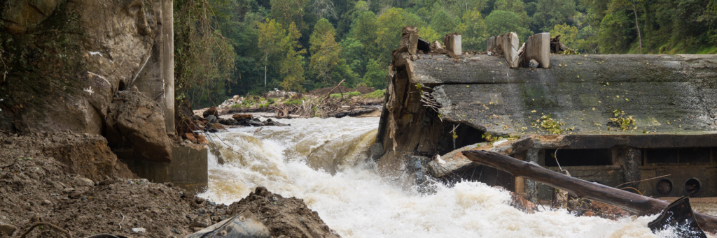
It’s a thrilling thing to watch: A big yellow machine rolls into the river and tears down a dam that has done so much damage to fish and wildlife habitat and often to the community. In a surprisingly short period of time, the bugs flourish, the fish come back and the river returns to life.
As Brian Graber, American Rivers’ senior director of river restoration, told me recently: “There’s no faster, more effective way to bring a river back to life than by taking a dam out. It’s pretty cool that we’re able to do something that makes a real, meaningful difference.”
This year marks two decades since excavators turned Maine’s Edwards Dam to rubble. That simple act kickstarted a nationwide movement to free other rivers by removing dams. The pioneering efforts of American Rivers and local partners set the stage for freeing the Kennebec River. Together, we convinced the Federal Energy Regulatory Commission that removing Edwards was better for local communities and wildlife than continuing to maintain the dam.
Since then, 1,199 dams — including the complex Bloede Dam on Maryland’s Patapsco River — have been removed by American Rivers and other groups. But like all complex infrastructure projects, removing a dam is almost never accomplished by a single organization.
More than 90,000 dams still block American rivers and streams, many no longer serving their original purpose. Some are drowning hazards, while others damage river health and water quality. With some states, like Pennsylvania, removing 25 to 35 outdated dams per year while other states remove none, we must make ask ourselves: What will truly make the greatest difference in making not just some but hundreds of projects happen?
The answer is that we must create an ecosystem that makes removing dams more efficient and commonplace. To this end, we have developed a set of six criteria necessary to successfully remove more dams:
- Strong leadership: You need strong leaders at the state level to break down the barriers to removing dams. Several states, including Massachusetts, Pennsylvania and New Hampshire, have staff dedicated to removal projects — and a lot more projects get done in those places.
- Incentives for dam owners: An effective dam safety office must recommend dam removal as a good option for unsafe dams and facilitate dam removal projects.
- Funding: It takes money to do the assessments, designs and implementation necessary to remove dams. Financial support must be available for multiple years and must cover everything from feasibility to construction.
- Regulators: State and federal regulators generally view dam removal as a positive approach. But because taking out a dam significantly changes the local environment in the short term, regulators struggle to fit dam removal projects into regulations that were designed to reduce change to the environment. Regulators must recognize the leeway available within most existing regulations to allow for projects that result in long-term benefits.
- Well-trained project managers: There must be enough project managers to sustainably shepherd all projects through the challenging and involved process.
- Momentum. As we like to say, “Every project makes the next project easier.” The more projects you do, the more engineers, regulators, and agencies understand the process and the more contractors know how to work in rivers.
As we look toward the next 20 years, Brian and his team are imparting what they’ve learned by sharing our six-factor approach with as many project managers, state agencies and local groups as possible. By holding dozens of workshops and trainings, and inspiring others to envision a future of free rivers, we are helping make dam removal easier, more cost effective and more doable on a growing number of rivers.
“I really like facing a super challenging issue, coming up with a complex plan, implementing the plan and seeing it actually work,” Brian told me. “We’ve figured out how to tackle and break down the barriers to dam removal. And we’ve seen huge growth. In a geeky way, that’s what excites me.”
Since its completion in 2015, Colorado’s Water Plan has been an essential roadmap for managing and improving Colorado’s treasured rivers, lake and streams – and establishing a future-forward path towards water security. The Water Plan has been essential in prioritizing the value of clean drinking water, promoting action around water conservation in cities, preserving Colorado’s agricultural heritage, improving vital river and watershed protection, and supporting flexible water policies across the state.
But to fully implement Colorado’s Water Plan, additional funding is needed to drive the Plan’s priorities. Earlier this year, the Colorado legislature recognized the importance of investing in our rivers and streams when they passed House Bill 19-1327, which would generate revenue for the Colorado Water Plan by legalizing sports betting in Colorado following voter approval of Proposition DD this coming November.
Inherently, ballot language can be unclear, especially on measures that raise taxes. When passed, Proposition DD would allow sports betting in Colorado and impose a 10% tax of the profits casinos receive (after paying taxes and paying out winners). This tax would only affect casinos, not individual betters. The majority of the tax revenue received by the state – 93% – will fund Colorado’s Water Plan, with a small portion of the revenue from the tax allocated to regulate and enforce gaming. The revenue generated from Proposition DD is an important down payment on the funds needed to support the implementation of Colorado’s Water Plan.
Similar in nature to how the state lottery funds Great Outdoors Colorado, Proposition DD would legalize sports betting and use proceeds of tax revenue on casinos to fund a share of Colorado’s Water Plan and will be an important down-payment on the total amount needed to support full implementation of the Plan.
All corners of Colorado have benefited from the implementation of Colorado’s Water Plan. Communities around the state like those in Yampa, Colorado, San Miguel, Roaring Fork, and Gunnison valleys, have developed stream management plans identifying specific projects to improve the health of their river and its surrounding lands. In Steamboat Springs, the local stream management plan developed actions to benefit the Yampa River through town by improving stream flows, restoring the river corridor, integrating green infrastructure and improving community education around river health.
Here is how Colorado Representative Dylan Roberts (D-Eagle) frames the issue –
Funding from Proposition DD goes to the Colorado Water Plan which is a bipartisan master plan that calls for projects across the state which are vetted by the Colorado Water Conservation Board and other entities and then approved by the legislature prior to being funding (kind of like a grant program.) The estimates of how much this change in law (if DD passes) would generate are a little hard to predict because it depends on how much people actually take part in the sports wagering but the models predict anywhere from $10 million-$29 million a year (which is a major improvement from the current $0 in guaranteed annual funding for water.)
American Rivers, along with a broad coalition of environmental, agricultural, recreation and water user groups support Proposition DD because of the funding it will generate for the conservation and restoration of Colorado’s rivers. Passage of Proposition DD will help implement critical activities like restoring river corridors, improving agricultural irrigation systems and keeping water in our rivers for people to swim, boat, and fish. American Rivers applauds use of these tax benefits from the passage of Proposition DD to support Colorado’s water future.
Want more views on Proposition DD? Take a look at these newspaper articles from some of the largest media outlets across the state:
- With a water shortage in sight, Prop DD will help keep the rivers flowing – The Denver Post
- Editorial: Legalize sports betting in Colorado with Proposition DD – Boulder Daily Camera
- Prop. DD Explained – The Colorado Sun
- Colorado Prop DD: Voter’s guide to sports betting ballot question
- Sports Books and Water Boards are Strange Bedfellows in the Push for Prop DD – Colorado Public Radio
- Outdoors leaders endorse Colorado gambling measure Proposition DD – Colorado Politics
- Why Colorado’s Proposition DD pairs water projects and sports betting – The Coloradoan
- Journal-Advocate article which rebuts many points from the Boulder Weekly article
In this episode of We Are Rivers, we take a look at the cultural shift in how we value free-flowing rivers – from the fight to save California’s Stanislaus River forty years ago, to the Klamath River today, which will soon be home to a major dam removal effort to restore the river and its salmon runs.
Craig Tucker, an environmental activist, has been working on behalf of the Karuk Tribe, the second largest Native American tribe in the state of California, to remove four dams on the Klamath to heal the river. Craig discusses why this restoration effort is so important to the Karuk and other tribes, and communities throughout the basin.

We also hear from Mark Dubois who, in 1979, chained himself to a boulder to protest the filling of the reservoir behind the New Melones Dam that would drown California’s Stanislaus River. Listen to Mark share his story of hiding for five days, postponing the filling of the reservoir and sparking national media attention in what was the biggest citizen effort to save a river and stop a dam in American history.
Rivers were made to flow, to run, to move. But for centuries, we have controlled and dammed them. Today, we’re realizing that letting rivers be rivers — giving them room, letting them flow — has major benefits, both for nature and for us. The stories in this podcast episode tackle this evolution, exploring loss and hope, the value of wild rivers and the promise of restoration.
American Rivers is proud to have played a key role advocating for removal of the four dams on the Klamath – and we continue to lead the movement to remove dams nationwide. We’re also proud to be working with local partners to protect our nation’s last, wild rivers (read our latest blog about new Wild and Scenic River designations).
It’s simple: we believe life needs rivers. If you agree, please join us. We’re grateful to our supporters who make our work possible every day.