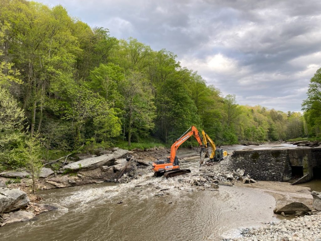
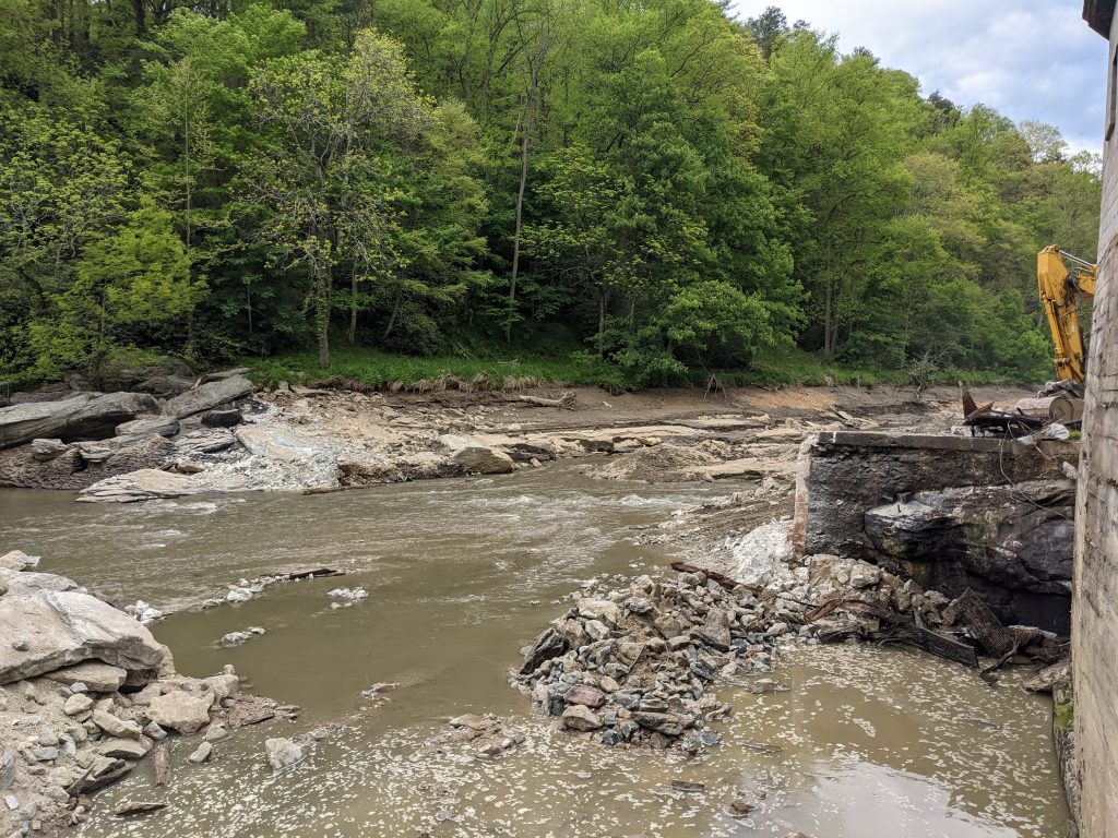
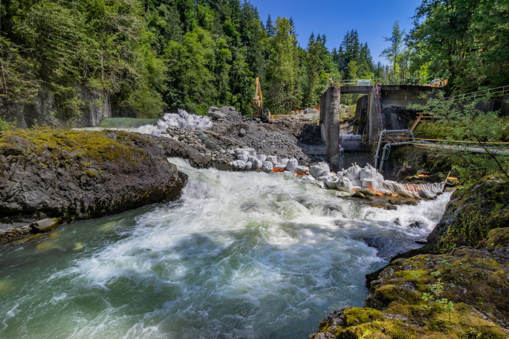
The unused hydro dam stretched across the Watauga River in mountains of North Carolina, obstructing free river flow and movement of animals. Today, it is gone. Today the river again flows freely, reconnecting with 140 miles of waterways. Today the Watauga is a better home for native brook trout, freshwater mussels, and hellbender salamanders. Removing this dam resonates through the ecosystem, but why is this important? In a word, science.
Science helps us to understand our world with observations and questions. We recognize that removing dams and freeing rivers impacts animals and plants who live in and near the water and changes the shape of the river. But how do we know? And why is it important?
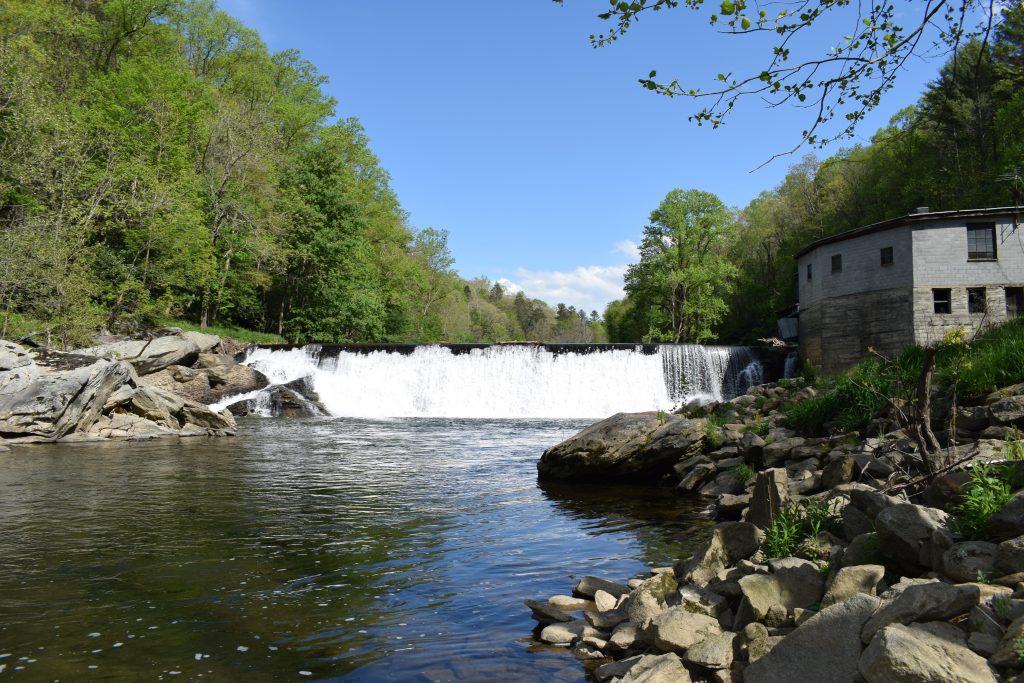
On the Watauga, with Appalachian State University, we study exactly those things before and after dam removal, looking at who lived in the river before and after removing the dam. Understanding how animals such as brook trout, tangerine darters, green floater mussels and hellbenders react after 80 years of separation will help us to better understand how free flowing rivers function.
We also look at how the shape of land and river changes after, once again, becoming free flowing. Rivers are dynamic places. Observing the Watauga before and after removing this dam helps us to understand the relationships between the flowing water, the moving earth and the nearby ever-changing terrestrial life. We see that reconnecting rivers allows waterways to absorb and disperse a wider range of rainfall. Studying the Watauga dam removal, among others, adds to our greater understanding of the link between removing dams, improved ecosystems and creating a more resilient world for all of us.
So, we know that reconnecting rivers creates a better environment, how do we find dams that need removing?
Science, the science of geography, helps us find these dams. This dam on the Watauga River was identified as a top priority for removal in the Southeast by the Southeast Aquatic Resources Partnership and “tier one, priority one” by the North Carolina Aquatic Barrier Assessment Tool. How? By digitally layering, ranking, and calculating data in a Geographic Information System. Here is a little more detail. Knowing where to focus our dam removal efforts is a critical tool to bring rivers back to life.
Through time, science has advanced our technology. Most of the dams that obstruct waterways from North Carolina to Oregon to Pennsylvania to Minnesota no longer serve their intended purpose. What was cutting edge when this dam on the Watauga River was built – equipment using the movement of water to grind grain, cut wood and to provide power – is no longer functional, relevant, or safe. We simply have found more efficient ways to do these things and know that a free-flowing river is the strongest base for healthy communities.
The science is clear, free rivers equal healthier wildlife, safer communities, improved climate resilience, a brighter future for all of us. How can we build on this impressive feat?
We are calling on congress to build on this science and remove exponentially more dams. When President Biden took office earlier this year, American Rivers prepared a bold blueprint for action that calls on the administration to investment in rivers and clean water. One of the priorities in this blueprint is investing in a national dam removal initiative. Let’s work together to build our healthy, safe, resilient communities one free-flowing river at a time.
The multitude of studies and reports about the impacts of climate change on western water and the Colorado River Basin increasingly come to parallel, if not precisely the same, conclusions: the future will be warmer and drier, with less water. The studies also show that the process of warming and aridification is happening faster than anticipated.
In 2008, Science Magazine published a short article claiming that the concept of “stationarity” in water management was dead. Stationarity—a fundamental concept in water resource management and planning— is the “idea that natural systems fluctuate within an unchanging envelope of variability”. The envelope of variability, however, is definitely changing.
But this is a difficult principal to let go of. It loosens the moorings of decades of water supply thinking.
While many water managers and policy professionals agree that stationarity is no longer valid, I wonder how well they understand its full implications. Many still assess temperatures and precipitation today as compared to “normal”. That “normal” is based on the concept of stationarity.
A 2019 report by the Colorado River Research Group, Thinking About Risk in the Colorado River, emphasized the loss of stationarity and the growing likelihood of what are called “Black Swan” events. These are events that fall outside the scope of normal expectations and planning efforts, thereby inflicting an unexpected shock to the system. While the current southwestern drought, possibly a megadrought, could be called a Black Swan, it’s more likely to become the norm than to disappear.
With the advent of increasing warming and aridification due to greenhouse gas emissions, any past certainty of droughts eventually breaking is now in question. We are in a time that climate scientists Brad Udall has labeled “The New Abnormal”.
The Center for Colorado River Studies at Utah State University recently released a new white paper, Alternative Management Paradigms for the future of the Colorado and Green Rivers (White Paper #6). This study takes a look at the future of water supplies in the Colorado Basin, using science as opposed to aspirational politics. We covered the report in more detail in a series of blogs titled, “Colorado River Futures”, which includes an overview, a “changed river” edition, and a “climate and the river” edition.
The study begins with the statement, “Our ability to sustainably manage the Colorado River is clearly in doubt”.
While we have responded to recent crises by developing new planning and management techniques, the report warns that “A gradual and incremental approach to adaptation… is unlikely to meet the challenges of the future.”
Simply put, we need to change how we think about the Colorado River and water supply in the southwest. The paradigms of the past no longer suffice.
The paper states “The Colorado River can be sustainably managed only if consumptive uses are matched to available supply. This will require Upper Basin limitations and substantially larger Lower Basin reductions than are currently envisaged.” The paper suggests that by capping Upper Basin use to 4 MAF or less and reducing Lower Basin use by 1.4 to 3 MAF critical storage levels in Lakes Powell and Mead might be maintained.
Across the basin, individual states are thinking about how they can address their climate and water supply challenges. Renegotiations of the 2007 Interim Guidelines are in their nascent stage. This round of discussions will be different from 2007 as the rights of the 29 Native American tribes, along with those of the environment, will be at the table. The tribes hold as much as 20% of the Basin’s water rights, 2.9 MAF. That’s more than Arizona’s compact allotment and a right that has never been included in basin wide agreements. This more inclusive and collaborative approach to negotiations is essential to address the serious challenges that are facing all of us.
Water conservation and evolving technologies will become increasingly important. But we need more than that. We also need to shift our perspectives, our ways of seeing and imagining water and rivers in the Colorado Basin.
I suggest that we think about water and rivers as Native Americans do, as sacred. Water IS life.
Whether or not we use water is not the question here, but our attitudes and how we use it are. Water should be used with respect, with reverence, with gratitude and within limits. You only take what you need, and never so much as to impair the integrity of the rivers and watersheds that supply us with that water.
We already have an idea of water as sacred codified in Colorado and Western water law in the concept of the Duty of Water.
The Water Rights Handbook for Colorado Conservation Professionals defines the Duty of Water as “The amount of water that through careful management and use, without wastage, is reasonably required to be applied to a tract of land for a length of time that is adequate to produce the maximum amount of crops that are ordinarily grown there.” If you don’t need the water, you have no right to it.
As irrigation technology and infrastructure improve, less water is required for transport and other “non-consumptive” uses. Less water is needed at the point of diversion and can be left in the river.
Seeing water as sacred also means that we must not regard it strictly as a commodity.
Water is a “natural resource” for our use and benefit, but water has worth far beyond base economics. This worth includes its spiritual, cultural and environmental value. While markets and economics do play a role in water supply management, seeing water solely as a tradeable commodity diminishes its true value.
We need to see and think of rivers and their watersheds as a whole and integrated system, rather than parceling them into separate disconnected “resource” and jurisdictional bins.
To do so, it is critical that we rely on the most up to date science. Science reveals the situation we are in, in all its complexity, uncertainty and without judgement. And we need to pair that modern science with the traditional knowledge that has guided water management for centuries. It is up to us to do the right thing, being clear-eyed and honest. If we hope to adapt and gain true resilience we need to change how we perceive, plan and use water.
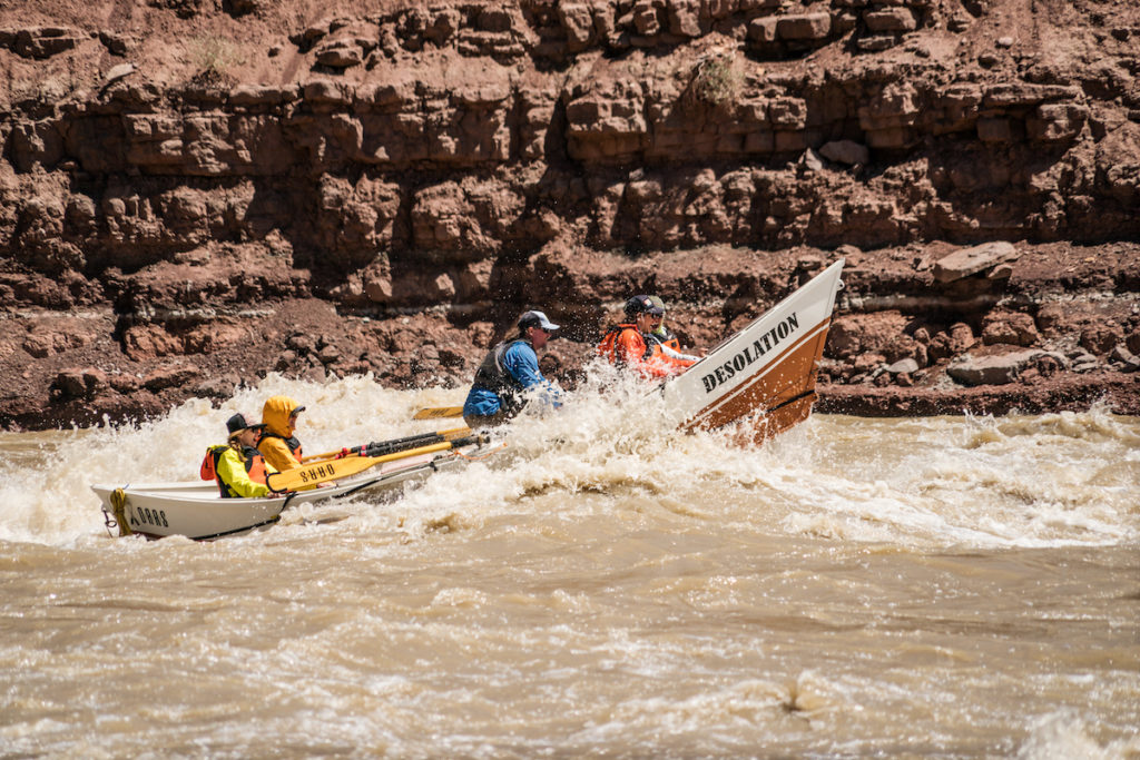
It’s late spring and winter’s bounty is mostly melted. Moisture is making its way into and through the parched soils and transforming into the flows of the rivers many of you (us?) are dying to float. And, alas, because last year couldn’t be the year for many, this year, too, won’t be the year for many. Permits for favored rivers are increasingly hard to snatch, and COVID only added to the brooding desire to get outside and on the water. The odds can be deflating. On the Middle Fork of the Salmon River, 17,000 applicants battled for only 387 permits in 2020. On the highly sought after and impossible to pull Yampa, applicants have about a 2% chance of pulling a permit. With odds like these, who needs enemies?
Rather than spend too much time lamenting the very system that works to preserve the health and long-term sustainability of the rivers we long to float, we’ve schemed up some alternatives. While we know these are no multi-day floats down the Selway or the Green, they’re better than a poke in the eye with a sharp stick. Fortunately, there are still a number of floats that don’t require permits, and floating rivers is not the only way to enjoy them. So, here are a few alternatives for you to ponder, pursue and check out yourself:
GET ON THE RIVER:
- In northern New Mexico, the Rio Chama offers a family-friendly overnight, and some easy day-trips running laps on the section below the Wild and Scenic stretch.
- In southwest Colorado, the Upper Animas river is touted as one of the best Class IV-V runs in the region, and beyond. There are more than 100 rapids on this spectacular run through the Weminuche Wilderness. Not for the faint of float, the river drops nearly 85 feet per mile along this stretch.
- The Flaming Gorge in Utah is a permit-free float on the Green River below the Dam. Broken into three sections, the full float is 23 miles through spectacular canyons, on relatively mellow water that plentiful opportunities for fishing, hiking, camping and wildlife viewing.
- For a day at the park—the whitewater park—head to Montrose, CO where their recently completed Winter Sports Park offers places for kiddos to splash around, and six drop structures where expert kayakers can test and hone their skills.
RECREATE RIVERSIDE:
- Pack a picnic and find your perch in the network of parks and trails built around Clear Creek in Golden, CO. You can play in the water or around it, the trails are paved and are biker, runner, skateboarder friendly, and the water is clean.
- Hike along the Verde River in the Mazatzal Wilderness in Arizona. There are numerous options, but the Verde River Trail offers a roughly 14-mile out-and-back that crosses the river in multiple places (take note).
- Bike the 22-mile Colorado Riverfront Trail in Mesa County. Connecting the towns of Fruita, Grand Junction, and Palisade, the trail is tied at the hip to the river, and meanders through or around numerous parks, Wildlife Areas, Botanical Gardens and lakes.
- Commit to a multi-day exploration of the Escalante River Canyon in southern Utah. Whether or not you decide to tackle the full 85-mile expedition, or to dabble in a shorter in-and-out hike, be prepared to wade through the river, and to be humbled by the deep geologic and human history on display in the canyon.
FOR THE RIVER:
- Give back: for as much as we enjoy rivers, our impact can be negative, and our ongoing ability to enjoy them will be dependent upon the ways we commit and contribute to their long-term health. To learn about opportunities near you, visit (or contribute to) our growing list of river clean-up opportunities and sign up to volunteer with National River Cleanup.
Finally, before we spend too much time cursing the permit system that has you in search of alternatives, take a moment to be grateful that these precious resources have some protection that can help usher their unbeatable existence into the next century (and hopefully beyond).
When the Bureau of Reclamation (BOR) released their standard 24-month study in April 2021, the reaction from media was swift: this is bad news. These regular forecasts project factors of water management—like inflow, releases, power generation and storage levels—for the Colorado basin, and the forecast’s “most probably” model predicts two back-to-back years of 7.48-million-acre-feet releases from Powell. According to John Fleck’s recent transmission, the last time there was a release that low in 2014, Lake Mead dropped 25 feet. And that was just one year. Now, the BOR is anticipating two years in a row.
It is, of course, worth noting that these warnings are not new. Scientists, non-profits, and concerned citizens have been sounding the alarm for decades, ringing that the compounding impacts of demand, over-allocation, and climate change will stress an already overstressed resource. And the predictions of shortfalls in deliveries to Mead aren’t altogether “new”, either. Resource managers have been predicting potential shortages in 2022. The projected shortfalls extending into 2023 is a bit more alarming.
What is perhaps most alarming, as Eric Kuhn flags in his recent post, is that “the assumptions underlying the study do not fully capture the climate-change driven aridification of the Colorado River Basin.” What we’re seeing is a pattern on repeat: the models show a shortage, but the models may well be too generous.
When it comes to less water in the Colorado and the predicted shortages, the Central Arizona Project (CAP) in Arizona will receive some of the first and most drastic cuts. The recently released forecast portends a dwindling Lake Mead, so much so that not just farmers will see a cut in their water supplies from the Colorado River.
While the warning itself may not be a surprise, it remains astonishing that we have ignored, and even more astonishing if we continue to ignore, the ramifications of these kinds of shortages and cutbacks, and the likelihood of their increased frequency should we choose to ignore them. During this nascent stage of negotiations for the 2026 interim guidelines, the most pertinent thing to draw attention to seems to be our inclination to underestimate the shortages that scientists fear the Colorado River will face.
At its core, the concern is about whether we’re facing drought or aridification. If the latter, even the studies incorporated in the BOR forecast that were considered “minimum probable”—the least available water— may be more probable than we’re giving them credence for. And, many scientists make the case that drought, or even megadrought, is no longer the most accurate term for what we’re experiencing. Instead, they argue that we’re in the midst of a more permanent shift to a hotter, drier climate with less available water.
Not to be conflated with science, it’s also important that we not ignore the very things we’re seeing and experiencing in the increasingly arid Southwest. We’ve all felt our eyes red and burning from smoke-ridden air. The soil on trails we walk or run or bike or wander is moved immediately to dust on impact, and it clouds around us. The wind, another potential byproduct of a changing climate, partners with the heat to extract any remnant moisture from a wimpy snowpack from the soil. Our rivers trickle. They dry up. We are witnessing these changes.
So what if the science is wrong? What if we prepare for aridification and less water only to discover that, folly on the scientists! We have bountiful water. What if instead of enforcing cuts, we were able to deliver more water than people had anticipated, because we had been conservative in our estimates. This is unlikely, but not impossible to imagine. What are hard to imagine—though it’s the path we’re on—are the dire consequences of over-promising and under-delivering a resource that not just humans, but that the very marrow of life depends on.
As President Biden’s honeymoon phase comes to a close, river lovers should take heart that the view from Washington, D.C. is undeniably optimistic. We are encouraged that the administration has taken swift action to embolden Congress to immediately address issues of crumbling water infrastructure, environmental justice, climate change and conservation of our lands and waters.
American Rivers’ 2021 Blueprint for Action offers five essential recommendations for investing in rivers, clean water, communities and our future. Here is a look at how the administration is tracking against these critical benchmarks.
Invest in rivers and clean water to recover from COVID-19
American Rivers recommends congress invest $500 billion for rivers and clean water over the next decade. That breaks down to $200 billion to improve water infrastructure, $200 billion to modernize flood management, and $100 billion to restore watersheds nationwide.
Announced in March, the American Jobs Plan calls for $45 billion to completely eliminate lead pipes and service lines under the Water Infrastructure Improvements for the Nation Act grants and the EPA Drinking Water State Revolving Fund. It also calls for $56 billion in grants and low-cost flexible loans to states, tribes, territories, and “disadvantaged communities” to modernize drinking-water infrastructure. Furthermore, the plan addresses the nation’s most concerning emerging contaminants by allocating $10 billion to remediate and monitor PFAS in drinking water, and to invest in rural small water systems.
Since then, the Senate passed the Drinking Water and Wastewater Infrastructure Act of 2021 (S. 914) by a vote of 89-2. This bill authorizes $35 billion toward water infrastructure programs across the country over the next five years. The bill includes, among other provisions, $2.4 billion for Clean Water State Revolving Funds, $100 million in grants for removing lead from drinking water, and the creation of Green Infrastructure Centers of Excellence. It also requires EPA to conduct an analysis of the history of fund distribution to disadvantaged and minority communities under the Safe Drinking Water Act and Clean Water Act.
While this is a good first step, we are only halfway there. After easily passing the Senate, the House must now take S. 914 into consideration as they advance their own companion bill, the Water Quality Protection and Job Creation Act of 2021 (H.R. 1915), which would authorize $40 billion to invest in wastewater infrastructure through the Clean Water State Revolving Fund. Also included, among other provisions, is $1 billion in Clean Water Act grants to implement PFAS standards, $2.5 billion in grants for State water pollution control programs, and $2 billion for municipalities to capture, treat, or reuse sewer overflows or stormwater. The bill is currently being considered by the Transportation and Infrastructure Subcommittee on Water Resources and Environment.
Reverse regulatory rollbacks and restore strong, effective federation protection for rivers and clean water
The actions taken by the previous administration set back the progress our country made with environmental laws like the Clean Water Act and the National Environmental Policy Act. The Biden administration is prioritizing making NEPA, a law that gives communities and tribes the opportunity to review federal infrastructure projects —like dams — before they’re built, a tool for combatting climate change. The administration intends to use NEPA to combat climate change by allowing more complete environmental studies to take place prior to federal projects that may impact communities and their environments. In addition, the Council on Environmental Quality announced that it is rescinding its Draft National Environmental Policy Act Guidance on Consideration of Greenhouse Gas Emissions, which sought to weaken considerations of greenhouse gases from federal infrastructure projects by allowing more readily available use of qualitative analyses, instead of data driven quantitative analysis. The Biden administration’s toughest, yet most important, rollback will be the Clean Water Act changes made by the previous administration. Specifically, the definition of “waters of the U.S.” (WOTUS) will be the most contentious topic and may eventually become one of the administration’s first tests for the conservative led Supreme Court.
Improve protection and management of the nation’s floodplains
Climate change has normalized more frequent and intense weather events. The fallout of these events causes billions of dollars of damage to property and devastates communities. American Rivers recommends the administration and Congress promote equitable, integrated flood management and prioritize nature-based approaches to managing floods. One step that Congress and President Biden can take to ensure that infrastructure investments are resilient to climate change is to pass H.R. 481, the Flood Resiliency and Taxpayer Savings Act of 2021, which would enact the Federal Flood Risk Management Standard in law. With a substantial infrastructure bill in the works, it’s very important that infrastructure projects are not placed in the floodplain and are designed to be resilient to future floods. Integrating resilience and sustainability with flood management, and prioritizing nature-based solutions would promote economic and environmentally friendly solutions, and it is first step in safeguarding our future against a climate-changed reality.
Launch a national initiative to prioritize and fund dam removals
In a show of bipartisanship, Congressmen Earl Blumenauer (D-OR) and Mike Simpson (R-ID) have spearheaded a $33 billion effort to restore the salmon of the Snake River — which American Rivers named America’s Most Endangered River of 2021 — give Native American tribes a louder voice and draw investment for the region’s infrastructure. The Columbia Basin Initiative has many provisions, but what stands out is the plan to remove four federally owned dams on the lower Snake River in eastern Washington to save salmon from extinction, while also honoring tribal treat rights and culture. Congressmen Blumenauer and Simpson plan to pitch the idea as a part of a Biden infrastructure package.
Increase protection of Wild and Scenic Rivers
The Wild and Scenic Rivers System is like a national park program for rivers: It is meant to protect our most valuable remaining rivers against new dams and development, in perpetuity. President Biden’s America the Beautiful plan (30×30 initiative) will rely heavily on the current and future successes of the Wild and Scenic Rivers System when considering existing methods for conserving 30 percent of our nation’s lands and waters by 2030. Congress has responded, and development of Wild and Scenic proposals is underway on rivers across the nation, with legislation to protect 6,700 river miles moving through the congressional process. Congress took its first action on public land legislation when the House passed the Protecting America’s Wilderness and Public Lands Act (H.R. 803) on February 26th, 2021. There are currently many pieces of legislation supporting new designations of Wild and Scenic Rivers.
- Senator Jon Tester (D-MT) sponsored the Montana Headwaters Legacy Act, which proposes adding Wild and Scenic designation for 336 miles of rivers of and creeks the Custer-Gallatin and Helena-Lewis and Clark national forests. This would be an 87% increase for the existing 388 miles of rivers and creek listed as Wild and Scenic thanks to the 3,000 Montanans and more than 1,000 Montana businesses supporting the cause.
- Senators Ron Wyden (D-OR) and Jeff Merkley (D-OR) introduced the River Democracy Act, which seeks to protect over 4,600 miles of rivers and streams in the McKenzie, the Deschutes, the Grande Ronde, the Rogue, Illinois and Nestucca river watersheds.
- Representative Derek Kilmer (D-WA) reintroduced the Olympics Wilderness and Wild and Scenic Rivers Act, which would protect 464 river miles and more than 126,500 acres flowing out of Olympic National Park and the surrounding National Forest. The bill recently passed the House as part of the Protection America’s Wilderness Act and now heads to the Senate where Sen. Patty Murray (D-WA) will take it the last mile.
Also, under Executive Order 14008, titled Tackling the Climate Crisis at Home and Abroad, the administration embarked a course of action to address our planet’s greatest threat. Some of the standout points include the America the Beautiful goal to conserve 30 percent of our nation’s lands and waters by 2030; the Justice 40 Initiative to direct 40 percent of federal investment to disadvantage communities, and a call to every federal agency to draft plans to “bolster adaptation and increase resilience to the impacts of climate change.”
This is all progress — not perfection. While the America Jobs Plan invests in water infrastructure, it only scratches the surface of the $500 billion financial commitment necessary to address the myriad water issues we face. President Biden and Congress will also need to act quickly to reinstate the Federal Flood Risk Management Standard to prevent future projects from being approved without meeting the standard. And while the administration’s clean energy agenda rightly takes an aggressive approach to transition from fossil fuels to renewable energy, to protect our rivers the focus on hydropower should be on responsible operation and environmental performance. Most importantly, our freshwater resources need to have a seat at the table. Their importance is too great to be left out.
Protecting our rivers is never easy and there are headwinds, even now. Still, the revitalized momentum and encouraging progress we are making with the Biden administration and environmentalists in Congress add up to the best opportunity in perhaps decades to unite behind protecting our lands and waters and preventing the worst of climate change.
Healthy cities require healthy rivers to provide clean water for drinking, manufacturing, agriculture, recreation…for living. To protect and restore our freshwater resources, cities are increasingly turning to green infrastructure solutions to adapt to the needs of growing populations and a changing climate. This type of water infrastructure is specifically designed to capture rain where it falls to reduce the number of harmful pollutants flowing into rivers. Green infrastructure installations provide a variety of benefits to communities, increasing its appeal for residents and stormwater managers.
Across urban landscapes, green infrastructure practices are implemented in parks, along the riverbanks, downtown sidewalks, shopping center parking lots, rooftops, walls, and residential backyards. Rain gardens, green roofs and other nature-based solutions improve water quality for rivers and foster climate-resilient communities by reducing localized flooding, improving air quality, reducing energy use, providing shade, promoting walkability, and fostering biodiversity.
Although a variety of resources on the multiple benefits of green infrastructure are widely available; many business owners and community advocates lack the time to explore options. Often, investments in green infrastructure are not a priority. The technical instructions that are available can also create distorted perception of costs, maintenance and value, discouraging property owners from adopting green infrastructure. Yet, the practice is actually simple in concept; plant trees, plants and flowers near paved areas and rooftops to keep pollutants from flowing into rivers.
American Rivers’ Clean Water Supply Team is reframing ‘green infrastructure’ solutions that foster healthy communities by illustrating the value of nature-based solutions. We aim to share perspectives from local advocates and business owners on the challenges and highlights of protecting hometown rivers through their “Green Story”.
Green Story #1: Increase Visibility with Rain Gardens
Property Type: Retail/Commercial
Green Infrastructure Practice: Rain gardens (curb-cuts)
Located near the most polluted stream in Grand Rapids, MI, a business owner demonstrates the significance of reimaging nature into urban spaces. La Casa de la Cobija (House of Blankets) is a central spot for community information and shopping within the neighborhood. Although the property is located on a busy corridor connecting to the downtown district, the business has failed to attract commuter traffic. Similarly, many business owners face expensive refurbishing costs in areas challenged by a historical lack of investment and socio-economical inequalities that proliferated environmental hazards, neglected neighborhoods and redlining policies. As a case study, La Casa de la Cobija demonstrates the value of implementing green infrastructure solutions of even limited size by simultaneously improving community health and water quality in the Grand River watershed. The COVID pandemic heightened the need for the attractive open spaces created by green infrastructure; green infrastructure can help meet the needs of business owners who are desperate to serve customers safely and organizations that need space to provide food and other assistance. The owner of La Casa de la Cobija shares perspectives for small businesses implementing nature-based solutions in this Green Story.
Q: In the height of a COVID pandemic, what motivated you, as a business owner, to implement green infrastructure on your property?
A: Visibility! Even though the traffic is heavy through the corridor, my business seems to go unnoticed to commuters. Bright flowers near the main street feel inviting and welcoming to new and current customers.
Q: Were you aware of green infrastructure as a solution for your business?
A: Not immediately but a local connection introduced me to Plaster Creek Stewards which provided education and assistance for funding to implement a rain garden feature.
Q: The building and parking lot take up the majority of the property, was this an obstacle? How did you address the challenge?
A: To take on by myself, yes it could have been challenging. The only green space is located in the right-of-way area on the residential street connected to my property. I was concerned about permitting and the potential expense of contractors. Plaster Creek Stewards works with city departments to implement gardens for right-of-way spaces known as curb-cut rain gardens. (As the name suggests; a small cut is made in a street curb to allow excess water during heavy rains to flow out of the garden)
Q: Were there other specific design elements to consider for your property?
A: I wanted the property to have bright color flowers that reflect the Hispanic culture shared in this community. The gardens contain 8-10 different native plants and flowers suited for Michigan’s climate, but the colors are bright red and pink in the summer.
Q: What did you learn about green infrastructure through this project?
A: Last year was extremely difficult for business, but the project demonstrated how we can re-imagine our neighborhood. Once the flowers grew, the vibrant colors drew in neighbors, customers, and advocates who were able to utilize the parking lot to distribute food to the community. The rain gardens were highlighted during Southtown’s Caravan Parade celebrating the “Revitalization without Displacement” neighborhood plan.
La Casa de la Cojiba’s rain gardens also inspired community members and with additional support from the City, residential neighbors are planting to promote river health and improve food security. The property is an example of the multiple benefits green infrastructure provides to communities and a model of collaboration between city agencies, businesses, and watershed partners working together to improve community livability and water quality. Reintroducing nature into urban landscapes is significant to restoring the Grand River and fostering a resilient city in the face of climate change.
The Lower Grand River Organization of Watersheds (LGROW) recently launched a program that aims to bridge the gap for small business owners by assessing properties’ feasibility for green infrastructure, providing planning and design support, and connecting owners to local design experts. With the help of employees and neighbors, some business owners are lowering their cost significantly using LGROW’s Rainscaping for Business templates and recommendations to install these river protectors. Some municipalities offer financial incentives to private property owners to encourage the implementation of nature-based practices in urban areas. American Rivers’ Stormwater Currency partnership with Corona Environmental Consultants is working closely with the City of Grand Rapids to launch a credit trading program that will allow property owners and developers to buy and sell rainfall retained on their property though green infrastructure practices. In a region surrounded by freshwater resources, improving water quality with green infrastructure is a priority for many cities in the Great Lakes.
Look for the next “Green Story” in a city near you…
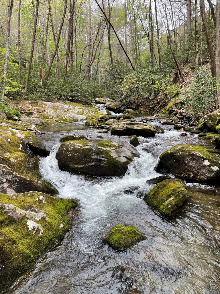
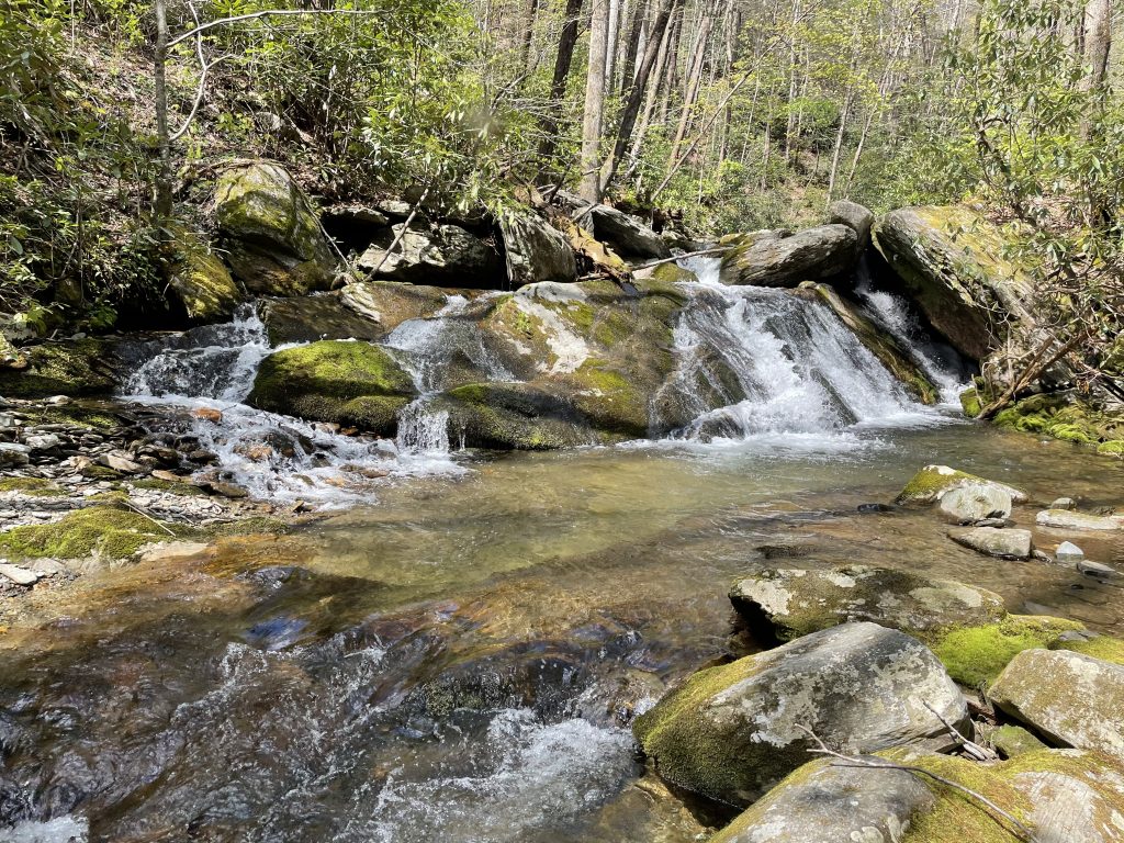
This year, spring carries a special meaning, and as an angler, I couldn’t wait to get back on the river. Driving up to the mountains yesterday and then hiking along the lower stretches of one of my favorite Southern Appalachian trout streams gave me a welcomed sense of relief and anticipation.
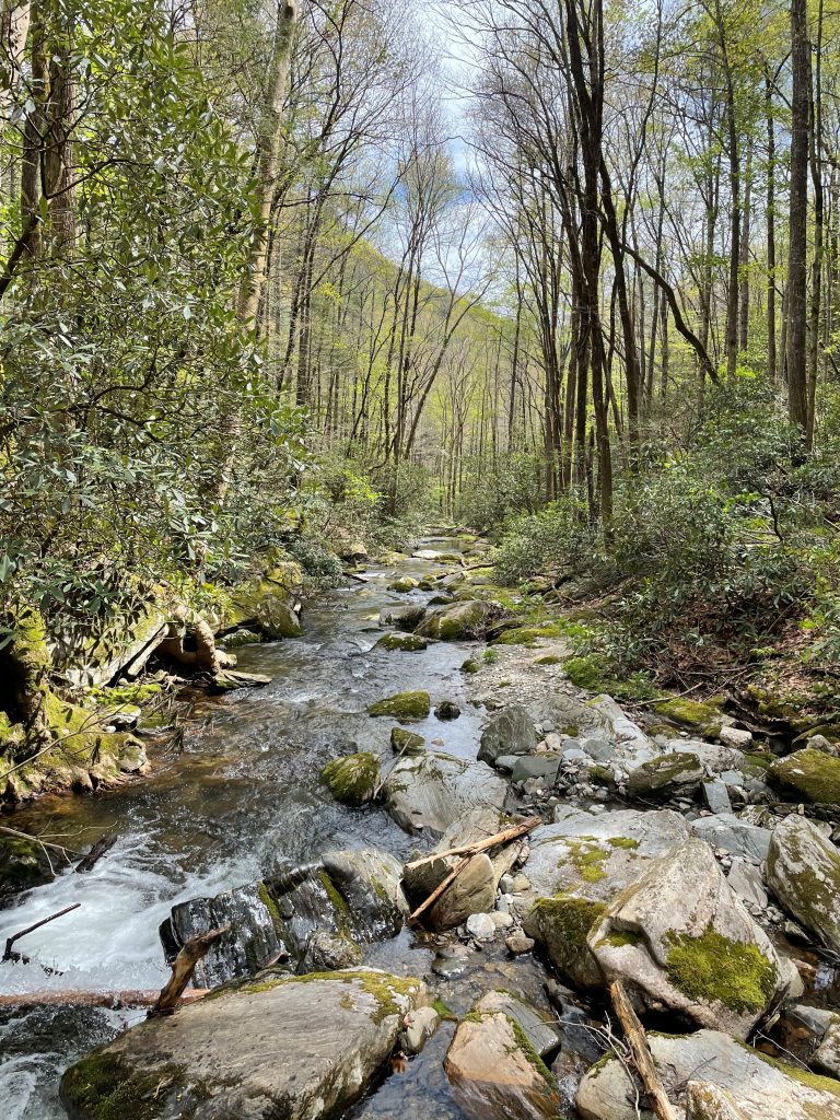
Spring had already come to mountains. The dogwoods were in full bloom, the birds were singing, the rhododendrons were starting to bud, and there was plenty of water in the river. I had hoped the fishing would be good, and looking back on the day, it certainly was. Of course, there were fish that I missed and situations that I could have handled a little better – times when one of the small trout would splash at the fly and miss it, or I wouldn’t clearly see a subtle take and be too slow to set the hook, or in one case the fly moved out of my line of sight behind a small rock, just as the fish took it.
But as many times as the fish got away, there were just as many times when it worked – with the splashing water all around me, feeling the coolness of the air chilled by the water in the canyon, seeing early season bugs dancing on the water, and knowing that the fish would eat.
Every angler has a way they like to fish, and for me, it is fly fishing with dry flies. It’s a quiet process – Zen-like, where everything condenses down to one thing – and the best moment is when out of complete hiding, unseen in his perfect, undetectable camouflage, one of these beautiful wild trout slowly lifts himself to take the fly. Of all the time on the water, 99.9% is spent getting ready for that moment, and when it happens, it’s that half-second that you remember. He angles up in the current and opens his mouth, the fly is gone, and the game is on.
The “fight”, if that’s the right word, will only take a few seconds before he’s back in the water, lost into the stream that hides him so well. But the thrill of that moment, wrapped in the anticipation that had led to it – whether all year, all winter, all day or just that moment – is what sticks with me. It feels so good to be back on the river.
People ask me why I fish, and I’ve always said how it’s full of hope and optimism. Every time I come to the river, every time I make a cast, there’s that chance that something magical can happen. It’s like opening a new birthday present every time I catch a trout.
Likewise, people ask why I work in river conservation, and it’s the same thing. Rivers are magical, wonderful places. They offer each of us peace and joy and maybe even a sense of relief or escape when times have been tough. For me it’s through fishing; for others it might be paddling or birding or resting or something else – it really doesn’t matter. It’s the river that matters. And like fishing is a hopeful act, so is saving rivers. They are some of the most resilient things in nature. So many times, after they’ve been damaged or abused, rivers have come back to their former, beautiful selves. Ask the Cuyahoga or the Penobscot or the Elwha. If we give them a chance, most times, that’s all they need – and by giving them a chance, we’re giving back to them in hopeful ways.
After all, hope springs eternal.
This week, I was excited to be part of Action Day for Clean Water and Rivers. There is such a great need for funding to support healthy rivers and clean water infrastructure across the county and especially in low-wealth communities, we decided to provide a platform to lift up the voices of local activists working on clean water and river conservation challenges around the country.
We teamed up with our good friends at River Network to jointly organize and host a three day virtual event during water week, where local river and clean water activists could meet up with their representatives and Congress to share with them the importance of clean water and rivers to their local communities. Over 75 activists representing 23 states participated, and attended over 50 lawmaker meetings.
Organizations spanned the country, from We the People of Detroit, in Michigan, the Connecticut River Conservancy in Massachusetts all the way to the West Coast and the Tuolumne River Trust based in California.
All the activists related their local work and clean water challenges, and highlighted the need for increased federal support. Crumbling infrastructure and the water affordability crisis were a few of the issues raised. The top-level policy requests that were offered to help address these issues included:
- $3 billion in immediate funding to the Department of Health and Human Services’ Low Income Home Water Assistance Program (LIHWAP). This new program creates a direct water assistance program modeled after the existing Low Energy Heating and Energy Assistance Program (LIHEAP). Additionally, this program should be authorized, made permanent at either Health and Human Services or the Environmental Protection Agency, and tracked to ensure it reaches those most in need.
- $60 million/year for the Environmental Protection Agency’s Assistance for Small and Disadvantaged Communities Drinking Water Grant Program under the Safe Drinking Water Act. This program is designed to support drinking water projects and activities in underserved, small and disadvantaged communities that are unable to finance projects to comply with drinking water regulations under the Safe Drinking Water Act.
- $10 Billion for the Clean Water State Revolving Fund and $10 Billion for the Drinking Water State Revolving Fund over the next five years. Included in this ask, we requested a minimum of 20% of this funding to be distributed to disadvantaged communities via grants, rather than loans. Also we asked for an increase to the green infrastructure set-aside program, from 10% to 20%. This program incentivized Clean Water State Revolving Fund funds to be used for green infrastructure projects, like rain gardens, wetland and floodplain restoration, and green roofs. These sustainable approaches provide multiple benefits to communities and waterways.
It was an amazing event and we are looking forward to hosting an in-person version next year!
It’s official – spring has sprung in the Appalachians. All that has lain dormant is emerging. This spring feels special to me as momentum grows around COVID-19 vaccinations. I see potential in all the sprouts and swelling blooms around me. I see a way through into a better future.
In the darkest part of this past year, at East LaPorte Park in the mountains of North Carolina, we worked alongside the clear water that flows from the Balsam Range, past Judaculla Rock into the Tuckasegee River. We drove stakes of native woody plants, alive with potential, along the bank line. Now, these sticks are sprouting.
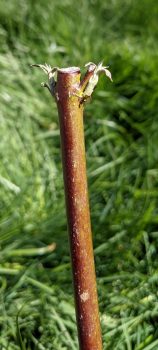
(Cornus amomum) live stake
| Photo courtesy of American Rivers
As those once dormant stakes spring to life, I find myself ruminating on the words of Dr. Robin Wall Kimmerer. She speaks eloquently of healing our relationship with the world, and about reciprocity with all that surrounds us. I have posted a question from Dr. Kimmerer on the wall next to my computer asking what does the earth ask of me, after the earth has given so much to all of us?
As I ponder that question, I think back to those mid-winter days, planting, when the water flowed crystal clear — but it is not always like that. The Tuckasegee River, like many, struggles with muddy water from construction and thoughtlessness, making life difficult for fish, insects, and other creatures.
This was exactly why we were there in the winter planting along the riverbanks – we planted to make homes for food and animals, to shade the water and to reduce erosion. We were creating a mini-wilderness along the riverside, following the tenants of Shade Your Stream for cool and clean water. It is something that anyone can do, and it makes a positive change from the smallest drainage ditch to the mightiest river.
The buds on these sticks will unfold into leaves and put out roots this summer. Next spring, they will do it again. After a couple of good growing seasons, the plants will fill out and shade. Like anything good this takes time, along with rain and sunshine.
So, what can I gift our earth and our waterways? Planting hundreds of native plants along the water is one way to give back. Another, less tangible, answer is embracing collaboration with the passion, knowledge and expertise of partners.
East LaPorte Park, aside from being one of my favorite parks for its beauty and easy interaction with the river, is run by Jackson County Parks and Recreation, who had the vision to support this riparian restoration for the greater benefit of the community. The Tennessee Valley Authority (TVA) provided the funding. The vision of this work was a part of the landscape level coalition of the Little Tennessee Native Fish Conservation Partnership, visioning change for the watershed. Mainspring Conservation Trust, a driving force behind Shade Your Stream, powered the work. Mountain True supplied critical plants and expertise. And, most importantly, the tireless efforts (and dedicated volunteers) of the Watershed Association of the Tuckasegee River, or WATR, will continue to move these habitat and riverine improvements into the future.
I am also hopeful that the hard-working folks at the Eastern Band of Cherokee Indians Natural Resources program will be able to use the area to test auditory surveys of the area as it develops from a relatively sterile swath of grass to a deeply inhabited strip of land, resonating with life. This park is part of the vast aboriginal land of the Cherokee Indians, and right downstream from the landmark Judaculla Rock.
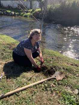
banks of the Tuckasegee River |
Photo courtesy of American Rivers
Can embracing this kind of collaboration be part of a larger reciprocity to each other, and to the rivers that deliver so much for us? Could we, together, inspire more cultivation of these narrow wildernesses along our flowing waters? Can we start to see riverside beauty through its ability to support layers of life rather than a manicured edge? This spring, the answer sounds like a resounding yes.
I hear this yes as I watch the new growth and have faith that the currently lifeless live stakes will bud out into a multitude of growth. These links of collaborations will put out strong roots. Such is this spring.
In the tender sprouts around me I am finding the answer to the question that Dr. Kimmerer poses: what does the earth, these rivers, ask of us? The answer is in these small, individual things that collectively sprout into verdant, intricate, healing growth.
When anyone asks me my favorite color, I simply say ‘Hoh River Blue’ and show them this photo:
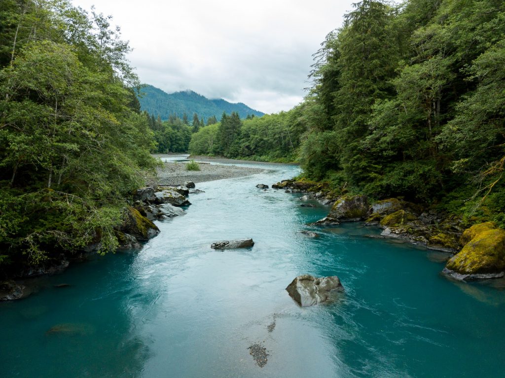
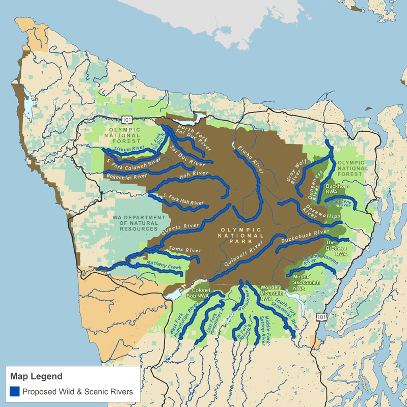
The jaw dropping Hoh River on Washington state’s Olympic Peninsula is just one of the 19 rivers and their tributaries that are proposed to receive federal protection under the Wild Olympics Wilderness and Wild and Scenic Rivers Act, which passed its way through the U.S. House of Representatives on February 26th, 2021, as part of the Protecting America’s Wilderness and Public Lands Act package.
Protecting America’s Wilderness and Public Lands Act
The newly convened 117th Congress took its first action on public land legislation with the passing of the Protecting America’s Wilderness and Public Lands Act (H.R. 803) by the House of Representatives on February 26th, 2021. The House passed H.R. 803 by a vote of 227-200 (see how your representatives voted here).
As is, the Protecting America’s Wilderness and Public Lands Act (PAW+) includes 1.5 million acres of new Wilderness, adds 1,079 miles of rivers to the National Wild and Scenic Rivers System, and includes more than 1 million acres of sensitive watersheds closed to new mining claims, all stretching from the Olympic Peninsula in Washington to California’s Central Coast, Trinity Alps, and Rim of the Valley; and public lands and waters in Colorado. These federal public land protections serve to safeguard critical wildlife habitat, promote climate resilience, enhance outdoor recreation opportunities, and to ensure community access to clean drinking water sources and healthy air quality.
The PAW+ consists of the following eight bills. More information, including legislative language for each bill, can be found here.
- The Wild Olympics Wilderness and Wild and Scenic Rivers Act
- The Colorado Outdoor Recreation and Economy (CORE) Act
- The Grand Canyon Centennial Protection Act
- Colorado Wilderness Act of 2020
- The Northwest California Wilderness, Recreation, and Working Forests Act
- The Central Coast Heritage Protection Act
- The San Gabriel Mountains Foothills and Rivers Protection Act
- The Rim of the Valley Corridor Preservation Act
Wild Olympics Wilderness and Wild and Scenic Act
Nestled within the PAW+ is the Wild Olympics Wilderness and Wild and Scenic Rivers Act (Wild Olympics Act), which includes over 126,500 acres of Wilderness protections and would designate roughly 464 miles of rivers as Wild and Scenic—the strongest protection a river can receive. The Wild Olympics Act was passed in the House of Representatives back in February 2020 and again in July 2020 as part of the National Defense Authorization Act, but it saw no movement in the Senate. The congressional reinvigoration of the Wild Olympics Act was more recently made possible by Representative Derek Kilmer (D-WA-06) who reintroduced the legislation in the House early February 2021, and by Senator Patty Murray (D-WA) who introduced the bill in the Senate (S.455) in late February.
The bill’s primary sponsor, Rep. Kilmer, highlighted the significance of the Wild Olympics Act to local communities and businesses: “As someone who grew up in Port Angeles, I’ve always said that we don’t have to choose between economic growth and protecting our environment. We can and should do both. I’m proud to support this practical, balanced strategy, that will protect the wildest and most pristine places on the Peninsula while ensuring we can keep and grow jobs in our natural resource industries and other sectors.”
In addition to the support of these highly motivated elected officials, more than 12,000 local residents have pledged their support, and the bill has over 800 endorsements from local sportsmen’s organizations, businesses, farms, and conservation organizations. The Quinault, Quileute, Elwha, and Jamestown s’Klallam Tribes have also endorsed the campaign. With this strong support, these permanent protections will safeguard much of the Olympic Peninsula’s ancient forests and sources of clean water, ensure the free-flowing characteristics and outstanding values of the rivers, and provide sustainable world-class recreation and unmatched opportunities for inspiration and solitude.
How You Can Help
The Wild Olympics Wilderness and Wild and Scenic Act, encased within the Protecting America’s Wilderness and Public Lands Act, will move to the Senate Committee on Energy and Natural Resources, chaired by Senator Joe Manchin (D-WV). The Committee may choose to host hearings or make changes to the legislation, which includes the potential to add other bills to the package. If released from the Committee, the Senate will hold debate and take a vote.
Writing to your representatives can make a tremendous impact on the success of the Wild Olympics bill. If your House Representative voted ‘yea’ on the Protecting America’s Wilderness and Public Lands Act (find out here), send them a note to say ‘thank you’ for prioritizing the protection of your public lands. Then write to your Senator and urge them to take up this monumental package of land and river protection bills.
We know that President Joe Biden supports this legislation, stating, “H.R. 803 puts in place protections for some of our nation’s most iconic natural and cultural resources and safeguards recreational opportunities for the benefit of current and future generations, while creating jobs and investing in the recreation economy.”
With the support of our members and conservation voices across the country, we can ensure that the lands and rivers of Washington’s Olympic Peninsula receive the permanent protections they deserve.
The first time I saw the Kern, it was the upper reaches of the river’s north fork, cutting through wildly steep and craggy mountains of the southern Sierra. My mission then was to help survey meadows at the river’s headwaters. After my fieldwork, I drove down the exhilarating slopes, with the wild river running in a deep canyon to my right. The canyon deposited me and the river into the wide, open plains of the southern Central Valley, just east of Bakersfield. The highway pulled away from the river as I drove into the valley, and when I arrived in Bakersfield, I saw that the riverbed through the city was empty and dry.
The temperamental, wild Kern River once flowed along the northern edge of Bakersfield, even flooding city streets every 20 years or so, when wagons were the main mode of transit. Since the 1800s, the lower Kern has been diverted to grow cattle and crops on some of the richest soil in the region. Throughout the first half of the 20th Century river flows through Bakersfield decreased due to irrigation withdrawal, but water still reached the Kern’s terminal Buena Vista Lake west of Bakersfield, supporting millions of migrating birds. When the Kern was dammed upstream of the canyon in the 1950s, high spring snowmelt flows were held back in the reservoir. Irrigation canals withdrew water from the river downstream of the reservoir and, as the crop amounts grew, water demand and market value increased, and flows past Bakersfield diminished. Since the 1970’s, the river simply doesn’t flow by Bakersfield at all, except briefly during extremely wet years.
There is both a classic and unique backstory, but the long and short of it is that the residents of Bakersfield would like their living river back.
Instead of dusty shopping carts and drifting plastic fragments of modern life, the people of California’s ninth largest and often forgotten city would like flowing water in its riverbed, complete with native fish, shady green plants, birds and other wildlife. A living river would give the Kern River Parkway reason to exist and bring joy to its hundreds of bikers, hikers and ever-hopeful bird watchers, who seek connection to nature. A river running through Bakersfield could replenish groundwater that helps supply the city’s residents with drinking water. It would fill Kern and Buena Vista lakes and quench thousands of birds as they migrate south along the Pacific Flyway, restoring some of the symmetry between the meadows in the headwaters and the valley wetlands below. Not all of this can easily happen, given how much water it would take to restore water flows from where the water is diverted in East Bakersfield all the way to its historical terminus at Buena Vista Lake, but Bakersfield residents are mobilizing around the cause of having at least an “ankle to knee deep” river year-round within city limits.
Water to irrigate agricultural fields can come from other sources, but Kern River water can only come from the Kern itself.
Jonathan Yates, founder of Bring Back the Kern presses on some key points:
“The fact that there’s not a river perpetuates a feeling that our city isn’t a good place to live. I hope Bring Back the Kern helps our community come to a wide-reaching consensus that the best use of some of our water is to put it in the river channel.”
Agriculture plays an important role for people living in Bakersfield and the surrounding communities, accounting for approximately 24% of the private sector jobs in Kern County in 2011. While most of the river flow is used for agriculture, there is an opportunity to have some water stay in the channel through Bakersfield, as irrigation infrastructure exists on the west side of the city that could still deliver the water to the same end users.
In the process of flowing through the river channel, more water will percolate into the groundwater, the source of drinking water to the City of Bakersfield, and another key agricultural irrigation source. More water needs to be put in the groundwater across the Kern subbasin to comply with the Sustainable Groundwater Management Act anyway. All of this water would stay in the Kern river subbasin for use, either as surface water or as groundwater, so it’s a clear win for quality of life, environmental justice, and local ecosystems / migratory waterfowl, without causing undue harm to agriculture jobs.
Getting more water in the river in the near term is relatively simple: The State Water Resources Control Board could approve the city of Bakersfield’s water rights application.
These water rights were forfeited by the Kern Delta Water District in 2007, according to a subsequent board ruling. By agreeing to the city’s application for those now-unappropriated rights, the board could let 11,000 to over 100,000 acre feet of water stay in the river through Bakersfield, depending on the water year. This could help keep a low amount of water in the channel all year — anywhere from 15 to 138 cubic feet per second (1 CFS is approximately one basketball of water) — or provide higher seasonal flows, depending on the water year and how that water is managed.
While appreciating many of the competing needs for water, letting water stay in the river also supports the rights of the people of Bakersfield and the rights of the river and wildlife it supports.
The State Water Resources Control Board is the decider. They have delayed this decision for over a decade and recently announced they will be holding a hearing on Kern water rights, but no date is set, so we have no clear timeline for when a decision will be made. Every year they delay is a year lost for the plants, animals, and people that should have access to a flowing river.
You can support the living river and people that want it back by doing one of the following:
- Sign this petition to re-water the Kern (30 seconds of your time)
- Call the State Water Board to give a comment in favor of the river (3 minutes of your time)
- Call (916) 341-5600. Click here for some ideas of what to say.
- Write an email to the State Water Board. Use our template and send an email or letter directly to the water board (5 minutes of your time)
- Email commentletters@waterboards.ca.gov. Click here for a draft message to use as a starting point for your message.
- Give a virtual public comment to the State Water Board in support of the Kern River in one of their bimonthly board meetings (30 mins of your time)
- Message contact@bringbackthekern.org for more details on meeting times and assistance in giving a virtual comment
Thanks for helping influence this outcome for the better!
This past week President Biden unveiled his American Jobs Plan, proposing a nearly $2.3 trillion investment in our national infrastructure. A game-changing investment of this size in modernizing our infrastructure and fighting the effects of climate change is a necessary step, but the question remains, does this bold plan do enough for rivers?
Last year we wrote the Rivers as Economic Engines report, which identifies a $500 billion need over the next 10 years in order to properly support for our waters. This includes investing $200 billion for improving water infrastructure, $200 billion for modernizing flood managements, and $100 billion for restoring watersheds in our community. President Biden exemplifies his own commitment to our nation’s water resources through his American Jobs Plan, which includes $111 billion to revitalize our nation’s antiquated water systems.
“Too many American families drink polluted water, lack access to affordable, high-speed internet, or experience power outages too often – all while paying more for those services. President Biden’s plan invests in the infrastructure necessary to finally deliver the water, broadband, and electricity service that Americans deserve.”
In an effort to remediate lead exposure in homes, schools and childcare facilities, President Biden aims to eliminate lead pipes and service lines completely by investing $45 billion in the Environmental Protection Agency’s Drinking Water State Revolving Fund and in Water Infrastructure Improvements for the Nation Act (WIIN) grants. To address the myriad of other issues facing our aging water systems, President Biden will modernize these systems by investing $56 billion in grants and low-cost flexible loans to states, Tribes, territories, and disadvantaged communities across the country. President Biden plans to stymie our nation’s most concerning emerging contaminants by allocating $10 billion to remediate and monitor PFAS in drinking water, and to invest in rural and small water systems.
“President Biden’s plan will protect and, where necessary, restore nature-based infrastructure – our lands, forests, wetlands, watersheds, and coastal and ocean resources. Families and businesses throughout the United States rely on this infrastructure for their lives and livelihoods.”
The American Jobs Plan maximizes the resilience of land and water resources by directing Congress to invest in protecting communities by building coastal resilience to sea-level rise and hurricanes. Congress is also directed to invest in the protection and restoration of major land and water resources like Florida’s Everglades National Park and the Great Lakes. In addition, President Biden takes aim at the western drought crisis by investing in water efficiency and recycling programs, Tribal Water Settlements, and dam safety.
American Rivers applauds President Biden’s commitment to restoring watersheds, providing clean water, modernizing water infrastructure, and addressing water scarcity. The American Jobs Plan has the opportunity to re-energize our country and refocus our needs towards our most vital resource, water.
While this is a good start, it will not get us across the finish line. To finish the fight, American Rivers calls for investments of an additional $200 billion for improving water infrastructure, $200 billion for modernizing flood management, and $100 billion for restoring watersheds in our communities. With these added investments, we feel we move closer to a future of clean water and healthy rivers everywhere, for everyone.