Here in Montana, we like to gamble, as evidenced by the hundreds of small casinos scattered across the state. But we’re gambling with the health of downstream residents by storing decades of industrial waste in the floodplain of the Clark Fork River while we cross our fingers that the next big flood never happens. Tons of industrial toxins could wash down the Clark Fork River. It could happen next year. It could happen ten years from now. It’s not a matter of if the next big flood will happen, but when.
And when we double down on flood risk coupled with industrial toxins, the stakes are just too high.
For over a half-century ending in 2010, the Smurfit-Stone pulp mill along the Clark Fork River near Frenchtown, Montana produced cardboard. Industrial processes to manufacture parts of cardboard boxes left tons of hazardous cancer-causing toxins including heavy metals, PCBs, dioxins, and furans strewn across nearly 1,000 acres next to the river. These toxins have been partially protected from flooding by a decrepit gravel berm separating the mill from the river channel. But a recent berm failure study commissioned by American Rivers and the Clark Fork Coalition predicts a scary re-enactment of the infamous 1908 flood and the toxic waste it swept downstream.
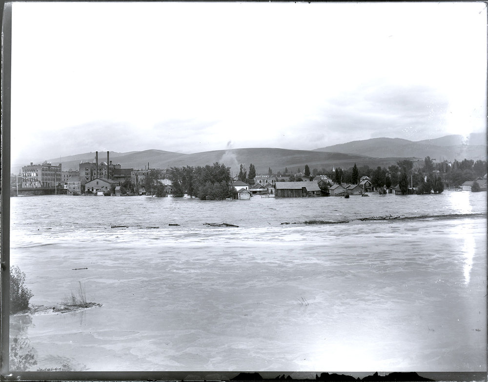
The 1908 flood is the largest on record for the Clark Fork River. It inundated portions of Butte and Missoula, washed out numerous bridges, threatened the then-new Milltown Dam, and dispersed copper mine waste for more than 100 miles. More than a century later, we are still in the midst of grueling, complex efforts to clean up this waste. Sadly, a complete cleanup is simply not possible. Back then, it would have been very difficult to anticipate the catastrophic outcomes of such a large flood, but we know better now.
Estimating the size of future floods requires extending beyond the historical record, and the use of climate forecasting tools to describe expected changes in local river systems. As climate change continues to tighten its grip on the Northern Rockies region, we can expect a shift in the causes, timing, and frequency of higher flows in western Montana, with less snowfall and more rain. Floods triggered by heavy rain, or rain-on-snow, can raise river levels faster and more unpredictably–just like during the 2022 Yellowstone River flood. The chances of that flood happening in any given year were infinitesimal–less than one-in-a-thousand. Yet it happened less than three decades after back-to-back 100-year floods wreaked havoc on the upper Yellowstone River in the mid-1990s.
We now know that a catastrophic flood on the Clark Fork River would breach the berm at the Smurfit-Stone pulp mill and could deposit industrial waste for miles downstream. While catastrophic flood risk may be small for any given year, that risk compounds over time the longer we wait for a cleanup. The extreme toxicity and persistence of waste at the Smurfit-Stone pulp mill underscores the need to consider flood risk over generations and to avoid leaving waste in place long-term, as has happened elsewhere across Montana.
American Rivers and the Clark Fork Coalition are calling on the Environmental Protection Agency (EPA) to include the 2024 berm failure report in its risk assessment for the Smurfit-Stone pulp mill. Ensuring that flood risks inform cleanup plans means completely assessing waste stored in – and next to – the floodplain without delay and adopting a cleanup that removes waste, eliminates the berms, and fully restores the floodplain.
At the Smurfit-Stone pulp mill, the consequences of a future flood just aren’t worth the gamble.
Help safeguard the Clark Fork River – Tell the EPA to take flood risks seriously!
Co-authored with: Sam Carlson, Staff Scientist, and Andrew Gorder, Legal & Policy Director, at the Clark Fork Coalition work to protect and restore the Clark Fork River. Together, Clark Fork Coalition, American Rivers, and other partners commissioned the berm failure study from River Design Group, a local engineering firm.
A benefit of working for a river conservation group as an avid angler is that you have a chance to get to know some excellent fishing rivers. This past month has been a great example of that, where I’ve been able to visit some amazing rivers, many of which American Rivers has worked on.
The month started on a small tributary to the Watauga River. American Rivers and Mountain True were spearheading the removal of Shull’s Mill Dam on the Watauga, which is a special river to me because that’s where my dad taught me to fly fish. Seeing the dam come out was meaningful, and catching trout in a healthy feeder stream nearby made it even more so. When a river is dammed, there’s nothing better you can do for it than taking the dam out.
From there I had a chance to fish on the Penobscot River in Maine. This river benefited from two major dam removals and a fish ladder around a third that were done about ten years ago in collaboration with the power company that owned the dams. The negotiated deal allowed the power company to generate more power from their tributary dams, and the native fish (Atlantic salmon, alewife, herring, etc.) got access to 1,000 miles of spawning habitat. That’s a huge number
and the fish are now returning in record numbers. And by the way, the fishing was tremendous – working the banks with popping bugs for eager smallmouth bass – and it was fun to be joined by a local Bald Eagle who fished near us.
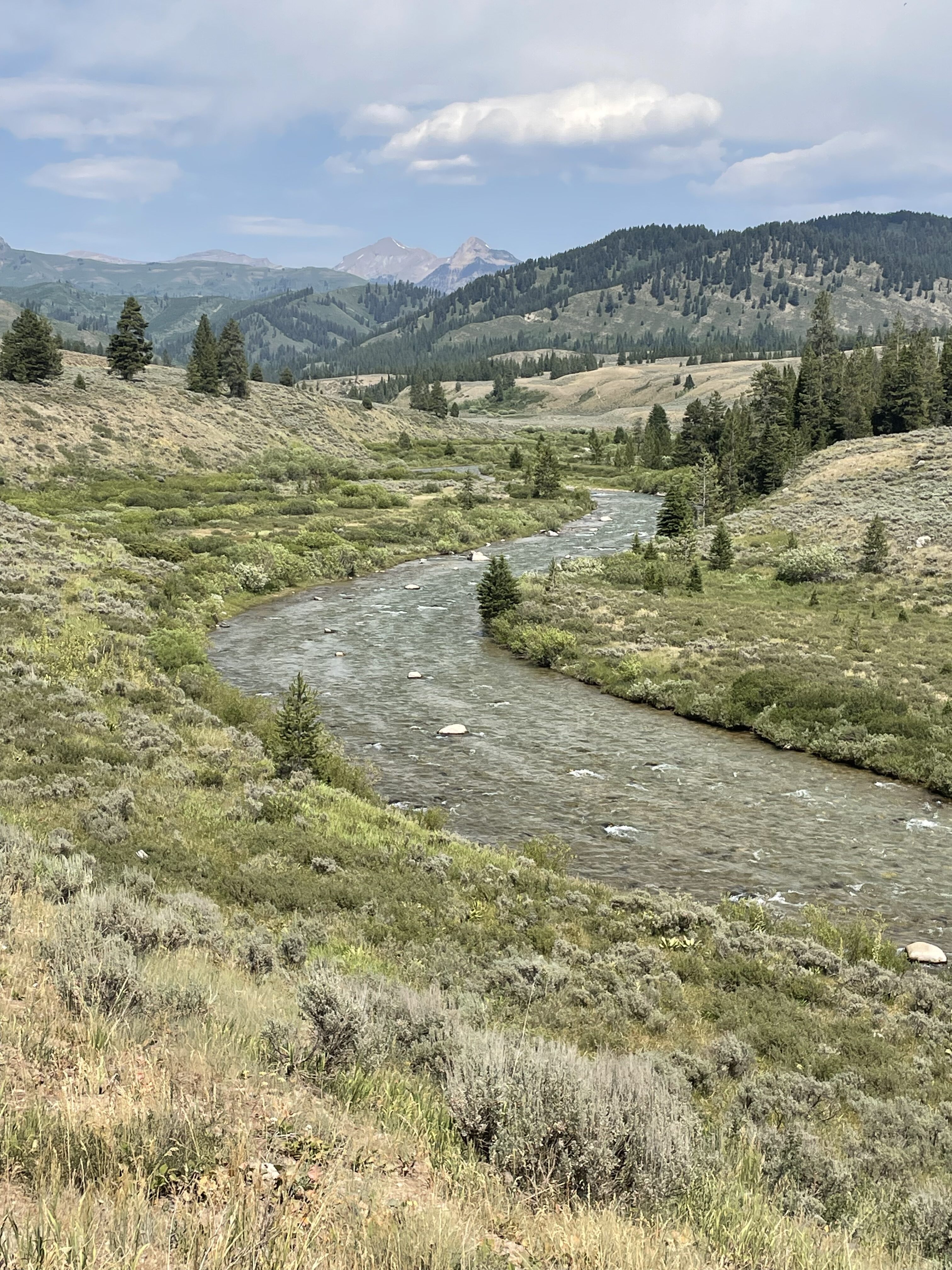
The next trip was a driving tour of Wyoming trout streams with my son. We have been taking fishing trips since he was about six, and they just keep getting better. Our first stops were tributary streams to the Snake River near Jackson – cold, crystal-clear creeks that hold native Fine Spotted Snake River Cutthroat Trout. That’s kind of a mouthful, but the fish are gorgeous and have been there since the Ice Age. When you hold them near the river bottom, you can see how their colors match the colors of the rocks, and they blend in perfectly. All these streams have been protected by “Wild and Scenic River” designations (led by my colleague Scott Bosse several years ago), so the creeks and the fish will continue as they were meant to be forever.
From there we went up to Yellowstone National Park where we fished for native Yellowstone Cutthroats. If you’ve not been to the Lamar Valley, I would highly recommend it. Driving past herds of bison and pronghorns was thrill enough, but then to catch native Cutts in the beautiful Soda Butte Creek was icing on the cake. Though crowded, if you’re patient and careful, the fishing is tremendous.
After Wyoming, my son and I met up with the rest of the family in northern California. We stayed on the Middle Fork of the Feather River, which glistens beautifully in the morning sun. Like the Snake River headwaters mentioned above, the Middle Fork of the Feather River is protected by “Wild and Scenic River” designation. There are some small streams that feed into it that have clear, cold water that support native Rainbow trout, which my daughter and I love to fish for. Sometimes they jump several feet out of the water – pretty impressive for a six-inch trout.
For me, my love of rivers is coupled with my love of fishing. We’re blessed to have such wonderful rivers and fishing in this country, and American Rivers is working to keep it that way.
Good luck the next time you’re on the water.
Michigan is a state defined by water. Well known as a Great Lakes state, Michigan also has 51, 438 miles of rivers and is home to some of the most outstanding rivers in the contiguous United States: the Au Sable, Manistee, and Pere Marquette rivers in the south and the Presque Isle, Ontonagon, and Paint rivers in the Upper Peninsula to name a few. Thankfully some of these rivers, especially those in the northern part of the state, are permanently protected either as nationally designated Wild and Scenic Rivers or as Michigan Natural Rivers under state law. American Rivers is working with its partners to enhance these protected rivers and explore opportunities to protect more rivers — including the Huron River in southeastern Michigan.
This continues a legacy of work by American Rivers going back to the 1980’s, when we, along with local river groups and the Michigan United Conservation Clubs, championed the Michigan Scenic Rivers Act which protected 569 miles of Wild and Scenic Rivers. Today, Michigan has more protected miles of rivers than any state east of the Rocky Mountains.
Many of the state’s most outstanding rivers are part of the National Wild and Scenic River System, supporting habitat, clean water, and recreation for surrounding communities. American Rivers recently surveyed local river groups and state and federal agency staff to assess the opportunities to protect more rivers and streams and improve stewardship for currently protected rivers. Based on the feedback, we are leading efforts to explore improving stewardship, increasing restoration funding for protected rivers, and seeking new protections for rivers such as the Huron River, a candidate for a Partnership Wild and Scenic River study and designation. This designation would substantially increase annual funding to support the successful restoration and stewardship of this outstanding river.
The Huron is known for having outstanding fishing and recreation and the river hosts a number of historic and Native American village sites. The river provides for a wide range of quality gamefish species such as smallmouth and largemouth bass, trout, and steelhead. The Huron River Water Trail, a part of the National Water Trails System provides an exceptional 104-mile-long water-based recreational opportunity for paddling, fishing, and hiking through a significant number of public access sites.
American Rivers is working with our partners to actively explore the Huron River for Partnership Wild and Scenic River status. We are especially grateful for the support of Michigan’s representatives in the U.S. Congress, including U.S. Senator Peters and U.S. Representative Dingell, who are river champions and whose staff have expressed support for exploring opportunities to protect the Huron River.
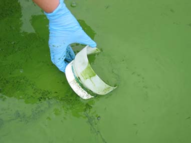
It’s summer, prime season to play in rivers and lakes. Unfortunately, summer is also toxic algae season, which impacts our ability to enjoy our public waters. Toxic algae are actually a type of bacteria often referred to as “algae” because it looks similar. It grows quickly — in what are called “blooms” — with a combination of warm temperatures with excess nitrogen and phosphorous from urban and agricultural runoff. By August, peak toxic algae month, blooms appear as green slime choking the water body or as bright floating mats of scum on the surface.
Toxic algae isn’t just unsightly; it’s a serious threat to our economy, drinking water supplies, and fisheries. That’s because it releases toxins into the water that can harm people and animals. Blooms can be toxic if consumed or touched, causing headaches, stomach pain, dizziness, vomiting, diarrhea, and liver damage. Inhaling the bacteria can cause skin and respiratory irritation. It can be fatal to dogs that swim in or drink the water. As the algae decomposes, it uses up the oxygen in the water, leading to fish kills.
Toxic algae outbreaks have been growing in intensity and frequency, thanks to the increased use of fertilizers and rising temperatures associated with climate change. In 2023, heat waves as a result of El Niño made for a particularly bad year. A toxic bloom off the coast of California left hundreds of sea lions and dolphins sick or dead. In Utah, blooms in the Virgin River and Utah Lake killed two family dogs and sickened more. Toxic algae covered half of Lake Okeechobee’s 730 square miles in Florida and 312 square miles of Lake Erie. Other severe outbreaks appeared in Kansas, Texas, and Oregon.
In past years, toxic algae outbreaks in drinking water supplies have resulted in advisories for children, pregnant women, and nursing mothers to avoid drinking the water; and left hundreds of thousands of people in urban areas without drinking water for multiple days. A Center for Disease Control report from the 2021 toxic algae season recorded 117 cases of human illness and nearly 3,000 animal cases.
There are ways to reduce pollution into waterways, particularly on the local level. When we alter natural landscapes, we change the way water moves over the land and what it carries: think rainfall washing fertilizer off lawns and farmlands to contaminate local streams, or parking lots and rooftops preventing rain from soaking naturally into the ground. But we can reduce our use of fertilizers, update our infrastructure to eliminate sewage overflows, and increase green infrastructure in cities and towns — like installing green roofs, planting more trees, creating rain gardens, and making space for more natural areas — to naturally absorb and minimize pollution that flows into our waters.
“At the national level, it’s essential that we strengthen clean water safeguards. All waters are connected, and pollution anywhere threatens our communities and our drinking water. We need Congress and the administration to make clean water and healthy rivers a top priority.”
– Gary Belan, Senior Director, Clean Water Supply, American Rivers
And remember to check local advisories, including park alerts, local news, and public health websites, for toxic algae blooms before heading out to play in your public waters this summer.
While many are familiar with the fish and wildlife that define our landscapes there are other lesser-known critters that play a role in creating and maintaining a healthy ecosystem. This little guy isn’t flashy with brilliant plumage, a thrilling call, or a remarkable migration story. It is very difficult to see by the naked eye, doesn’t have a dramatic migration story, and isn’t tasty to eat. But you can always know where to find it … in clean clear healthy waters.
So what is this new river friend of ours?
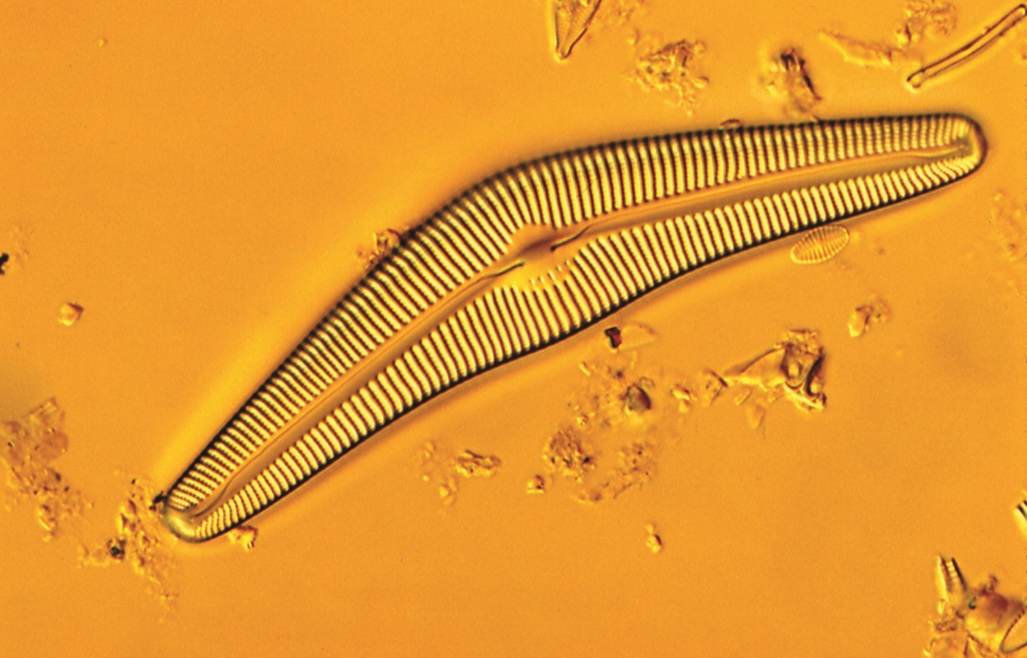
Cymbella cistula shown here is one of the many members of the genera and among the many thousands of varieties of diatoms, or what are commonly called algae. Diatoms are microscopic cells with an outer body shaped in a dramatic and diverse array of wondrous forms. These individual diatoms can exist as individuals or group together in visible colonies (such colonies can be mistaken for a vascular plant, e.g., a plant that has circuitry like blood vessels for transporting water and nutrients through their stems … as a simpler form of life, diatoms have none of this circuitry).
Diatoms generate oxygen through photosynthesis – the process where sunlight and carbon dioxide are converted to oxygen, energy, and water. They are often referred to as planktonic (from the Greek for “wandering”) because despite some having the ability to swim about, they spend their time moving with the currents. The companion group of critters to the plant-like diatoms, or phytoplankton, are the zooplankton, the first consumer in the ocean that eats phytoplankton, also small or early life stage animals that swim or float about.
These two types of planktonic organisms are critical to freshwater and marine food webs and make up a tremendous amount of the living biomass, or organic matter, in our rivers and streams.
Algae? Phytoplankton? You may be envisioning a lake or stream covered in green, making recreation discouraging or even hazardous with certain types of algae blooming in the heat of summer. Too many nutrients from treated wastewater and lawn or farm chemicals allow many species of diatoms to excessively thrive. Impoundments behind dams are often subject to algae blooms due to the decreased flow of water and higher water temperatures. And while abundant amounts of algae generate oxygen from their photosynthesis, inevitably an excessive amount of algae biomass will crash and decay. And decay then consumes all that oxygen. What was a naturally clear and clean waterbody turns a murky green with little oxygen. And some species of diatoms generate toxins that are harmful to humans and animals, making an impoundment or lake not just unappealing to swim, but hazardous to your health. But what about our new friend Cymbella cistula? Not all diatoms are alike! And many species are quite sensitive to an abundance of nutrients and do not thrive in enriched and warmer waters. Cymbella diatoms are one of the diatoms that can really only flourish in low nutrient (“oligotropic”) conditions, waterbodies that run clear and clean. Here is where this tiny organism has an out-sized role in our work to protect and restore our waters.
To chart a course away from polluted and degraded rivers, streams, lakes, and wetlands we need to set a destination. One destination is a waterbody that has little or no impact from humans, or what scientists and regulators call a baseline condition. Because different types of waterbodies – wetlands, estuaries, lakes, streams, and rivers – all have different chemical, biological, and physical characteristics no two types of baseline conditions are exactly the same. Pristine rivers and streams in the northeast are generally those that run clear and cold and flow through forests and areas of little human disturbance. While you may know a pristine stream when you see it, in order to make decisions about how to restore an unloved reach of river, scientists and regulators need precise and measurable indicators of what a pristine baseline condition means.
For many years those indicators were chemical measures of water cleanliness – dissolved oxygen, suspended solids, or temperature. But these indicators only describe a condition at a point in time when the measurement was taken and don’t integrate conditions over longer periods. And they can miss other problems that may be present. So these chemical measures alone are not the best for ensuring we make it to our destination of healthy water. To get the get fullest and most robust picture of the health of a river or stream we need to listen to the critters!
To make a better roadmap (rivermap?) to our destination scientists have for years been exploring what types of fish, insects, and diatoms live in the different types of waterbodies. This work over the last 30 years has created biological definitions of a waterbody’s health to complement the more simplistic chemical measures. One of those biological definitions is based on the description of the types and amounts of diatoms present different environmental conditions. In many parts of the country including here in New England scientists have now collected enough diatom data across enough waterbody types and conditions to create statistical models that show us what diatoms should be living in what types of water conditions. These data and models allow environmental professionals to design clean-up plans or demonstrate how a high-quality water body can remain in good health. In our work to ensure our rivers can be as clean and healthy as possible we rely on the most robust tools, regulations, and policies that help guide science-based decision making. Biological indicators of river health are one of those important tools. The Cymbella diatoms whose presence in these models provides a scientifically robust measure of what constitutes high-quality water are ones we need to listen and pay attention to. So the next time you are paddling down or wandering along that clear and cold stream give a nod to that other “wanderer” helping guide us on our journey to clean and healthy water for all!
A version of this blog was first published in the Spring 2024 edition of Estuary, a quarterly magazine for people who care about the Connecticut River; its history, health, and ecology—present and future. Find out how you can subscribe at estuarymagainze. com
One Friday in May, I got up from my desk and went over to a municipal golf course in south Atlanta for a very special event. The event had nothing to do with golf, and everything to do with rivers.
This was the launch of Atlanta to the Atlantic—a collaborative and experiential act of art-making led by artists Rachel Parish and Sarah Cameron Sunde through Atlanta’s Flux Projects.
It was a slightly giddy bunch of us river paddlers, artists, watershed advocates, and community activists who traipsed down from the Brown’s Mill Golf Course clubhouse to the easiest river access on the property, accompanying Rachel and Sarah to what they’d deemed the best place to start their source-to-sea journey, where the river is barely a creek but is at least something you can float.
Starting a long kayak tour on a tiny urban river? Yes, if that’s where its source is. And why? Because, in their words, “Atlanta to the Atlantic aims to foster awareness of the South River and its environmental health by bringing people into closer relationship with its waters that run through their neighborhoods.”
And how? From the project website:
“A durational work, their journey will take them from the South River (aka Weelaunee) to the Ocmulgee, then along the Altamaha, and finally to the Atlantic Ocean.”
To highlight the interconnectedness of Georgia’s urban and rural communities, Parish and Sunde will invite engagement from local communities along the way. Documenting this journey through video, audio, drawing, and writing, their observations will construct a dynamic portrait of the human and natural communities that are united by this vital waterway.
The Installations: In the fall of 2025, their project will culminate with a series of temporary installations along the tributaries in three Atlanta neighborhoods. These installations (and supporting programs) will highlight the presence of the waterway, offer opportunities for recreation and reflection, and incorporate elements of the collective portrait that emerged along the journey.
With the support of Flux Projects, South River Watershed Alliance, and a whole crew of helpers and advisors, the journey is now underway. Standing on the riverbank and seeing them off, I chuckled at how much walking they’d have to do on Day 1 of the trip—on such a small river—and how very many downed trees, snags, and strainers they’d have to navigate. “Been there!” I told them, remembering long days canoeing (and walking) other small rivers elsewhere around here. “There’s gonna be more of that today!”
Scrambling up the steep riverbank after helping the kayaks down, I put my hand on an old, deflated air mattress that had been wrapped around a tree by the river’s current in flood. By some unwritten personal rule, I knew that I now had to take this exceptionally large piece of plastic trash out of the river. So I unwrapped it from the tree and dragged it up the bank to sit in a heap while we all said the rest of the goodbyes.
Finally, with the paddlers floating out of sight and clouds thickening overhead, the group of well-wishers slowly dispersed. Under a light rain I folded up the sandy, muddy air mattress the best I could and lugged it back across the fairways, up the hill to the parking lot. I drove the 15 minutes back home; changed out of my damp socks and dirty shirt; warmed up my lunch. Then I did something that surprised me: I opened my phone to see if the livestream from the camera mounted on the bow of Sarah’s kayak was working yet.
It surprised me because I’m a little bit technophobic, especially when it comes to the changing ways we experience the world around us (and, in particular, the natural environment) through ever-new technologies. And yet it delighted me as I sat down to my lunch, comfortable at the kitchen table but partly wishing I were there too, slogging through the shallows and hauling over logs. I saw things from the boat’s perspective. I could hear the birds singing, the gurgling repeated splash of paddles dipping the water, the chatter of the group as they noted game trails down to the river from the thick green forest growth all around and above them—still inside the city limits and well inside Atlanta’s perimeter highway.
There is a kindredness among the many of us who’ve done long river tours, that’s for sure. And I’m proud of the work I do in community meetings and the sterile, fluorescent-lighted halls of government to protect and restore our rivers, to bring communities back into touch with them. But the artists’ eye and ear that Sarah Cameron Sunde and Rachel Parish bring to their journey, to this river system and its people, makes for another way of knowing rivers altogether. Beyond going downriver to the Atlantic, I can’t wait to see where this project goes in the months ahead.
Restoring Ackerson Meadow is a story of big firsts. This was the first time I’d ever seen a wildlife conservation dog in action. Trained to sniff out the threatened northwestern pond turtle, Ari the Poodle and her canine colleagues have helped to find about 300 northwestern pond turtles at Ackerson. Who knew conservation could be both adorable and impactful? This project was also the first time this much earth had been moved in Yosemite National Park (150,000 cubic yards of soil or 15,000 dump truck loads), making it the largest full-fill meadow restoration in the history of the Sierra Nevada. And as of June 2024, the first phase of restoration is complete!
This project was driven by collaboration between American Rivers and Yosemite National Park, Stanislaus National Forest, Yosemite Conservancy, and others, a multifaceted partnership that led to the acquisition of the meadow from private landowners in 2016 and the restoration we are seeing play out today. Ackerson Meadow is a roughly 3-mile-long, 230-acre meadow system. Restoring it is no small feat! To make it more doable during the short snow-free months of the Sierra Nevada, the project is being implemented in two phases. The first phase, now complete, focused on restoring the downstream portion, roughly 80 acres, of Ackerson Meadow. This monumental effort involved excavating mineral soils from the areas burned in the 2013 Rim Fire and using them to fill an erosion gully nearly 15 feet deep.
Finishing the first phase of restoration on this picturesque site was something to celebrate, and on June 12, a large group gathered on the western edge of Ackerson Meadow, which straddles the western boundary of Yosemite National Park. Shaded under canopies in 90+ degree summer heat, speakers from Yosemite National Park, Stanislaus National Forest, Yosemite Conservancy, National Park Foundation, CA Dept of Fish and Wildlife, CA Wildlife Conservation Board, American Rivers, CA Natural Resources Agency, and Trust for Public Land stepped up to the podium to deliver celebratory remarks, with a newly watered meadow and the green Sierra Nevada in the backdrop.
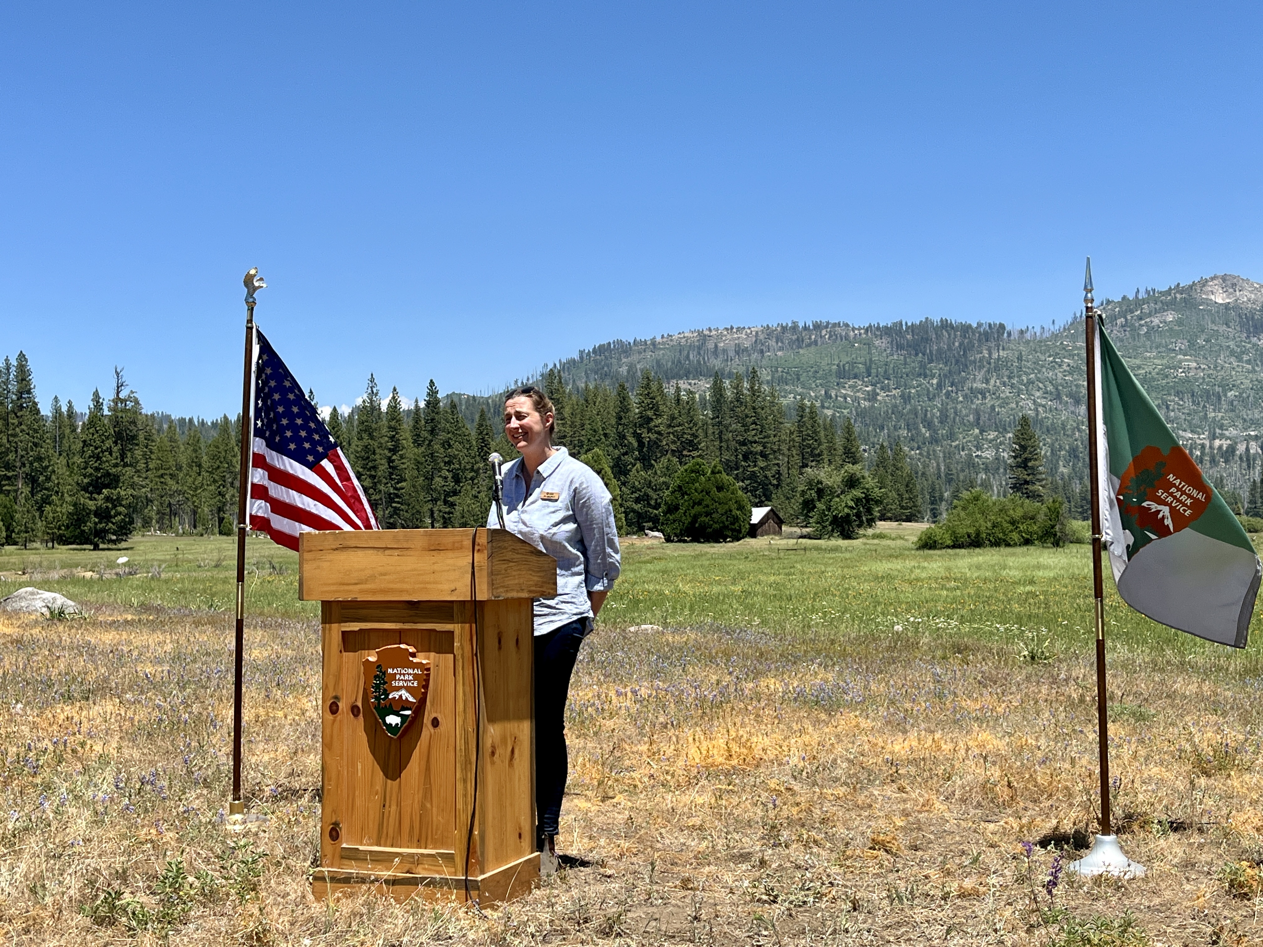
The impacts of restoration are already on display. After the ceremony’s speakers did a ceremonial planting of native wetland plants (also the first time I’ve seen a golden dibble), I led a tour around the site as interested folks peppered me with questions and observations. We could see water spreading across the meadow surface and sinking into the ground in real-time, glistening between the strands of tall grass. Results don’t always manifest this quickly. Natural processes can take years, decades, or even centuries to recalibrate. But the work isn’t over. We are moving on to Phase II, where with the support of the CA Department of Fish and Wildlife and their Nature Based Solutions grant program, we’ll restore the upstream 160 acres of Ackerson Meadow. This will complete the final step in a decade-long effort to protect and restore the site.
The story behind this gathering and this moment could be told from many perspectives in many eras. Ackerson Meadow was a gathering point for Native peoples from the east and west side of the Sierra Nevada mountain range for generations. After the Park was established in 1890, Californians and the world gained an indispensable national treasure, a promise for generations to come. But Ackerson sat outside the Park’s boundaries and was a privately owned cattle ranch for over a century before being acquired by a coalition of conservation groups, and transferred to Yosemite National Park. Now here we are, standing in the midst of transformation across 230 acres of wet critical habitat with a golden dibblein one hand and a happy turtle in the other. The Park’s Instagram page calls Yosemite “a shrine to human foresight,” and restoration like that at Ackerson Meadow feels very much the same.
Note: Phase 1 of the project This project was funded in part by the donors of American Rivers, Bonneville Environmental Foundation, California Department of Fish and Wildlife, California Wildlife Conservation Board, Google (in association with their Water Stewardship pledge and strategy), National Park Foundation (provided by The Coca-Cola Company, The Coca-Cola Foundation, and Stericycle), National Park Service (provided by Bipartisan Infrastructure Law-Ecosystem Restoration, Concessions Franchise Fee, and NPS Operations), US Forest Service, and the Yosemite Conservancy.
“There is nothing new under the sun, but there are new suns.” -Octavia Butler
It is not breaking news that communities of color (regardless of wealth) are more vulnerable to the impacts of climate change, and specifically more vulnerable to flooding (Natural Hazards Center, 2020). It is also not news that the legacy of formal policies that forced communities of color, specifically Black Americans, to live in flood-prone areas persists today (Redfin, 2021). These policies manifest daily for black and brown communities through the lived experience of disproportionate environmental burdens, and increased risk of hazards associated with flooding. Yet, too often well-meaning floodplain managers, conservationists, and policymakers advance flood risk reduction projects that displace people of color and drain intergenerational wealth.
So how do we transform the landscape of floodplain decision-making, planning, and policy? How do we create bridges between policymakers and the community members who are the most impacted? How do we generate meaningful dialogue, partnerships rooted in place, and actionable change where it is needed most?
Centering communities of color means learning from communities of color. There is a long and well documented history of failed regulatory support for black and brown communities. Despite this, communities of color have a rich history of success in transforming their own conditions (NRDC, 2022). Still, community organizers need support.
In April 2023, American Rivers partnered with the Illinois NAACP, Watertown Community Empowerment Organization, and United Congregations of Metro East to form the Illinois Floodplain Community Justice Network (IFCJN). This network formed as a direct result of the Illinois Floodplains Work: A Feasibility Study which made clear that flood-prone communities of color in Illinois have not been served well by their local governments, and illuminated the need for community organizers to augment the efforts of local floodplain managers, Illinois Emergency Management Agency (IEMA) and Department of Natural Resources (DNR), and Federal Emergency Management Agency (FEMA). The IFCJN organizes people by connecting flood-prone communities to share knowledge, information, and resources. Our nascent network offers training and guidance on flood issues, engages residents in the process of updating their Flood Insurance Rate Maps, and provides guidance on how to influence local Natural Hazard Mitigation Plans. Lastly, the IFCJN influences planning and policy by advocating for policies that center the needs of communities of color in planning and decision-making as it relates to flood issues.
Centering communities of color in decision-making for floodplain management enables more equitable and effective projects to reduce flooding in the face of climate change. We are hopeful that this network will serve as a model for future partnerships nationally.
June is National Rivers Month! Summer is upon us and long days on the river have begun. Whether you walk a local riverwalk, fish, kayak, canoe, swim, or even just float, this is the time of year to get out on your favorite river!
There’s a lot to celebrate about rivers this month. Here are some highlights:
It’s the 50th Anniversary of the Chattooga River becoming a Wild and Scenic River!
When Congress passed the Wild and Scenic Rivers Act of 1968 the Chattooga was specifically identified as one of 27 rivers across the country to be studied for possible future inclusion in the new National Wild and Scenic River System. Following the study, it was concluded that the Chattooga was indeed eligible and on May 10, 1974, the Chattooga River became the first river in the Southeast designated as a Wild and Scenic River. Read More…
New drinking water standards were recently introduced by the EPA to protect against “Forever Chemicals”
EPA Administrator Michael Regan recently spoke about the impacts of years-long contamination of our nation’s waterways by manufacturers of forever chemicals. Administrator Regan also highlighted the efforts of many citizens, scientists, EPA staff, and officials at all levels of government to hold these polluters accountable as well as enact regulations to protect against these harmful chemicals. Learn More…
Our team is making great strides in the California Headwaters
California relies on its headwaters in the Sierra Nevada to provide a steady clean water supply to downstream users, essential habitat for native species, and recreation for nature lovers. Restoring Ackerson Meadow in the California Headwaters will also provide multiple benefits for climate resiliency, water quality and supply, flood attenuation, carbon sequestration, and biodiversity. Learn More…
While there is a lot to celebrate, there is also still a lot to be done to ensure the health of our rivers and to protect clean water. A Supreme Court decision last summer gutted protection for streams and wetlands, dramatically narrowing the scope of the Clean Water Act and undoing protections that have safeguarded the nation’s waters for over 50 years. This decision erased critical protections for tens of millions of acres of wetlands which threatens the clean drinking water sources for millions of Americans.
To better understand how this Supreme Court decision will impact your clean water, we asked a friend to help tell the story. Meet Splashy! An eager small stream who wants you to know how this ruling cut protections for streams like him and how it has put your clean water at risk.
Splashy and the gang are here to teach you all about how small streams and wetlands are connected to your clean water. You will likely learn something new, and you might just fall in love with a little blue drop of water.
As for me, I’ll be spending most of my summer out on the James River in my hometown of Richmond, Virginia, creating memories with friends and loved ones during group paddles and river hangs. I also love to take time and ground myself by sitting and listening to the water as it makes its way downstream. It helps remind me that rivers have life within and around them — life that depends on them. Rivers count on you and me to be their voices and advocate for their health and well-being. So, I encourage you to spend time near your local waterways this summer and learn a little about them. Does your drinking water come from a river? What is your state doing to protect streams and wetlands? How can you get involved in your local river community?
Let me and Splashy know what you’ve learned in the comments down below!
I recently attended the announcement held along the banks of the Cape Fear River—of the long-awaited drinking water standards for 6 types of PFAS, also known as “forever chemicals.” EPA Administrator Michael Regan spoke about the impacts of years-long contamination of our nation’s waterways by manufacturers of forever chemicals. Administrator Regan also highlighted the efforts of many citizens, scientists, EPA staff, and officials at all levels of government to hold these polluters accountable as well as enact regulations to protect against these harmful chemicals.
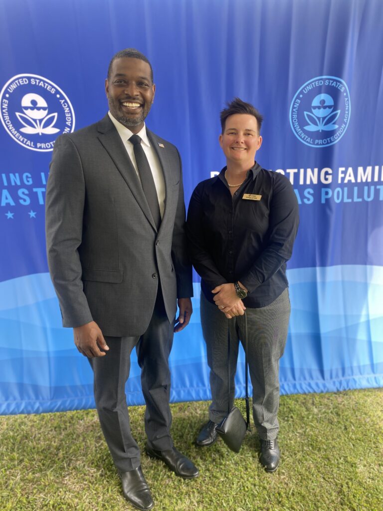
Donna Myers, Associate Director of Southeast Conservation, with North Carolina Governor Roy Cooper (Left) and EPA Administrator Michael Regan (Right)
This was an important day for affected citizens who’ve rallied their communities across North Carolina for years to address the serious health risks posed by the permitted dumping of PFAS, notably into the Cape Fear River by Chemours Fayetteville Works Plant. However, the concerns are not only downstream of this discharge. To learn more about the proliferation of these substances, The State of North Carolina Department of Environmental Quality began sampling for PFOS and PFOA in drinking water sources across the state. Citizens can find the results of those studies here or by contacting their local water utility.
American Rivers supports this monumental movement toward clean drinking water standards of PFAS contaminants. While this is a huge step forward, we and our partners remain concerned over contaminants still in the Cape Fear River and the State of North Carolina’s ability to regulate the polluters responsible for these releases. American Rivers supports our partners including Haw River Assembly and Cape Fear River Watch who continue to call for the polluters to be held accountable by cleaning up years-long permitted discharges of PFAS and end the discharge of these harmful chemicals into the river.
Guest blogger Tess McEnroe is a river conservationist with Idaho Rivers United and shares her recent experiences on Montana’s Smith River.
Taking a Smith River trip in early April is a rite of passage for river runners in Big Sky Country. Our recent trip was just the ninth launch of 2024, kicking off the season with typical Montana spring weather – a slice of teaser sun followed by two solid days of rain and snow, blanketing the canyon and our rafts with three inches of snow and soaking us to the bone for nearly 60 miles.
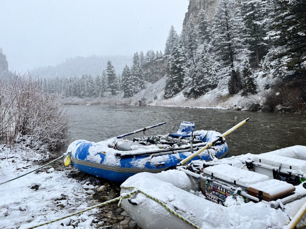
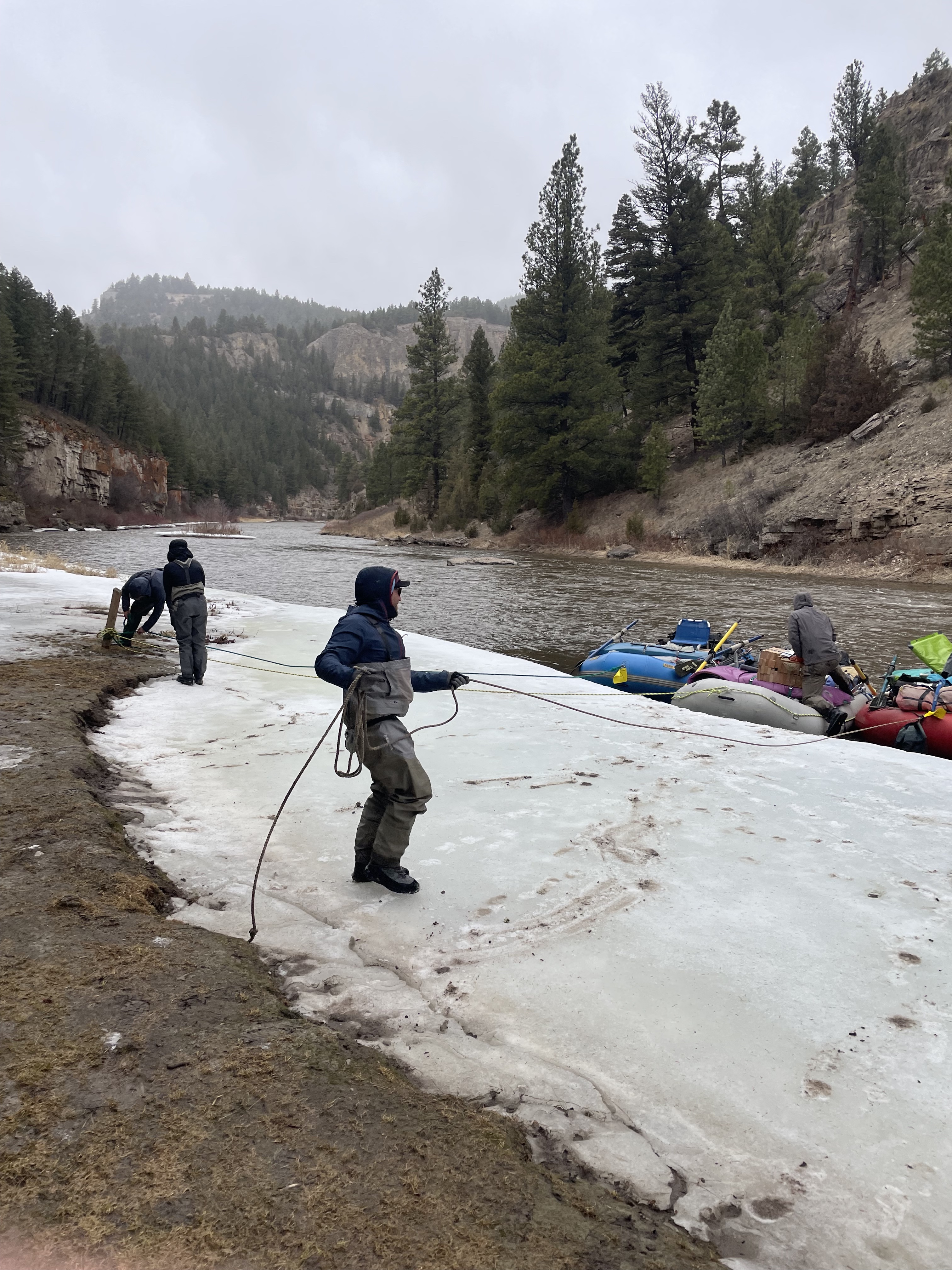
We had heard other stories about early season Smith trips being “stuck at a camp for five days because the river froze over,” or “having to break into a nearby home to warm the kids up.” But as with any good river trip, you laugh, snack, shiver, and imbibe through the frozen feet together. It’s “type two fun” and we would do it again in a minute. We paddle for preservation, just as anglers can cast for conservation, and by doing so we are actively connecting to the natural world while protecting these important wild places for now and future generations.
The Smith River is threatened by the Black Butte Copper Mine, which is being built about 17 miles up Sheep Creek. Sheep Creek is a clear-flowing trout spawning tributary that flows into the Smith at the Camp Baker boat launch, which is about a half hour drive from the small ranching community of White Sulphur Springs.
According to Earthjustice, the copper mine would produce nearly 13 million tons of acid-generating waste, threatening water quality and trout populations in Sheep Creek, the Smith River, and eventually the Missouri River, into which the Smith flows. Not only does the Black Butte Mine threaten a world-class wild trout fishery, but the Smith River canyon also has irreplaceable cultural value in the form of over 70 Native American pictograph sites hidden amongst its limestone walls and caves.
The Black Butte Copper Mine was temporarily stopped in April 2022 when a state district court judge ruled in favor of American Rivers and its co-plaintiffs, who argued the Montana Department of Environmental Quality (DEQ) failed to conduct a thorough enough environmental analysis. But last February, the Montana Supreme Court overturned that decision, reinstating the operating permit for the mine.
The battle is not over, however. The mining company still needs to survive another court challenge pertaining to the water rights the mine needs to operate. In late March, the Montana Supreme Court heard oral arguments in that case, and it is expected to issue a ruling by November. In the meantime, conservation groups are urging the Bureau of Land Management and Forest Service to implement a 20-year administrative mineral withdrawal on public lands in the Smith River watershed to ensure that any mining that occurs at the Black Butte Mine doesn’t spread onto the adjacent Helena – Lewis and Clark National Forest.
Another important way to protect the Smith River is through passage of the Montana Headwaters Legacy Act, sponsored by US Senator Jon Tester (D-MT). The MHLA would safeguard 384 miles of Montana’s most prized rivers as Wild and Scenic – including the Smith River and Tenderfoot Creek, its most pristine tributary. This legislation would also protect 18 other waterways in the Greater Yellowstone area, including portions of the Gallatin, Madison, and Yellowstone rivers.
The Smith River clearly deserves to be designated as a Wild and Scenic River and protected in perpetuity. As the only permitted river in Montana, the Smith is unique. It possesses stunning scenery, abundant wildlife, and an exceptional wild trout fishery, which generates over $10 million annually for nearby rural communities. Passing the Montana Headwaters Legacy Act and implementing a mineral withdrawal in the Smith River headwaters are two critical steps needed to protect this remarkable river and preserve the opportunity for others to experience their own snow-covered sufferfest like the one I just endured.
Rivers connect landscapes and humanity – they are the lifeblood of Earth, the pulsing, freshwater arteries of the planet. After floating the Smith this spring, I have a much better understanding of why the Smith is one of our state’s most treasured rivers. Let’s keep it that way.
Tell Senator Daines to support the Montana Headwaters Legacy Act, and sign the Smith River mineral withdrawal petition.
Tess McEnroe is a river conservationist at Idaho Rivers United and has river guided across the west for 18 years. She lives in Missoula, MT along the Clark Fork River.
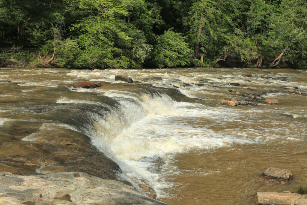
The world’s largest dam removal on the Klamath River continues to push forward, with one dam completely removed, and the remaining three in progress. During the removal process, sediment impounded in the dam’s reservoirs will keep moving downstream. What do these processes mean for fish and wildlife in the river and the communities who depend on the Klamath?
To make things easy, we put together four key things you need to know about the impacts of dam removal on the Klamath River.
1. Muddier in the short-term, healthier in the long-term
Since the drawdown behind three remaining Klamath dams began in January, the river has been looking muddy, and residents of the Klamath watershed are understandably concerned. Sediment is a natural part of river systems. Healthy rivers move sediment downstream and out to the ocean as part of their regular flows. Sediment has built up behind these dams since they were built, starting in the beginning of the 20th century. The Klamath dams impounded millions of tons of sediment over nearly 100 years. Before a single dam was breached, multiple scientific studies were conducted to predict how their stored sediment could affect the river. To minimize the harm to the river, including state and federally protected species, and harness the power of the river to mobilize the stored sediment, dam breaching, and the subsequent sediment release was scheduled for the winter months. Now that the three remaining dams have been breached, a century’s worth of sediment is flowing downstream and will temporarily affect the river’s water quality. The worst water quality conditions have likely passed as the initial slug of sediment has been flushed downstream. Water quality is seeing steady improvements; as the river begins to heal the removal of the dams will improve water quality, from nutrients to dissolved oxygen and stream temperature, and reduce the likelihood of toxic algae blooms, creating healthier habitat for salmon, other fish and wildlife, and people.
2. Is the Klamath safe to drink and play in?
No one should ever drink untreated surface water. This is true on major waterways across the U.S., including the Klamath River. Since there are no drinking water sources that draw directly from the Klamath River, and groundwater wells will be unaffected by sediment from the dam removals, the dam removals are not impacting the availability of clean drinking water. While the turbid river may look unappealing, recreating in the Klamath is also possible. According to the California Water Quality Board, data collected by Siskiyou County and the Klamath River Renewal Corporation indicate it is “unlikely that recreational activities in the Klamath will lead to adverse health effects from dam removal related sediment in the water.”
3. Are fish dying because of the dam removals?
Yes: while reports and images of dead fish following dam breaches are unfortunate, this outcome was expected. Fish stranded in the drained reservoir were invasive non-natives, including bluegill, yellow perch, and small- and largemouth bass.
Reports of a fishkill of juvenile salmon are related to the California Department of Fish and Wildlife’s release of non-listed fall-run Chinook salmon. These fish were released from the new hatchery facility upstream of the Iron Gate Dam because the hatchery had already exceeded its quota for producing these fish for the year, and the hatchery conditions were becoming too crowded. Although the loss of these fish is unfortunate, it will not affect the hatchery’s ability to reach its production goals. Mortality was caused when juvenile fish swam through part of the Iron Gate Dam facility that resulted in a gas-bubble disease, similar to the “bends” that scuba divers can experience.
CDFW will release all hatchery fish below Iron Gate Dam until the facility is removed. This past week, CDFW successfully released about 90,000 coho salmon, a threatened species, as well as more than 400,000 fall-run Chinook salmon that were raised in the Fall Creek Fish Hatchery. The problem associated with the Iron Gate Dam tunnel is temporary, as is the dam itself; following the dam’s removal, future hatchery releases will not need to take this into consideration. The good news is that we’re seeing healthy fish in downstream monitoring programs from partner agencies, the U.S. Fish and Wildlife Service, and the Karuk Tribe.
4. What is the timeline for recovery?
Other dam removal examples indicate that healing on the Klamath will take time… but not as much as you might think. When the Condit Dam on the White Salmon River was removed, 60% of the sediment was eroded through natural processes within 15 weeks, and native fish were found above the former dam locations within a year of the removal. When Bloede Dam was removed in 2018, 50% of the sediment eroded away within 6 months of removal, with native fish populations making a similar rebound. These case studies show us the immense ecological value of dam removal, in addition to providing some context around what’s happening on the Klamath River. However, since the scale of the Klamath River dam removal is unprecedented, it’s difficult to predict exactly when the negative short-term effects will subside. What is certain is that dam removal is the first vital step to restoring the Klamath River and will jump-start its path to recovery.