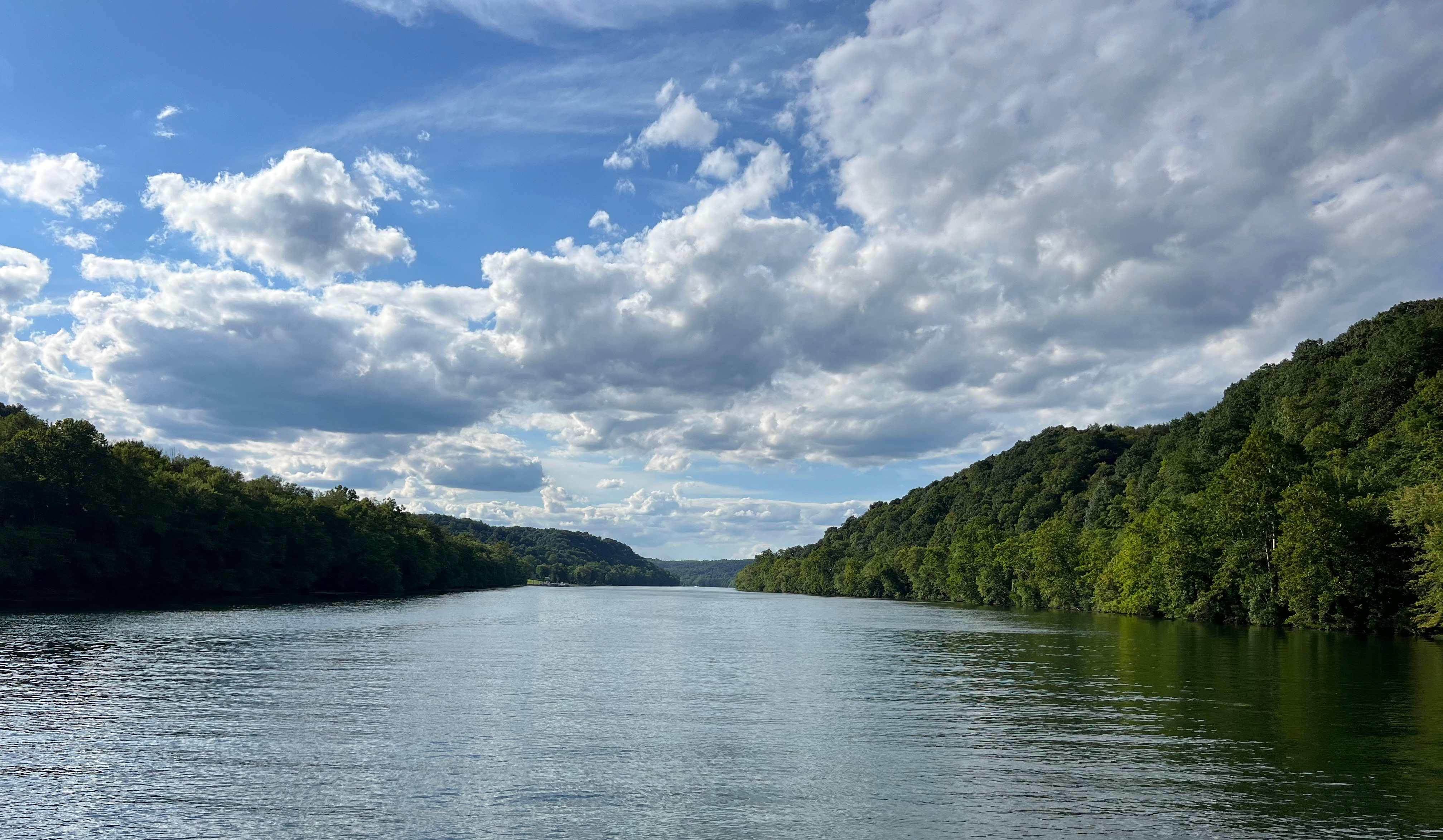
The One Big Beautiful Bill Act (OBBBA), also known as H.R. 1, is now law. Signed by President Trump on July 4 after months of intense negotiations, its path was anything but smooth. The legislation advanced through a fast-track process known as reconciliation, which allows members of Congress to bypass the typical 60-vote threshold in the Senate and pass bills with a simple majority in both chambers.
After passing the House, the bill moved to the Senate. Earlier this month, after substantial changes to the bill, the Senate passed H.R. 1 by a 51–50 vote, with Vice President J.D. Vance casting the tie-breaking vote. Three Republicans joined all Democrats and Independents in opposing the bill. Just 48 hours later, the House narrowly approved the Senate-amended bill by a vote of 218–214. All Democrats opposed the measure, joined by Republicans Thomas Massie of Kentucky and Brian Fitzpatrick of Pennsylvania.
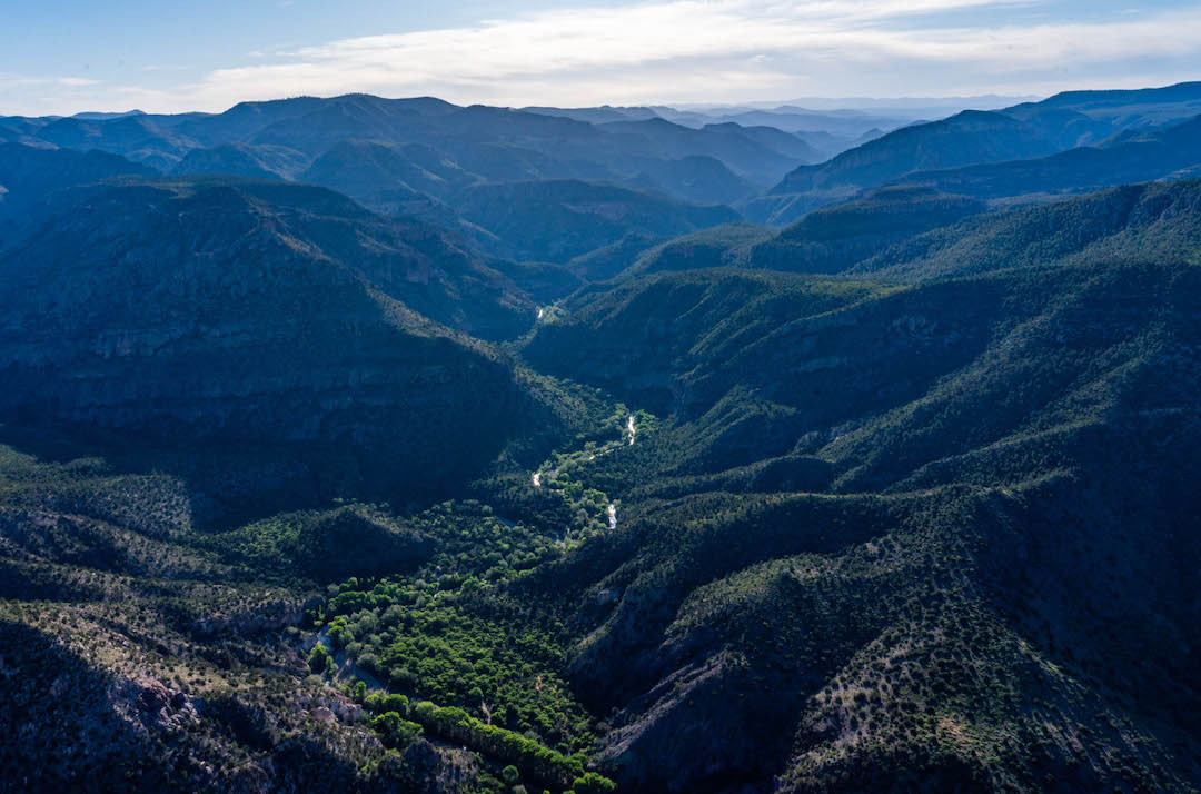
The following analysis observes three ways in which the OBBBA presents modest opportunities and potential challenges for Western water infrastructure.
Revitalizing Western Water Infrastructure
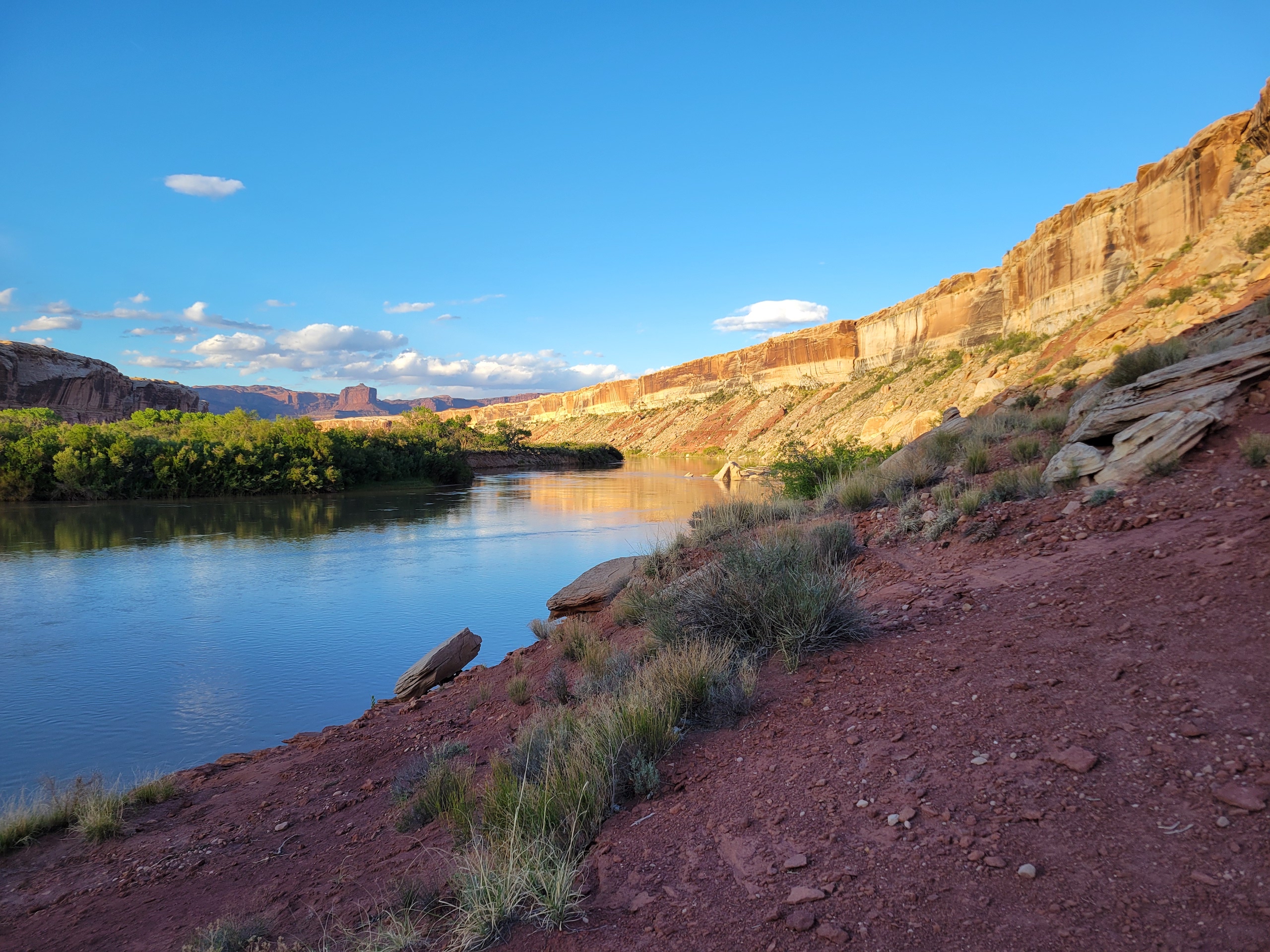
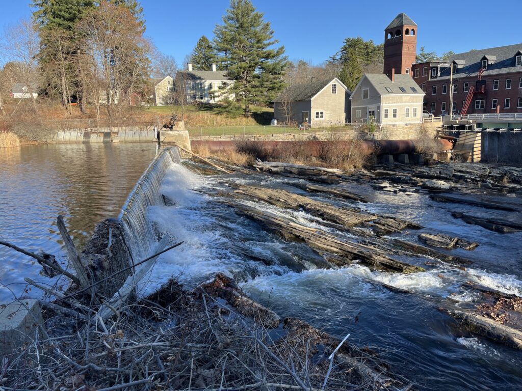
Section 50501 authorizes and appropriates $1 billion to enhance conveyance facilities and improve surface water storage under the Bureau of Reclamation, which primarily operates in the West. Notably, this funding waives any reimbursement requirements or cost-sharing to states and tribes—offering a direct investment in Western water systems. Projects may include retrofitting dams like Shasta Dam for improved salmon migration, upgrading Colorado River facilities for greater efficiency, and addressing groundwater challenges.
While this funding provides a boost, it also raises concerns. Prioritizing the modernization of aging infrastructure without equal emphasis on long-term watershed health and public welfare could pose risks. And while $1 billion sounds substantial, it must stretch across 13 states with extensive and expensive needs—posing clear limitations.
Expanding Hydropower and Grid Reliability
Sections 70512 and 70513 preserve tax credits for hydropower operators to upgrade facilities, improve dam safety, and modernize equipment—all of which help bolster grid reliability and reduce service disruptions. More efficient systems and expanded storage capacity can lower energy costs while supporting river restoration efforts.
In 2024, the Department of Energy awarded up to $430 million in incentive payments to 293 hydroelectric projects across 33 states, aiming to improve both performance and environmental standards. While outdated dams that are no longer in use need to come down, others continue to provide needed energy. Many of these hydropower facilities are over 80 years old and in critical need of modernization.
However, these tax credits are not permanent. They expire at the end of 2036, creating urgency to complete upgrades within a limited window. Strengthening agency guidance will be essential to ensure these improvements deliver lasting ecological and operational benefits.
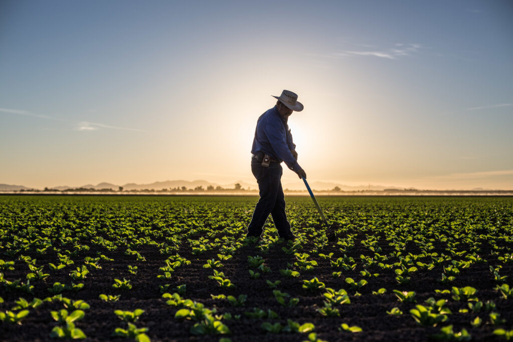
Boosting Conservation Tools for Farmers
Section 10601 strengthens the USDA’s voluntary conservation partnerships by expanding long-term funding for key programs like EQIP, CSP, RCPP, and ACEP. These initiatives support farmers and ranchers in adopting practices that enhance soil health, water quality, and wildlife habitat—often benefiting rivers and streams as well. By adding resources to the Farm Bill’s permanent funding baseline, the OBBBA ensures more stable, long-term support for sustainable land and water management.
The bill also allocates $150 million to the Small Watershed Program (PL-566) to support flood control, watershed rehabilitation, and retrofitting or removal of outdated dams. These investments improve community resilience, reduce downstream flood risk, and restore river connectivity. Beginning in FY 2026, the bill also provides $1 million annually for the Grassroots Source Water Protection Program, which supports locally driven efforts to safeguard drinking water sources through upstream conservation.
These measures expand the conservation toolkit significantly. However, existing programs—though effective—are often oversubscribed and challenging to access, especially for small-scale farmers. Streamlining application processes and increasing technical support will be key to ensuring access.
What Happens Now
Looking ahead, American Rivers will work closely with federal agencies—including the Departments of the Interior, Agriculture, and Energy—to recommend projects that upgrade infrastructure, protect rivers, and enhance aquatic and riparian habitats. These efforts will improve how water is captured, stored, and delivered across communities.
Meanwhile, Capitol Hill is already discussing the possibility of another reconciliation bill. We’ll continue monitoring legislative developments and will keep our partners informed of opportunities to engage and advocate for smart, sustainable water policy.
President Trump signed the One Big Beautiful Bill Act (OBBBA) into law on July 4th, 2025. The legislation passed both chambers of Congress after narrow, party-line votes and reflects major Republican priorities in tax policy, energy development, immigration enforcement, and regulatory rollback. Senate Majority Leader Thune delivered the bill to the White House just in time for the President’s Independence Day deadline, with Vice President J.D. Vance casting the tie-breaking vote in the Senate.
Recapping the top 5 Final Provisions
- Environment and Public Works
- Section 80151: “Project Sponsor Opt-In Fees for Environmental Reviews”
- Creates an opt-in fee program at the Council on Environmental Quality for expedited environmental reviews under the National Environmental Policy Act.
- Section 80151: “Project Sponsor Opt-In Fees for Environmental Reviews”
- Commerce, Justice, and Science
- Section _0008. “Rescission of certain amounts for the National Oceanic and Atmospheric Administration”
- Rescinds unobligated balances of the Inflation Reduction Act’s 40001 (coastal communities and climate resilience), 40002 (marine sanctuaries), 40003 (permitting, planning, and public engagement), and 40004 (research and forecasting weather).
- Section _0008. “Rescission of certain amounts for the National Oceanic and Atmospheric Administration”
- Energy and Natural Resources
- Section 50501: Reclamation Infrastructure Improvements- Subtitle E “Water”
- Authorizes $1 billion from the U.S. Treasury (FY2025–FY2034) for the Secretary of the Interior to enhance existing conveyance and surface water storage facilities managed by the Bureau of Reclamation.
- Funds are not subject to reimbursement or cost-sharing, offering direct investment in western water infrastructure.
- Section 50501: Reclamation Infrastructure Improvements- Subtitle E “Water”
- Agriculture
- Sec.10601. “Conservation”
- Increase baseline mandatory funding for four working lands programs (ACEP, CSP, EQIP, and RCPP)
- Provides $150M for the Small Watershed Program, commonly referred to as PL-566.
- Provides $1 million for the Grassroots Source Water Protection Program starting in fiscal year 2026.
- Rescinds unobligated balances of IRA funds within the four working lands programs.
- Sec.10601. “Conservation”
- Finance
- Sec. 70512. “Phase-out and restrictions on clean electricity production credit.” & Sec. 70513. “Phase-out and restrictions on clean electricity investment credit.”
- Wind and solar tax credits are phased out completely by 2027.
- 100% of the clean energy production tax credit (45Y) and clean energy investment tax credit (48E) are available only for hydropower, geothermal, and nuclear facilities if they start construction in or prior to 2033, then step down to 75% in 2034, 50% in 2035, and 0% in 2036.
- Sec. 70512. “Phase-out and restrictions on clean electricity production credit.” & Sec. 70513. “Phase-out and restrictions on clean electricity investment credit.”
Analysis
The bill’s water infrastructure provisions, including $1 billion in direct funding for Bureau of Reclamation facilities, could benefit western water delivery systems. However, without environmental safeguards or restoration priorities, these investments may have limited or even negative downstream impacts on river health.
The OBBBA sharply prioritizes tax breaks, fossil fuels, manufacturing, land privatization, and border enforcement while rolling back IRA-era investments in climate resilience and clean energy. While indeed some Farm Bill conservation programs see modest funding boosts and tax credits for hydropower are extended through 2036, these are outweighed and overshadowed by sweeping rescissions and divestments.
Regrettably, the legislation leaves rivers and river-dependent communities behind, exposing them to greater risks from pollution, flooding, drought, and other extreme weather disasters. It falls far short of addressing today’s urgent water security and infrastructure needs. Although the public lands sell-off pieces were ultimately removed, the attempt itself – combined with deep cuts to IRA-backed programs – sends a clear message: river restoration and climate resilience may not be receiving the level of attention and investment needed at this time.
The bill’s winners are defense industries, big banks, traditional energy producers, real estate developers, and high-income taxpayers. Its losers include Medicaid beneficiaries, clean energy industries, nonprofit and environmental sectors.
Next Steps
With the bill now enacted, the federal agencies will begin implementation immediately. Legal and environmental challenges are likely, especially around rescissions and Medicaid work requirements. The bill’s wide-ranging impacts are expected to shape national policy debates through the 2026 midterms and beyond.
Helpful Resources
The legislative text of the final bill is roughly 900 pages and was modified throughout the legislative process. For more detailed information, utilize these resources in addition to the summary of relevant public health provisions below.
- Full Text — H.R. 1
- Congressional Budget Office — Information Concerning the Budgetary Effects of H.R. 1, as Passed by the Senate on July 1, 2025
- Council of Economic Advisors – Legislation for Historic Prosperity
- Evergreen Action – Memo on H.R 1
Growing up in Fort Collins, Colorado, the Colorado River has been a pillar of my life for as long as I can remember. As the child of a family that frequently took my younger brother and me rafting, the river was the backdrop of my best childhood memories. It was my first glimpse into the exciting world of white water, along with the beauty of nature. In many ways, it was responsible for my love of rivers in my youth. When your access to rivers is present, it becomes easy to forget the sanctity of water and the role that rivers play in everyone’s lives, whether present or not.
As a young adult embarking into the world of conservation through a lens of river protection, I have again been reminded of the importance of the Colorado River. This lifeline provides water to 40 million people and is a vital water source and spiritual foundation for 30 tribal nations throughout its vast footprint. In Colorado, it is a critical source of drinking water for Denver and most of the Front Range, including Fort Collins. It also sustains a vibrant agricultural heritage and economy across most of the state. Colorado is the primary headwaters state, delivering water for more than 1,450 miles from a tiny, high mountain rivulet, to raging whitewater in the Grand Canyon, to a salad bowl of America before crossing the border with Mexico. It sustains human life, recreation, and vital ecosystems in the region we all depend on.
However, we have collectively taken the benefits of the Colorado River for granted. Warming temperatures, lingering drought, and a fast-growing population have exacerbated unsustainable water management practices that threaten the very rivers our nation depends on. We are in the grip of a severe water crisis, according to leading scientists. The flow of the Colorado River has declined 19% over the past two decades, and Lake Mead and Lake Powell have both reached critically low levels. The increased demand for water from the Southwestern U.S has taken more water than the river can sustain. We are at a crossroads, and it is critical that leaders across the Basin identify a clear path forward.
This is a challenging time to lean into the world of conservation when so much remains unknown, and the road ahead seems uncertain. Nonetheless, hope springs eternal and provides a vision for a more sustainable and equitable future for protecting our vital rivers. In communities around the country, youth are stepping up and following in the footsteps of the river experts and advocates who have come before us. There is a growing community of voices, including young people, who have shown a deep commitment to rivers and protecting a future for all of us.
Earlier this year, Fort Collins enacted the city’s Water Efficiency Plan (WEP) to reduce water use, enhance landscape resilience, and minimize the risk of future water shortages. Fort Collins is dependent on the Colorado River for most of its drinking water and is setting an important precedent by emphasizing a conservation-first approach while incorporating community feedback and values into its structure. This policy is an important step for our future because it highlights a proactive river protection approach that reflects the impacts of our changing world.
I encourage you to get outside and reflect on the places or rivers that help you thrive, whether through recreation, appreciation for the drinking water they provide, or how they support an economy that benefits you and your community. Celebrate the folks around you who continuously fight for stronger water polices and healthy rivers. Support the passion and dedication of the younger generation who have banded together for the Colorado River, working to secure a future that sustains the life, culture, and communities we all depend on across the Southwest.
Dani Trevino joined American Rivers as the Southeast Conservation Intern for the Summer of 2025.
Some of my earliest memories of whitewater kayaking involve my mom waking me up early in the morning, my teenage self lazily walking to her car, and falling right back asleep in the passenger’s seat during the over two-hour-long car ride to Richmond, Virginia. When the Richmond section of the James River floods above eleven feet, a surf wave comes into play that attracts paddlers from all around. Memories of paddling here with my mom include endless flat spins, cramming paddlers in a line like sardines to see how many people fit on the river-long feature, and adrenaline rushing through my veins.
Another river wave I grew up surfing is just twenty minutes away from my house on the Potomac River. Like the wave in Richmond, it is only surfable at higher water levels. Another thing these waves have in common? They are both created by low head dams.
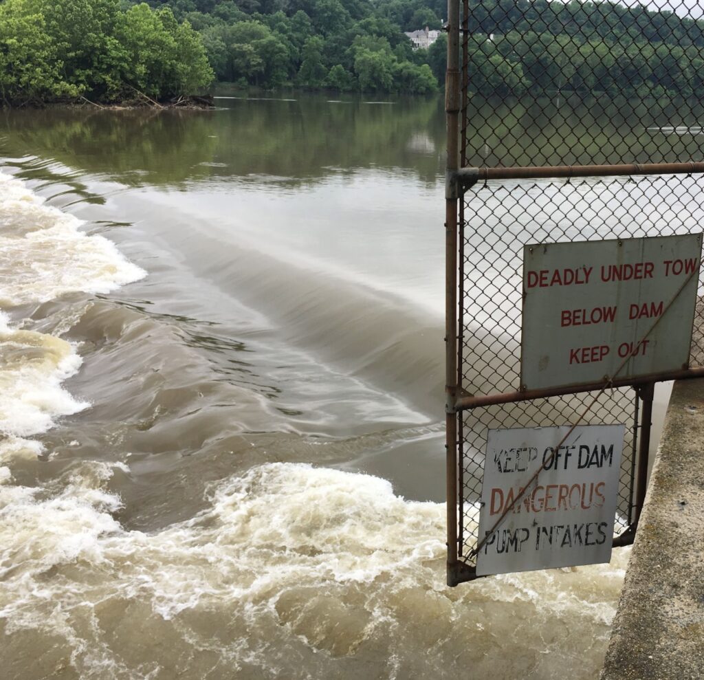
Low head dams are shorter structures where water continuously flows over the crest of the dam. At most water levels, this creates a washing machine-like hydraulic at the base of the dam that can trap and kill swimmers, paddlers, and rescuers. Although I went out on the river when I knew the water was high enough to wash out this hydraulic, my time with American Rivers this summer has opened my eyes to the harsh reality of low head dams.
My lifelong love for paddling inspired me to begin my internship with American Rivers. Immediately, I dove into the world of low head dam safety and regulations following the fatality of a park ranger at a low head dam in Pennsylvania. Low head dams were originally built for local needs such as water supply, powering mills, or irrigation, but many of these dams no longer serve a public purpose. Because most are less than fifteen feet tall, many states do not regulate them, exempting them from inspections and safety requirements.
The dams are deceiving to the eye; when looking downstream at a low head dam, their flat horizon lines often blend in with the river, making them almost invisible to see and very easy to miss. I soon realized that the occasional faded sign stating “Keep out, low head dam” fails to prevent the more than 1,400 fatalities that have occurred at these “drowning machines,” and approximately 50 additional fatalities occur each year. I learned that more than 20 people have passed away at Z Dam, and over 15 at Brookmont Dam, the two dams that I have learned to surf at during high water. I also discovered that low head dams are underregulated nationally, increasing the imminent threat to public safety in communities. Not only are they a threat to safety, but in a world facing the climate crisis, they disrupt aquatic ecosystems, fish passage, and river flow. Low head dams are a hazard to the public, boaters, and the environment alike.
As an experienced whitewater kayaker, I have gained a deep knowledge of river hydraulics and appreciation for river safety. This transfers to informed paddling at certain features. Clashing emotions occur; enjoying a surf session, but at a man-made dam that has taken numerous lives. How can one reconcile with a non-natural, persistent threat to public safety while relishing in a perfect surf on a rare river wave?
Greater public awareness of low head dam hazards is the first step in facing this dilemma. Understanding how low head dams are unsafe and supporting stricter regulation and removal can begin to change this life-threatening problem. During my internship, I identified which states have safety regulations or educational materials on low head dams, such as Indiana, Pennsylvania, and Virginia. I worked with a team to advocate for increased safety and community awareness at these dams and a smoother path to removing low head dams that are no longer necessary.
As a kayaker, I feel a strong responsibility to advocate for the protection of rivers and nearby communities. Using our unique knowledge of rivers, we can work to inform communities of the dangers of these dams. Even though there are some boaters who feel connected to a certain infrequent surf spot, or a swimming hole below a low head dam, free-flowing rivers are better for everyone: public safety, ecosystems, and recreation.
Think hard about your local lowhead dam or check the National Inventory of Low Head Dams if you do not know if there is one near you. Picture what this low, river-wide structure looks like, and the sound of the water flowing down its subtle yet consequential drop. Now think about the same spot if the impoundment were not there. Think about the possibility of more fish, more recreation, and increased safety. Imagine the river in its natural state, the river flowing freely, no deadly barrier in its way.
This is an attainable future if we continue to fight for it.
As for epic surf waves, there are plenty of natural waves on rivers across the country and abroad. My mom and I continue to find them and surf them. It is always more fun to get out on free-flowing rivers together.
Days after President Trump took office, he signed an Executive Order establishing a Council to Assess the Federal Emergency Management Agency (FEMA) and recommend changes, including potentially abolishing the agency. This Executive Order was followed by dramatic staff reductions and funding cuts for FEMA and other agencies charged with natural hazard management. The long-needed Building Resilient Infrastructure and Communities program that funded pre-disaster mitigation projects was suspended, and federal policies, like the Federal Flood Risk Management Standard, which was intended to promote flood-resilient infrastructure investments, were rescinded. The floodplain and emergency management community has been collectively holding their breath, waiting to see what these changes will mean for communities impacted by floods and other natural disasters.
Unfortunately, we’re watching the results play out in real time.
We’re still learning the details of how and why the Texas floods were so destructive, but what is clear is that improvements are needed by everyone involved in emergency management- federal agencies, states, local governments, and individuals.
U.S. disaster management systems are imperfect and in need of repair. Stories of residents being displaced for years after a disaster as they struggle to get reimbursed for damages and rebuild their lives are all too common. Inefficiencies in our bureaucratic systems move remarkably slow and the complexity of navigating agency processes makes even the experts heads spin. Increased efficiencies at the federal level are desperately needed, but states and local communities have always played a key role preparing for disasters – outspending the federal government 2:1 on disaster infrastructure thanks to revenue-backed state and local bonds and barrowing ability.
With the federal government stepping back from disaster mitigation and recovery it’s essential that states take steps now to fill the gap and help their communities prepare.
While the future of federal agencies critical to our disaster system, like FEMA, is uncertain, there are clear steps states can take to prepare.
- Know Your Risk: Relying on historical data to inform future decision-making is no longer effective. Updates in climate projections, modeling, mapping, and design allow for more informed planning and decision making. Clearly communicating risk to communities, disclosing flood risks, and proactively planning for increased resilience can mitigate the impacts of future events while providing residents the information they need to prepare.
- Coordinate Across Agencies: Preparing for and recovering from natural hazards is a shared responsibility across all levels of government and several agencies. States have separate departments for floodplain management, emergency response, natural resources, housing, and human services etc., but all these entities play an important role and need to work together. Establishing a Chief Resilience Officer with the appropriate authority to enact change can be an effective way to coordinate efforts across agencies. There are now over 16 states with this model.
- Grow Capacity: Managing any public funding requires people to administer the funds and oversight to ensure statutory requirements are met. One option currently being considered by the Trump administration is passing federal funding directly to the states; however, most states and communities are already understaffed and do not have the capacity to properly administer these funds, especially when federal funding has a high administrative burden with low overhead caps. If this option moves forward, it will be critical that federal funding programs increase the administrative caps and states begin growing their capacity to manage new funding, either from the federal or state government.
- Fund Integrated Hazard Mitigation: Preventing a disaster is far more cost-effective than recovering from one. State-integrated hazard mitigation programs are an effective way to reduce risk and create efficient systems tailored to local needs. Programs can utilize state revenue or receive infusions of federal funding, when available, making these programs more resilient to political shifts.
Effective state programs establish overarching goals and guidance but provide flexible funding to support local coordination, planning, implementation, and administration to ensure outcomes are locally driven. Prioritizing nature-based solutions like floodplain restoration, open space preservation, and coastal marsh restoration that provide multiple benefits to a diverse range of partners further strengthens support for these programs and maximizes investments.
- Strengthen Land Use and Development Standards: The National Flood Insurance Program (NFIP) sets minimum standards for land use and development for participating communities. While updates are long overdue to these minimum standards, states can adopt higher standards to reduce risk at any time. As states take on more disaster mitigation and recovery responsibilities, guiding development away from high-risk areas can reduce recovery costs and protect floodplain and wetland ecosystems while safely increasing economic development and meeting other community needs like affordable housing.
- Address Infrastructure Vulnerabilities: Our nation’s dam and are aging and many are in poor condition and struggling to keep up with modern storm events. States should establish dam and levee safety programs that fund inspections, maintenance, or removal of these structures when they have outlived their purpose.
With a new hurricane season upon us and the federal safety net thinning, states have a choice – either wait for the next storm or lead the way on building a safer, more resilient future.
The temperatures have made it quite obvious, but just in case you did not know, summer has officially begun! To get you all just as excited as we are here at American Rivers for those long summer river days, we asked you to share your river photos with us, and let me say, you all did not disappoint.
From cute pets to epic whitewater shots to serene sunsets, we’ve got it all. Below you can see just some of the pictures we received. It was so hard to pick which ones to feature, so if you don’t see your picture, don’t fret! Keep following American Rivers across our platforms to see if your picture is featured.
Now, enough of the chitchat. Let’s showcase some photos!
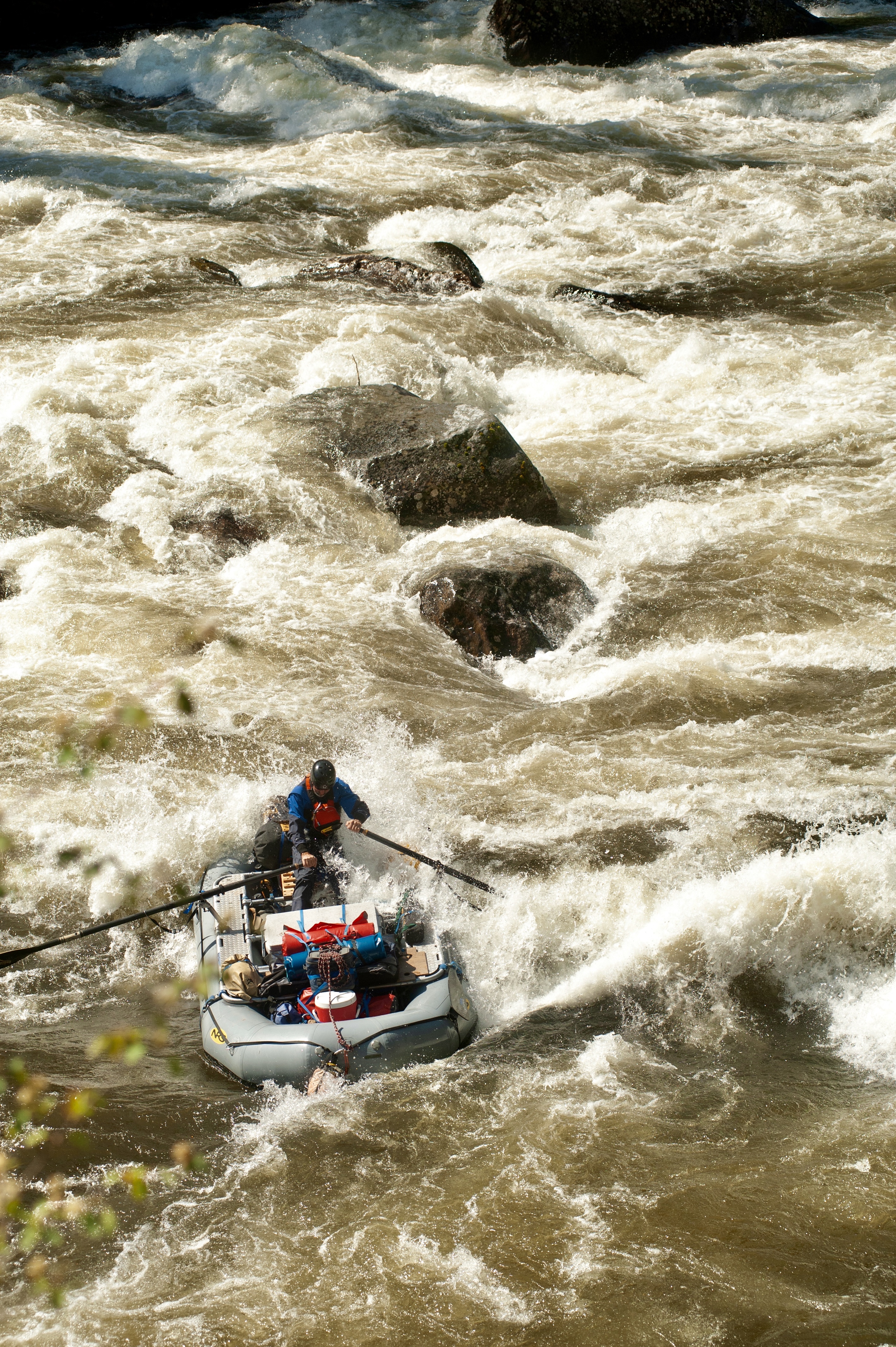
Whitewater
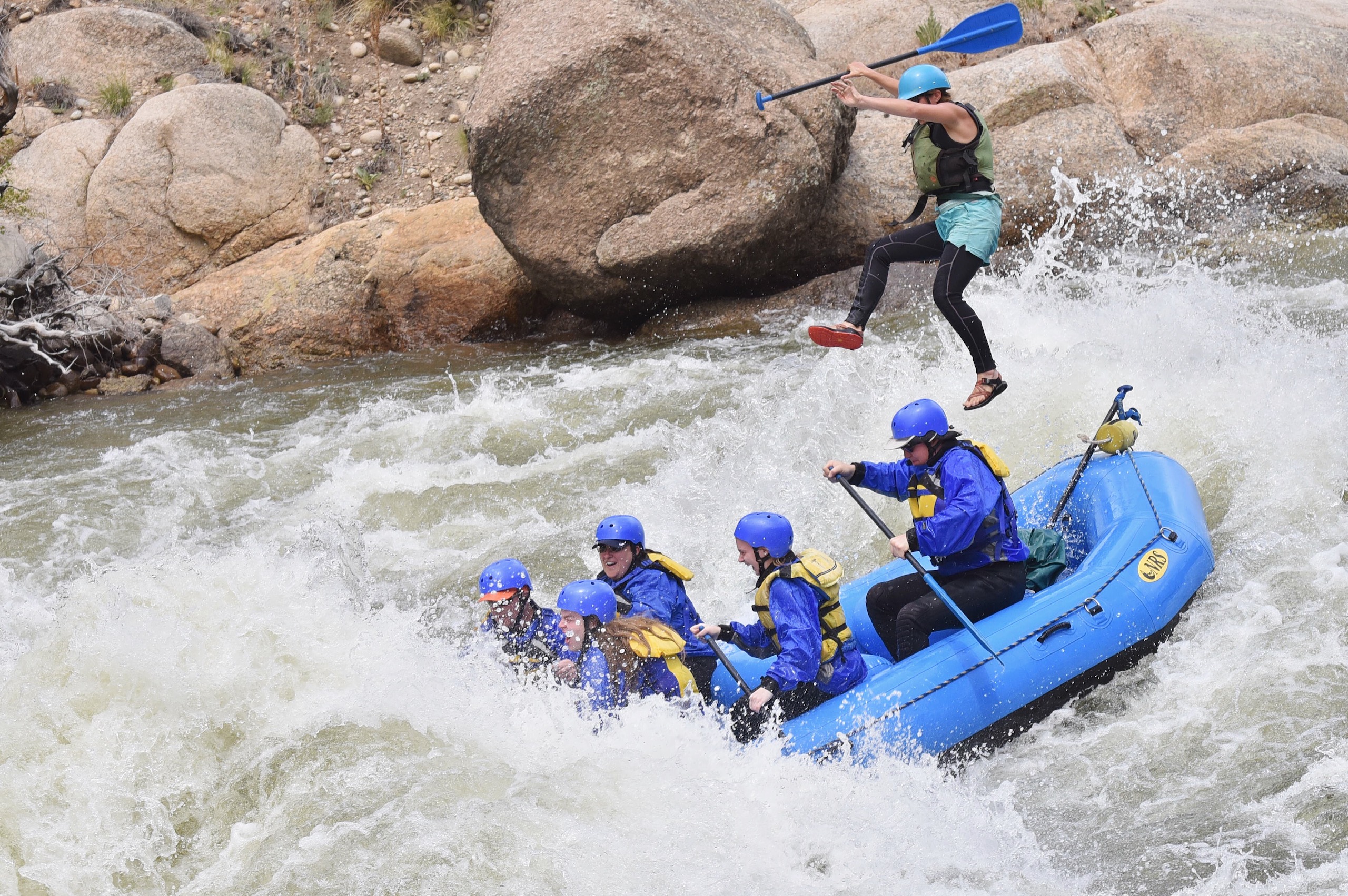
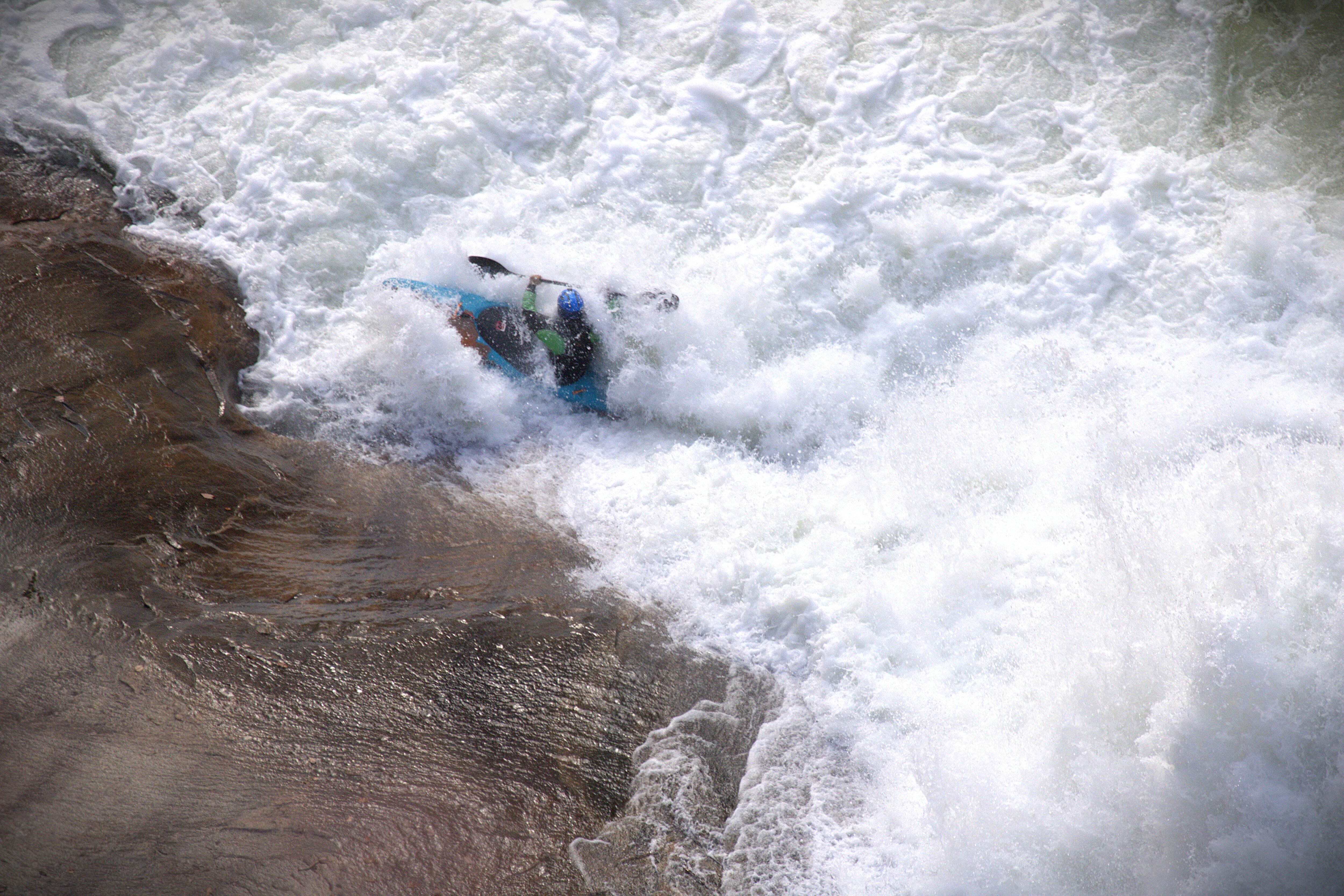
If you have been in whitewater, you know just how unpredictable it can be. With crossing currents, strong eddy lines, rock gardens, and more, you never paddle the same river twice. Just ask Bekah Grim:
“I got up close and personal with Pinnacle Rock at 2,800 CFS, a prime level just before this hit is washed out. This is in Brown’s Canyon on the Arkansas River in Colorado. I somehow landed in the raft and resumed guiding.”
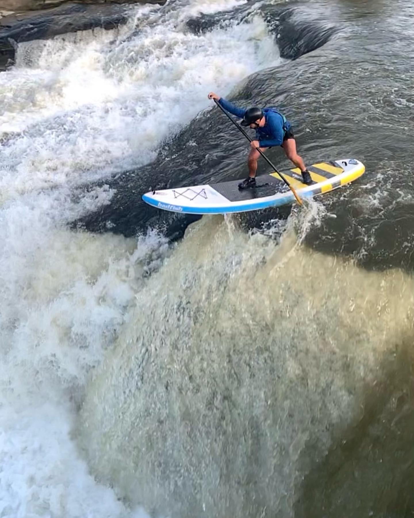
Sometimes you intentionally style yourself down some falls, which by the way, do not do without proper equipment, safety boaters around you, and knowledge of the river. Thankfully, Addison had all of those things when he decided to send Kanawha Falls on the Kanawha River in West Virginia on his paddleboard. Skill, precision, guts.
Paddling rivers and moving through whitewater also brings a sense of being part of something bigger. Mandela van Eeden shares what guiding on the Alsek River in Alaska means to her:

“I’ve guided rivers around the world for 20 years, but the Alsek remains one of the most powerful. From rowing across iceberg-studded Alsek Lake to preparing for the Turnback Canyon portage, every moment here reminds me: running rivers is a privilege, and with privilege comes responsibility. Wild places like this inspire awe, but more importantly, action. I guide to help protect them—because people fight for what they’ve experienced.” – Mandela van Eeden
Photos from left to right: Oceana Falls, Tallullah Gorge State Park | Robyn F. Baker, Wolf Creek Rapid on the Selway River, Idaho | Jake Blotter, Rackette River, paddling towards Long Lake in the Adirondacks of Upstate New York | Sarah Campbell
Pets and Wildlife
Who doesn’t enjoy a walk or paddle with their best furry friend? I mean come on…that smile says it all.
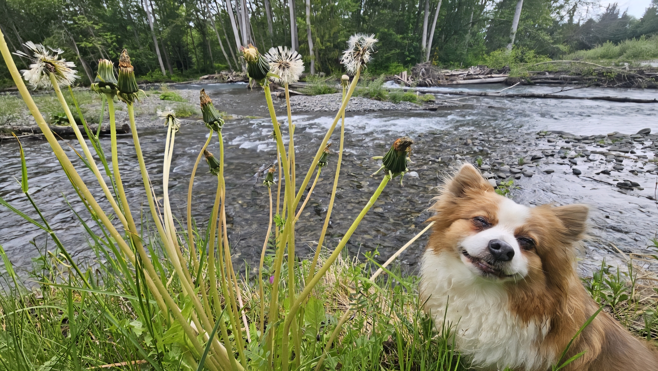
“Majestic protector” is what I would use to describe this pupper.
“Deerfield River near Charlemont, MA. Chili, our little rescue, loves paddling the lower section below the Gap in our inflatable. She watches over all members of our group when we go.” – Deborah Spadaro
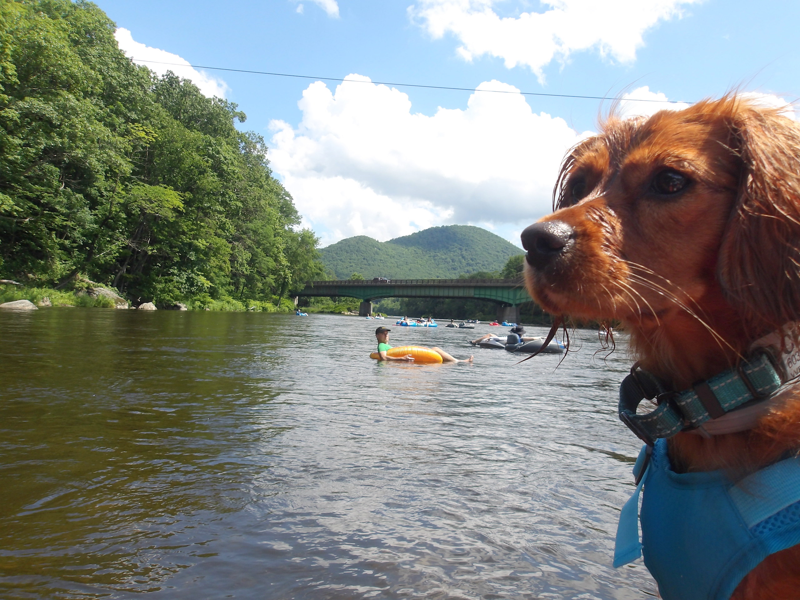
Even if they might not be sure of it at first, floating with your furry friend is always a special time!

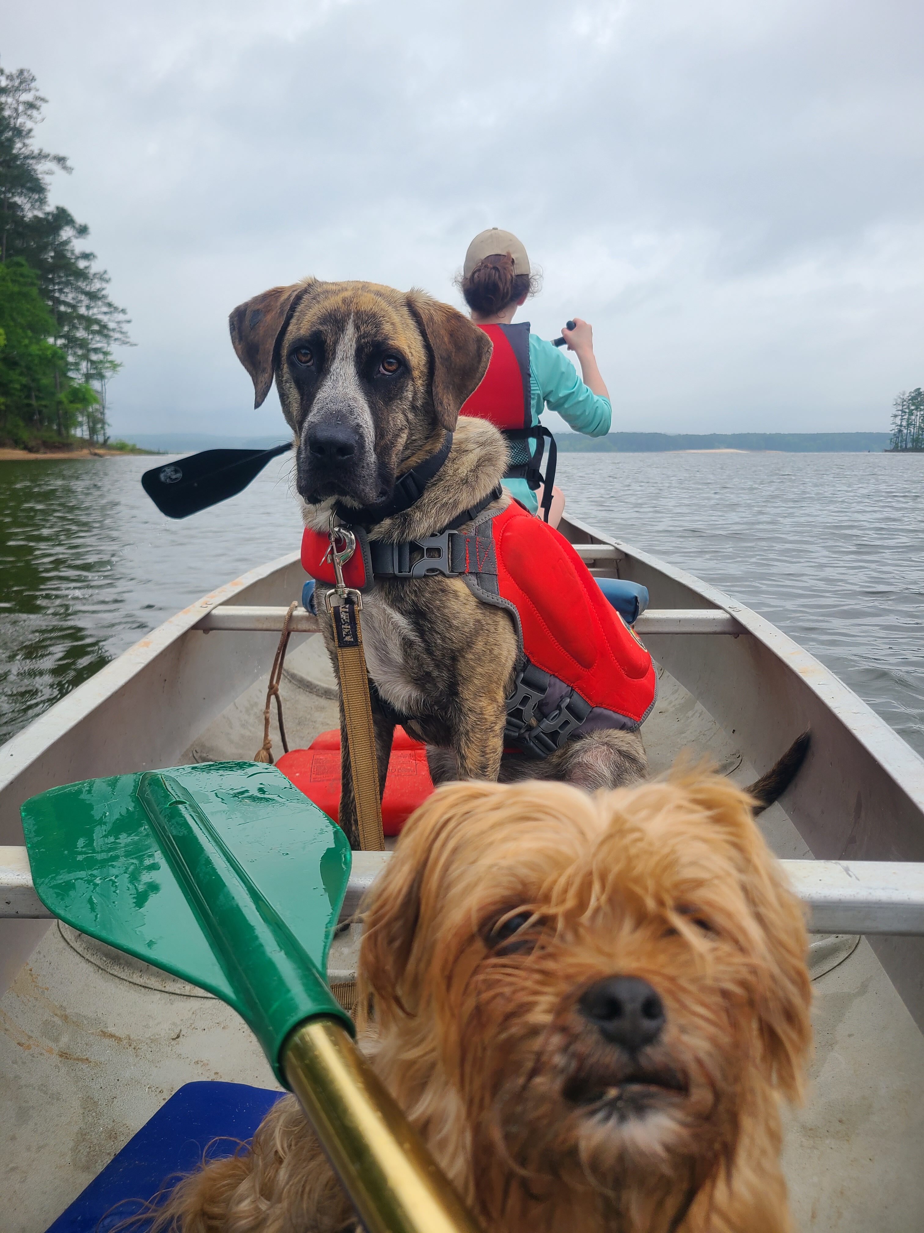

Photos from left to right: “We float the beautiful Buffalo National River every weekend in the spring/summer! Located in Arkansas & it is the 1st National River. 10/10 ❤️” Geneva Stafford | “Eddy, our 2 year-old rescue, wasn’t sure about his first paddling trip on the Haw River near Cary, NC. Lucky for him, little sister Rosie was happy to show him the ropes.” Kerri Hable | Tubing on the Pine Creek in Pennsylvania | Joseph Womer
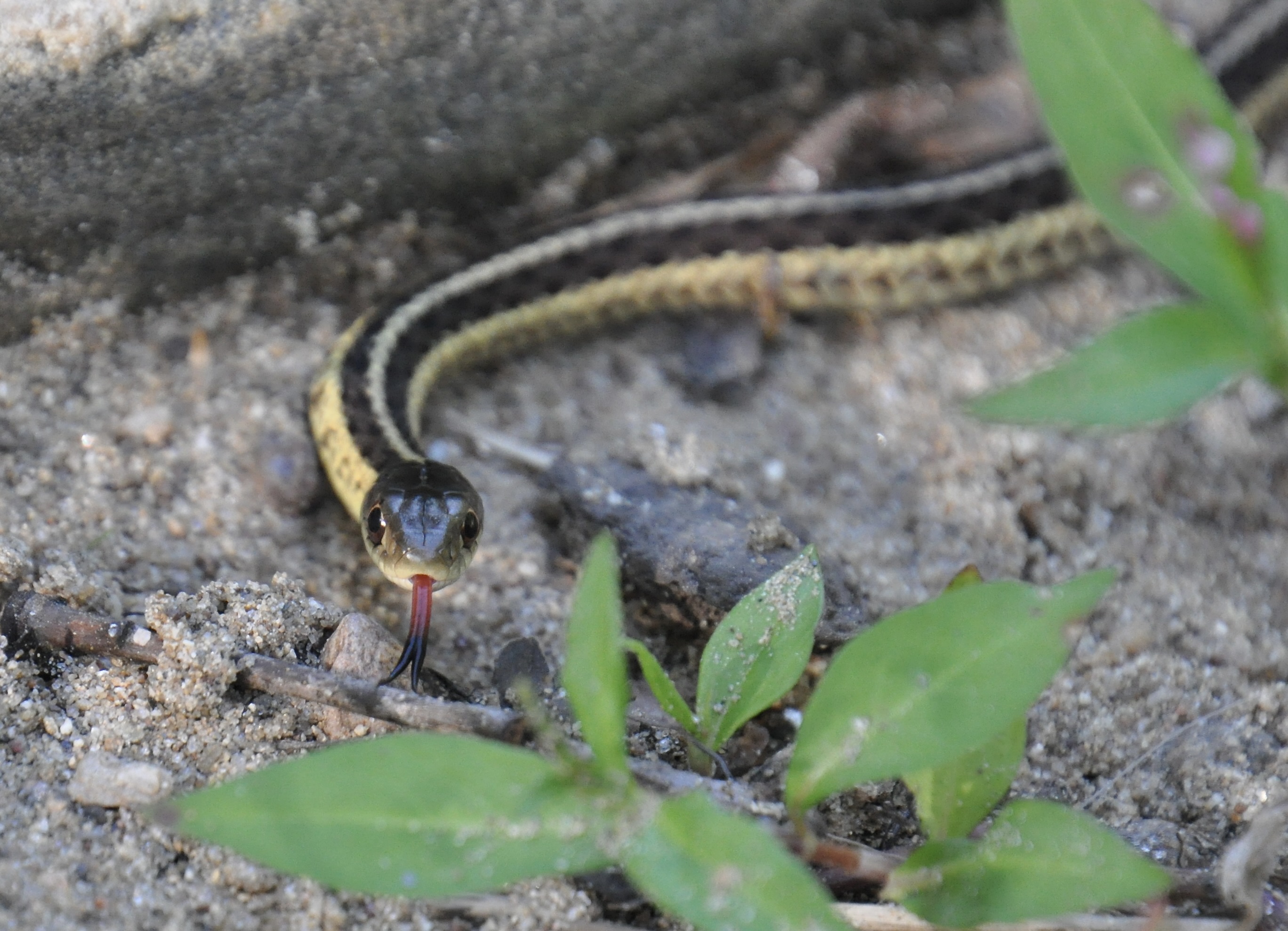
Bonus: Check out some pro tips to keep you and your dog safe on the river all summer long! Make sure to be aware of your surroundings, you never know who is slithering by…or flying by!
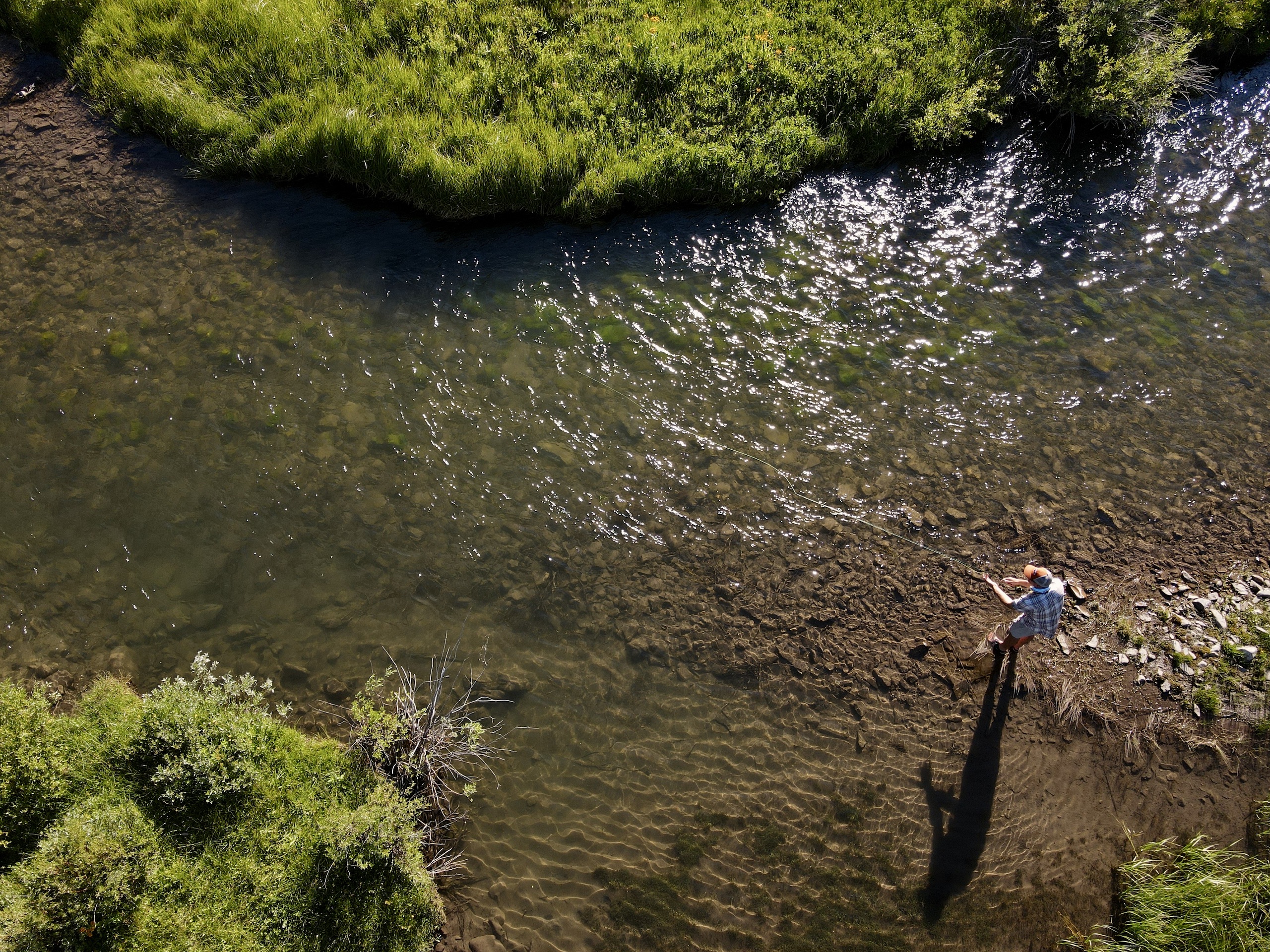
Fishing
Fishing…one of the greatest pastimes. Whether you’re spending time with friends and family or going solo to be one with the river, fishing is an experience that truly can be described as “ya never know what you’re gonna get.” It can take you to some scenic areas where you get some pretty sick drone shots:
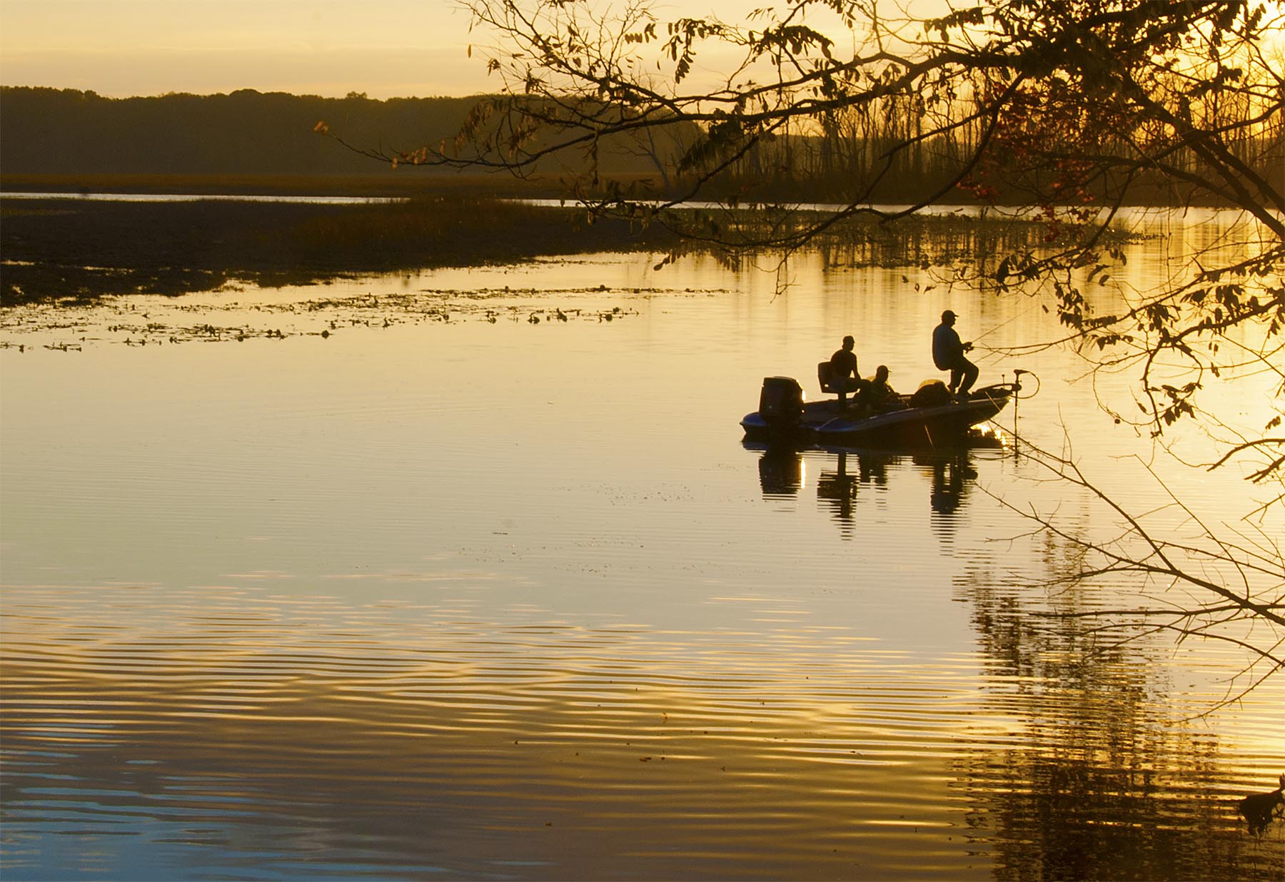
You’ll also find yourself in places where you are lucky enough to witness the most stunning sunsets.
“Last casts on Mattawoman Creek in Maryland. The freshwater tidal portion of this coastal plain river is a favorite of largemouth bass anglers who can be reluctant to call it a day.” – Jim Long
Captivating Beauty
Honestly, rivers are just freaking beautiful.

The story of just how important rivers are to us across the country is clear — we depend on rivers, and rivers depend on us. Rivers flow through our communities, they flow through our lives, and they flow through our taps, providing most of our nation’s drinking water. So, while you’re out on rivers this summer, take some time to learn more about them, take care of them, and have fun! And remember: Life Depends on Rivers™.
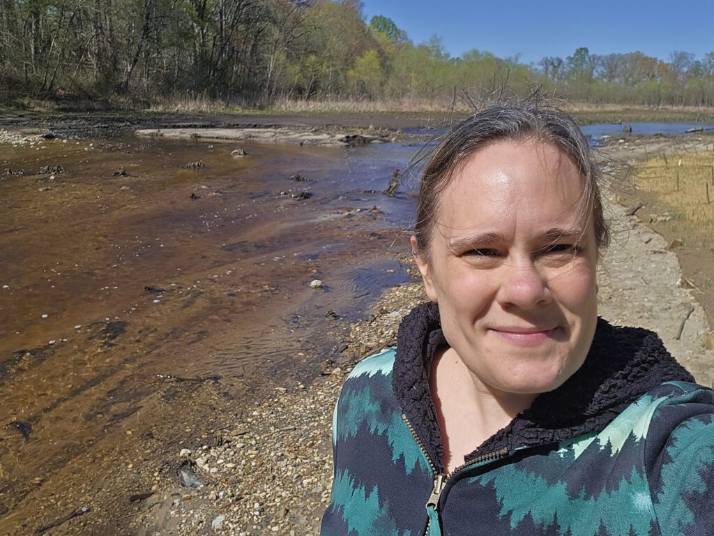
I always appreciate a trip out to Maryland’s Eastern Shore. There’s so much space. Deep breaths. Cruise control.
I’m driving from Northern Virginia. No space. Brake lights. Honk honk.
This winter I got to drive out to the Eastern Shore many times to track the evolution of a river coming back to life. Water flowing. Sun shining. Freedom. YES.
Most days I sit at my desk. My dog asks what we’re working on today. I tell him we’re saving rivers. Making people safer. Making communities more resilient. He says that looks like a lot of documents and Brady Bunch (he’s old school). He’s right.

But this winter, oh boy! Out to the mythical “field”! This is what we’re working for. Transformation. Rejuvenation. Living. Breathing.
The day I went out after the river was finally reconnected, I felt like an idiot walking by myself with a big stupid grin, bopping along with my muddy, happy feet. We did it! Years of work lead up to this moment. This future.
I couldn’t help but think back through the hurdles to get to this moment.
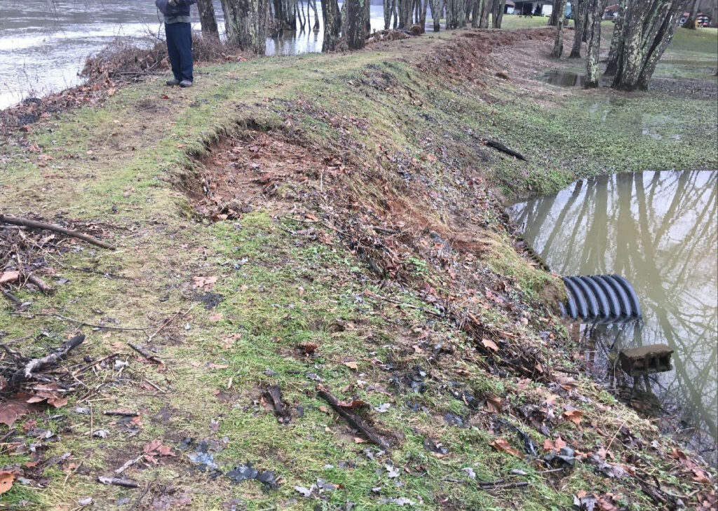
This project didn’t start with me; it started with Serena McClain, who is now the leader of our National Dam Removal Program, but who at that time was in the trenches. We were working on wrapping up the Bloede Dam removal project, and the Maryland Department of Natural Resources had another dam in another state park that they were thinking about removing— Cypress Branch Dam in Cypress Branch State Park in Millington.
While this is a newer state park, the dam was old and busted. You had to wander around in the woods to find it. It was a relic in the milling history of the Eastern Shore. No one really knows who built it and when. More recently, it had become breached, but was still keeping fish from migrating upstream to spawn and disrupting normal river functions. Hence, the motivation to look into removing it. It checked all the boxes:
- Not serving a useful purpose ✅
- Public safety hazard ✅
- Impacting fish passage and river function ✅
- Falling apart ✅
Serena got things started in 2019 with the Maryland Geological Survey who did some investigations on sediment. If you follow rivers in the Chesapeake region at all, you KNOW sediment is a big topic of conversation. Where’s the sediment coming from? Where is it going? What do we do about it? And on and on until I’m buried six feet under.
I digress. Fortunately, the sediment experts determined that there was no contaminated sediment at this site, and the volumes were fairly low because the dam had been breached for some time already. So, not a big concern, which was great.
Fortunately, the U.S. Fish and Wildlife Service was an early supporter and funder of the project. They saw the potential to reconnect more than 35 miles of habitat for herring, hickory shad, and other species, and they dove right in with us.
Next, an engineering firm, Princeton Hydro, was hired to pull together design drawings. They got rolling along… and then the pandemic hit. What day is it again? Ugh.
Things start to move again… then we had some design disagreements. I love having good partners and working with good contractors. Everyone is invested in making the project the best it can be, with the most positive impact for the system. However, that doesn’t necessarily mean that everyone always agrees on the path to get there. So sometimes we have to wade through the process, compromise, and eventually find the path forward.
I stepped in as Project Manager in the middle of this wallowing period. Determined to shake this thing loose and get to the finish line. We move a step forward.
Now, I’ve talked about this in the past— one problem with projects that float around for a while is that other problems can arise as time goes on. In this case, the cost of construction work popped right up after the pandemic. I realized that we were not going to have enough funding to make it through construction. We needed some more dough.
Fortunately, the Environmental Protection Agency, by way of the National Fish and Wildlife Foundation, agreed to help us out with a generous grant. Awesome! Back on track.
Just need the final permits. Negotiating. Still waiting. Need to figure out historical mitigation. More negotiating. More waiting. Need an adaptive management plan. What’s that? An adaptive management plan is more or less a plan for if things do not go as expected. Who makes decisions? What triggers actions? We figured these things out. We worked with our partners and regulators to decide on a plan for follow-up post-project. We received our permits. Whew.

In the midst of these permit negotiations, there are rumblings about a problematic railroad crossing that bypasses the park and incidentally our construction access road. Do I know anything about railroads? Really not much more than I’ve learned from Thomas the Tank Engine. So, we go back and forth about what to do with this crossing. We don’t want to damage things with our heavy equipment. Eventually, we decide that we can use mats to cross it and then work towards a plan to rehabilitate it while construction is ongoing.
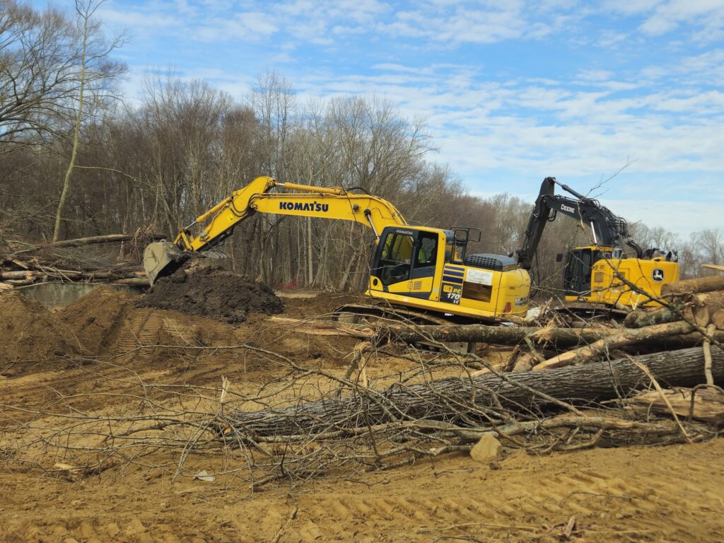
In Fall 2024, we hired an environmental construction company, Ecotone, to do the work on the ground. We hope to go to construction in December. We need to get some shop drawings (i.e., detailed plans for a specific element of the design) approved before we can do that. It is right in the middle of the holidays. Deck the halls and all that. More waiting.
Finally, we are able to break ground in mid-January! And there was much rejoicing… until… we have a new federal administration. And federal grants are being paused. And my anxiety shoots through the roof. Will today be the day we lose our funding? Tomorrow? Court cases. Temporary reprieves. Will we make it?
The thing about these projects is that they are akin to a massive surgery. You get to a certain point where the guts are all out, and you just can’t go back. The only way is to keep moving forward.
Fortunately, our grants did not get paused. And we got the guts all put back, this time in the right places without a clogged artery.
And it is beautiful. And cool!
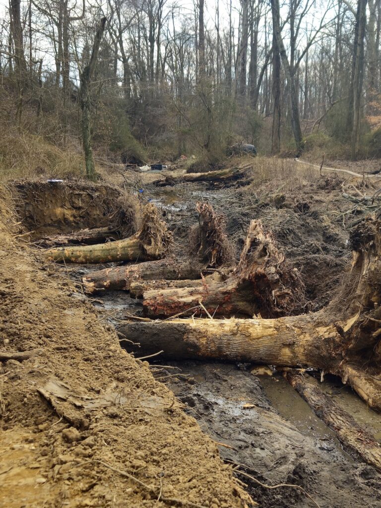
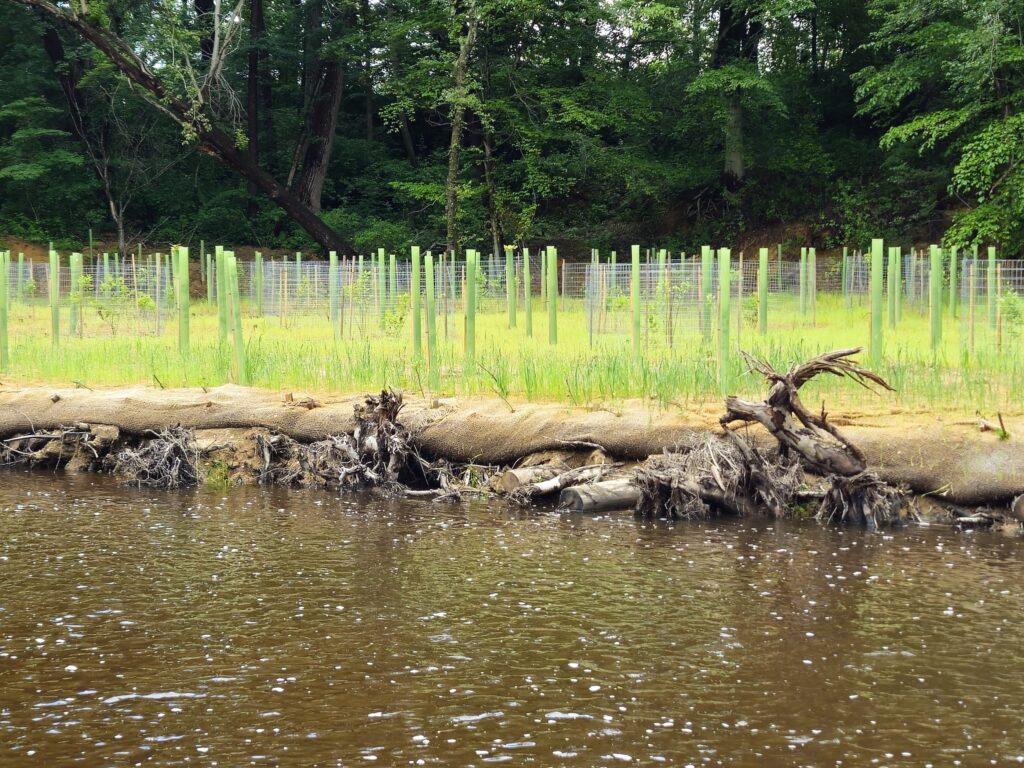
We installed some very neat root wad structures to stabilize the river banks. It’s like nature reaching out with its creepy fingers. We removed all the concrete from the former spillway and moved around parts of the earthen portion of the dam. We also realigned the channel which had been breaking off into different sections to make its way around the spillway. It was an odd site to photograph from the ground before the removal, so I am sharing some aerial images to help give a sense of the restoration effort.
Did we ever figure out what to do with the railroad crossing? Oh yes, indeed. We came to an agreement right near the end of construction. Thanks to a funding supplement from Maryland Department of Natural Resources, we were able to fix that crossing right up while on our way out of the site.
We also received a bit more funding support from RJN Foundation to round things out at the end. I am so grateful to all of our funders for their support.
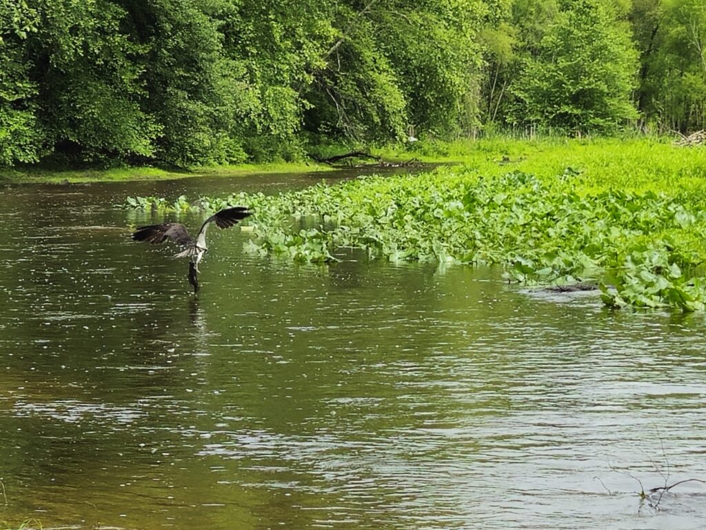
Shortly after the final plantings were completed, I revisited the site to see how things were adjusting. This osprey seemed to be enjoying itself quite thoroughly in the former impoundment! What a lunch!
And there you have it. Another one bites the dust. Huzzah!
As we observe National Dam Safety Awareness Day and reflect on the anniversary of the Johnstown, Pennsylvania dam failure in 1889 that took the lives of 2,200 people, I am heartened to know that this is a problem we can solve.
There are more than 500,000 dams scattered across our rivers and streams, many of which are in a state of advanced disrepair. The good news? These tragedies can be avoided with proper funding for repair and maintenance. To make that happen, we must prioritize restoring funding to FEMA’s National Dam Safety Program and to state dam safety offices.
In many cases, the most cost-effective way to ensure public safety is to remove dams, many of which no longer serve their intended purpose anyway. Removing outdated, hazardous dams protects our communities from preventable disasters. The good news is that communities across the country are doing just that! To show the positive progress being made across the country, we have curated a list of upcoming dam removal projects to show how these removals are possible in communities across the country.
1. Lockville Dam | Deep Creek, North Carolina
Why you should care: The Lockville Dam removal project has been designed to improve public safety and long-term sustainability for the surrounding community. The dam is in poor condition, and a backup of fallen logs and debris has accumulated behind the dam. American Rivers aims to reconnect 56.5 miles of the Deep River and its tributaries through the removal of the dam. The project is a restoration priority for the endemic and federally endangered Cape Fear Shiner. Several freshwater mussel species, including the Federally threatened Atlantic pigtoe, are known to be in the Deep River. The removal of Lockville dam, which was originally damaged during Hurricane Florence in 2018, is a critical step in a wider transformational watershed restoration project which is aimed at restoring fish passage for migratory fish species.
2. Bridge and East Elm Street Dams | Royal River, Maine

Why you should care: American Rivers is working in partnership with state, municipal, and local conservation organizations to restore migratory fish runs in the Royal River watershed. The Royal River is a 140-square-mile watershed that drains directly to the Gulf of Maine. These two mainstem dams, which are the first barriers on the Royal River, have been blocking fish passage since their construction in the 19th century and together block access to over 100 miles of mainstem and tributary habitat for river herring and other fish species. Both dams are small, coming in at 10’ and 12’ in height, respectively, and are in poor condition.
3. Allegheny Side Channel Dam | Allegheny River, Pennsylvania
Why you should care: Removal of the Allegheny Side Channel Dam is part of a broader project that includes the removal of 10 dams throughout the Ohio and Susquehanna River watersheds, resulting in reconnecting 285 river miles and roughly 28 acres of wetlands and floodplain habitat. As its name indicates, the Alleghany Side Channel Dam blocks a side channel of the Allegheny River near the Allegheny National Forest, which provides important nursery habitat for small darters and shiners, as well as habitat favored by endangered freshwater mussels.
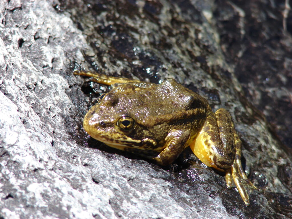
Approximately a quarter of the world’s freshwater organisms are at risk of extinction, and the world is losing freshwater species faster than land or ocean species. From the Colorado River, where the pikeminnow lives, to the North Fork of California’s Feather River, where the foothill yellow-legged frog calls home, rivers provide critical habitat for endangered fish, amphibians, insects, and birds that rely on them. Endangered freshwater species include unique freshwater mussels in the Southeast and culturally significant salmon in the Pacific Northwest, which in turn supports the Southern Resident Orcas in Puget Sound. In many places, endangered freshwater species are a keystone — supporting entire webs of life and bolstering the healthy rivers and creeks that we all know and love.
One of our nation’s landmark environmental laws that holds this delicate balance of nature together, the Endangered Species Act, is currently facing a new threat. A new rule from the U.S. Fish and Wildlife Service and the National Oceanic and Atmospheric Administration would redefine what harming a species means under the Endangered Species Act by eliminating the protection against habitat destruction. This has been a longstanding protection that directly protects against one of the leading drivers of species extinction — habitat loss.
If this rule moves forward, the essential places that numerous endangered species use for feeding, breeding, sheltering, and surviving will be at risk. The ecosystems upstream and downstream that those species support will also be at risk, as well as areas that we humans depend on for clean drinking water and many other benefits.
Examples of rivers with endangered wildlife include:
- The Lower Missouri is home to piping plover, interior least tern, and pallid sturgeon
- The Puyallup River and South Fork of the Salmon River house Chinook salmon, steelhead, and bull trout
- The Columbia and Snake Rivers are home to thirteen salmon and steelhead runs that are listed as endangered
Without the protection afforded by the Endangered Species Act, these rivers as crucial habitat may be at increased risk of unfettered and unmitigated development, improper water allocation, and other inappropriate and environmentally unsound uses.
The current inclusion of what “harm” means in the Endangered Species Act has historically enabled dam removals that lead to restored habitat. The removal of the 160-year-old Edwards Dam on the Kennebec River in Maine was driven by the need to protect threatened and endangered species, including the shortnose sturgeon and Atlantic salmon. Since that river restoration project was completed in 1999, more than 2,000 other dams have been removed across the country for the benefit of wildlife and communities alike.
Attacks on habitat and wildlife protections are harmful, short-sighted, and out of step with what the American public wants. Abundant nature and wildlife are values that we all share and enjoy, no matter who we are or where we come from. Hunting and fishing are treasured traditions – not to mention a multi-million dollar industry – and depend on healthy rivers and ecosystems. The health and strength of our communities are directly related to the health of our rivers and waters. We must do more, not less, as a nation to protect our water wealth.
Clean water is a fundamental need, and rivers touch every aspect of our lives. Telling positive stories about rivers is important to ensure every river is clean and healthy for people and wildlife. So it was a pleasure to team up with CBS News on a significant package of stories for Earth Month.
Together, these stories provide an excellent overview of the challenges and opportunities facing our nation’s rivers. They remind viewers about the vital role rivers play in providing our drinking water, supporting fish and wildlife, powering our economy, ensuring healthy communities, and creating endless opportunities for beauty, connection, and joy.
“An American River” – a documentary about the Delaware River
The CBS News crew traveled from source to mouth down the Delaware, meeting people along the way who work on, and speak up for, the river. The documentary is a heartfelt and hopeful look at the vital work underway to protect the river and all the life it supports.
Paddling his canoe, Adam Schellhammer, Mid-Atlantic Director for American Rivers reflects, “It’s not just about fun… from a very basic survival need, we need to protect our waterways.”
America’s Most Endangered Rivers® of 2025
This year’s list of America’s Most Endangered Rivers® is a call to action for clean water and public safety. CBS showcased the campaign with thoughtful news coverage, interviews with American Rivers leaders, and a spotlight on New Jersey’s Passaic River.
Local reports highlighting river threats and solutions
All 14 CBS-owned stations produced local reports highlighting regional rivers’ threats, and had great examples of river restoration. From Maryland to Texas to California, here are some inspiring stories:
Take action and support your river
If you feel inspired after watching these videos, there are great ways to help:
- Take action for America’s Most Endangered Rivers of 2025
- Donate to American Rivers to support our river protection efforts nationwide
- Speak up for your own river: contact your local decision makers and encourage them to be river champions. Find your local river group and support their important work.
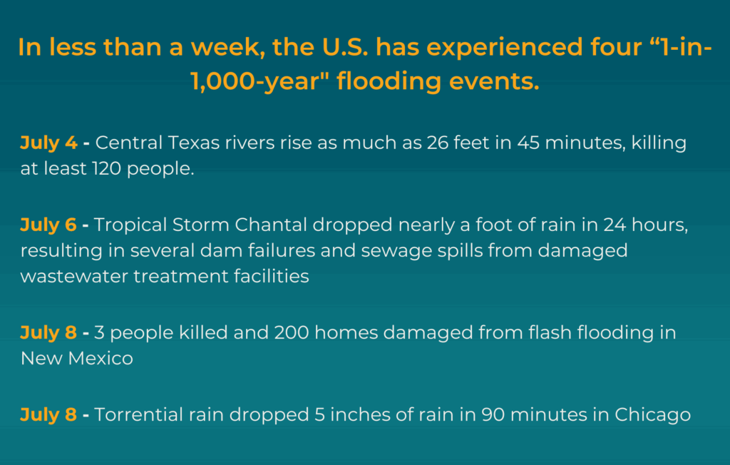
Flooding earlier this month claimed lives and destroyed homes and businesses across the South and Midwest. It is the most recent example of how extreme weather is devastating communities and putting our rivers and clean water at risk.
It’s against this backdrop that American Rivers is announcing America’s Most Endangered Rivers® of 2025. Our message is simple, and we have a plan: To stop the cycle of destruction, we must invest in solutions that protect river health and our nation’s clean water security.
Topping the 2025 list is “America’s River”, the Mississippi. As I write this, portions of the river are at flood stage, or approaching flood stage, as a result of recent heavy rain and snowmelt, according to the National Weather Service.
But high water isn’t the only threat. Layoffs at the Federal Emergency Management Agency (FEMA) and calls to abolish both the agency itself and the National Flood Insurance Program put river health and human safety at risk, and could compound longstanding threats to river health.
Spotlighting what matters most
Whether your community is more vulnerable to floods, droughts, or wildfires, we all want to keep our families safe from extreme weather. And no matter where you live, it’s the communities with healthy rivers that are stronger, better equipped, and more resilient in the face of these threats.
In addition to safety, another need we all have in common is clean, safe, reliable drinking water. Most of our drinking water comes from rivers – but half of the rivers in the United States contain unsafe levels of pollution.
Public safety and clean water aren’t red or blue state issues. They are shared values that connect us all. “Our water wealth is one of our greatest assets as a nation,” says American Rivers president and CEO Tom Kiernan.
Protecting these shared values and our nation’s water wealth is the motivation behind America’s Most Endangered Rivers ®. Every year, working with local partners, we sound the alarm and deliver an urgent and timely call to action for the rivers we all depend on. As we celebrate the 40th anniversary of this campaign, protecting clean water and healthy rivers has never been more important.
America’s Most Endangered Rivers ® of 2025: Ten rivers at a crossroads
- Mississippi River: The lifeline of America faces an uncertain future as FEMA’s role in floodplain protections and infrastructure maintenance hangs in the balance.
- Tijuana River: Severe sewage and chemical pollution threaten communities on both sides of the US-Mexico border.
- Rivers of Southern Appalachia: Extreme weather is testing the limits of aging dams while hurricane recovery efforts struggle to keep pace.
- Passaic River: Historical industrial pollution continues to impact this essential New Jersey waterway.
- Lower Rio Grande: A mega-drought combined with outdated water management threatens this crucial border river.
- Rappahannock River: Declining groundwater levels and explosive growth from data centers are creating a perfect storm for water insecurity.
- Clearwater River Basin: Some 700 miles of potential Wild and Scenic River protections are at risk of being lost.
- Susitna River: Road construction and mining threaten one of Alaska’s most pristine waterways.
- Calcasieu River: Toxic and heavy metal pollutants endanger this Louisiana river system.
- Gauley River: Strip mining in the headwaters is introducing toxic pollution to this beloved recreational waterway.
Making a difference together
The America’s Most Endangered Rivers ® campaign has a track record of success. It galvanizes the public to speak up on behalf of the rivers, gets the attention of decision makers, and creates positive change. Together with partners, we have helped stop pollution in the Buffalo National River and prevented harmful mining in fragile ecosystems like the Boundary Waters. The campaign played an important role in protecting Wyoming’s beautiful Hoback River, and has contributed to dam removal and river restoration efforts on rivers such as the Penobscot, Klamath, and Eel.
You can help turn this year’s endangered rivers into success stories. We need your voice for America’s Most Endangered Rivers ® of 2025. Learn more about the rivers, and take action today.
This year marks an important milestone for America’s Most Endangered Rivers®— the 40th anniversary of the campaign that combines years of environmental action and grassroots mobilization. Each year, this campaign has highlighted ten rivers whose fate depends on the decisions we make today. Over the decades, together with our partners, we’ve achieved significant changes to protect our rivers and the communities that depend on them.
However, this anniversary isn’t just a moment to look back and celebrate what we’ve accomplished—it’s also an opportunity to reflect on the road ahead. Over these 40 years, we’ve faced countless challenges, but we’ve also seen victories that continue to motivate us to keep speaking up for the health of our rivers.
As a way to celebrate 40 years of America’s Most Endangered Rivers®, we wanted to highlight some of the most impactful stories; rivers that represent not only the challenges our rivers face but also the solutions we’ve been able to achieve through our collective efforts.
New Mexico’s Rivers: A Hopeful Future
2024 #1 River Listing
In 2024, New Mexico’s rivers were highlighted as the #1 most endangered due to threats facing nearly all streams and wetlands in the state, particularly the loss of Clean Water Act protections. This left the state’s waterways at risk of pollution from industrial runoff and agricultural waste, posing a danger to the local communities and ecosystems that rely on them.
But just last week, New Mexico Governor Michelle Lujan Grisham signed a bill to restore clean water protections that creates a state surface water permitting program to ensure the state’s precious water resources have the proper management and safeguards.
Neuse River: A Turnaround Story
Listed in 2017, River of the Year 2022
When the Neuse River was listed among America’s Most Endangered Rivers® of 2017, it faced threats from industrial agricultural waste being dumped into its floodplains. This was a river that, for decades, has been a vital water source for communities in eastern North Carolina, but its future seemed uncertain.
Inclusion in America’s Most Endangered Rivers® sparked action and amplified community engagement to honor the progress and to support forward momentum, we named the Neuse “River of the Year” in 2022. Local advocates and communities continue to push for improvements to keep the Neuse River on a positive trajectory.
Klamath River: A Milestone in River Restoration
Listed in 2002
The Klamath River, one of the most iconic rivers in the Pacific Northwest, made the America’s Most Endangered Rivers® list multiple times over the years, with four dams devastating river health, water quality, salmon runs, and a vital source of sustenance and cultural heritage for the river’s tribes. The Yurok, Karuk, Klamath, and other Tribes and Indigenous communities advocated tirelessly for river restoration. Last year, dam removal was completed and now the river is on a path to recovery. Learn more about the Klamath Dam removals.
Gila River: The Ongoing Fight for Water Security
Listed in 2019
The Gila River, one of the most critical rivers in the American Southwest, was listed among America’s Most Endangered Rivers® in 2019 due to threats from the proposed construction of a damaging water diversion project.
The diversion could have dried up the Gila River, impacted fish and wildlife, the local outdoor recreation and tourism economy, and harmed critical habitat for seven threatened or endangered species. Declining groundwater levels caused by the diversion could also have harmed some of the last remaining intact riparian forest in the Lower Colorado River Basin.
In a win for the river and all who depend on it, in 2020, the New Mexico Interstate Stream Commission voted 7-2 to end work on the Environmental Impact Statement for the Gila River diversion.
Looking Ahead: A Call to Action for 2025
As we approach America’s Most Endangered Rivers® 2025, the work to protect our rivers is far from over. This anniversary not only celebrates the progress we’ve made but also serves as a starting point to redouble our efforts. The rivers and clean water that continue to face threats need our help now more than ever.
Every action counts, and every voice raised has the power to make a difference. I invite you to join us in supporting efforts to protect and restore these endangered rivers, and all of the rivers we depend on nationwide.
Check back on April 16, when we will announce America’s Most Endangered Rivers® 2025!
This is a guest blog written by Alejandra Galindo, American Rivers MAP Fellow. Alejandra is a dynamic Senior Program Manager at Entrepreneurship for All (EforAll), where she spearheads initiatives that empower early-stage entrepreneurs from underserved, low-income, and minority communities. With a passion for inclusive economic development, Alejandra leverages over a decade of international experience to design and implement high-impact programs that drive innovation and opportunity.
Originally from Colombia, Alejandra holds a degree in Political Science and International Relations from Icesi University, an MBA in Finance from EUDE Business School in Spain, and a Strategic Project Management Certificate from Harvard University. Her global education and professional journey have shaped her into a versatile leader with a deep understanding of both grassroots challenges and strategic solutions.
Fluent in both English and Spanish, Alejandra blends her multicultural insight with sharp operational acumen to build bridges between communities, entrepreneurs, and resources. Her work continues to open doors for aspiring business owners, helping to cultivate resilient, inclusive ecosystems where all entrepreneurs can thrive.