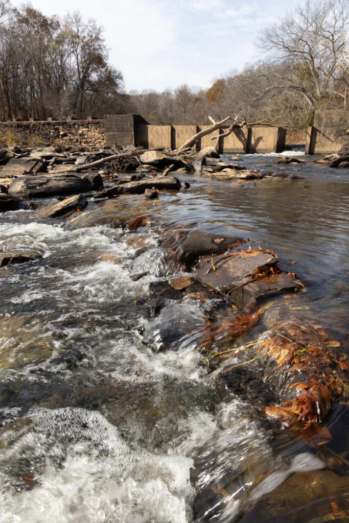
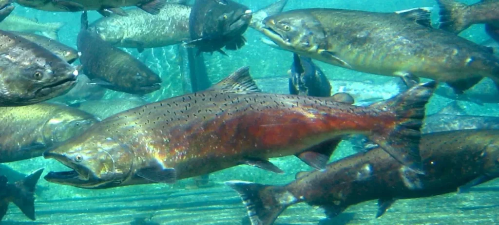
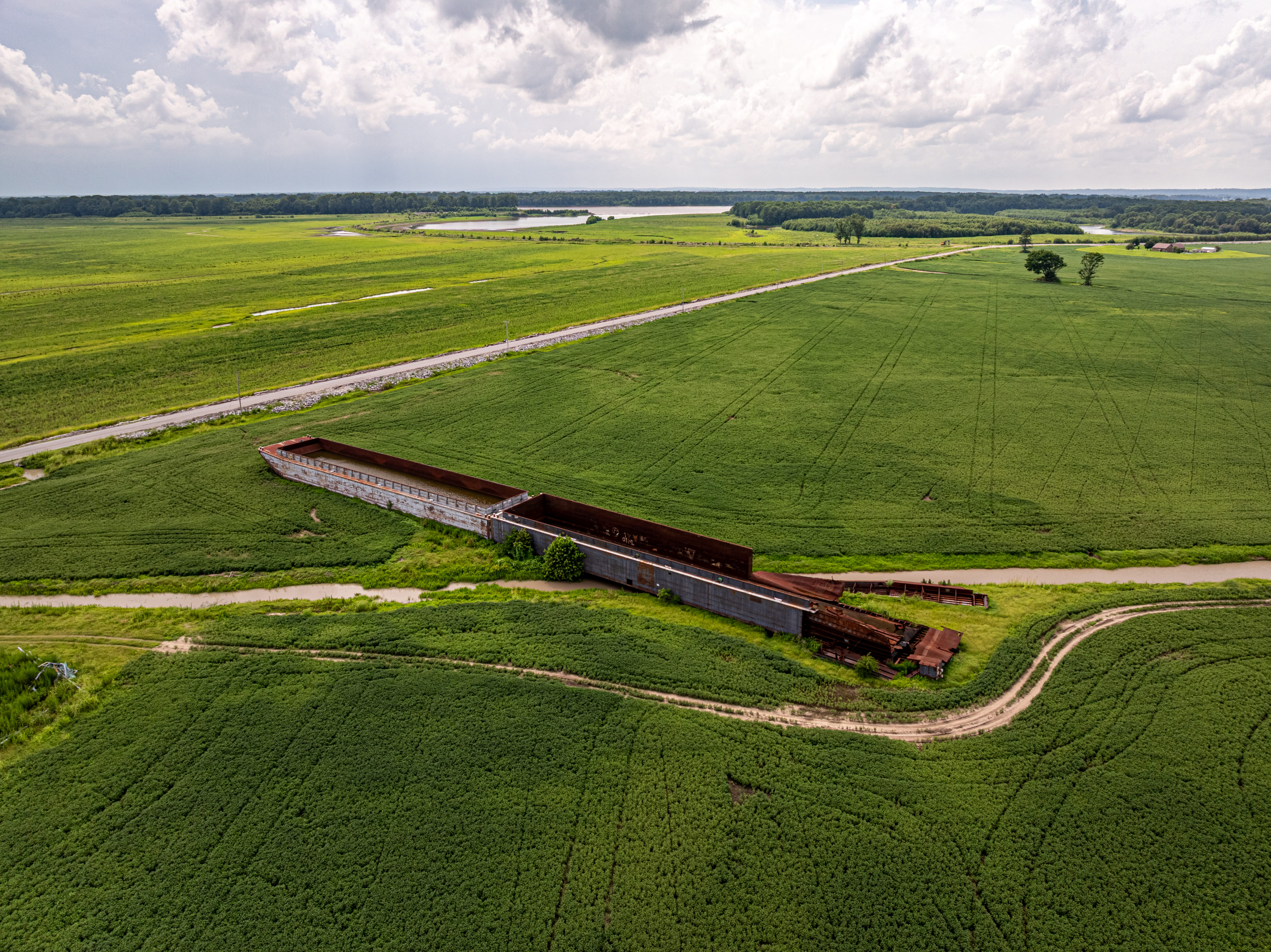
What an amazing year for river restoration in California–from the Oregon border to the U.S.-Mexico border to the south. We saw salmon return to the upper watershed of the Klamath River for the first time in over a century. We broke ground and completed a massive floodplain restoration project at Great Valley Grasslands State Park in California’s Central Valley. We moved the needle on cleaning up the Tijuana River and protecting the communities of San Diego County. But California is a big state–the fourth largest economy in the world and larger in area than Germany and Japan. Sometimes it helps to zoom in. In the Sierra Nevada, our headwaters team has been restoring meadows across the range and planning for the future–healthy biomes in one of the world’s most stunning and biodiverse mountain ranges.
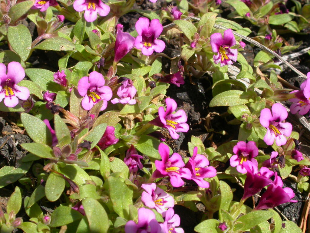
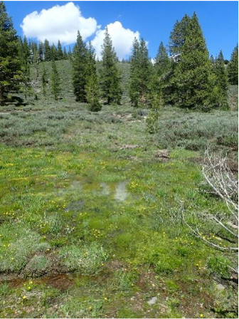
Ackerson Meadow
The landmark restoration at Ackerson Meadow finished in the summer of 2025, kick-starting the recovery of a meadow that had been dewatered and degraded the meadow for the last century. Now we see the return of native meadow plants like the slender-stemmed monkeyflower and wildlife like the Great Gray Owl and Northwestern pond turtle. This was the largest wetland restoration in the history of Yosemite National Park, and a powerful collaboration between American Rivers, National Park Service, US Forest Service, Yosemite Conservancy, public lands grazers, and many funders. Stay tuned for a new video about the project and its ongoing development!
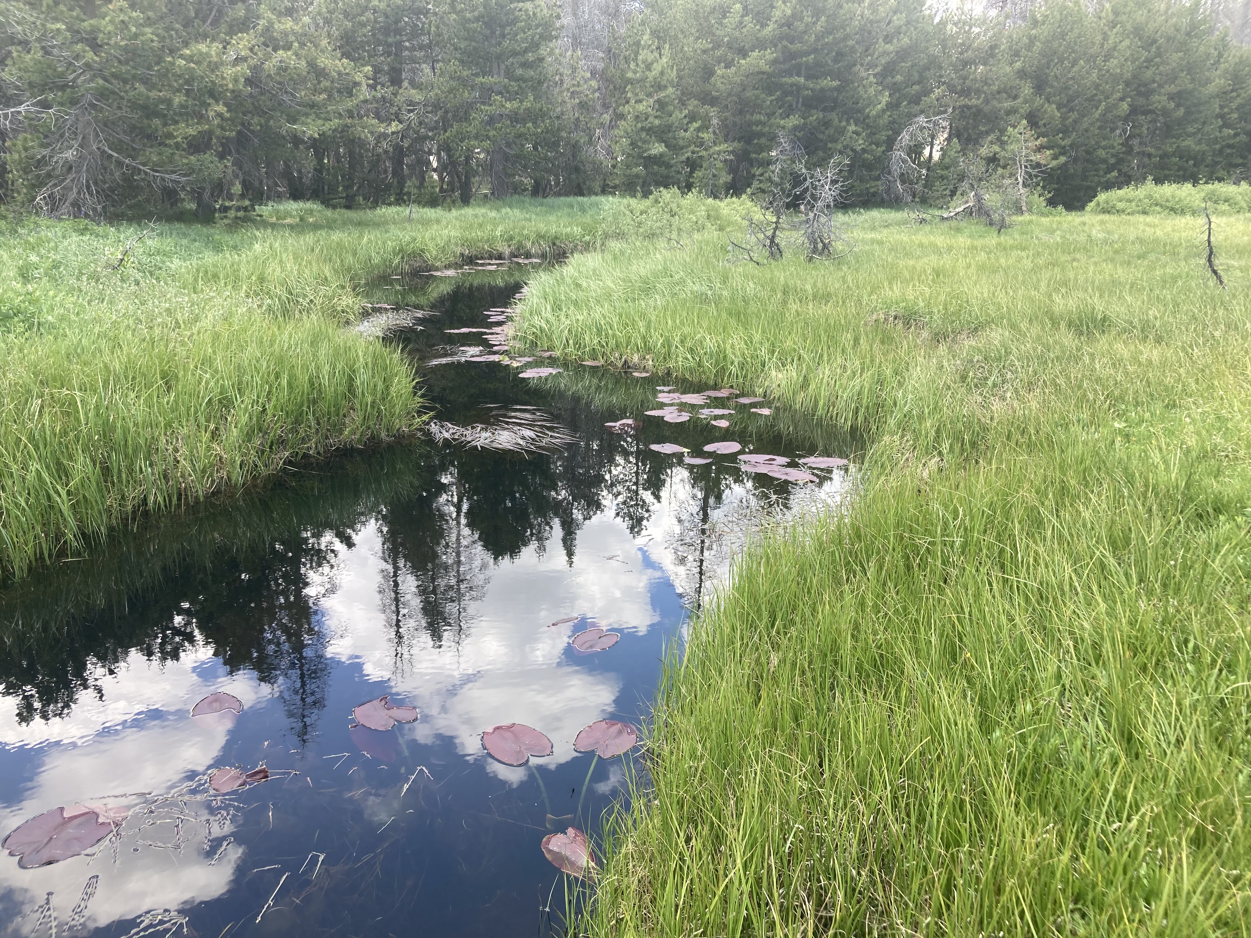
Confluence Meadow
The restoration at Confluence Meadow nears completion!. By reconnecting Pine Creek and Little Harvey Creek to their meadows, we can reduce erosion and allow water to spread and soak back into the landscape to ensure more water flows into Pine Creek rather than draining out through incised channels. A healthy Pine Creek provides important spawning habitat for Eagle Lake Rainbow Trout, a species found only in the Eagle Lake watershed. Our monitoring shows groundwater staying closer to the surface for longer, helping wet meadow habitat recover and stay green later into the season. And the impacts go further! Native vegetation has re-established across treated areas, stabilizing soils and improving habitat for wildlife, while ongoing work on the site continues to strengthen the meadow’s long-term resilience.
Grouse Meadow
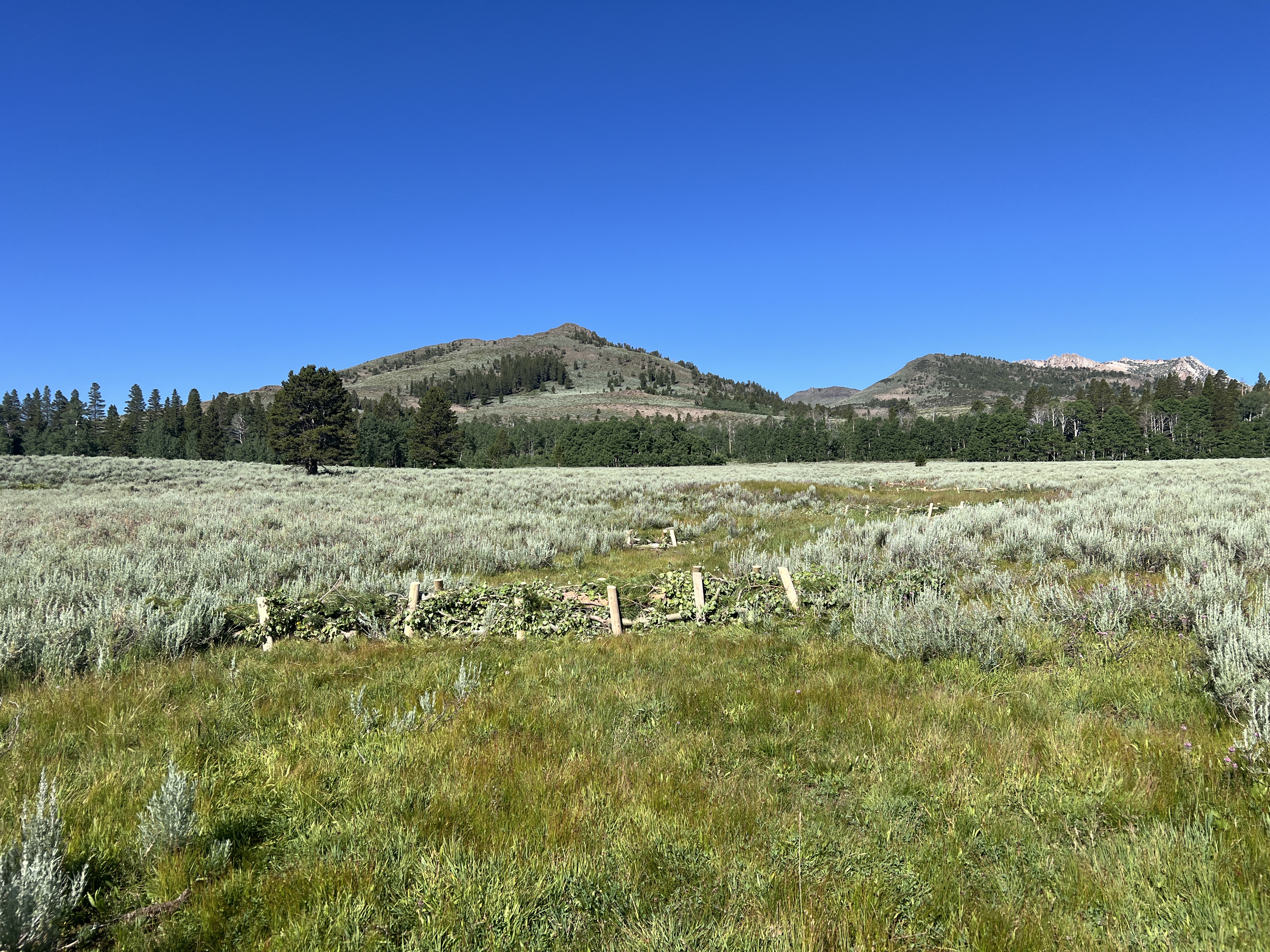
We completed restoration at Grouse Meadow in the West Walker River watershed this past July 2025, replacing a culvert with a low-water crossing to prevent degradation, building beaver dam analogs in an adjacent tributary, and filling and stabilizing several headcuts throughout the meadow. Now we will monitor the site and see how vegetation responds to restoration!
Pickel Meadow
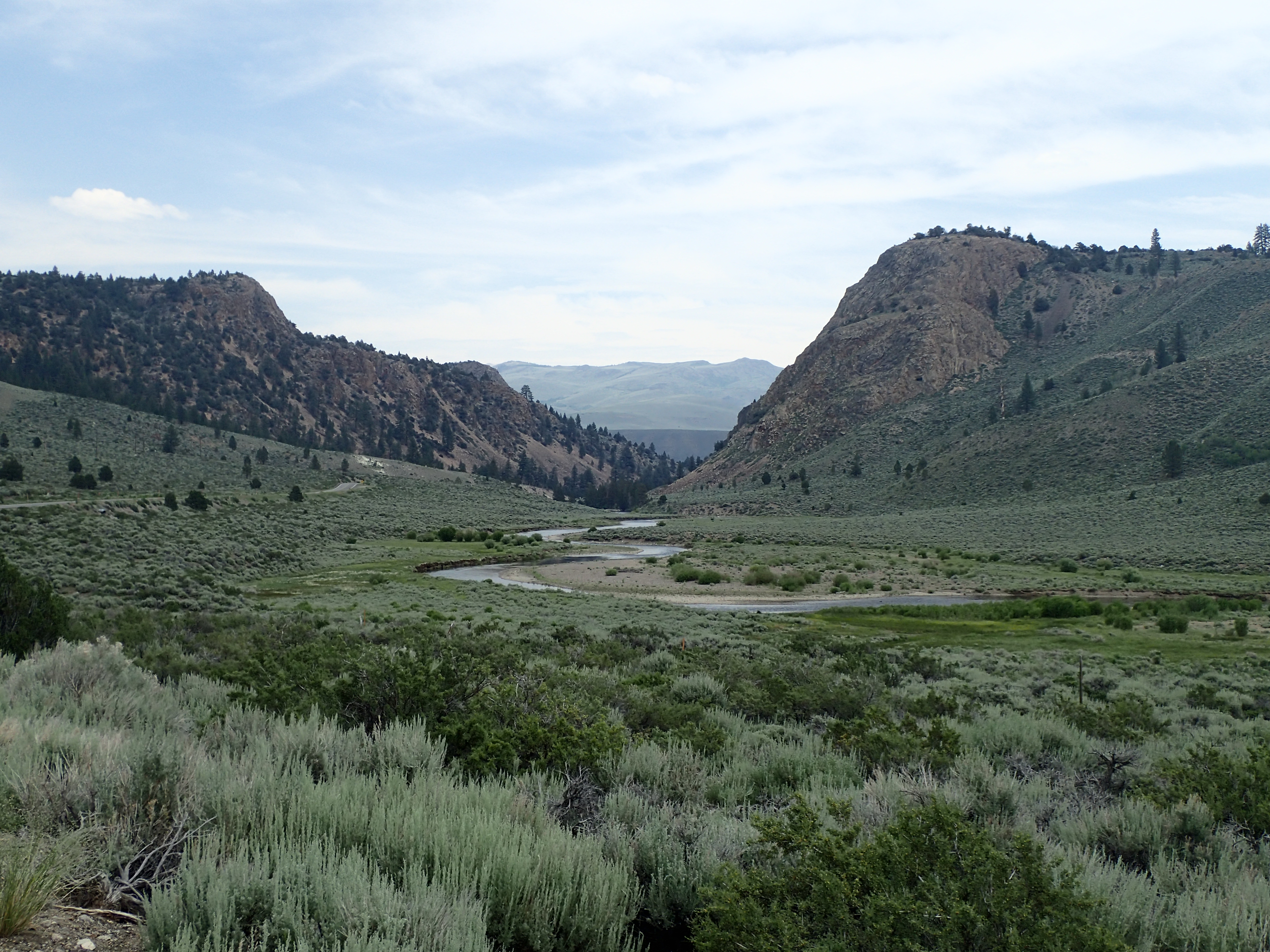
At Pickel Meadow, also in the West Walker River watershed, we recently received nearly $5M from the CA Wildlife Conservation Board to restore this 450-acre meadow. This effort, in partnership with the California Department of Fish and Wildlife and the US Forest Service (Humboldt-Toiyabe National Forest) will impact the ecology of this critical habitat and expand recreational opportunities, reconnecting a 3.2-mile section of the West Walker River to its historic alluvial fan, restore over 250 acres of wet meadow habitat, and enhance habitat through revegetation and the installation of in-stream features. It will also improve a water diversion to prevent fish entrapment, improve water supply for local grazing, protect a spring with wildlife-friendly fencing, and create a parking lot and trail improvements. And we are set to begin construction in summer 2026!
Lower Sardine Meadow
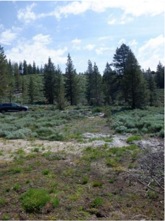
Sometimes restoration work needs follow-up. Working with the US Forest Service Humboldt-Toiyabe National Forest, American Rivers restored Lower Sardine back in 2019, but our site monitoring suggested that small tweaks were needed. We have adaptive management planned for fall 2026 to ensure the success of the restoration. We’ll be placing wood and rock in places where channel incision is starting to form, revegetating a former parking lot, enhancing a public trail, and removing small lodgepole pines that are encroaching on the meadow. We can protect this precious meadow for future generations.
Forni Meadow Complex
In 2025, the California headwaters team, alongside the US Forest Service Eldorado National Forest, was in the thick of planning for restoration at the Forni Meadow Complex. The Complex is made up of a group of three meadows at the headwaters of the South Fork American River in the Eldorado National Forest. We are monitoring the impacts of restoration by photographing the site over time and measuring groundwater levels to ensure our collaborative work stands the test of time. This project builds on our longstanding partnership with the Eldorado National Forest, where we have partnered to complete two other projects as part of ENF’s first meadow restoration efforts, as well as conducting the Caldor Fire meadow assessment and prioritization effort, which identified the Forni Meadow Complex as a high priority for restoration. This year, we will be busy getting ready to start the construction phase of the project, with on-the-ground restoration anticipated to begin later this summer.
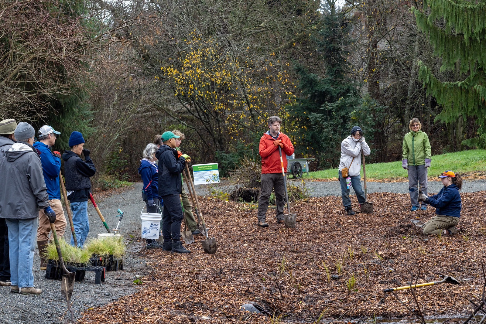
On a cold and overcast day in November 2025, a small team stood at the edge of a degraded wetland in Seattle, Washington, and excitedly discussed construction plans for a wetland restoration project that had been decades in the making.
A 10,000-year-old wetland in Roxhill Park known as the Roxhill Bog is one of the few surviving fragments of a much larger peat bog ecosystem that once flourished in the Northwest. The 5.3-acre wetland is the headwaters of Longfellow Creek, which travels for about four miles before entering the Duwamish River, the only naturally flowing river that still runs through Seattle, and one of America’s Most Endangered Rivers® in 2019.
Peat bogs occur in cool, wet environments and are exceedingly rare, covering only 3% of the Earth’s land. They form over millennia from the accumulation of dead plant material and act like sponges, holding water and slowly releasing it over time. This provides stable flows and cooler water to downstream river systems during drier summer months and helps to retain water when it floods.
Peat bogs filter water pollutants and provide a home for many unique plants and animals, including sphagnum moss, bog laurel, Labrador tea, Makah butterflies, and bog lemmings. They also contribute outsized benefits to the world’s climate, storing about 30% of land carbon.
Over time, peat bogs in Seattle were drained, filled, and paved over by urban development. The remaining patch in Roxhill Park slowly dried up due to groundwater diversions, which impaired water quality, destroyed downstream salmon habitat, and limited safe public access to open recreational spaces.
“One of my colleagues at Seattle Public Utilities put it best — the bathtub is broken, the natural processes that once allowed water to remain onsite are no longer working,” said Danielle Devier, senior urban ecology analyst with Seattle Parks and Recreation. “Repairing the broken bathtub is one of the best ways to rewet the bog.”
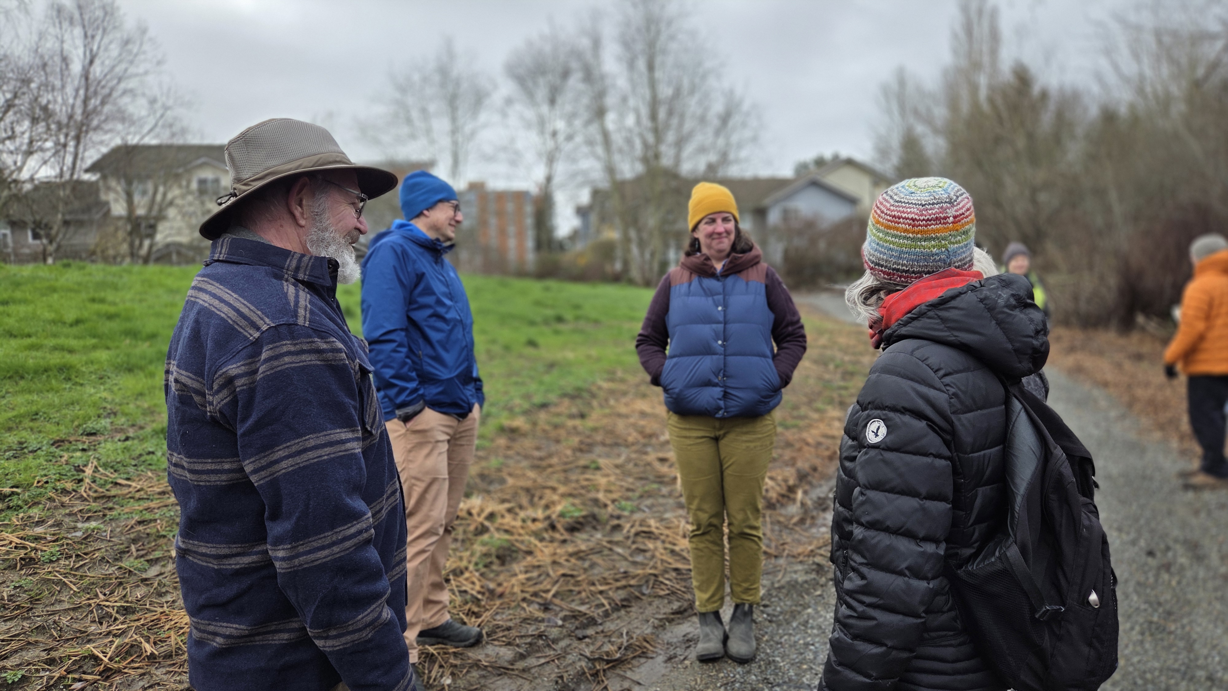
Members of the surrounding community in West Seattle were alarmed at what was happening in their local park. They came together in 1999 to advocate for the restoration of the Roxhill Bog to help recover lost habitat and ecosystem functions.
“This is the last of Seattle’s original 32 peat wetlands, located within an urban area of low-income, diverse communities where this natural area is their sole connection to nature,” explained Sharon Leishman, executive director of the Duwamish Alive Coalition.
“People gather here to experience the ethereal bloom of the fawn lily, hear chorus frogs at twilight, and see the magic of dragonflies, but this special ecosystem is being lost.
The power of community, which started with two neighbors, has grown into a broad, collaborative effort of persistence, patience, and passion. We are all stewards of these lands and waters. We are all connected.”
With support and funding from the Seattle Parks Foundation, King County Wastewater Treatment Division, the Rose Foundation, and the Cox Foundation, plans for the bog’s restoration eventually began to form. American Rivers joined the effort in 2019, serving as project manager for engineering and construction.
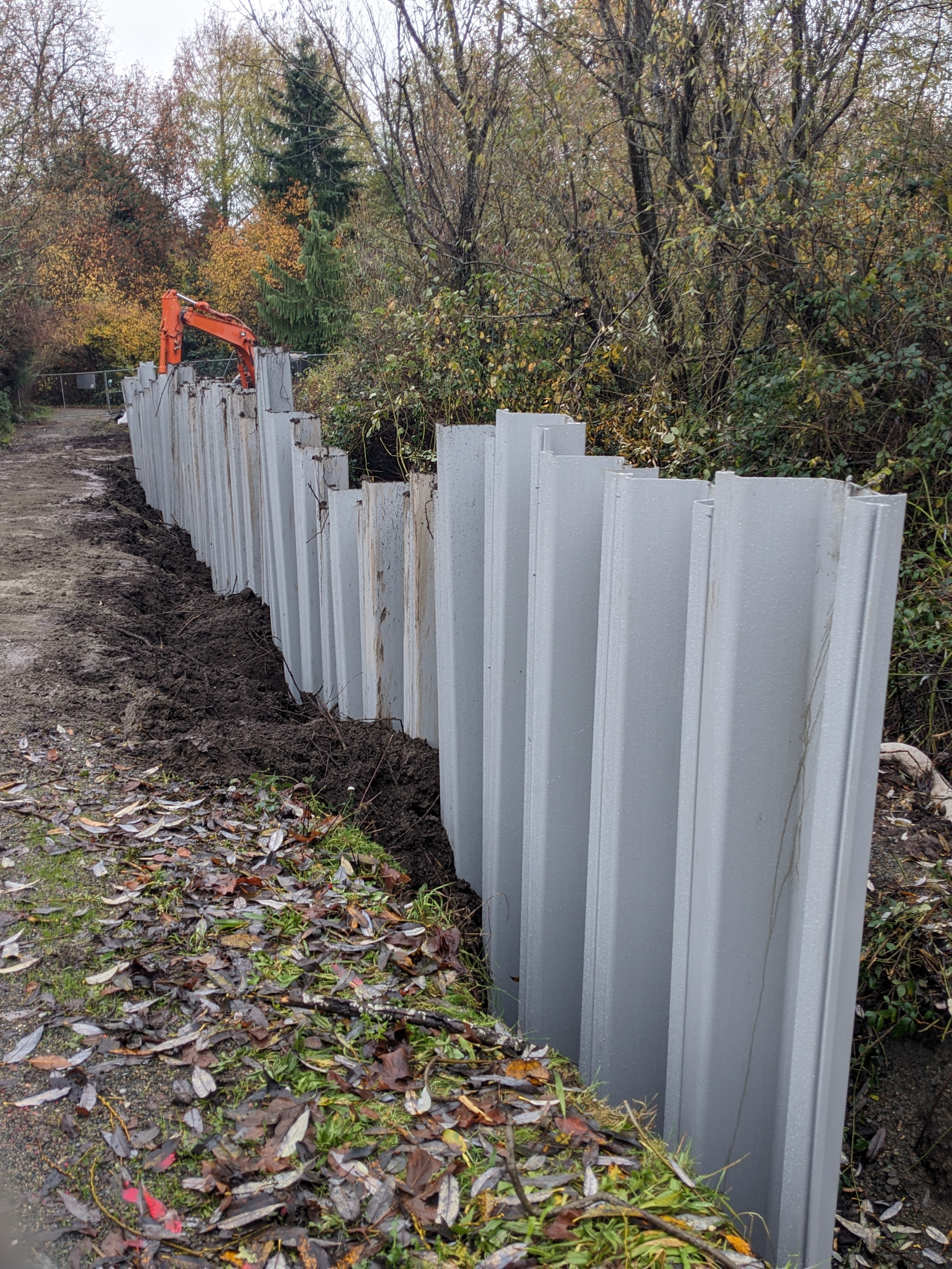
Finally, in late November 2025, construction contractors with Rodarte Construction, Inc., excavated earth and installed 15-foot-high pilings into the Roxhill peat. The pilings form an underground wall for 300 feet along the park’s trails. The wall is designed to slow the flow of groundwater and raise water levels to rehydrate the degraded peat wetland.
Just like the day construction started, rain drizzled down as contractors placed the last shovel of gravel. Nature responded almost immediately. By mid-December, groundwater had risen three feet, with water pooling at the surface of the bog. This showed the engineering design of the groundwater block was working well and starting to rehydrate the peat bog.
“Completing this first phase of the bog’s restoration provides a model for how urban areas across the country can restore wetland functions and improve the quantity and quality of water for people, fish, and wildlife,” said Sarah Dyrdahl, Northwest regional director for American Rivers. “In addition to the West Seattle community, we hope salmon in the downstream Duwamish will be the big winners of this work.”
The bog’s water level will be monitored over the coming years to help inform additional restoration, including work by Seattle Public Utilities to reroute stormwater and by Seattle Parks and Recreation, which may install more blocks to increase groundwater retention.
A few days after construction, community volunteers planted native species in the project area to jumpstart the revitalization of the wetland ecosystem. Local organizations and project partners, such as the Delridge Neighborhoods Development Association, plan to host more nature walks, art activities, and class field trips centered on peat bog ecology. They are also facilitating trash pick-up events in collaboration with the Green Seattle Partnership.
“It’s been an honor to be part of the restoration of Roxhill Bog and to work alongside the community in caring for this important ecosystem,” said Caroline Borsenik, environmental programs director with the Delridge Neighborhoods Development Association. “I’m excited to see Roxhill continue to grow as a place where restoration and community come together, and where people can connect with, celebrate, and enjoy this special place.”
Earlier this year, President Trump signed H.R. 7148, the Consolidated Appropriations Act, which included Interior and Environment, Energy and Water, Commerce, Justice, and Science bills. With this package, Congress has now completed work on 11 out of 12 annual appropriations bills that fund government agencies and programs through September 30 – leaving Homeland Security as the final bill yet to be negotiated.
The Fiscal Year 2026 agreement reflects a compromise between the House and the Senate. The enacted legislation differs drastically from the White House budget request, which called for cuts in funding and staff to critical river programs. The new agreement maintains annual funding for EPA, NOAA, NPS, USFWS, and many other agencies that manage river programs, infrastructure, wetlands and watersheds, and implement habitat conservation.
While there is still work to be done, we wanted to share 5 Key wins for rivers that came from the Fiscal Year 2026 Agreement.
Key Wins for Rivers:
- Prioritized place-based restoration initiatives
The Interior bill preserves the EPA’s State Revolving Funds, which provide states and Tribes opportunities to modernize upgrades to water infrastructure. It also provides increased funds to the Chesapeake Bay Program at $96 million, the Great Lakes Restoration Initiative at $369 million, and the Delaware Watershed Conservation Fund at nearly $11.8 million. These increases reinforce a clear preference for locally led science, conservation, and restoration efforts.
- Preserved infrastructure repairs, fish passage, and habitat conservation
The Commerce, Justice, and Science bill includes $65 million for the Pacific Coastal Salmon Recovery Fund, and nearly $58 million for NOAA’s Community- Based Programs. The National Fish Habitat Partnership (NFHP) received $7.2 million under the Interior appropriations bill. Together, these programs support resource management and the removal of unsafe or obsolete aquatic barriers. Even modest increases promote a shared goal: improve recreational fishing, strengthen regional economies, and balance habitat conservation.
- Sustained investments for nature-based solutions
The Energy and Water bill sustains $6 million for the Cooperative Watershed Management Program (CWMP). The CWMP helps communities form watershed groups to plan and implement projects that improve watershed health and fish and wildlife habitat. An example of this being implemented is the Big Thompson Watershed Coalition in northern Colorado, which used CWMP funding to build local capacity and conduct restoration planning while identifying watershed data gaps to support potential project designs in the future. Additionally, the bill increases funding to the Central Valley Project Restoration Fund to $65.3 million and also provides $7.5 million for the Army Corps’ Engineering with Nature.
- Continued focus on Wild and Scenic Rivers and healthy ecosystems
To maintain strong local-state-federal partnerships, the Interior bill provides nearly $5.7 million for the National Park Service’s Partnership Wild and Scenic Program. The funding ensures the approved conservation plans of these rivers will continue to be effectively and efficiently implemented. This includes the Kissimmee and Little Manatee Rivers, located in Florida, which are under study now, demonstrating growing demand for Wild and Scenic River designations.
- Progress for flood relief across rural communities
Aligned with the One Big Beautiful Bill Act, the agriculture appropriations bill provides $50 million to the Watershed and Flood Prevention Operations program, which supports projects that protect and restore watersheds. Language in the bill report directs funds for increased fish and wildlife habitat and improvements to in-stream river flows. An additional $3 million goes to the Watershed Rehabilitation (REHAB) program to help address aging, unsafe dams.
Costly Concerns
These wins come at a time when our nation is facing a historic Western water crisis, major flooding in Washington and West Virginia, and crumbling sewer infrastructure in the Potomac River in Washington, D.C. and Maryland. Cuts across the federal agencies are going to be felt for years to come. While imperfect, this is a straightforward package that sustains several priority river, water, conservation, and regional ecosystem programs. Due to the Senate’s bipartisan leadership, Congress rejected the most devastating cuts proposed by the White House.
What’s Next?
American Rivers will work with agencies and communities to ensure these funding provisions are interpreted and implemented successfully in ways that support river health and grow our economy. These decisions impact how projects are carried out on the water.
At the same time, we’re gearing up for the Fiscal Year 2027 appropriations cycle, which will be another challenging year due to ongoing constraints surrounding staffing and capacity across the federal agencies.
I first visited the town of Ramseur, North Carolina, two years ago as part of a river restoration effort focused on removing an outdated and unsafe dam that had blocked the town’s otherwise vibrant Deep River. I was new to my role at American Rivers but had a strong connection to the state’s rivers and unique freshwater ecology, having spent the prior decade as an aquatic scientist. I understood the importance of interconnected rivers for the health of native fish, aquatic salamanders, and freshwater mussels. But in the city with the apt slogan “Where Family and Friends Meet,” I soon came to understand how deeply passionate people – and their connection to place – can shape the success of complex and transformative river restoration efforts such as dam removal.
Dam removal is one of the most powerful tools we have to restore the health of rivers. A free-flowing river supports biodiversity, clean water supplies, and recreation. Sadly, the state of North Carolina has an astonishing 28,000 inventoried dams on its landscape, and many of them are obsolete. Flowing through the heart of Ramseur, the Deep River is one of two major tributaries to the Cape Fear River, together comprising the Cape Fear River Basin, which provides drinking water to nearly a quarter of a million people. This major river is severely fragmented by several major dams that disrupt its natural flow and block species movement.
The Ramseur Dam, originally constructed in the early 1900s to power a sawmill and later the Columbia Manufacturing Company, is one such structure. It no longer produces hydropower or supports manufacturing. Built largely of river rock, time has taken its toll: the gates are broken, water seeps through the structure, and rebar juts out in places.
With more than half a million dams obstructing rivers across the country, this isn’t a scenario unique to North Carolina, but it is a hazard felt deeply by the residents of our state. Storms now known as household names—Helene, Florence, and Matthew—reveal how aging infrastructure combined with extreme weather endangers people, wildlife, and our clean water supply. Dams that no longer serve a purpose are creating unsafe conditions, needlessly degrading water quality, and burdening city leaders and private owners with liability risks should they fail in the next major storm or from sheer old age.
Dam removal confronts these immense challenges with a solution – reconnecting our rivers. Removing a dam can be a big step for a town. A river restoration project requires vision, courage, and partnership. The Ramseur dam removal is an act of optimism – local leaders asking: how can we improve this amazing resource for both people and nature? The leadership and community of Ramseur chose to envision a place where children can safely wade into the cool waters, anglers fish for native species, and the river flows freely, tumbling over rocks as it moves downstream.
With respect and full understanding of the benefits they once served, more and more outdated dams are being removed to advance a future of ecological restoration, expanded recreation, economic opportunity, and community connection. Local leaders in Ramseur have embraced a future provided by a free-flowing river.
Plans for a state trail along the Deep River envision a continuous walking trail, termed greenway, winding alongside the river and a designated paddle trail, or blueway, stretching the length of the Deep River, reconnecting communities to the water and to each other. New trailheads and river access points tied directly to the restoration are designed to bring people back to the river—not as a backdrop, but as a centerpiece of community life.
While Ramseur’s story is its own, it is also part of something much larger. Restoring natural flow in the Deep River strengthens the health of the entire Cape Fear River system, from piedmont headwaters to coastal estuaries. The benefits are cumulative. Reconnecting even a single stretch of river contributes to a larger vision: a continuous, free-flowing river system where people can paddle from the Deep River toward the coast, where fish and other migratory species can move freely, and where communities along the way are linked by shared stewardship of a healthy watershed for people and for nature.
As the Ramseur Dam comes down, the Deep River will flow freely for the first time in more than a century. The water will find its natural rhythm again, carving new paths, supporting wildlife, and inviting people back to its banks. This transformation is possible because people, working together with care and vision, choose restoration and resilience.
Ramseur’s next chapter is about reconnecting—to the river, to each other, and to a broader vision of a restored Deep and Cape Fear River system flowing forward together. Which North Carolina town wants to add to the story?
Restoring floodplains — the low-lying lands next to rivers — is one of the most effective ways to reduce flood risk to communities, strengthen ecosystems, and improve water resources.
Across the country, communities, Tribes, and land and resource managers are working to restore rivers and reconnect floodplains. As weather events grow more intense and unpredictable, these projects are becoming more essential. Floodplains are a powerful and natural form of infrastructure. When floodplains are healthy and connected, they can absorb and slow floodwaters, recharge and store groundwater, reduce wildfire impacts, improve rangeland health, and increase biodiversity. Healthy floodplains can protect communities while also strengthening ecosystems.
Despite the proven benefits, floodplain restoration projects are often delayed or stopped entirely because of outdated policies from the Federal Emergency Management Agency (FEMA). Why? Because…
Outdated policies treat restoration like development.
Under current FEMA policy — even when projects pose no risk to people or property — river and floodplain restoration is regulated the same as new development. In other words, projects designed to reduce flood risk can get caught up in FEMA’s no-rise standard and Conditional Letter of Map Revision (CLOMR) process. The no-rise standard is meant to prevent floodplain development from increasing flood elevations and putting people or property at risk.
The thing is, restoration projects — such as reconnecting floodplains to rivers, planting riparian vegetation, or stabilizing streambanks — can lower long-term flood risk. The lack of distinction between restoration and development creates unnecessary roadblocks, slows urgently needed resilience work, and discourages restoration efforts that could help communities adapt to worsening floods.
So what can be done? Enter:
Floodplain Enhancement and Recovery Act
The Floodplain Enhancement and Recovery Act would modernize FEMA’s approach to ecosystem restoration.
If passed, the Floodplain Enhancement and Recovery Act would give states and local communities more flexibility under FEMA’s “No- Rise” rule to execute projects needed to restore these natural floodplains. Passing this act would reduce regulatory burdens and give states, Tribes, and local communities the tools they need to restore floodplains, protect lives and property, and build safer, more resilient landscapes.
The Floodplains Enhancement and Recovery Act would ensure that floodplain restoration is treated like what it is — an investment in safety and resilience — not a risk.
So don’t wait, follow the link below to tell Congress to support the Floodplains Enhancement and Recovery Act now!
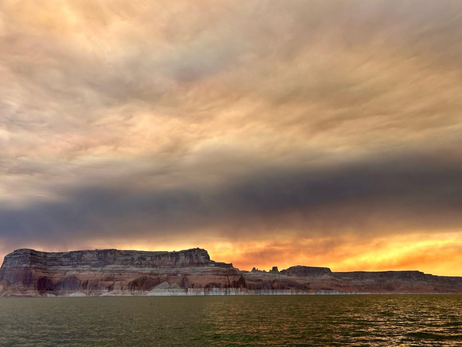
In December of 2025, a hodge-podge, high-power mix of water users, water managers and policy makers, non-profits, scientists, and journalists convened in Las Vegas for the 80th annual Colorado River Water Users Association Conference (CRWUA) in Las Vegas. The conference, and the open and closed-door meetings it hosts, was themed “forging a path forward”. Insofar as forging is an act of hammering and compression, the theme was almost too on the nose with states having missed a November 11 deadline for agreement on future management of the Colorado River, and is now facing a new deadline looming on the horizon of 2026. It was a fitting culmination of a complicated year on one of the world’s hardest-working rivers, where drought and demand have stretched already thin supplies to the brink. The economies and cultures of nearly 40 million people hang in the balance of the ongoing negotiations, as does the health and future of the river itself.

2025 on the Colorado River…
This past year was chock-full of high-profile meetings between the principals of the seven Colorado River basin states working to negotiate a path forward for management of the Colorado River. American Rivers participated in collective action and influence on the next generation of rules, called “Interim Guidelines.” Critically, we worked with partners to provide a science-informed Cooperative Conservation Alternative that prioritized the health and long-term viability of the river alongside community, economic, and cultural needs. While it’s been rebranded in the federal government’s latest document as the “Maximum Operational Flexibility Alternative” (we’ll get into this more below), the Alternative remains one of five under consideration.
Originally faced with a November 11, 2025, deadline for agreement, the upper and lower basin states failed to come together with a shared vision for the future of the Colorado River. We worked with partners to both pressure and support the principles working to find an agreement.
We leveraged the power of storytelling to encourage those determining the future of the Colorado River to prioritize the river itself. Our newest film collaboration with Fin & Fur Films, The American Southwest, aired in more than 70 theatres during a 40-day theatre run in the West, and inspired thousands to take action on behalf of the river. We hosted and spoke on panels to help audiences understand the significance of a very wonky process and know how to direct their energy to action.
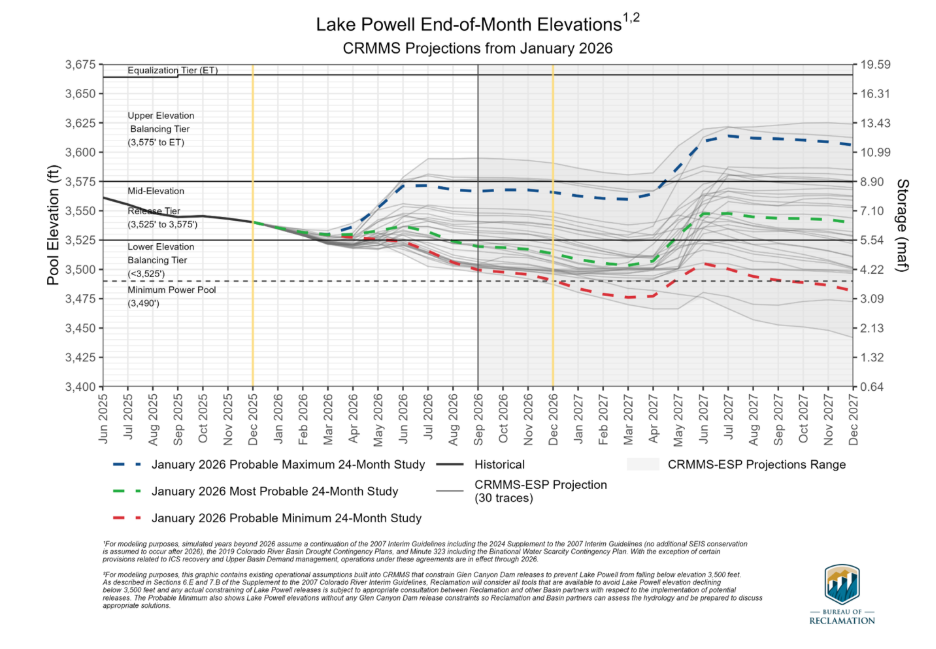
Meanwhile, the BOR 24-month projections released in October of 2025 suggested – and for many who have been tracking climate models for years confirmed – a worrying trajectory for water availability in the basin, with some models predicting Lake Powell dropping below the minimum level for hydropower as early as fall 2026.
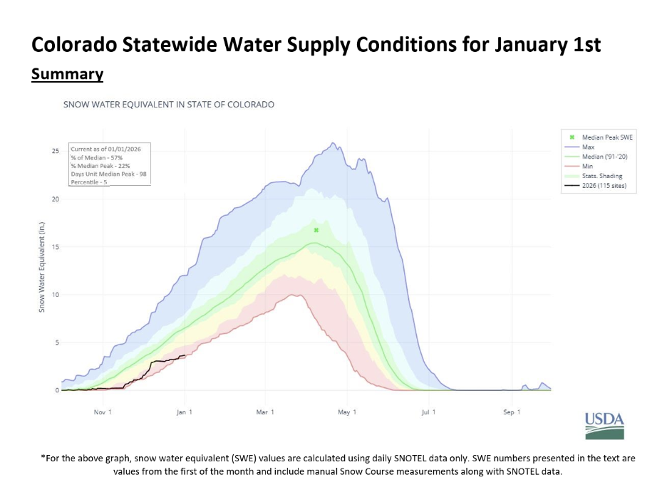
The 24-month study, paired with the sobering, recently released NRCS report for Colorado Statewide Water Supply Conditions, underscore the imminence of future water management strategies that plan for profound shortages, and look to integrate flexible tools, policies, and programs that can respond to a severely diminished water supply and work proactively to minimize harm to communities, economies, and the critically, to the river itself.
What’s next?
Well, it’s a little hard to say. The states face a new deadline of February 14th to come to an agreement about the future management of the Colorado River. Unfortunately, following a recent meeting of governors and their representatives in Washington DC, agreement does not look likely. In mid-January, the Trump Administration issued a framework for five alternatives, which overwhelmingly propose cuts to the Lower Basin States, nearly all of which are likely to lead to litigation.
The long-anticipated draft environmental impact statement (DEIS) was issued on January 9, providing a preview of the menu of options for future management of the overstressed river. The DEIS outlines five potential frameworks for managing the river, and tests them against various climate forecasts. Some experts claim the models don’t go far enough to represent the likely extent and impact of prolonged drought in the Basin.
- No Action Alternative: assumes that after this year, reservoir operations would revert to pre-2007 conditions. Current drought-response adaptations would cease, and annual decisions would rely on outdated and broad authorities rather than strategies aimed at mitigating the risks the Basin faces now and going forward.
- Basic Coordination Alternative (Federal Authorities Alternative): The Draft EIS expressly recognizes that this alternative would not successfully sustain the basin for the term anticipated (20 years) but may work if needed for a short-term. Under most hydrologies, it may not sufficiently reduce the risk of reservoir drawdown in prolonged drought, potentially perpetuating low reservoir storage impacts on ecosystems and water supplies.
- Enhanced Coordination Alternative (Federal Authorities Hybrid Alternative): Intended to strike a balance between federal coordination and stakeholder-driven strategies that factor in Tribal water, it yields improved reservoir health (stability and predictability) under a broader range of hydrological conditions than the No Action and Basic Coordination Alternatives. The success of this alternative depends heavily on the size and extent of stakeholder participation and involvement.
- Maximum Operational Flexibility Alternative (Cooperative Conservation Alternative): Prioritizes system resilience and conservation, potentially achieving greater storage stability and flexibility if implemented effectively. It may require new agreements among stakeholders, voluntary contributions to conservation reserves, and broader water management tools. This alternative is likely the most protective of critical infrastructure and long-term ecosystem health because it integrates conservation reserves, proactive storage buffers, and measures that could support more stable instream flows and habitat conditions, benefiting native species and riparian environments. It’s important to note that in order to achieve the stability and reliability the Basin demands, this alternative assumes the largest cuts (of the proposed alternatives) to water user supplies and deliveries.
- Supply Driven Alternative: This alternative is designed to respond dynamically to actual water supply conditions, potentially triggering deeper conservation actions in dry conditions and moderating releases when supply is higher. This alternative has the potential to better align water use with hydrologic realities, reducing stress on storage and ecosystems during drought. However, the plan relies on operations that directly implicate competing interpretations of the Colorado River Compact and other elements of the Law of the River, which the Basin States have not yet been able to overcome. Like the others, this alternative depends heavily on broad agreements among states and stakeholders before implementation.
It’s important to recognize that all alternatives face a number of uncertainties, and no alternative fully eliminates the risk of low storage under extreme drought scenarios. This means monitoring, adaptive triggers, and stakeholder cooperation remain critical across all scenarios.
If the states don’t come together by the new Valentine’s Day (ironic, we know) deadline, it’s hard to know what will happen; however, a Federal alternative will likely result in litigation from the states. And, while there may be a time and place for litigation, the consequences of Colorado River management being tied up in court for the foreseeable future is bad news for a river facing dwindling supplies, a very grim snowpack, and increasing demand. It limits the flexibility and collaboration required for thoughtful, proactive response, and the kinds of solutions that the circumstances and the river demand.
Our own Sinjin Eberle said it best in his recent quote in this LA Times article:
“Ultimately, we would hope that all of the states and the federal government combined recognize that without the river being healthy and sustainable, industry is going to suffer, agriculture is going to suffer, communities are going to suffer. Hopefully the states can respond to that in a way that is comprehensive and allows for sustainability.”
Sinjin Eberle
More than two decades ago, Where Rivers Are Born helped establish the scientific case for protecting the small streams and wetlands that form the backbone of our river systems. This newly updated edition—developed by the University of Georgia’s River Basin Center in collaboration with leading freshwater scientists and American Rivers—reflects more than twenty years of additional peer-reviewed research on how headwaters function and why they matter.
The conclusion is even clearer today: rivers don’t begin where we boat, fish, or swim. They begin quietly—often invisibly—in small streams, wetlands, and seasonal channels that lace together our landscapes. These headwaters make up the vast majority of our stream networks and are essential to clean water, flood protection, biodiversity, and reliable water supplies downstream.
Drawing on hundreds of studies published since the original report, Where Rivers Are Born documents how small streams and wetlands slow floodwaters, recharge groundwater, trap sediment, and naturally cleanse pollution before it reaches downstream rivers, lakes, and drinking water sources.
The report shows that intermittent and ephemeral streams—many of which flow only seasonally—are especially effective at processing excess nutrients that otherwise fuel harmful algal blooms. It also explains that wetlands often labeled “isolated” are typically connected through groundwater and subsurface flows, playing a critical role in maintaining water quality and streamflow. Collectively, these headwaters support extraordinary biodiversity, store carbon, and sustain the ecological and economic benefits people depend on from downstream rivers.
That science stands in direct conflict with the EPA’s proposed Waters of the United States (WOTUS) rule. As we’ve written before, the rule relies on narrow legal interpretations that ignore how water actually moves across landscapes, excluding non-perennial streams and most wetlands from Clean Water Act protections. Where Rivers Are Born makes clear why this approach is so risky: removing protections from the very waters that filter pollution, moderate floods, and sustain river flows undermines the integrity of downstream waters the Clean Water Act is meant to protect.
Simply put, you cannot protect rivers by abandoning their sources—and any WOTUS rule that does so abandons both the science and the purpose of the Clean Water Act.
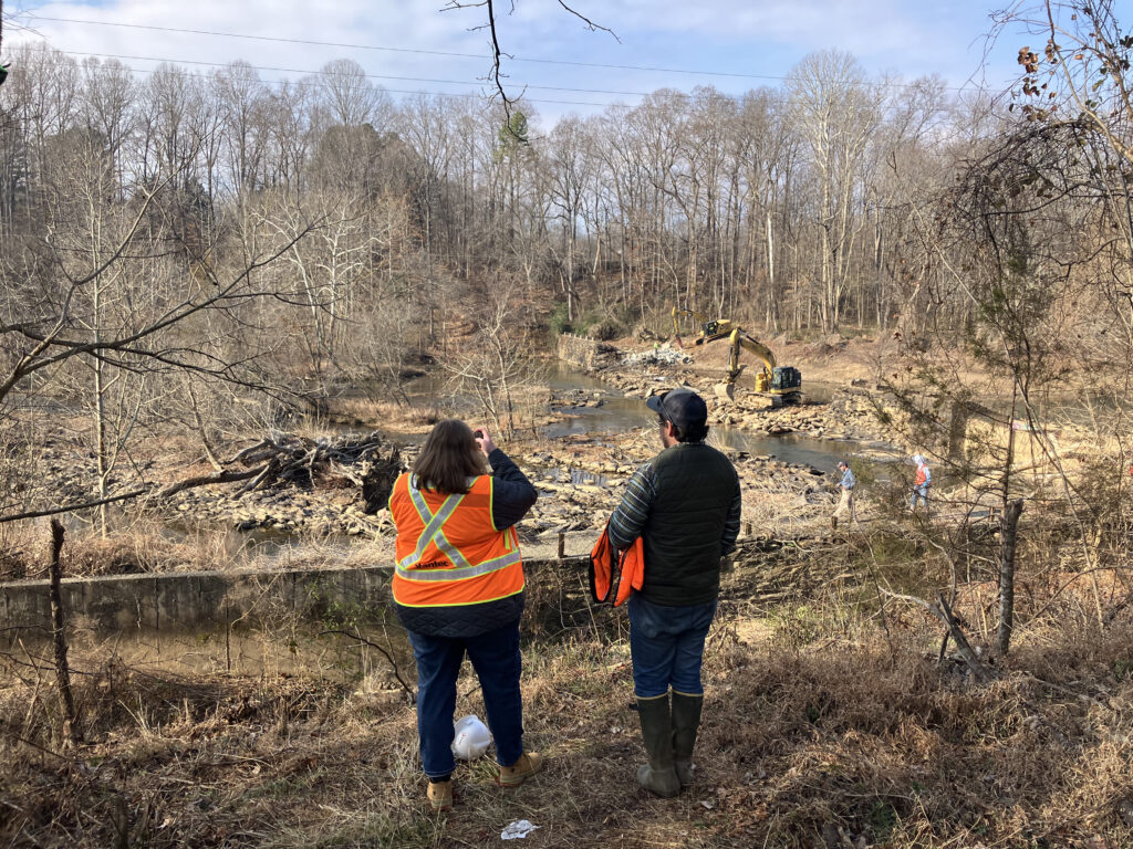
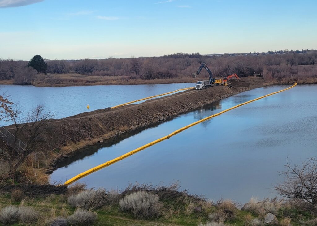
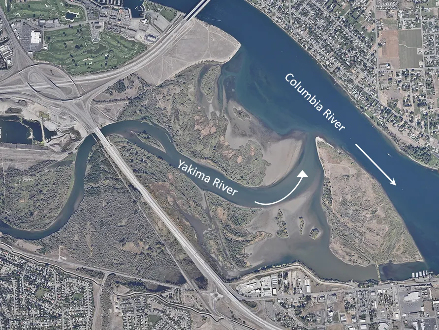
After more than 10 years of planning, the deconstruction of a human-made causeway that blocks an entire section of the lower Yakima River in Central Washington is underway.
American Rivers has long advocated for the causeway’s removal at Bateman Island. Freeing the river here will allow salmon and steelhead to migrate unimpeded for the first time in decades, maximizing significant habitat restoration investments in one of Washington’s largest watersheds and marking an important step towards healing the Yakima River Delta.
Salmon are essential to the culture and sustenance of the Confederated Tribes and Bands of the Yakama Nation, who are working tirelessly to replenish fisheries on the river, a major tributary of the Northwest’s great Columbia River.
We’re excited to see this major project begin and grateful for the collaboration between all our partners in the Yakima Basin Integrated Plan.
Learn more about the expected benefits to the river ecosystem below.
This story was originally published by the Washington State Department of Fish and Wildlife on January 5, 2026
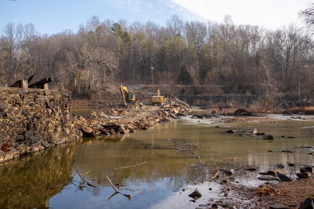
Many years ago, people built a dead end where two rivers met — and blocked an ancient pathway for migrating salmon and steelhead.
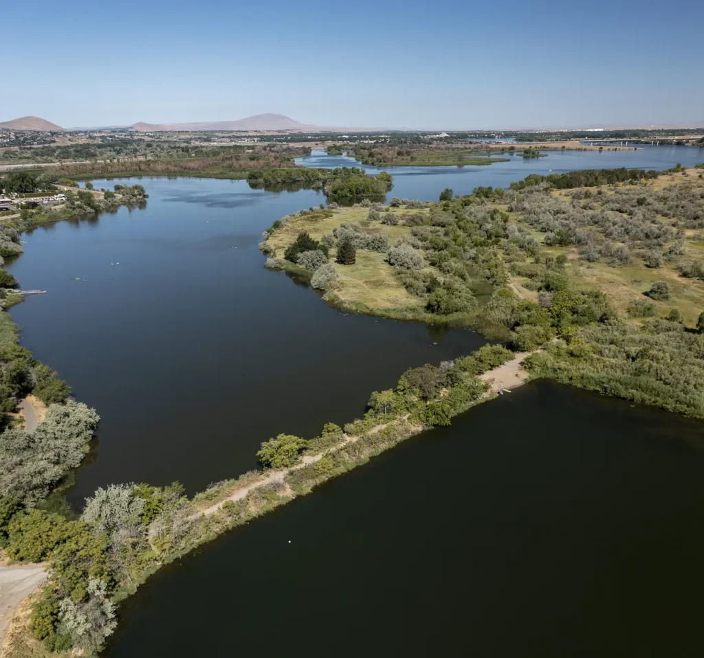
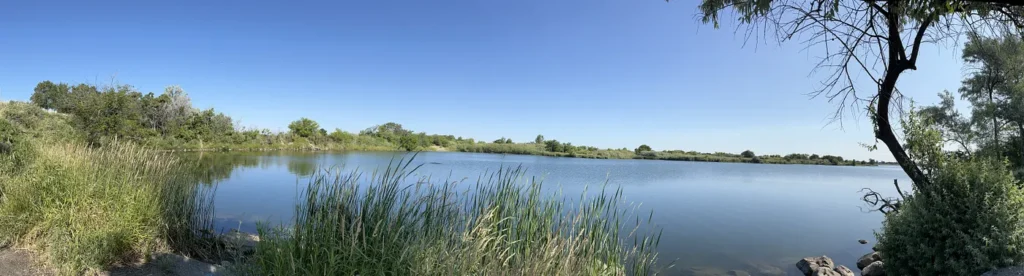
Bateman Island is a beautiful place resting in the delta where the Yakima River flows into the Columbia River near Richland. While the exact history is unclear, around 1939 or 1940, a causeway (or raised path) was built in the river to reach the island, probably for agricultural use. Over time, the causeway and other modern infrastructure along the river have contributed to the development of a shallow pond of warm, stagnant water — perfect habitat for invasive fish to thrive and prey on young juvenile salmon and steelhead.
Blocking an entire section of the Yakima River, the causeway also fosters an overgrowth of vegetation that limits where salmon can swim. It also makes it difficult for juvenile salmon to migrate downstream to the ocean during spring and early summer, while also limiting passage for adult salmon returning to spawn in summer and fall.
Impacts to salmon
Today, while some populations of salmon and steelhead are on the rise in other parts of Washington — thanks to years of recovery work — the causeway has contributed to depressed populations in the Yakima River Basin.
In addition, the Yakima Basin has experienced drought for three years in a row, exacerbating impacts to salmon in this ecologically significant river delta. When salmon spend excessive time in warm, shallow water depleted of dissolved oxygen, it can be fatal. Swampy, stagnant water blocked by the causeway harbors a warm ecosystem of mosquitoes, algal blooms, overgrowth of a plant known as water stargrass, non-native predatory fish, bacteria, parasites, and degrades water quality. In summer 2024, high water temperatures in the Yakima River delta killed at least 75 sockeye salmon.
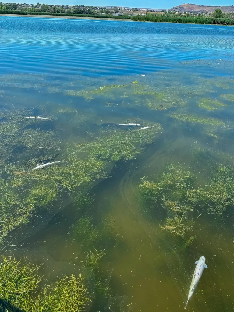
Warm water can also act as a thermal barrier, blocking fish passage and causing adult fish to stray or wait in cooler waters in the mainstem Columbia, decreasing their chances of successfully spawning.
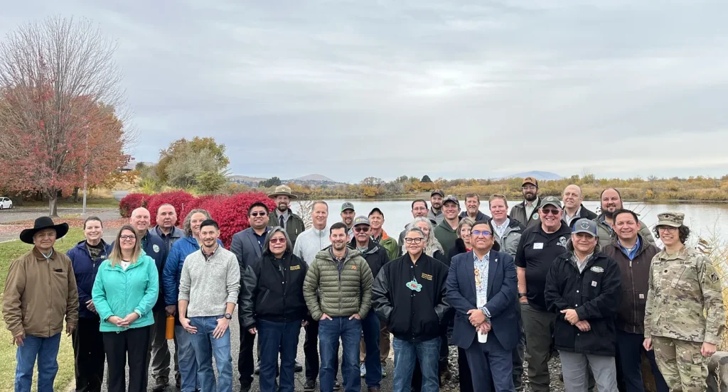
Partners take action
This month, the Walla Walla District of the U.S. Army Corps of Engineers (USACE), Yakama Nation Fisheries, the Washington Department of Fish and Wildlife (WDFW), and the Mid-Columbia Fisheries Enhancement Group are working together to begin removal of the Bateman Island causeway. This work will improve fish passage, spawning habitat, water quality, and water movement. The collaborative effort began years ago with planning and public engagement. A feasibility study and environmental assessment were finalized in October 2024.
Project partners also led the removal of an upriver marina in August 2025, which eliminated an artificial habitat that was supporting a growing population of predatory, non-native fish. This resolved another problem for salmon in the river delta. The project included compensation to the marina owners through a fair market appraisal process and for the decommissioning of the facility.
On Nov. 7, the USACE, in partnership with WDFW, the Yakama Nation, the Washington State Department of Ecology, and the Mid-Columbia Fisheries Enhancement Group, awarded a $1.2 million contract to Pipkin Incorporated for the causeway removal. Excavation of the causeway is slated to begin as early as Jan. 5. The USACE has developed and will implement a water quality monitoring plan during and post-construction
“Mid-Columbia Fisheries Enhancement Group has been proud to work alongside regional partners for nearly 15 years — including early collaborators at the Yakima Basin Fish and Wildlife Recovery Board, Yakama Nation, and the Benton Conservation District — to elevate water quality and fish passage priorities in the lower Yakima River,” said Margaret Neuman, Executive Director of Mid-Columbia Fisheries Enhancement Group. “Restoring the Yakima River Delta is critical for the recovery of salmon, steelhead, and lamprey throughout the Yakima Basin. We are grateful to see the long-planned removal of the Bateman Island causeway move forward, restoring natural river processes, improving water quality, and supporting healthy fish migration throughout the system.”
Cultural significance of Bateman Island
Bateman Island and the Yakima and Columbia rivers are culturally important to the Yakama Nation and the Confederated Tribes of the Umatilla Indian Reservation. The broader community is also invested in this project, which was developed with extensive public input.
“This is a long-term collaborative effort, working together to get the process completed, working to get the permitting required, and working to also educate everybody, especially the local people near the island who are going to see changes in their area,” said Joe Blodgett, Yakama Klickitat Fisheries Project Manager and spokesperson for the Integrated Plan.
“The causeway and its resulting problems in the Yakima River are a high priority for Yakama Nation Fisheries’ staff,” Blodgett said. “The removal of the causeway is going to be a huge benefit for our first foods with the salmon returns and also to people living nearby who rely on clean, flowing water.”
Blodgett feels that “the removal of the causeway is a big win for many.”
“It is incredibly rewarding to see the years of collaboration come to fruition — the Yakama Nation taking the lead on fisheries, the Army Corps contracting out the excavation work, and WDFW co-managers supporting the coordination with Mid-Columbia Fisheries,” he said. It’s a great team with a lot of persistence to move through the long process to get here.”
The history of salmon in this area
Historically, the Yakima River was home to the second-largest salmon run in the Columbia River basin, behind only the Snake River. More than 800,000 salmon return to spawn and die here every year, enriching the river and the surrounding landscape.
Mike Livingston, WDFW’s south-central Washington regional director, states, “The Bateman Island causeway creates a bottleneck for salmon in the Yakima River delta and compromises our restoration work upriver, such as the major fish passage facility being built at Cle Elum Dam. The success of the causeway removal project will magnify benefits to the whole Yakima River system for salmon.”
Several salmon stocks have recently been reintroduced or supplemented into the Yakima River through collaboration between Yakama Nation and many other state and federal agencies. These include sockeye, coho, fall, spring, and summer Chinook, steelhead, and Pacific lamprey.
The causeway removal will benefit these species, as well as birds, other species nearby that live on land, and other aquatic species native to the area. Additionally, the project will improve water quality and enhance recreational fishing opportunities.
A more friendly future for fish
Restoring fish passage at Bateman Island will open the Yakima River delta to a better home and future for salmon and steelhead.
Project partners are optimistic about the health of the Yakima River delta as they look forward to continuing collaborations to nurture strong salmon runs and new recreation opportunities for locals and visitors to the area.
“As commander of the Walla Walla District, I am proud to be part of this effort to return the Yakima River delta to its natural state,” said Lt. Col. Kathryn Werback of USACE. “The island causeway blocks the river’s course, which has significantly impacted critical habitat for culturally significant fish for a long time. Removing it will begin reversing that harm through a restoration effort made possible by our strong partnerships with WDFW, the Yakama Nation, and Mid-Columbia Fisheries.”
Other partners
Additional stakeholders and tribal nations supporting the causeway removal include the Washington departments of Ecology and Natural Resources, the U.S. Environmental Protection Agency, NOAA Fisheries Service, the U.S. Fish and Wildlife Service, the cities of Richland and Kennewick, the Confederated Tribes of the Umatilla Reservation, Resources Legacy Fund, Roza and Kennewick Irrigation Districts, and outdoor enthusiasts. Trout Unlimited served a key role in the removal of the Columbia Park Marina, and the Benton Conservation District and the Yakima Basin Fish and Wildlife Recovery Board were early, critical partners in project identification and development.
The causeway removal is part of the Yakima Basin Integrated Plan, a coalition of local, state, and federal agencies, the Confederated Tribes and Bands of the Yakama Nation, and non-governmental environmental organizations that are collaborating on projects to benefit farms, fish, and communities in the Yakima River Basin.
The Integrated Plan, the USACE, the Department of Ecology, and the Washington Salmon Recovery Funding Board provided state and federal funding for the causeway removal. Yakama Nation also secured a grant from NOAA that funds fish passage improvements in the Yakima River delta.
See the causeway removal project in real time from the City of Richland’s time lapse footage.
Across the country and across the political spectrum, communities are demonstrating their desire for, and commitment to, clean water and healthy rivers. One example of this is how voters showed up to support rivers on election day. On November 6, voters overwhelmingly approved multiple ballot measures, buoyed by the American Rivers Action Fund, that support rivers, infrastructure, and parks.
In Texas, citizens passed Proposition 4 with 71% of the vote, authorizing a billion-dollar-a-year fund for water security and stream and floodplain restoration efforts across the state for the next 20 years. This is the largest state-based water ballot initiative in the history of the United States. Partners, including the National Wildlife Federation Action Fund and Texans for Opportunity, were vital to the effort, amplifying the issues with the Texas State Legislature, and to Governor Abbot and communities across the Lone Star State.
“Across the country, when water is on the ballot, water wins. Texans of all political stripes turned out to show they understand the need to fund water projects to sustain communities and wildlife,” says Karla Raettig, Executive Director of the National Wildlife Federation Action Fund.
In Idaho, Boise voters approved a 2-year, $11 million property tax levy that will supply critical funding for clean water, parks and urban trails, and wildfire prevention measures. Boise voters approved the measure with 81% of the vote, illustrating how integral improvements to Boise River habitat, walkable parks, and wildfire protection measures are to the quality of life across the city. The coalition effort was led by Conservation Voters of Idaho, which coordinated a substantial get-out-the-vote campaign, knocking on more than 10,000 doors across the city.
“Boise is great because of our open space, and the City has received a mandate that we must continue to expand and protect these special places and resources. We’re proud that Boise continues to show up big and united in shared values like protecting our river and open space,” says Alexis Pickering, Executive Director of Conservation Voters of Idaho.
Much of the water that we rely on comes from rivers, which also provide crucial habitat for fish and wildlife. Our economies, farms, and cities depend on river water for growth, and rivers offer unparalleled opportunities for reconnection with nature and with one another.
These wins at the ballot box build on other water funding measures that have passed with broad, bipartisan support, such as Propositions DD and JJ in Colorado, which have raised over $130 million for water conservation and river health projects across the state since 2020.
“Water security is a unifying issue across the political spectrum. No matter where you live or who you vote for, we all need clean water coming out of our kitchen taps, and we all want to be able to take our kids to the local creek to play,” says Heather Taylor-Miesle, Executive Director of the American Rivers Action Fund. “These wins will make life better in Texas and Idaho, and they provide a blueprint for actions other cities and states can take to protect their water wealth.”
When a major natural disaster strikes, local and state officials often turn to the federal government for assistance in preparing for extreme weather events and rely on it afterwards to help with the clean-up and recovery efforts.
Since 1979, the branch of the federal government responsible for this has been the Federal Emergency Management Agency, also known as FEMA. Originally formed under an executive order by President Jimmy Carter, FEMA is tasked with helping Americans before, during, and after a disaster.
Before an event
Before a disaster, FEMA helps communities and individuals prepare for an anticipated disaster with regular training, engagement, and education, so state and local officials are prepared to handle the event, evacuate people, and keep the community as safe as possible under difficult conditions.
This includes actions like knowing the flood risk in your neighborhood and, if your property sits in a FEMA flood zone, having flood insurance through the National Flood Insurance Program (NFIP), which is administered by FEMA. The agency also works with local and state planners to consider floodplain management to help reduce the risk of flooding to adjacent communities.
FEMA provides grants and other programs to help make communities more resilient to natural disasters, as well as offer training and educational tools to local and state emergency managers so everyone is prepared with the latest technology and best practices to respond to extreme weather events.
During the disaster
During a disaster, if the damage is significant enough to qualify for federal assistance, a governor or a tribal leader can apply for a Presidential disaster declaration. Once the sitting president approves a disaster declaration, FEMA coordinates with local and state leaders on providing the necessary assistance to support the recovery efforts.
In some instances, this may require FEMA to utilize the broader efforts of the federal government to support disaster response assistance, like requesting the U.S. Army Corps of Engineers to help with infrastructure assessments. In other cases, state authorities may have the appropriate help on the ground, but they need additional FEMA funds to ensure the work gets done, like overtime pay for local emergency responders and debris cleanup.
Clean-up and recovery
After a disaster, FEMA is still available to provide public and private assistance to recover and rebuild. FEMA will often work with local leaders on developing a recovery framework so communities can get the physical help and financial support as fast as possible to return to business as normal. This could be in the form of temporary housing while structures are rebuilt, or making sure communities are reconstructed with techniques that are designed to mitigate future disasters. FEMA also processes flood-insurance claims from homeowners with policies through the National Flood Insurance Program, or NFIP.
The role of FEMA has evolved since it was first established in 1979. It continues to change as more responsibility has been placed on it, due to an increasing number of natural disasters that have caused significant economic damage in communities across the United States. There is a current push for states to take more accountability for disaster response, with FEMA playing a smaller role and pushing states to play a bigger role in paying for the disaster preparation, response, and recovery. At the moment, state capability to step up and lead in disaster management varies widely, so it is essential that FEMA remains well funded and rebuilds its staff to help all communities prepare for, respond to, and recover from floods and other disasters.
It feels like every year, meteorologists are reporting more and more “100-year floods.” This term is often misunderstood and misrepresented from a scientific perspective.
Meteorologists, floodplain managers, and the media often use the term “100-year flood” as shorthand for an event that has a 1 percent chance of occurring in any given year. It does not mean that the event will occur once every 100 years. Let me explain.
This type of statistical analysis is done by hydrologists — scientists who study the occurrence, distribution, and movement of water. They can predict how frequently a major precipitation event is likely to occur in a specific area.
Hydrologists need at least 10 years of data to perform a frequency analysis in locations to predict how often a major precipitation event can cause significant flooding. The more historical data available over a longer period, the more accurate the prediction.
Let’s look at a hypothetical river — the Pretend River — for which a hydrologist gathers historical rainfall patterns and stream data and finds that there is a 1 percent chance of a flood cresting 20 feet above its normal level each year at river mile 4.5. A flood of that size, at that location on the Pretend River, is determined to be the “100-year flood” for that river. Our hydrologist also determines that a flood cresting at 23 feet has a 0.5 percent chance of occurring each year, so that size flood is determined to be a “200-year flood,” while a flood cresting at 25 feet has a 0.2 percent chance of occurring each year and is determined to be a “500-year flood,” and so on.
Just because a 100-year flood occurs doesn’t mean it won’t happen again for another 100 years. The risk of these different-sized events reoccurring remains the same every year, statistically.
The reason why more “100-year floods” seem to be occurring is that many areas are seeing larger floods more frequently. Let’s say our hydrologist redoes her flood study ten years later and she now finds that there’s actually a 1 percent chance of a flood cresting at 25 feet every year. What was once a “500-year flood” is now a “100-year flood.”
Why is this shift happening? One of the main reasons is global warming, which causes major precipitation events to occur more frequently because global warming causes the atmosphere to hold more moisture, which translates into more extreme rainstorms repeatedly producing record-breaking events. This is increasing the likelihood that a 100-year flood event can happen two years in a row.
Take Houston, Texas, where the city experienced 500-year floods three years in a row. The first was produced on the Memorial Day holiday in 2015 and 2016, then again by Hurricane Harvey in 2017.
Researchers from Princeton University published a paper in 2019 that determined 100-year floods could become annual occurrences in New England by the late 21st century due to increased storm surge, coastal sea level rise, and more frequent tropical storms.
So the question before us is not will a 100-year storms occur, the question is how can we mitigate the impacts to people, property, and our communities? Learn how protecting and restoring floodplains can help communities adapt to increasing flood risk.
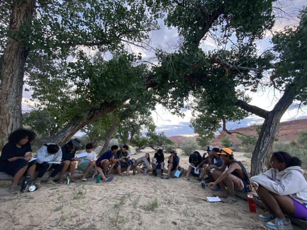
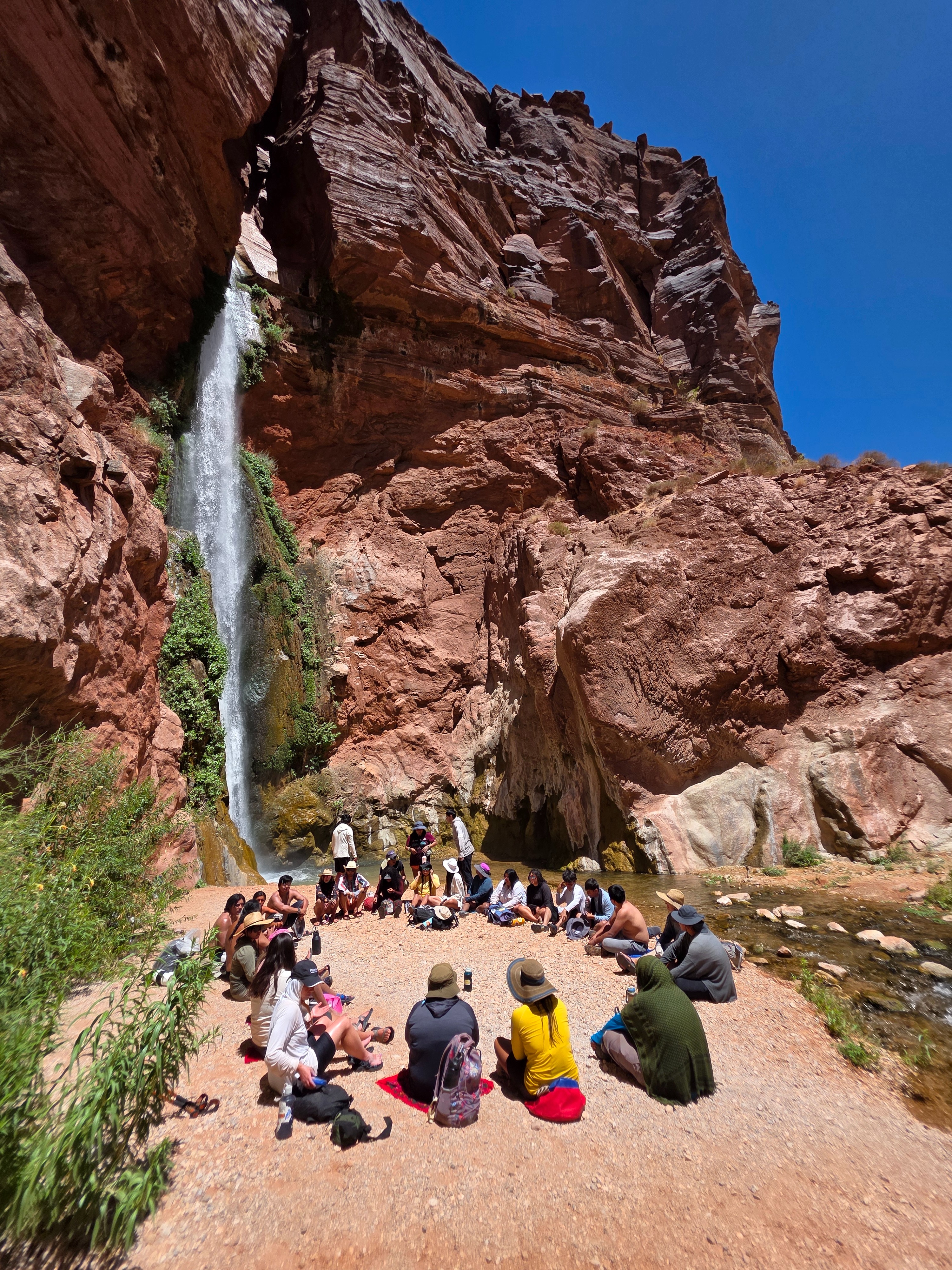
The canyon was a sanctuary of morning shade as we spread out across the natural sandstone benches. The rocks around us mirror the color of our own skin—an intergenerational group of youth and elders nestled in for reverence. The silence before our prayer began was accompanied only by the steady trickle of the creek, a melody to the distant waterfall. The gourds rattled to a familiar beat, and our voices followed the tempo. Eyes closed, smelling the scent of burning tobacco. The harmony of voices, singing in unison, the appreciation for water, for the river.
Months passed after that morning, and I sat in a forest of ponderosa on the rim of that same sacred canyon. I sit pondering how the stream-carved chasm sounds today. It’s absent our singing voices, although our blessings remain in the spirit of that place. Drifting away from the daydream, I’m filled with contentment knowing that the medicine created, shared, and received lives on with the Native youth who sang with me that day.
I live, work, and play across the Colorado Plateau, committing most of my time to engaging with Native youth in outdoor spaces. I build community with Native youth on traditional farms across the Navajo Nation, in deep canyons and forests, and on all the mesas in between. Indigenous youth are our future—a proclamation that became abundantly clear this year as I facilitated culturally relevant outdoor education programs with various nonprofits in the Four Corners region. This level of community engagement in relation to the land represents movement toward the protection of biocultural diversity. Through generations of caretaking, the land of Indigenous peoples has maintained immeasurable biodiversity. The degree of protection and caretaking is evolving in challenge and intensity due to the unfortunate reality that Native communities are disproportionately affected by the severe impacts of climate change. The consequences of climate catastrophe will be left in the hands of Indigenous youth. So how do we inspire them to play a part in the story they are woven into?
It begins with reminding youth that they hold an intrinsic connection to the land. One of the many lasting tactics of colonialism is the forced disconnection of Native peoples from the land. Decades of violent removal, boarding school, and dispossession of land and water have left generations of youth to feel they don’t belong to the land the way their ancestors did. This lack of belonging is exacerbated by the gatekeeping of outdoor spaces by white communities. Socially discouraged accessibility to the outdoors is a barrier to maintaining cultural connection to place.
Growing up in the storied land of the Northern Arizona desert, I began shaping my personal relationship to land at a very young age. My time in red sand and between canyon walls was enriched by the teachings of my family, of my Diné community, that we are a part of this land. While I was never involved in an outdoor youth program, my proclivity for facilitating such programs stems from my belief that Indigenous youth should have limitless opportunity to design an intentional relationship to land and water based on their cultural and personal values.
This year, I had the privilege of helping to facilitate the annual RIISE (Regional Intertribal Intergenerational Stewardship Expedition) trip through the Grand Canyon Trust. Indigenous youth and elders gathered to share prayer, tradition, and abundant laughter along the Colorado River. On this trip, we honored the fact that spirit, knowledge, and tradition live in a physical space, brought to life by the stories told and prayers sung. To pass on teachings, Native youth must have access to these places. I’ve shared space and time with over a hundred Indigenous youth this year, and a resounding theme among all of them is a deep desire to know their culture by personally experiencing the land their relatives knew so intimately.
The relationship they desire has been taken away from them by the settler-colonial state we live in, which exploits racial identities to gain economic capital. National Parks are an example of this racial exploitation: land dispossessed from Native peoples has been turned into a commercialized and profitable space. Outdoor recreation is a predominantly white space, a privilege to those who can afford and feel safe in such environments. Outdoor recreation spaces are curated for the white experience, therefore becoming inherently exclusive. Native youth rarely see people of their own cultural background or race represented in the outdoor industry, thus perpetuating the false narrative that they don’t belong.
Providing a safe learning space for Black and Brown youth outdoors is a revolutionary act that uplifts both the individual and the community. Time on the land, in community, ignites a sense of belonging; an opportunity to heal the youths’ relationship with land. I observe this phenomenon when facilitating Native Teen Guide in Training trips through the Canyonlands Field Institute on the San Juan River each summer.
We walk alongside sandstone walls that tell of migration in the river corridor from millennia ago. The tradition continues as the youth paddle down the river. This river trip is the first and potentially only time many of these youth will have access to experiential learning and cross-cultural exchange in an outdoor recreation space. The riotous laughter of the youth ricochets across the water as we spend days passing by boats of people who don’t look like us. Some youth notice; others are blissfully oblivious to the racial disparity on display on their ancestral river. Despite these observations, we find our belonging in the stories of our people that etch themselves into the rocks, plants, and animals. Our night air is filled with a steady drum as we round dance, our hands interlaced, feet shuffling in red sand, an offering to the stars.
Outdoor programs geared toward Native youth have an impact that shouldn’t be limited to a singular experience. The magnitude of a culturally-relevant trip is, in essence, a reclamation of a relationship to land and water. How do we ensure the continuous growth of this relationship? We continue to provide Native youth with the opportunity to learn and build relationships with the land and water—to know the river and land as beings with a spirit, as relatives. We help them cultivate an inclination to care for such relatives. By instilling the traditional belief that our lineage is rooted in the land and the water, we can help create a generation of protectors. People protect what they know; they protect who they care about.
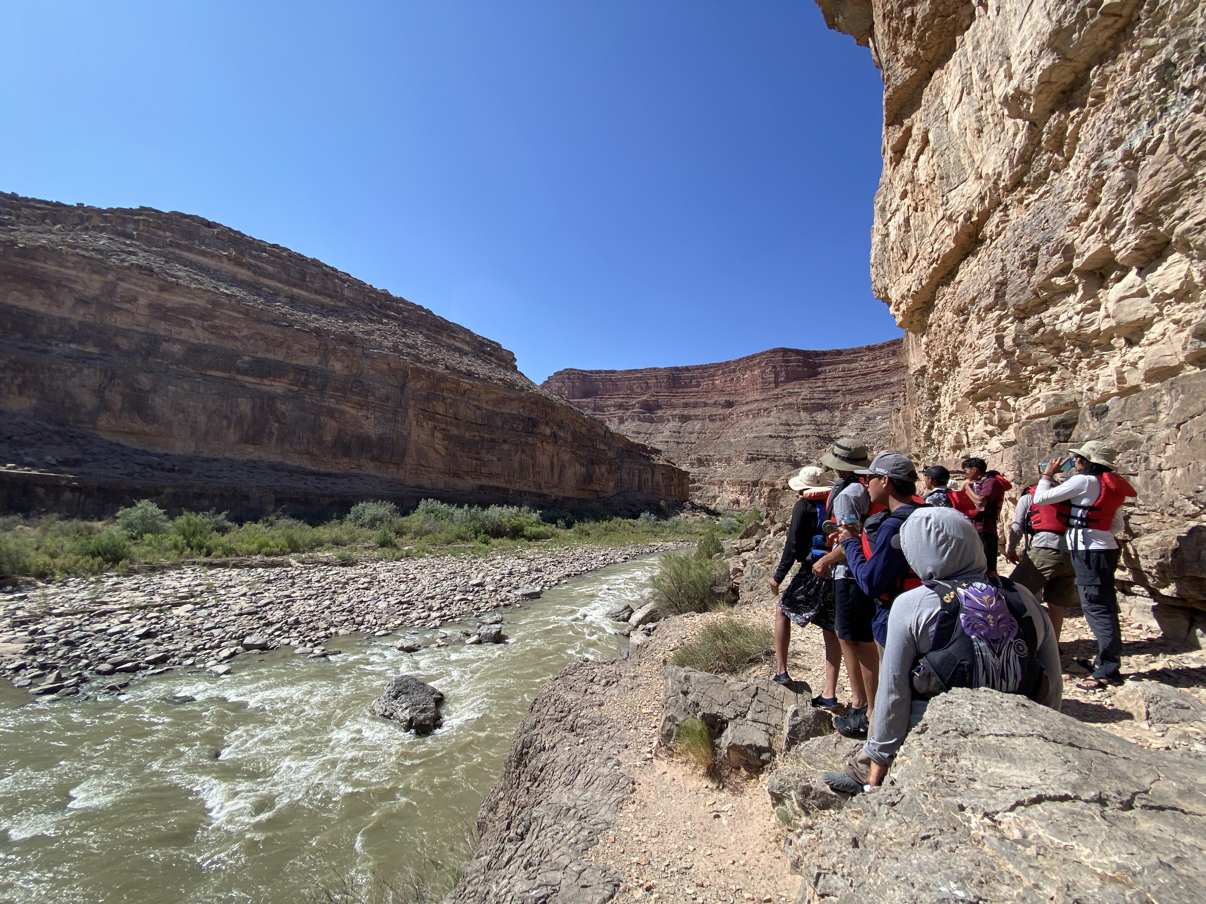
Encouraging the changemakers of the future does not eliminate the feeling of helplessness regarding the water and climate crisis in the Southwest and around the world. On a sunbaked afternoon, bellies full and lungs worked from hours of games at Redwall cavern—in Marble Canyon on the RIISE trip this past summer—the Native youth settled in for a floating talk. They sank into their seats on the rafts, all tied together for the moment, allowing the serenity of the walls to add a dramatic effect for our discussion of water in the West.
Complex topics like water law, legislation, and litigation—and related and problematic jargon, too—hindered a complete understanding of Western water among the youth. A discussion like this can have a similar effect on adults. Worried that we were losing their attention, my mind raced with ideas on how we, as facilitators of the discussion, might connect this topic to their lives, personally. Thinking on my feet, I reminded them of culture: of the days we had already spent giving offerings and blessings to the land and water, learning and strengthening our bond to the sacred. This is specialized knowledge, I told them truthfully.
“There are people in windowless rooms making decisions about a river they may have never floated on, bathed in, or prayed to. Despite this, you cannot forget the generations of wisdom passed through this place, through you, that instructs accountability as land and water protectors.” This dynamic connection to ancestral homelands is what sets Native youth apart; it is their superpower against a world committed to poisoning the earth.
Indigenous youth play a critical role in the unfolding story of our planet. They, too, hold wisdom. The significance of intergenerational knowledge exchange becomes especially evident when in the presence of Native youth. One teaching I received from their enlightened youthfulness is the seamless transition between prayer and play. After an hour-long ceremony at each stop in the Grand Canyon, play promptly ensued. It is a teaching applicable to anyone living in this time, an honoring of the dualities omnipresent in the Indigenous experience. The youth raised my belief that there is room for reverence and laughter in sacred spaces. Our presence throughout the Canyon was marked by steadfast joy: joy for the chance to be in community, to reinhabit the spaces of our ancestors. In this way, joy was our act of resistance.
It’s midday at Whitmore Panel in Grand Canyon (If you know this place, you know scorching heat). We gathered around three young Zuni wisdom holders. We stood, backs of legs burning, listening to the youth sing us into the place in a good way. Taking in the stories on the wall, one of the Zuni youth recognized a symbol. The same symbol he paints on his traditional pottery. Thousands of years between him and his ancestors disappeared at that moment, a lineage connection so profound it forced all of us to recognize the depth of our presence. The presence of Native youth on sacred land is essential for the continuation of culture and the envisioning of the future.
Resistance to the exclusionary character of outdoor recreation is reconnecting Native youth to their right to access their ancestral homelands. Inclusivity begins with acknowledging the barriers to access and understanding how these barriers are a result of systemic oppression. Following this acknowledgment comes owning the part we each play in upholding these systems. Ultimately, this privilege can be leveraged to support Native youth outdoor programs. These programs are gaining traction as we collectively work toward Indigenizing the future. This future honors Indigenous lifeways and values like reciprocity, care, and relationship building. You can be a part of the movement by supporting organizations like these:
- Rising Leaders—Grand Canyon Trust
- Native Teen Guide In Training—Canyonland Field Institute
- Paddle Tribal Waters—Rios to Rivers
- River Newe
- Pandion Institute
- Pollen Circles
You can amplify your support by advocating, donating, and building relationships with your local Native youth programs and community.
Guest contributor Chyenne (she/they) is a Diné adzaani from the small desert town of Page, AZ. The sandstone mesas, canyons, and sagebrush-painted plateaus became her teachers, instilling her creative capacities. Today, Chyenne works and writes as a dedicated land and water protector, applying her lessons from her homeland alongside a MA in Indigenous Studies and BA in Social Justice and Environmental Studies from Prescott College in her work with various non-profits in the Four Corners region.