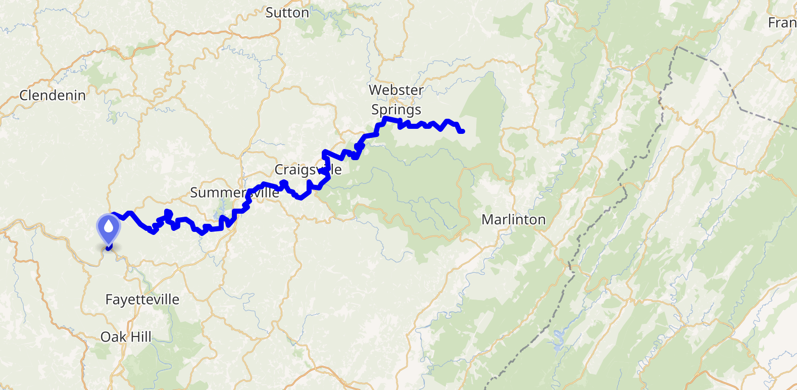
Gauley River
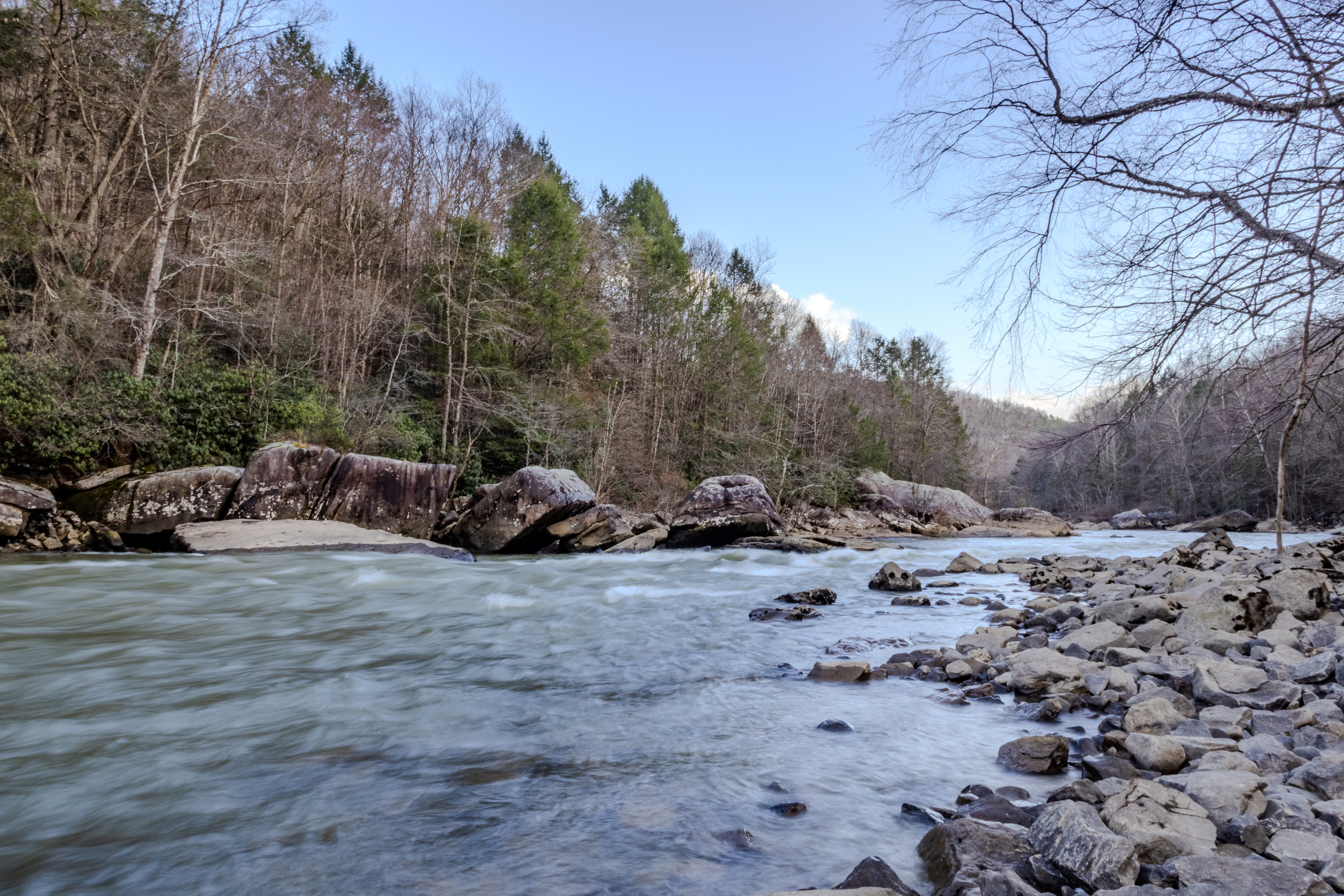
The Gauley River flows for 105 miles through the beautiful mountains of West Virginia. The headwaters of the Gauley originate in the highest-elevation streams of the Allegheny Mountains, largely within the Monongahela National Forest, home to old-growth forests and an extraordinary array of wildlife, from the rare northern flying squirrel and the eastern hellbender salamander, to the brilliantly hued candy darter. Here, vast tracts of unspoiled wilderness form some of the largest and healthiest forests in the eastern United States, providing essential habitat for endangered wildlife. Local residents and businesses depend on the river as a major source of their drinking water.
As part of the greater New River watershed which extends from West Virginia all the way down to North Carolina, local residents and businesses heavily depend on the Gauley River as a major source of drinking water.
Where is the Gauley River?
The Gauley River is in West Virginia
When is Gauley Season?
Gauley Season starts the Friday after Labor Day and runs for 6 consecutive weekends.
America’s Most Endangered Rivers®
The Gauley River was named as one of America’s Most Endangered Rivers® of 2025. West Virginia’s Gauley River originates in the highest-elevation streams of the Allegheny Mountains, an area renowned for its extraordinary array of wildlife. The Gauley is a world-famous whitewater destination, beloved by kayakers and rafters from around the globe. Yet, this same remarkable watershed faces a grave threat: toxic pollution from coal strip mining in the headwaters of the Cherry River, one of the Gauley’s primary tributaries. We must protect the river and its clean water from illegal coal hauling through the headwaters.
Protect the Gauley River
Urge the Office of Surface Mining Reclamation & Enforcement to protect the Cherry River, the Gauley River watershed, and the Monongahela National Forest from illegal coal hauling and mining pollution.
Outdoor Recreation
The Gauley River fuels an outdoor-recreation economy that generates millions of dollars annually. The Gauley is a world-famous whitewater destination with incredible Class V runs. While during the majority of the year boating is heavily dependent on the river’s water level, starting the Friday after Labor Day, a series of controlled releases from Summersville Dam occurs for the sole purpose of downriver recreation. These releases are collectively known as “Gauley Season” and are scheduled on six successive weekends. Thousands of whitewater recreationalists from around the world come together to enjoy intricate Class V rapids on the upper Gauley River during this time of year. Gauley Fest, a one-of-a-kind weekend festival, takes place during these scheduled releases every September.
Let's Stay in touch!
We’re hard at work in the Mid-Atlantic for rivers and clean water. Sign up to get the most important news affecting your water and rivers delivered right to your inbox.
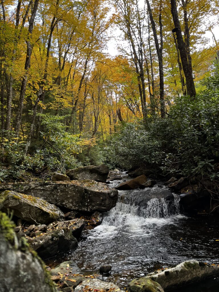
Tributaries and headwaters
Few places in West Virginia rival the scenic splendor of the Gauley River’s headwaters. Within the Monongahela National Forest, ephemeral streams and artesian springs bubble up from the black earth of the Allegheny Highlands to form the Cranberry, Williams, and Cherry Rivers. These waterways meander through the cherished Cranberry Wilderness and Backcountry, skirt some of North America’s southernmost red spruce forests and offer prime spots for hiking, fishing, hunting, boating, and camping.
The Cherry River is home to the critically endangered candy darter, which has lost half of its habitat due to human impact. Native brook trout still swim and spawn here, and the eastern hellbender—a two-foot-long salamander recently proposed for endangered species status—lurks beneath submerged rocks.