Deep River
A rocky rural beauty with a milltown history
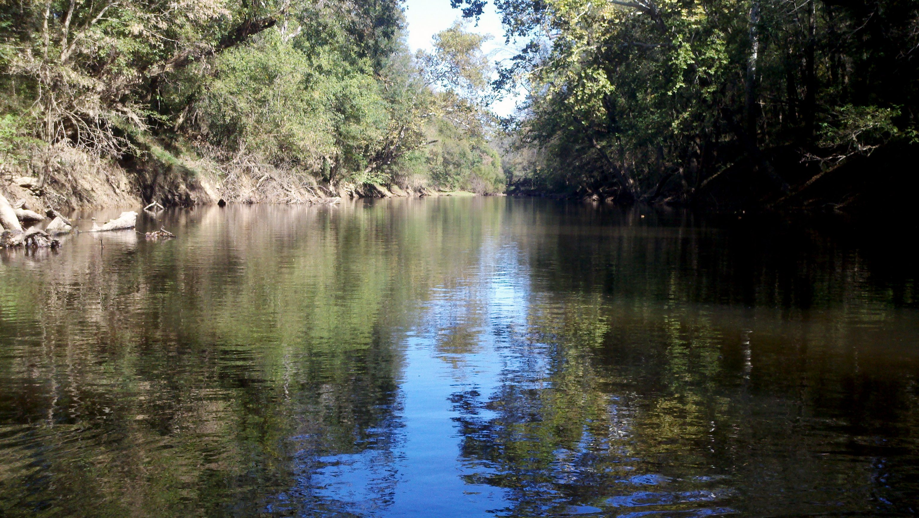
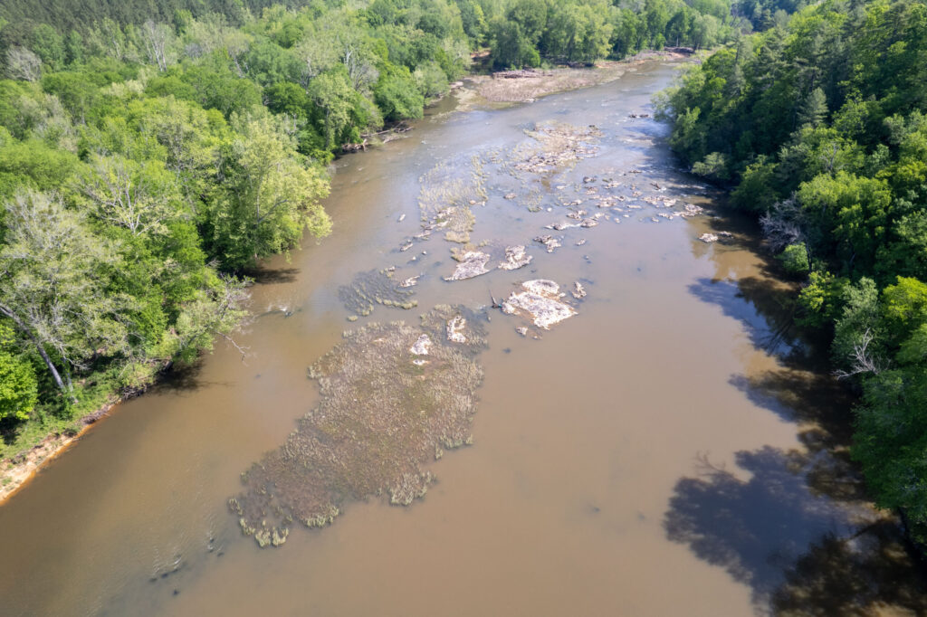
The Deep River, translated from the native people’s name “sapponah,” refers to the steepness of the banks and not the depth of the water. The watershed is characterized by rocky shoals, riffles and outcrops of bedrock and flows within the Carolina Slate Belt. Huge natural rock formations can be seen poking up from the riverbeds at different points along the river creating scenic natural falls.
The River has seen its share of inhabitants over the years. The history of this region is complex. Several eastern Siouan tribes, including the Eno, Occaneechi, Shakori, Sissipahaw and Sara had established communities in the watershed prior to European colonization. Artifacts, and the presence of fish weirs, or structures in the river thought to direct fish to be caught, indicate the presence of the Siouan tribes and their connection with the Deep River. Early European settlers colonized the area in the mid-1700s and used the land for agriculture, logging and mining. Native American presence had a marked decline during this time period and much of their history was lost.
The Deep was historically a ‘working river’ and is dotted throughout the watershed with former mill dams. The mills that were powered by these dams helped to form communities along the river and drive the economy and culture of the region. The manufacturing backbone of the region is still present and active but no longer depends on the dams. Many mill dams have since been altered from their original use to serve as hydroelectric power.
Today, this largely rural part of North Carolina is developing rapidly, and there is a renewed focus on the Deep River and its watershed as an asset for people and nature.
Did you know?
The Deep River was named for its steep banks in many places, and not for the depth of the river.
What states does the river cross?
North Carolina
What’s new?
American Rivers is working on a transformational project on the Deep River, along with partners across the watershed, to reconnect nearly 100 miles of the main channel of the river. The project started in 2023 and we expect it to be completed by 2030.
ABOUT THE RIVER
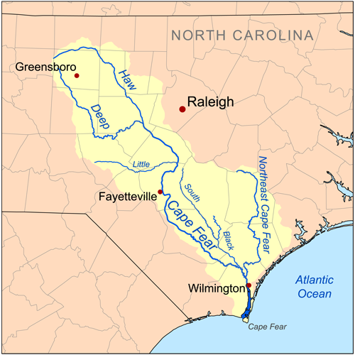
The Deep River winds through steep banks within a largely rural portion of North Carolina. Stretching 125 miles, the Deep River begins just north of High Point, NC, and flows south and east until it connects to the Haw River where it forms the Cape Fear River. The river is a critical thread connecting the communities within it and providing clean water supplies. It is unique and prized for the natural beauty it supports and by outdoor enthusiasts for paddling and fishing.
Climate change impacts, water pollution and aging dams are limiting the river’s ability to deliver clean water and support resilient natural populations. Investments made into reconnecting the river and prioritizing its health has the potential to not only protect and heal the Deep River but ensure this resource remains an asset to the communities in the watershed into the future.
Let's stay in touch!
We’re hard at work in the Southeast for rivers and clean water. Sign up to get the most important news affecting your water and rivers delivered right to your inbox.
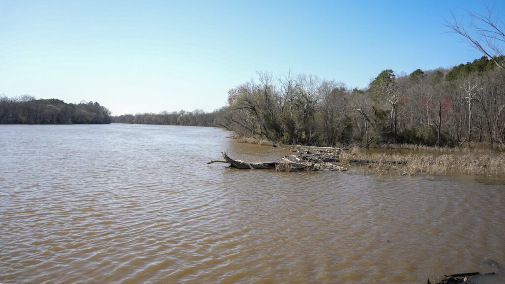
The river and its tributaries provide drinking water to approximately a quarter of a million people. Near its head waters is the large Randleman Reservoir that was the last major reservoir built in North Carolina for drinking water. It was completed in 2004 and serves the population of the Triad. There are dozens of additional smaller reservoirs throughout the watershed that provide water supply to communities like Randelman and Franklinville and businesses that still dot the banks of the river. The agricultural production in the watershed counts on reliable flows in the river for irrigation and drinking water for livestock.
The Deep River is a quiet ecological jewel in North Carolina with a diversity of interconnected species that call it home, including rare and endangered freshwater mussels that pump millions of gallons of clean water into the river, endangered fish species that only call the Deep River home and river otters that can be found playing in the shallows and along the muddy banks.
In the Deep River, and in rivers everywhere, aquatic species are interconnected. They all work together in a complex ecosystem that affects us all. For example, freshwater mussels rely on fish to complete their life cycle and mussels are crucial as they filter the water returning clean water to the river. Many freshwater mussels rely on free-flowing water and gravel and pebbles on the riverbed to survive and reproduce. The state-endangered Brook Floater, the federally threatened Atlantic Pigtoe, Savannah lilliput and Yellow Lampmussel, and the state-threatened Triangle Floater and Creeper are all freshwater mussels that live and depend on a healthy Deep River. The federally endangered Cape Fear shiner is a fish found nowhere else on earth. It relies on clean, shallow river beds composed of gravel and cobble to be able to survive and thrive. The Deep River is also historic habitat for numerous migratory fish species like American shad, River Herring, Striped Bass, Atlantic Sturgeon and American eels – all of which are blocked from reaching the habitat in the Deep River due to downstream dams.
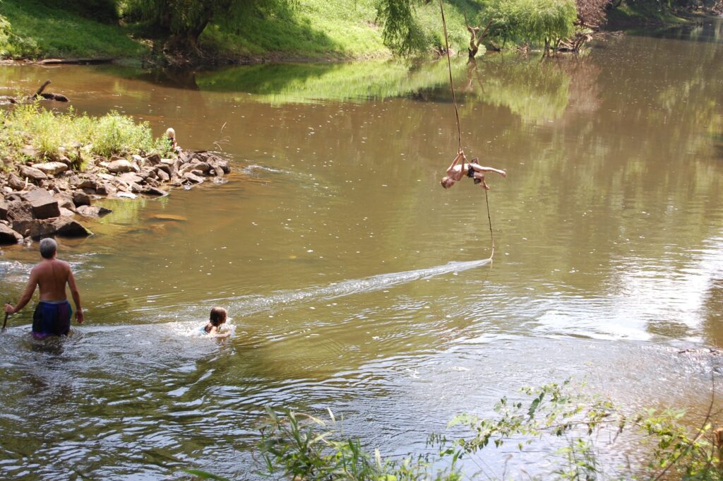
Recreational paddling and fishing are popular on the Deep River. There are many parks lining the river and several kayak routes that wind through undeveloped landscapes where paddlers are likely to spot blue herons and basking turtles. Anglers fish along the riverbanks or in small boats. The Deep River State Trail, which was designated in 2007, is currently under development in the upper portion of the river. The vision for the trail, when completed, is to connect the communities of the Deep River by providing paddling and hiking opportunities through a combined blueway paddle trail and a greenway along the entire length of the river.
ENDANGERED BUT NOT FORGOTTEN: THE TALE OF THE CAPE FEAR SHINER
In North Carolina, the endemic Cape Fear Shiner is one of those hard-to-find species, named for its shiny body that reflects the light. Endemic means that this fish is known only to be found in the Cape Fear River Basin and nowhere else in the world. The fish’s range is currently isolated to small sections of the Deep River, The Rocky River, and a few tributaries. Even within this range, the fish is challenging to find.
THREATS
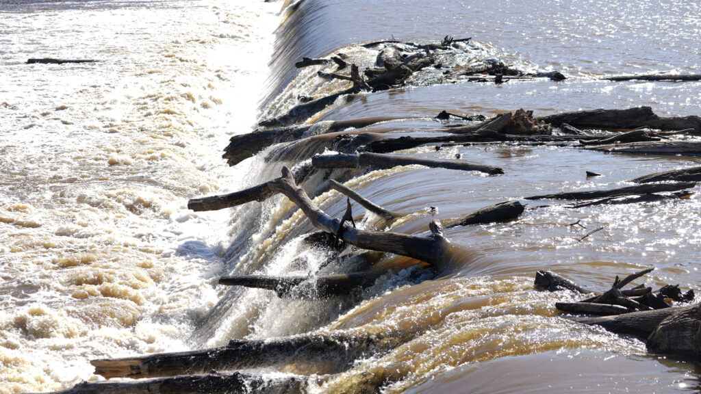
Along the entire Cape Fear River system, there are an estimated 1,100 barriers including locks and low-head dams. The Deep River is home to several of them, including High Falls dam, which has blocked free-flowing water for more than a century. Many of the dams existing in the Deep River no longer serve a purpose. In fact, it is estimated that 85% of dams in the U.S. are unnecessary, harmful or even dangerous. Low-head dams have been associated with hundreds of drownings as the result of the dangerous hydrologics that form at the bottom of a dam.
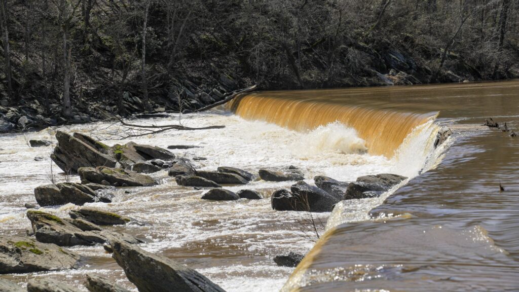
Dams built throughout the late 18th and 19th centuries served as grist-mill and sawmills, or were part of a lock and dam systems to transport materials. In the early and mid-20th century, eight low-head dams within the Deep River watershed were repurposed to provide some remaining value by generating hydropower. In 2018, Hurricane Florence flooded many of the dams along this river system, several of which have considerable damage and active leaks. Many no longer produce power and require costly maintenance. Aging dams have the potential for failure and are liabilities for the dam owner and for the downstream community.
The Deep River is also challenged with water quality issues and contamination. This watershed is in a rural part of the state, but it is urbanizing due to exurban sprawl driven by development along the I-85 corridor in the Triad region and the U.S. 64 corridor west of the Triangle. Increased development in the region is creating stress on the Deep River system. Pollutants like excess sediment, phosphorus and nitrogen flow into the river because of failing water infrastructure like outdated wastewater treatment plants and stormwater run-off from agricultural lands and development. People and nature are impacted by the water quality in the streams and rivers of the Deep River watershed.
Climate change exacerbates many of the threats already present in the watershed. As storms become more frequent and more severe, the dams along the Deep River become increasingly susceptible to damage.
BENEFITS OF DAM REMOVAL IN THE DEEP RIVER
The implementation of a watershed-scale restoration project in the Deep River has the opportunity to reconnect fragmented habitats, restore natural water flow and meet environmental challenges. Removal of the dams on the main stem of the Deep River could bring a return of many of the migratory species once known to inhabit the river. Looking towards a sustainable future for the Deep River watershed means putting in place a myriad of protection and conservation measures that would allow for resilience and adaptation.
American Rivers is working on a transformational project on the Deep River, along with partners across the watershed, to reconnect nearly 100 miles of the main channel of the river. The project started in 2023 and we expect it to be completed by 2030.
Natural flowing river systems transport sediment downstream, allowing for floodplain connection and exchange of nutrients. Removing dams allows the sediment collected behind them to be dispersed, and for a natural wetland riparian buffer to be restored as native plants will grow once again in the formerly impounded areas.
Healthy riparian buffers are incredibly important to water health as they filter pollutants, provide habitat, help absorb flood waters, and shade the rivers. Additionally, native plants and trees remove carbon from the atmosphere. The more native plants and green space in a river system, the more resilient a river will be to withstand climate events.