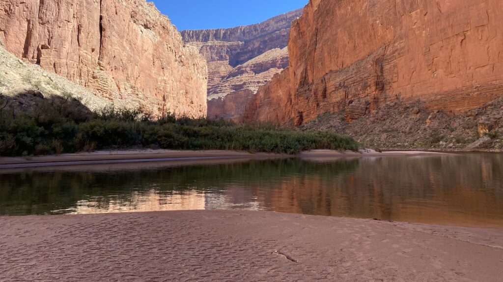
The Grand Canyon is magical in any season, but fall may take the cake for the perfect boating season on that stretch of the Colorado River. Cool mornings, warm days that are still long enough to dry out your gear after a day of getting hammered by huge waves, and starry nights that appear after the sun has dipped below the ramparts of rock in the distance. This year, canyon explorers are lucky to experience the additional gift of abundant sand from the High Flow Experiment(HFE) that was conducted in April, 2023.
I was on the river a couple of weeks ago, conducting survey activities alongside scientists from the United States Geological Survey’s (USGS) Grand Canyon Monitoring and Research Center (GCMRC). This is part of a long-running program to quantify impacts to various resources throughout the canyon from the construction of Glen Canyon dam in the early 1960s. Since the early 1990’s, scientists from GCMRC and Northern Arizona University have been using geodetic survey techniques to measure sand volume, in three dimensions, to a select group of around 40 beaches and sandbars from Lee’s Ferry to Diamond Creek. The changes are compared year over year and show trends of how these beaches shrink or grow based on Colorado River flow conditions over the year. These measurements are coupled with photographic evidence from cameras also placed throughout the canyon to observe these changes across an entire year or multiple years.
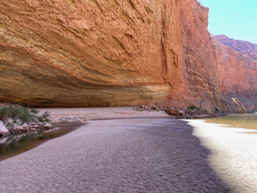
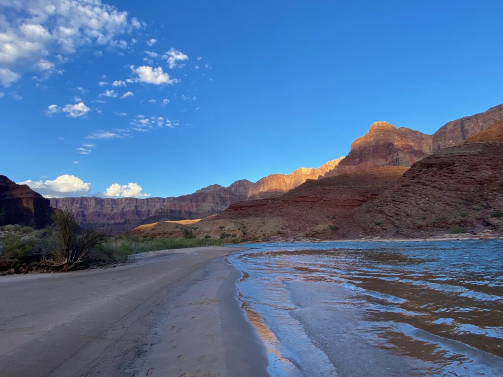
My observation? There is a lot of sand down there, with huge beaches the likes of which I have not seen in many years. The last time an HFE was conducted in the canyon was 2018, and the last time a spring high-flow was conducted was in 2008. Without these HFEs, the sediment-reduced water coming out of Glen Canyon dam actually erode beaches and sandbars, deteriorating conditions over time that impact not only beaches for recreation but allow greater encroachment of vegetation as well as the gradual uncovering of cultural resources near the river throughout the 277-mile corridor. Nearly every beach that was either surveyed, seen from a distance, or camped on was larger – much larger – than what I have seen before. And many of the beaches actually had two stages of sandbars; a lower, very large bench of flat sand, and a higher, more piled berm of sand behind it which formed a tall dune crest or back-bench of soft sand. The volumes we witnessed in places were surprising to say the least.
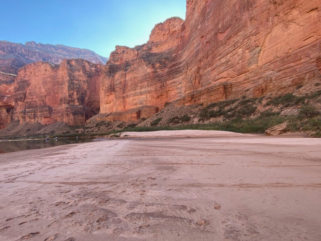
This configuration of sand was created by the flow regime that was the HFE itself as well as the summer flows that followed. When the HFE was conducted in mid-April, about 42,000 cubic feet per second of water (a very high flow!) was released continuously for 72 hours before the flows were brought back down to normal (~10,000cfs). That mobilized more than 1.5 million tons of sand that had been deposited by the Paria River (roughly 15 miles downstream) over the past couple of years – this is the sand that rebuilt the beaches and sandbars I saw on my trip. After the HFE, though, Bureau of Reclamation moved nearly 10 million acre-feet of water from Lake Powell to Lake Mead, creating unusually high flows (topping out at about 19,000 cfs) each day all summer long. These higher daily flows actually stripped some of that new sand at the lower elevations of the channel, shooting it downstream. In September, Reclamation pulled the flows back a bit more, revealing those lower, expansive benches of sand.
Let's Stay In Touch!
We’re hard at work for rivers and clean water. Sign up to get the most important news affecting your water and rivers delivered right to your inbox.
Where is all this leading? Well, in early October Reclamation issued a Notice of Intent for scoping some supplemental rules related to the Long-Term Experimental Management Plan, or LTEMP. While much of what is being considered is related to a situation where invasive small mouth bass have come into the canyon from Lake Powell, threatening the humpback chub population in the canyon, it also is proposing to amend the guidelines for how HFEs are conducted. The new rules would make it so the period of time that sand is accounted for in the canyon would be longer (on an annual basis rather than two, shorter timeframes) as well as lengthening the one of the periods that HFEs could be conducted (importantly making it so HFEs could be triggered in May and June, which they cannot be under the current rules.)
Importantly, you can comment on these new rules. You can read more at the Notice of Intent link above and send your comments by email to LTEMPSEIS@usbr.gov. But you only have until November 3 to make your voice heard.
Seeing these beaches and sandbars firsthand is an extraordinary experience, but being able to speak up for the canyon and all that depend upon it is both a privilege and responsibility. I know that I for one am proud to be able to put my energy into making my voice heard for such a special place. And for even more Grand Canyon exploration, check out our award-winning storymap, Caught in the Middle, which we published last spring.
3 responses to “A Firsthand Look at Grand Canyon Beaches”
Looking Good
interesting photos
How helpful to connect your findings of such sand build up with a low water flow photo to promote the effectiveness of the high water release when dam releases return to 30,00 cfs and the little colorado river floods and other canyons flood, the beaches will be stripped of there new found sand and new sand will be layed down but none of that sand will stay because there is no growth to keep it in place. I was with all the initial academic scientists as running all the original MNA trips to inventory the condition of the grand canyon and what lives and goes on down there including camp sites and beaches , in fact one “specialist” on campable campsites used photos from a fly over at low water flow and came up with hundreds of campable sites of which i told him these sites are not used as the dam release floods them and are not ever used. He using photos to arrange and submit his report on camps and number of trips that could be allowed on the river due to volume of camp sites. main point, the sand will not stay on beaches but for a temporary visit. the sand build up may be new and exciting to you but it always goes down stream.