Fifty Years of Wild and Scenic Rivers in Washington: The Klickitat River
In this second installment of our Washington Wild and Scenic River series, we take a closer look at Southwest Washington’s beautiful Klickitat River.
This is a guest blog by Gregory Fitz.
In October of 1968, President Lyndon B. Johnson signed the National Wild and Scenic Rivers Act into law. The legislation had been sponsored in Congress by Senator Frank Church of Idaho. The National Wild and Scenic Rivers system was conceived around the remarkable idea that some rivers were so valuable to the cultural and environmental legacy of a region that they, and some of their surrounding area, should be preserved as natural, free-flowing waterways for the benefit and enjoyment of future generations. Since then, almost 13,000 miles of 208 rivers across the country have been protected. Six of those rivers are in Washington.
To celebrate the 50th Anniversary of the National Wild and Scenic Rivers Act, we’re going to spend some time over the course the year telling the stories of Washington’s designated rivers: Illabot Creek, the Klickitat River, the Pratt River, the Skagit River, the White Salmon River and the Middle Fork of the Snoqualmie River. Each is a unique part of Washington’s astounding network of rivers and each earned its designation in the national system through the hard work and foresight of advocates.
In this second installment of our series, we’ll take a closer look at Southwest Washington’s beautiful Klickitat River.
The Klickitat River
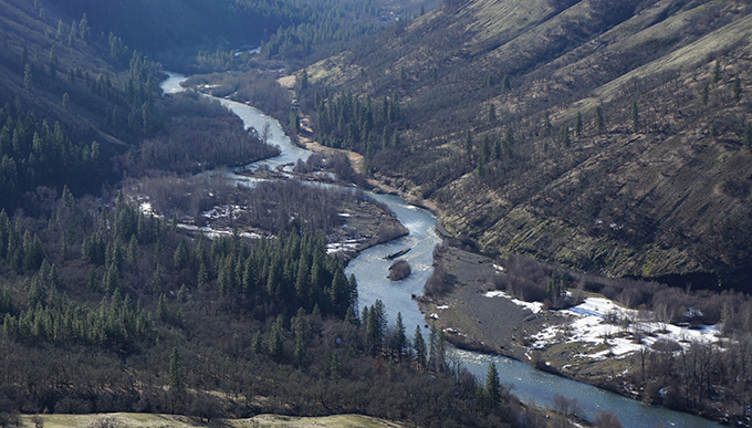
The headwaters of the Klickitat River originate in the Goat Rocks Wilderness on the east side of the Cascade Range. It flows south through the Yakama Indian Reservation and gains water from the glaciers of Mount Adams and Gilbert Peak along the way. In the heat of summer, those melting glaciers raise the flows and stain the water with till. The river is approximately 95 miles long and the watershed drains almost 1300 square miles. It joins the Columbia River near the town of Lyle, Washington.
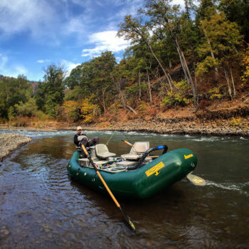
The Klickitat River hosts a popular summer steelhead and fall chinook fishery. | Photo: Brian Bennett/Moldy Chum.
The mouth of the Klickitat is upstream of the White Salmon River on the Columbia River and downstream of the historic Celilo Falls, which is now submerged behind the Dalles Dam. Along most of its route, it tumbles through a broad valley filled with dry pine forest. In its final few miles, the river constricts through a narrow, rocky gorge before pouring over Lyle Falls.
The river is named for the Klickitat people, the Shahaptian Tribe who inhabited the area before the arrival of people of European descent. The Klickitat people fished the river for generations, and like Celilo Falls once was, the river’s gorge remains an important site of Native American dip-net fishing.
National Wild and Scenic Rivers Designation
The final 10.8 miles of the lower Klickitat River were added to the National Wild and Scenic Rivers System in November of 1986. This section of the river runs from the confluence with Wheeler Creek to the Klickitat’s mouth at the Columbia River. It, and the first section designated on the White Salmon River, were recommended for protection following the establishment of the Columbia River Gorge National Scenic Area.
In the Environmental Impact Statements recommending Wild and Scenic designation for the lower Klickitat, the river’s fish habitat, dramatic basalt gorge and the cultural significance of the dip-netting fishery were listed as outstanding and remarkable reasons to keep the river free-flowing and protected. To gain further insights into the process, we spoke with Bob Ratcliffe at the National Park Service (NPS) in Washington, DC.
When the Klickitat was being considered for Wild and Scenic River designation in the mid-1980s, Ratcliffe was working for a company called Land and Water Associates. He was among the large team of advocates and researchers who would go on to complete the Environmental Impact Statement and draft the Management Plan for the Klickitat River. The team recognized that a grassroots effort and close collaboration with the local communities would be the best way to encourage investment and participation in the program. They held public meetings and met with local constituencies. Over the course of a couple years, they had conversations with tribes concerned about protecting fishing rights on traditional grounds, sport anglers, loggers, ranchers and other people living and working in the Klickitat basin.
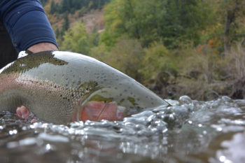
A late fall day with a wild Klickitat River summer steelhead to hand. Photo: Brian Bennett/Moldy Chum.
Throughout the process, Ratcliffe and his peers looked to the “Partnership” Wild and Scenic Rivers in the eastern part of the U.S. as inspiration. That management model seeks to bring county land managers, private land owners, watershed groups and other vested communities into dialogue around rivers that would benefit immensely from protection and free-flowing status, but aren’t primarily encompassed by federal land. Those rivers depended on local partners and collaborators to opt to preserve the watershed in Wild and Scenic status and commit to co-manage the river with a combination of federal, state and local agencies.
In the end, the process was a success. After many hours of meetings and negotiations among user groups and local communities, the U.S. Forest Service (USFS) accepted the management plan’s recommendation to designate the lower 10.8 miles of the Klickitat River as a Wild and Scenic River.
The Wild and Scenic Klickitat River: Today
The Klickitat River remains a beloved and well-traveled tributary of the Columbia River Gorge. Its proximity to Portland, Hood River and even Seattle means that it is a popular destination among kayakers, rafters and fisherman. It has great habitat and good water quality. There are a number of small communities along its length, but it also has long sections with little or no development in the riparian zone. Logging has been relatively limited in the river valley in recent years.
Summer and winter steelhead are native to the Klickitat. It used to host a strong native run of spring Chinook as well, but those populations are struggling, along with both runs of steelhead. Seasons for those species are truncated or closed. Hatchery produced summer steelhead, fall chinook and coho have been introduced to the watershed and are now successfully spawning, with mixed results in terms of intermingling with the wild fish populations. The river still supports a tribal dip-net fishery at Lyle Falls.
Popular with hikers and fisherman, a rail line between the towns of Lyle and Goldendale was abandoned by the railroad company in 1992 and soon reborn as the Klickitat Rails-to-Trail. It is a wonderful way to walk a long stretch of this beautiful Washington Wild and Scenic River.
Next month, we’ll be profiling the Middle Fork Snoqualmie and Pratt Rivers, two more of the six Wild and Scenic designated rivers in Washington.
In celebration of the 50th Anniversary of the Wild and Scenic Rivers Act, we have teamed up with a number of partners and outdoor gear companies to collect 5,000 wild-river stories and to protect 5,000 more miles of such rivers nationwide. Share your story and learn more.


5 responses to “Fifty Years of Wild and Scenic Rivers in Washington: The Klickitat River”
That is the correct spelling
Thank you for writing about the unique, Klickitat River. My family has lived in the canyon, along the river since 1913. Between the river and the trail, the canyon has a bounty of outdoor experiences to offer.
I used to live in the area and would go fishing on the klickitat river. So beautiful there, especially in the Fall. I only wish the Dalles Dam was gone and the Columbia river was free flowing.
That’s what it says on the map: “Yakama Indian Reservation.” It seems like the writer made every attempt to be respectful.
Yakama Indian
Wow, serious faux pas