A Visual Journey Along the Black Warrior River
Join us on a photographic journey of the waters and wildlife of the Black Warrior River, one of the rivers in the Mobile Bay Basin, which is one of America’s Most Endangered Rivers of 2017.
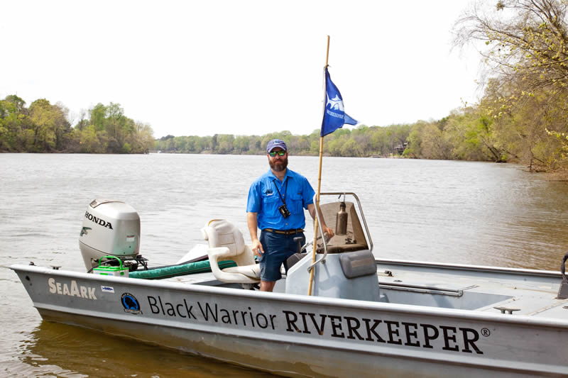
Guest post by Nelson Brooke is a part of our America’s Most Endangered Rivers® series spotlighting the Mobile Bay Basin.
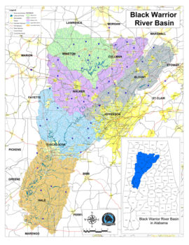
The Black Warrior River watershed looks like a left footprint and drains northcentral Alabama. | Photo by Nelson Brooke
The Black Warrior River gets its name from Chief Tushkalusa, and so does the City of Tuscaloosa, situated on the river’s banks. In Choctaw, tushka means warrior and lusa means black. The Black Warrior watershed is contained entirely within Alabama, drains 6,276 square miles and parts of 17 counties, and measures roughly 300 miles from top to bottom. Black Warrior Riverkeeper has worked tirelessly since 2001 to protect this river from polluters on behalf of all who use it and call it home.
Alabama’s 14 major watersheds, including the Mobile River basin, flow through the perfect blend of geological variation to provide ideal habitats for aquatic critters. Alabama’s 132,000 miles of rivers and streams are home to more aquatic biodiversity than any other state. The Black Warrior River watershed contains over 16,000 miles of streams and is home to 127 fish species, 36 mussel species, 33 crayfish species, 27 snail species, 15 turtle species and over one million humans.

The vermilion darter (Etheostoma chermocki), a federally endangered species, lives in Turkey Creek in Jefferson County, Alabama, and nowhere else in the world. | Photo by Nelson Brooke

The watercress darter (Etheostoma nuchale), another federally endangered species, lives in five springs in Jefferson County, Alabama, and nowhere else in the world. | Photo by Nelson Brooke
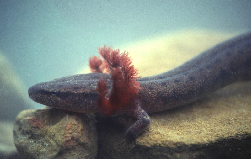
The Black Warrior waterdog (Necturus alabamensis), a candidate species for listing under the Endangered Species Act, is endemic to the Black Warrior basin above the Fall Line. | Photo by Mark Bailey, Conservation Southeast
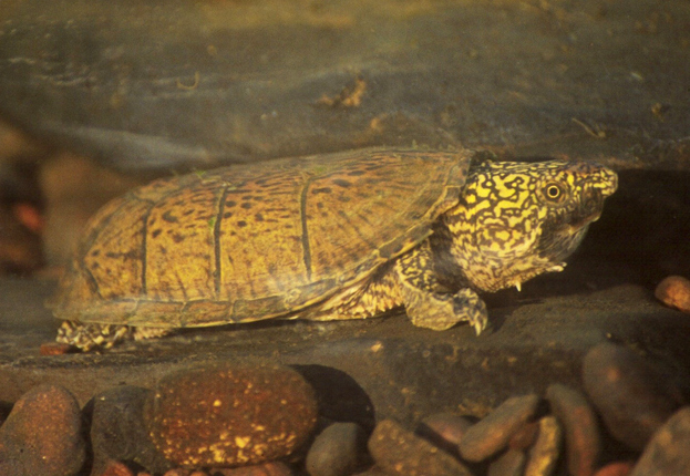
The Flattened Musk Turtle (Sternotherus depressus), a federally threatened species, is endemic to the Black Warrior basin above the Fall Line. | Photo by Mark Bailey, Conservation Southeast
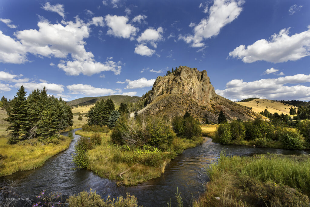
The river’s headwater tributaries – Sipsey Fork, Mulberry Fork, and Locust Fork – begin within the rocky Cumberland Plateau. These rivers are popular recreation destinations for swimming, fishing, canoeing and kayaking.
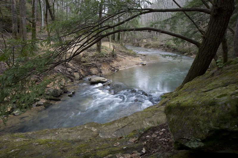
The Sipsey Fork flowing through the Sipsey Wilderness is Alabama’s only federally designated Wild and Scenic River. | Photo by Nelson Brooke
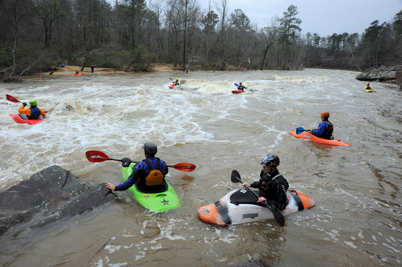
The Mulberry Fork is a popular whitewater kayaking destination in Cullman County, Alabama. | Photo by Nelson Brooke
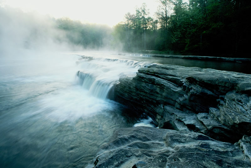
Cornelius Falls is one of several waterfalls along the upper Locust Fork in Blount County, Alabama. | Photo by Nelson Brooke

The Locust Fork is home of the annual Locust Fork Whitewater Classic in Blount County, Alabama. | Photo by Nelson Brooke
The Mulberry Fork and the Locust Fork merge west of Birmingham to form the Black Warrior River, which flows southwest through the tail end of the Appalachian Mountains.
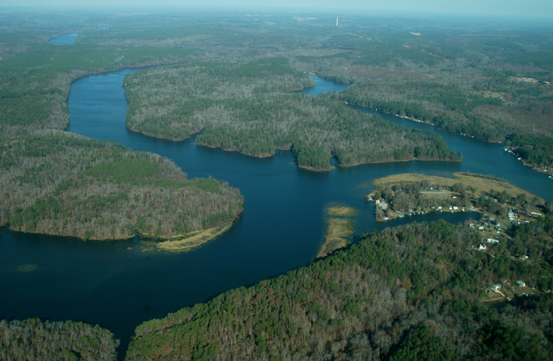
The confluence of the Mulberry Fork (L) and the Locust Fork (R) forms the Black Warrior River at Howton’s Camp. Flight provided by SouthWings.org | Photo by Nelson Brooke
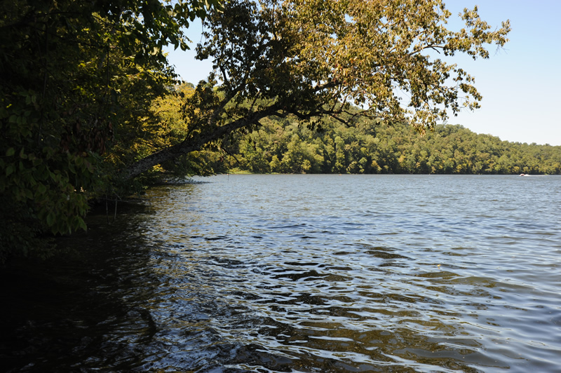
The upper Black Warrior River is regularly used for swimming, boating and recreation, and is home to the 33,280 acre Mulberry Fork Tract, part of Alabama’s public lands program called Forever Wild. | Photo by Nelson Brooke
Near Tuscaloosa, the river starts flowing through the sandy East Gulf Coastal Plain. Here, the river’s vibrant floodplain, which floods thousands of acres of bald cypress and water tupelo wetlands, begins flowing through the Alluvial-Deltaic Plain within the Fall Line Hills and Alabama’s Black Prairie.
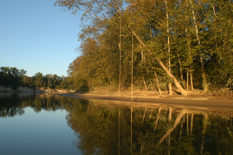
The river’s sandy banks downstream of Tuscaloosa give way to large sand bars commonly used for swimming, camping and recreation. | Photo by Nelson Brooke
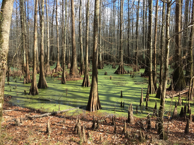
The bald cypress (Taxodium distichum), known for its iconic buttresses and knees, inhabits thousands of acres of wetlands, swamps and oxbows throughout the lower Black Warrior floodplain. | Photo by Nelson Brooke
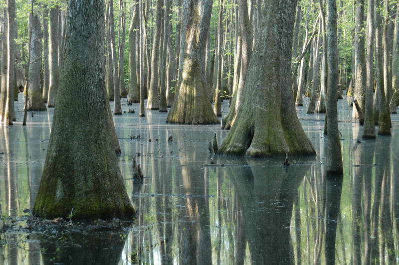
The water tupelo (Nyssa aquatica) often inhabits the same floodplain swamps as the bald cypress. | Photo by Nelson Brooke
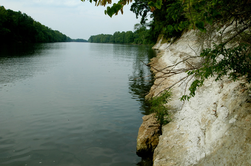
The river’s lower reaches cut through late Cretaceous Period deposits from 66 to 85 million years ago, exposing white chalk bluffs that are filled with interesting fossils of open-marine animals from the time when dinosaurs still roamed and roughly half of Alabama was covered with sea water.
At Demopolis, Alabama, the Black Warrior River flows into the Tombigbee River, which joins with the Alabama River to form the Mobile River, just North of Mobile Bay.
[su_button url=”https://act.americanrivers.org/page/712/action/1″ background=”#ef8c2d” size=”5″ center=”yes”]Take action »[/su_button]
Author: Nelson Brooke
 Nelson Brooke is the staff Riverkeeper at Black Warrior Riverkeeper, a citizen-based nonprofit clean water advocacy organization dedicated to protecting the Black Warrior River and its tributaries by holding polluters accountable.

7 responses to “A Visual Journey Along the Black Warrior River”
Got any historical information, pics, stories about the Ferries (Franklin’s, Copeland’s, Taylor’s)
Great site! I was wondering if you had any old photos where Bells (an old store and camp marina boat repair ) was. I believe it was on Hurricane Creek and in the fifties and sixties we spent our summers there down not far in a slu where my uncle had a primitive cabin. If no photos a map showing where it was. Thanks for your good work.
I just moved to the Black Warrior the end of June 2019. This was right after the Tyson plant spill. I moved to enjoy the fishing and swimming. I heard so many stories of the huge fish pulled out of the river and great fishing spots. I almost didn’t close on my house because of the spill. For months we would fish the banks and pier with no results. I’m sure it will take a while for the environment to recover. Thank you for protecting our River and making people accountable
Thank you! We are doing a play about one of the sons of Black River and Tuscaloosa,, and settled here in Michigan, after the WWIi
In 2012 I worked for a mining company in Sipsey ,Al. there was a fuel spill I’m guessing less than a quarter mile from the river .I called the EPA in washington, D.C. and was told to call their office in Atlanta .So I called that office and every one I called told me I’d have to call another office and finally I pissed them off when I told them all they wanted was a paycheck but didn’t want to do anything but sit on their asse. So I called the Al surface mining commission and talk to the head of asmc I told him about the spill and how the company hid it and he asked if I could point the exact place to one of their inspectors ,I told him I would he said let call you right back .That was 5 years ago and still no word , also a couple of months later they voted to give that same company a permit on the banks of the river at Cordova, Al. that River keepers was fighting to block . Sounds like someone got paid off ,right?
Excellent photo gallery and description of your much needed work. Thanks!
Really, enjoyed Your Photo Journey and sure learned a lot about the Black Warrior & It’s Tributaries. Especially, liked Your Photos & Information about endangered Species. I’m a Friend of Hurricane Creek and in love with Our States Lakes, Rivers, Streams, and Creeks. We are very Lucky to have these and sure need to protect Them now & for the Future! Many thanks for Your work!